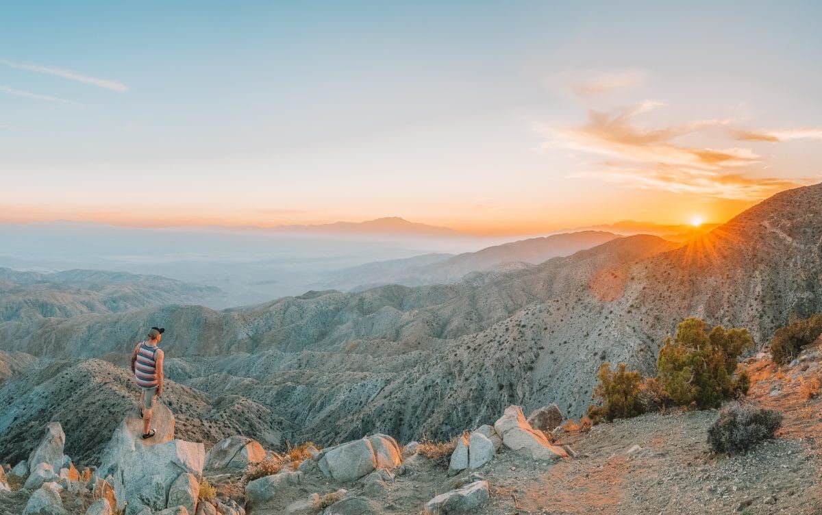
The best hikes in Joshua Tree National Park for every fitness level and adventure schedule.
I’ve spent many years exploring the southwest desert and believe me, there’s nowhere like Joshua Tree National Park!
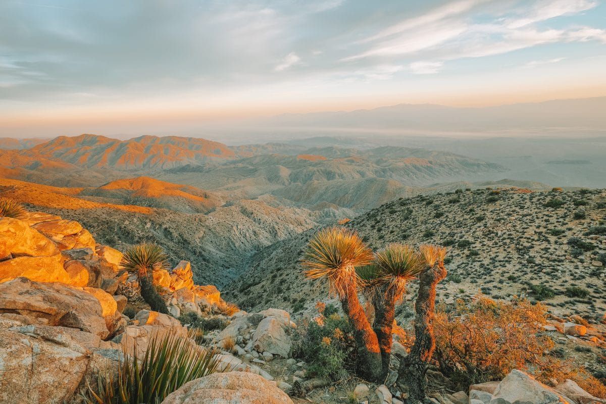
Joshua Tree National Park sits in a transition zone between two big deserts and as a result, has a spectacular diversity of plants and animals.
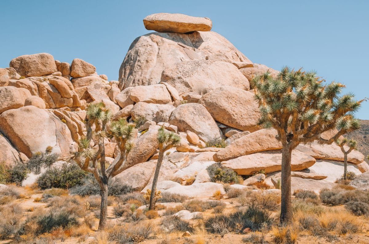
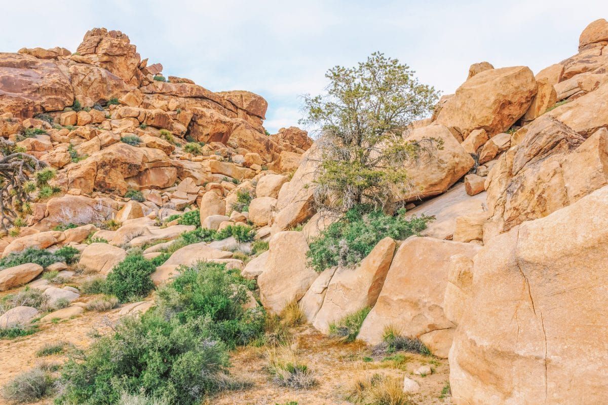
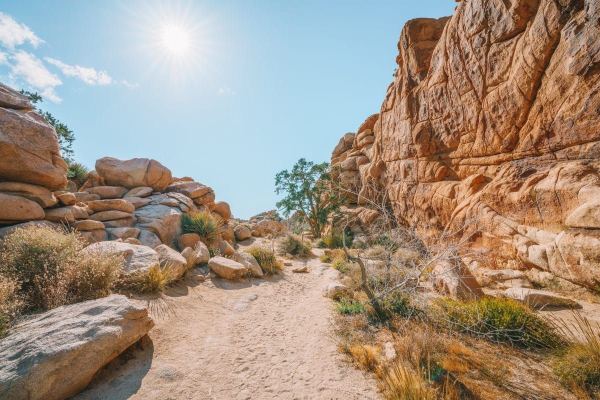
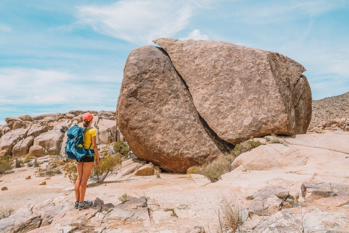
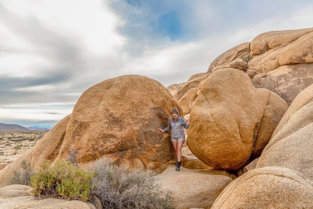
The geology of Joshua Tree is like nowhere else in the world either. With giant white boulders scattering the landscape, it’s a mecca for rock climbing.
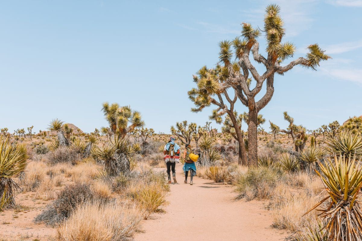
Hiking and backpacking are very popular here too – with miles of hiking trails you can easily spend years exploring this gorgeous desert park.
If you’re planning a trip to Joshua Tree and looking to explore the park’s many trails, this extensive guide to the best hikes in Joshua Tree will help you.
I’ve taken all the legwork out of researching, so you can enjoy the best Joshua Tree trails, no matter what you’re looking for.
In addition to my own experience with hiking Joshua Tree, I’ve read hiking forums, watched enough trail videos that I’ve practically hiked the whole park, and talked with locals to get the best tips on hiking in Joshua Tree.
Below, I’ve listed the best hikes in Joshua Tree by trail length. Read on to find the best Joshua Tree hiking trails to add to your trip!
Note: this post contains affiliate links, which help run this site at no extra cost to you so I can keep providing free travel advice and tips.
Get your FREE California Travel Planner – including printable checklists and my favorite two-week itinerary for the state.
Joshua Tree Hikes Map
Best Hikes in Joshua Tree
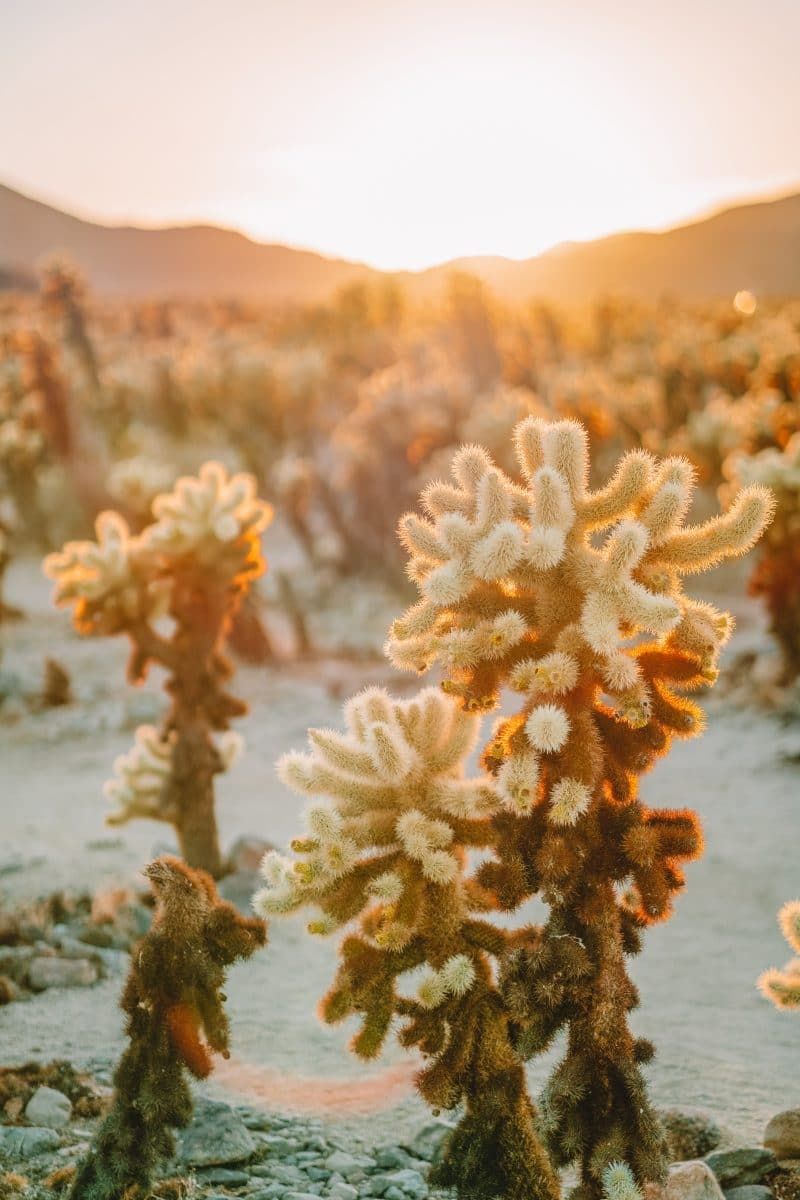
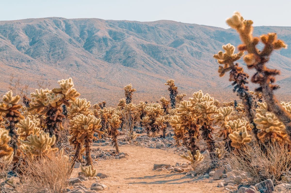
#1 Cholla Cactus Garden
Best hike for: Cacti enthusiasts and adventurers who have mobility issues.
Distance: 0.2 miles | Elevation Gain: 9 ft | Difficulty: Easy
Trailhead: Cholla Cactus Garden Parking Area, 33.9253, -115.9289
Features: Cholla cactus galore!
Trail Guide
The Cholla Cactus Garden Trail is a wheelchair-accessible quarter-mile path located just off Pinto Basin Road.
The Cholla (pronounced “choy-a”) Cactus Garden is right on the boundary between the Mojave and Colorado Deserts and features one of the major desert plants in the Colorado Desert.
Cholla cacti are short with spines that make them look almost fuzzy, giving them the nickname “teddy bear cactus.”
You may not want to cuddle with the cholla but they want to cuddle with you! Cholla segments break off very easily if you rub against them so be careful not to get too close.
Once, I backpacked in the Arizona desert and like a newbie, packed my inflatable sleeping pad on the outside of my pack (facepalm). After a few brushes past the cholla, my pad was no longer inflatable.
Thankfully, you won’t be camping anywhere near the Cholla Cactus Garden. The short, even path makes it one of the best hikes for wheelchair and stroller-users alike.
Additionally, I’d rate it as one of the best hikes in Joshua Tree at sunset. Go at sunset or sunrise and see the cholla “glow” at golden hour.
#2 Cap Rock
Best hike for: Plant buffs
Distance: 0.4 miles | Elevation Gain: 39 ft | Difficulty: Easy
Trailhead: Cap Rock Parking Area off Keys View Rd.
Features: Cap Rock, Joshua trees, juniper groves, a wide diversity of desert flora.
Trail Guide
The Cap Rock Trail is an easy 0.4-mile out-and-back trail that starts at the Cap Rock parking area off Keys View Rd. For context, Keys View Road is off Park Boulevard, which is the main east-west road through the park.
This trail winds through classic Mojave Desert landscape with Joshua Trees, juniper groves, and an abundance of desert plants marked by interpretive signs. The interpretive signs make the Cap Rock Trail one of the best easy hikes in Joshua Tree for plant nerds.
In addition to all the plants, Cap Rock, a big rock formation, is nearby.
#3 Discovery Trail
Best hike for: Kids
Distance: 0.7 miles | Elevation Gain: 8 ft | Difficulty: Easy
Trailhead: Park on the road near the signs for Skull Rock.
Features: Short hike designed by students with lots of informational placards.
Trail Guide
The Discovery Trail is a new trail in Joshua Tree National Park that was designed by kids and installed by a high-school youth corps.
The short trail has lots of informational signs and a viewing tube which identifies local landmarks.
To get to the Discovery Trail, park on the road near signs for Skull Rock.
#4 Hidden Valley Nature Trail
Best hike for: Quick visits to Joshua Tree National Park.
Distance: 1.0 miles | Elevation Gain: 114 ft | Difficulty: Easy
Trailhead: Hidden Valley Nature Trail Trailhead, 34.01237, -116.1680
Features: Popular hiking area, interpretive signs, large boulder fields.
Trail Guide
The Hidden Valley Nature Trail is a popular one-mile loop trail. It’s located across Park Boulevard from the Hidden Valley Campground and is in the same parking lot as the Hidden Valley Picnic Area.
The Hidden Valley Trail is one of the best short hikes in Joshua Tree for those who don’t have a lot of time. This is a loop trail with signage about the various plants, animals, and geology that can be found in this desert park.
If the trail isn’t exciting enough for you, you can swap your hiking boots for some climbing shoes and scramble on the big boulders in the area. Some of these boulders are so big that they provide shade to the picnic area nearby.
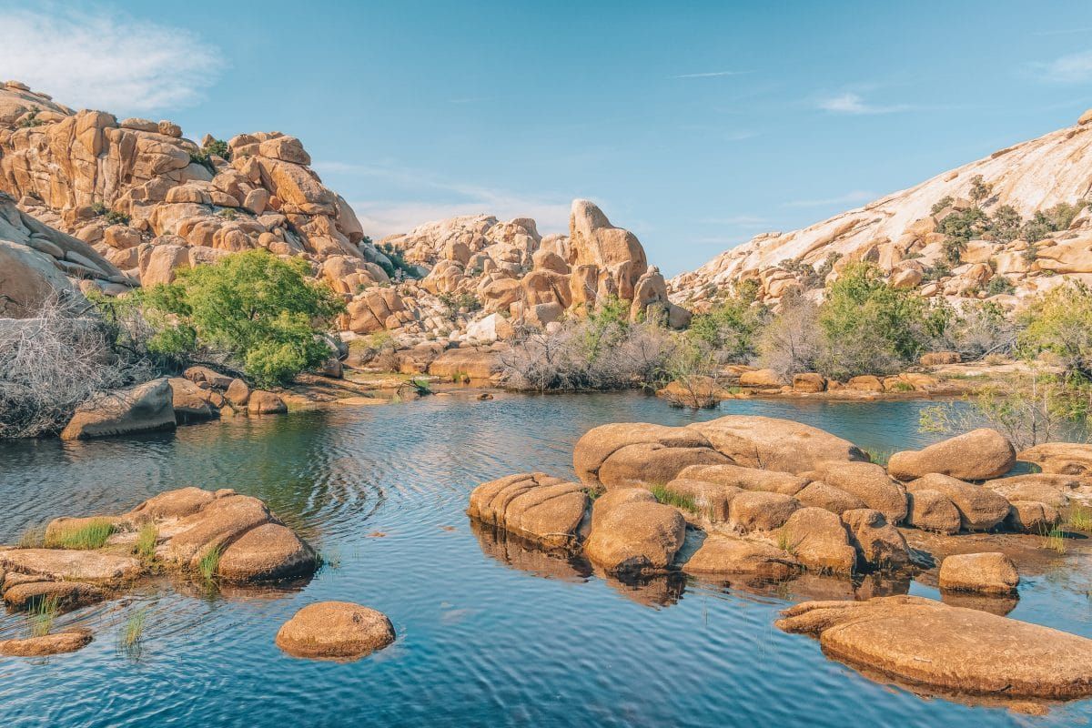
#5 Barker Dam Trail
Best hike for: Wildlife viewing
Distance: 1.3 miles | Elevation Gain: 62 ft | Difficulty: Easy
Trailhead: Barker Dam Parking Area
Features: Joshua trees, historic Barker Dam, ancient rock art.
Trail Guide
The Barker Dam Nature Trail is an easy 1.3-mile loop trail with 62 feet of elevation gain. Barker Dam, also known as the Big Horn Dam, is a historic water trough for cattle that was built by local ranchers (including C.O. Barker) in 1900.
The water in the Barker Dam is an invaluable source of life for the desert animals. If you go early enough, you might even catch a glimpse of bighorn sheep taking a drink.
The trail also winds through large monzogranite boulders, which are iconic in the park.
The ease of the Barker Dam Trail, plus the possibility of seeing wildlife, makes this one of the best hikes in Joshua Tree for wildlife viewing.
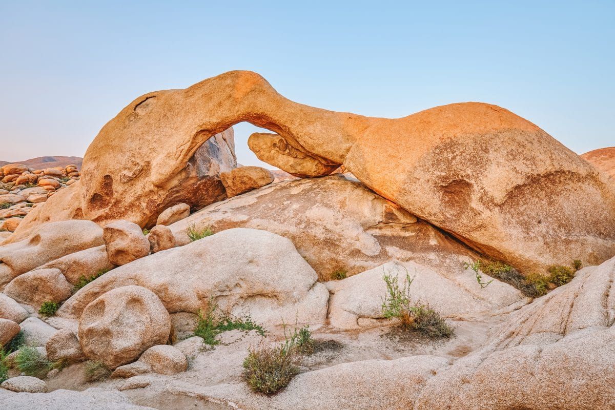
#6 Arch Rock Nature Trail
Best hike for: Doing one of the top hikes in Joshua Tree in a short amount of time.
Distance: 1.4 miles | Elevation Gain: 100 ft | Difficulty: Easy
Trailhead: Arch Rock Nature Trail Trailhead
Features: Natural rock arch.
Trail Guide
The Arch Rock Trail is a short, easy hike to a natural rock arch. It’s one of the best Joshua Tree hikes for those staying at the White Tank Campground since the trailhead is located in the campground.
Even if you’re not staying in the campground, it isn’t hard to access this trail. White Tank Campground is located on Pinto Basin Rd, the main north-south road in the eastern part of the park.
The campground, FYI, is named after the White Tank granite, which makes up the buff-colored boulders in Joshua Tree.
Arch Rock is one of the most popular Joshua Tree hikes – people really get jazzed over natural arches.
If the parking area is full for the Arch Rock Trail, have a backup plan and come back later in the day. It’s such a short hike that you can easily knock it out in under an hour.
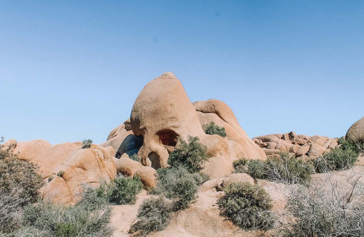
#7 Skull Rock Nature Trail
Best hike for: Eerie desert photography.
Distance: 1.7 miles | Elevation Gain: 160 ft | Difficulty: Easy
Trailhead: Across from the entrance to Jumbo Rocks Campground.
Features: Skull Rock, climbing areas, interpretive signs.
Trail Guide
Skull Rock is a big, naturally occurring boulder with holes in it that look like the eye sockets of a skull. Skull Rock is located just south of Park Boulevard, east of the Jumbo Rocks Campground.
Skull Rock can be seen from the road and, in addition to being a popular sight itself, is situated near a large, popular campground (Jumbo Rocks).
You can start the easy hike at the Jumbo Rocks Campground and walk the 1.7-mile loop, which takes you through boulder fields with interpretive signage to learn about the nature around you.
There’s also parking on both sides of the road near Jumbo Rocks Campground, although these can fill up on weekends.
The Skull Rock Trail is a great place to capture that stark, eerie desert vibe if that’s something you’re looking to cultivate on your Insta. If not, it still has great wildflowers in the spring.
Jumbo Rocks Campground is also one of the popular climbing areas in Joshua Tree National Park, so you’ll likely see people scrambling on the rocks. Even if you’re not a climber, it can be fun to see people up on the boulders.
#8 Keys View to Inspiration Peak Trail
Best hike for: Lazy peak-baggers.
Distance: 1.9 miles | Elevation Gain: 669 ft | Difficulty: Easy
Trailhead: Key’s View, 33.9272, -116.18745
Features: Panoramic View of the Coachella Valley.
Trail Guide
Keys View to Inspiration Peak is one of the best hikes in Joshua Tree National Park (and maybe even in all of California) for those who love to brag about peak bagging but don’t want to work up a sweat.
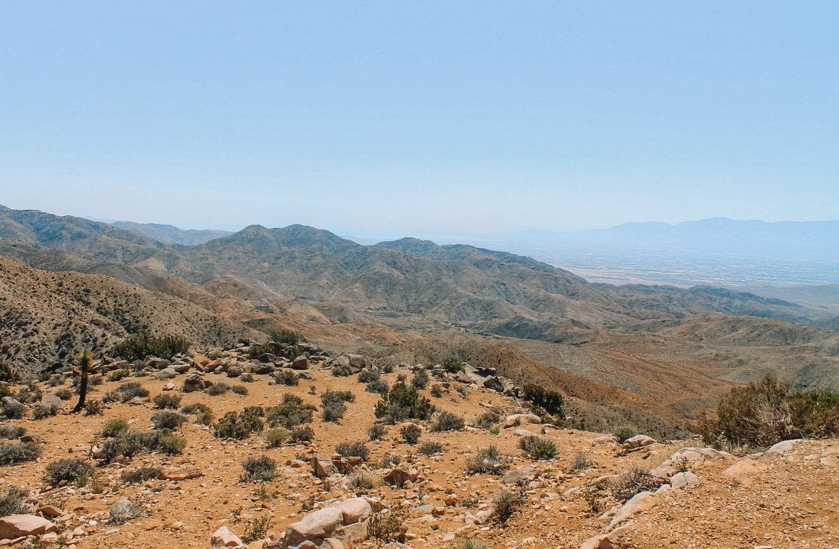
Keys View is one of the most popular overlooks in Joshua Tree. It’s a high point in the Little San Bernardino Mountains and is located at the end of Keys View Road, off of Park Boulevard.
The vista overlooks the Coachella Valley to the west as well as Mount San Jacinto. While the vista at Keys View is amazing, the views at the top of Inspiration Peak are even better.
To get to Inspiration Peak, you’ll take a social trail (an unofficial trail) off the southwest corner of the parking lot.
From the top of Inspiration Point, you can also look into the park towards the surrounding mountain ranges, including the popular Ryan Mountain.
#9 Split Rock Loop Trail
Best hike for: Interesting rock formations with minimal effort.
Distance: 1.9 miles | Elevation Gain: 360 ft | Difficulty: Easy
Trailhead: Split Rock Trailhead
Features: Archeological sites, Joshua Trees, views of Face Rock and Sleeping Turtle.
Trail Guide
The Split Rock Loop Trail is a 1.9-mile easy hike that’s located on the east end of Park Boulevard. You’ll turn onto Split Rock Road and the trailhead is at the end of the road.
I haven’t done the Split Rock Loop Trail myself yet but many people describe it as one of the best short Joshua Tree hiking trails with great views.
The northwest side of the park is the busiest part of Joshua Tree National Park and since this hike is closer to the eastern side, it’s a bit quieter than say, Barker Dam. That said, the parking area can fill up on weekends.
The trail is named Split Rock because of a very large boulder at the start of the trail. When you walk around the back of the boulder, you’ll see a large undercut (“split”) in the boulder.
This space was once used by indigenous people as a shelter. You can still see the char marks on the ceiling of the little cave from their fires.
As with any archeological site, please do not enter, touch, or take anything you find.
If you’re up for it, you can also take a short 10-15 minute detour to Face Rock. There are signs for the detour to Face Rock and the cool thing about Face Rock is that it looks just like a face in profile.
Finally, on your way back to the parking lot, keep an eye out on the left for the rock formation known as Sleeping Turtle. It really does look like the head of a giant sleepy turtle.
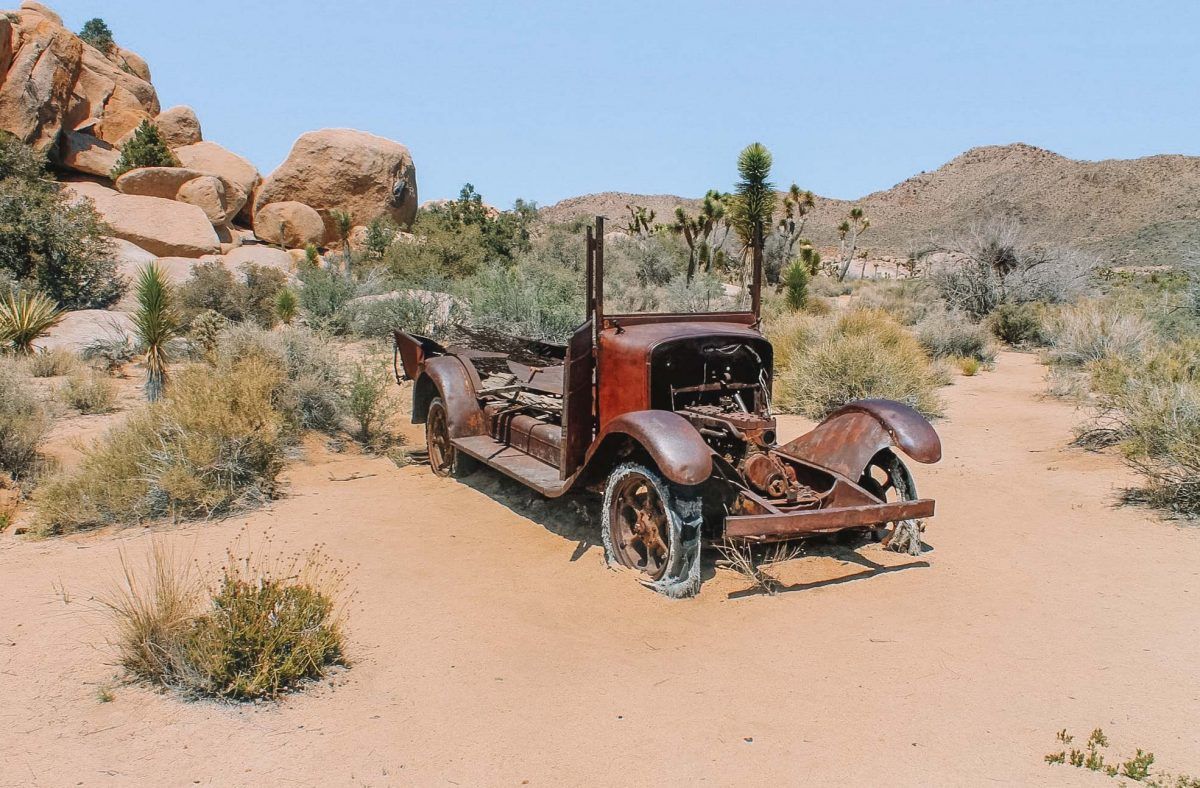
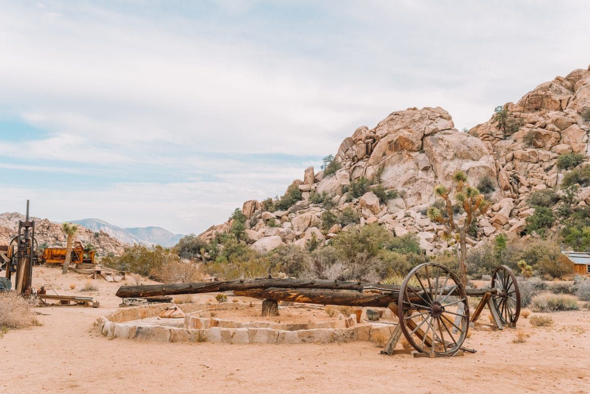
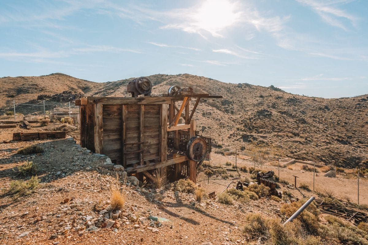
#10 Wall Street Mill
Best hike for: Old West history buffs.
Distance: 2.4 miles | Elevation Gain: 88 ft | Difficulty: Easy
Trailhead: Barker Dam Parking Area
Features: Historic mining operation known as the Wall Street Mill.
Trail Guide
The Wall Street Mill Trail is an easy trail that takes you to the historic Wall Street Mill.
Before Joshua Tree National Park was established, the desert was littered with gold and silver mines.
Once the ore-bearing rocks were extracted, they were taken to a mill to be pulverized and to have the valuable metals removed.
The Wall Street Mil preserves one such milling location, as well as an old homestead and a few rusty cars.
The mill is on the National Register of Historic Places and the trail has a marker that denotes the spot of a deadly gunfight between the mill owner, Bill Keys, and a neighbor named Worth Bagley.
All of this lurid history makes this one of the best hikes in Joshua Tree for Old West history buffs.
In terms of the actual trail, there are two ways to start the Wall Street Mill hike.
You can reach the Wall Street Mill trailhead at the Barker Dam Parking area. However, if that parking lot is full, you can drive east on Queen Valley Road (a dirt road). The turnoff to the left will be very soon after the parking lot.
#11 Mastodon Peak Loop Trail
Best hike for: Those entering from the south entrance.
Distance: 2.6 miles | Elevation Gain: 440 ft | Difficulty: Moderate
Trailhead: Cottonwood Group Campground, 33.7370, -115.8107
Features: Mastodon Peak and historic Mastodon Mine, Colorado/Sonoran Desert.
Trail Guide
The Mastodon Peak Loop Trail is a moderately difficult 2.6-mile loop trail in the southern part of Joshua Tree National Park. This trail offers the best hiking in Joshua Tree for those entering the park from the southern entrance.
To get to the trailhead, turn onto Cottonwood Oasis Road from Cottonwood Springs Road. You can start the loop trail from the Cottonwood Group Campground or Cottonwood Spring at the end of the road.
The cool feature of this trail is that it takes you to the top of Mastodon Peak (3371 ft) and past the historic Mastodon Mine.
Since this trail isn’t in the Mojave Desert, you won’t find Joshua Trees, but there are still plenty of other neat desert plants (like the cholla cactus) that you’ll see along the way.
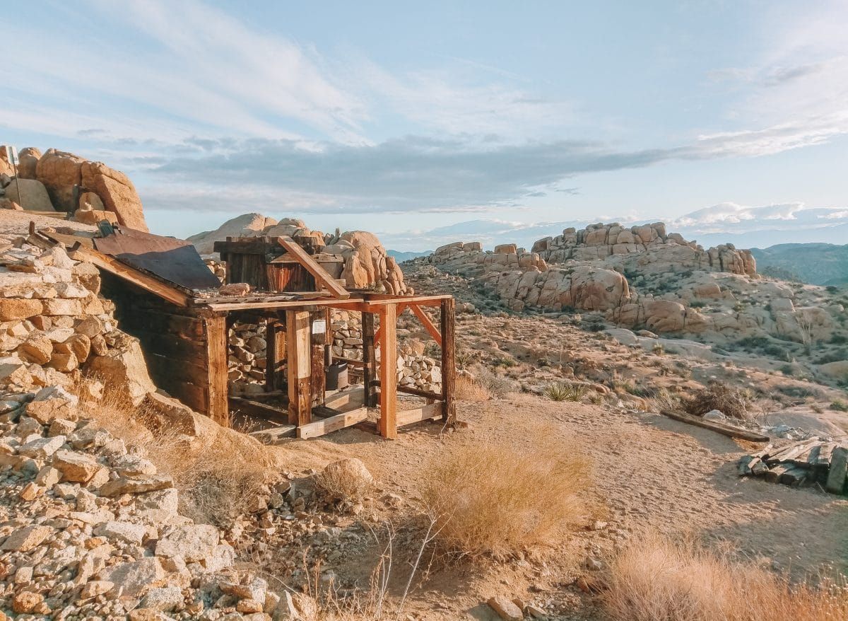
#12 Desert Queen Mine
Best hike for: Anyone interested in mining history.
Distance: 3 miles | Elevation Gain: 180 ft | Difficulty: Moderate
Trailhead: Desert Queen Mine Trailhead, 34.0236, -116.0776
Features: Historic mining operations, overlooks, Joshua Trees.
Trail Guide
Located in the northeast part of Joshua Tree National Park, the Desert Queen Mine is a moderate hike with little elevation gain.
To get to the Desert Queen Mine Trailhead, turn off Park Boulevard onto Desert Queen Mine Road and park at the end of this road. The trailhead parking lot can fill quickly as the Pine City Trail also starts here.
The Desert Queen Mine was a very profitable gold mine back in the day and continued to operate into the 1960s.
The first part of the trail was originally part of the old mine road and you can explore all around the old mine.
There are also a ton of artifacts from that area scattered along the trail, which are very cool to walk around. As always though, please leave any rusty artifacts you find as they are.
As you hike, you’ll pass by gated mine shafts that are now roosts for bat colonies. Just please be respectful of the bats and don’t yell or throw things into the mine shafts.
#13 Ryan Mountain Trail
Best hike for: A workout and sweeping mountain vistas.
Distance: 3.0 miles | Elevation Gain: 1,069 ft | Difficulty: Difficult
Trailhead: Ryan Mountain Trailhead
Features: Popular hike with panoramic views on top of Ryan Mountain.
Trail Guide
The Ryan Mountain Trail is one of the best day hikes in Joshua Tree for a leg workout and excellent desert vistas.
This trail takes you to the top of Ryan Mountain (5,457 ft), giving you sweeping views of Joshua Tree National Park and the surrounding mountains, including the San Jacinto Mountains and San Gorgonio.
The Ryan Mountain trailhead is located east of Ryan Campground on Park Boulevard. The trailhead is signed, paved, and has pit toilets.
The Ryan Mountain hike is the tallest peak with an official trail, which makes it very popular. So, you’ll want to get to the trailhead early on weekends if you’re gung-ho on doing the Ryan Mountain hike.
Hiking Ryan Mountain is deceptively difficult. Although the trail is just three miles round-trip, there’s over 1,000 feet of elevation gain.
Most hikes in Joshua Tree are very sunny, and this trail is no exception. With little shade and lots of upward hiking, this is a difficult trail.
Once you get to the top though, the views are worth it! From here, you can see the tallest peaks in Southern California, Mount San Jacinto and San Gorgonio.
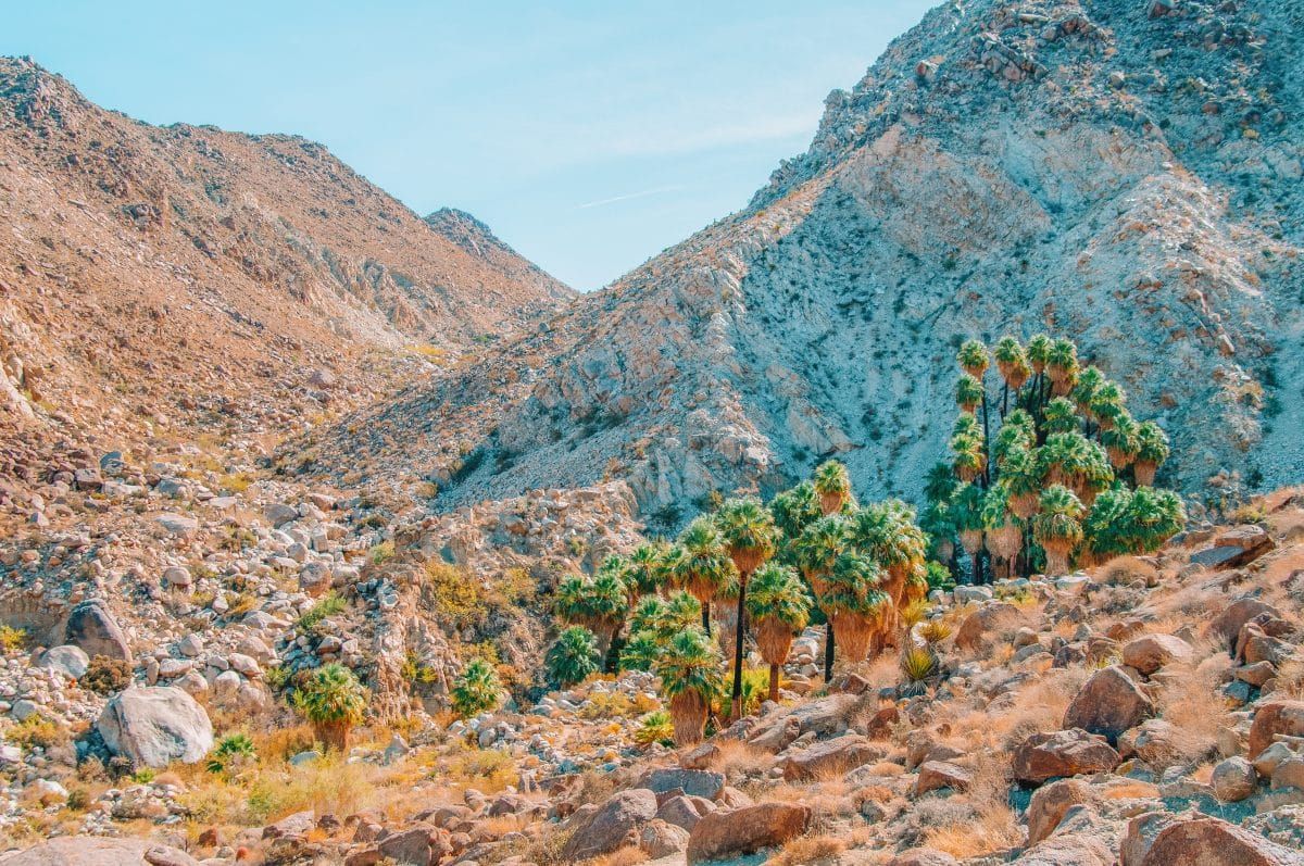
#14 Fortynine Palms Oasis Trail
Best hike for: Those looking for secret Joshua Tree hikes.
Distance: 3.1 miles | Elevation Gain: 350 ft | Difficulty: Moderate
Trailhead: Fortynine Palms Canyon Road, Joshua Tree National Park, Twentynine Palms, CA 92277, 34.1193, -116.1120
Features: Natural desert springs and a quiet hiking experience.
Trail Guide
The Fortynine Palms Oasis Trail is one of the best trails in Joshua Tree to see natural desert springs.
One thing to note is that the trail isn’t located on the main Park Boulevard, instead you have to enter the park through the town of Twentynine Palms on the north border of the park. This feature makes it kind of “secret,” and is one of the quieter trails in the park.
This trail is a relatively quick hike with little elevation gain and takes you to Fortynine Palms Canyon, where European/American settlers planted palm trees in the desert springs.
Today, the palms still grow and you can enjoy a picnic lunch beside the shallow pools.
These desert springs are very valuable for wildlife, so be sure not to leave any food scraps behind. These can spoil in the water and make animals sick.
#15 Black Rock Canyon and Panorama Loop (Or Warren Peak)
Best hike for: Horseback riding.
Distance: 6.5 miles | Elevation Gain: 1,220 ft | Difficulty: Moderate
Trailhead: Site #30 in the Black Rock Campground.
Features: Views of the San Jacinto and San Gorgonio Mountains.
Trail Guide
The Black Rock Canyon Trail is a moderately difficult 6.5-mile loop trail that is popular among trail runners and horseback riders.
The trail is located inside Joshua Tree National Park but is right on the northwest edge of the park near the town of Yucca Valley.
Due to the somewhat remote location, this is one of the best long hikes in Joshua Tree to get away from crowds.
This trail starts in the Black Rock Campground, near site #30, and is one of the few trailheads in Joshua Tree National Park with both drinking water and a toilet.
The parking lot has a few spots marked off for day-use, so try not to park in a camping spot.
This trailhead is also the start of a 35-mile stretch of the California Riding and Hiking Trail, which is a horse-friendly trail. Despite the allowance of horses here, dogs are still not allowed on this trail (or any other Joshua Tree trail).
In addition to the main draws of this trail, you can expect to enjoy views of the San Jacinto and San Gorgonio Mountains along the way.
The Warren Peak Trail is another popular destination that leaves from this trailhead and a good alternative if you’re not feeling Black Rock Canyon. The Warren Peak Trail is a moderately difficult 5.5-mile hike and takes you to Warren Peak (5,103 ft).
#16 Lost Horse Mine Loop
Best hike for: Views of Pleasant Valley.
Distance: 6.7 miles | Elevation Gain: 882 ft | Difficulty: Moderate
Trailhead: Lost Horse Mine Loop Trail, Lost Horse Mine Rd., Twentynine Palms, CA 92277
Features: Historic Lost Horse Mine, Optimist Mine, views of Pleasant Valley.
Trail Guide
The Lost Horse Mine Loop Trail is a moderately difficult 6.7-mile trail located in the northwest portion of the park, south of Park Boulevard.
From Park Boulevard, turn onto Keys View Road, then stay left at the junction with Juniper Flats Road. Turn left onto Lost Horse Mine Road and the trailhead will be at the end of the road.
There are hundreds of historic mining sites inside Joshua Tree National Park, but few were more profitable than the Lost Horse Mine. It extracted the equivalent of five million dollars in gold and silver in today’s currency.
To see the remnants of the Lost Horse Mine, you can either do the entire loop or you can do a shorter out-and-back hike which is only four miles roundtrip.
Hiking the whole loop will give you amazing views of Pleasant Valley, so if you have the stamina, I’d say go for it!
If you choose to do the whole loop, you’ll also pass by the remnants of the Optimist Mine, which was a failed mine (they didn’t find enough gold to prosper).
As with virtually all the hiking trails in Joshua Tree National Park, there’s no shade here.
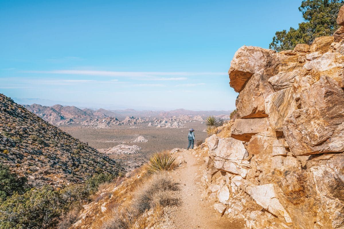
#17 Boy Scout Trail
Best hike for: Backpacking in Joshua Tree.
Distance: 16 miles | Elevation Gain: 219 ft | Difficulty: Strenuous
Trailhead: Keys West Trailhead, 64568 Park Blvd, Twentynine Palms, CA 92277
Features: Joshua trees, Wonderland of Rocks.
Trail Guide
The Boy Scout Trail in Joshua Tree National Park is a popular, longer out-and-back hike that takes you through two distinct eco-regions.
Due to its length, the Boy Scout Trail is popular with backpackers, but many day hikers stop at the viewpoint for a 9.5-mile day.
The trail begins at the Keys West Trailhead off Park Boulevard near the west entrance to the park. Even though this is a relatively large parking area, it still fills up on busy weekends.
The Boy Scout Trail takes you through a classic Mojave Desert landscape with lots of Joshua Trees to begin and slowly winds down into a low-elevation wash as you near the end.
Between the two, you’ll pass through the Wonderland of Rocks, which is a rocky ridge marked by big lumpy boulders.
At the top of this ridge, 4.5 miles in, is a wonderful viewpoint of the surrounding landscape. If you’re only doing the day hike, you should turn around here.
Note that this hike starts at a higher elevation and ends at a lower elevation. This means the hike back is harder than the hike out.
Hiking Joshua Tree: What to Expect
Geography of Joshua Tree National Park
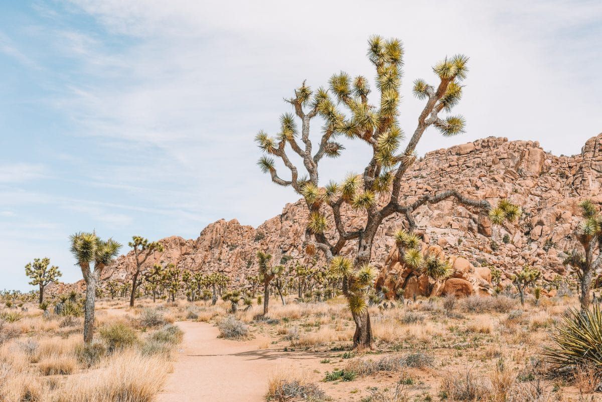
Joshua Tree National Park is an enormous national park (almost 800,000 acres or about the size of Rhode Island) in Southern California. It straddles two major deserts: the Mojave Desert and the Colorado Desert.
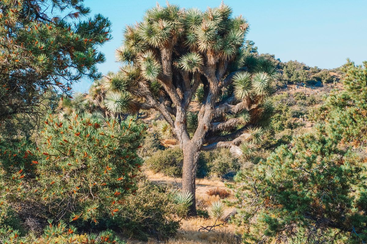
The Mojave Desert in the northwestern part of the park is where you’ll find the park’s namesake: Joshua Trees.
In the lower-lying Colorado Desert to the southeast, you’ll find an even drier landscape with shrubby creosote bushes.
Joshua Tree National Park consists of several small mountain ranges with low-lying basins between them. This is an extension of the Basin and Range topography you’ll find in neighboring Nevada.
History of Joshua Tree National Park
Joshua Tree National Park has a rich cultural history dating back thousands of years.
The Serrano, Cahuilla, Chemehuevi, and the Mojave tribes are known to have used the area of Joshua Tree hundreds of years before the arrival of Europeans.
The name “Joshua Tree” was given to the whimsical desert plants by Mormon settlers who thought the plants resembled the biblical figure Joshua, stretching his hands to the sky in prayer.
For more on the history of Joshua Tree National Park, you can visit the park webpage.
Weather in Joshua Tree National Park
Expect the unexpected in terms of weather at Joshua Tree National Park. The elevation of the park varies from 536 ft to 5,814 ft and weather can be hard to predict.
Heat
The summer in Joshua Tree can easily go over 100 degrees Fahrenheit. In high temperatures like this, it’s not recommended to hike more than one mile. Even in the fall and spring, the temps can get into the 80s and low 90s.
Cold
Despite the heat of the day, night in the deserts can cool off quickly. Bring extra clothing layers to stay comfortable at night.
Flash Floods
In late summer, monsoons can cause flash floods that wipe out roads in the park. Be aware of the forecast if you’re visiting in late summer!
Wind
The wind can whip up at any time of year in Joshua Tree and can spray the landscape with sand. The best protection against stinging sand is tightly fitted sunglasses, long-sleeved tops, and pants.
Cell Service in Joshua Tree National Park
There’s no cell service in Joshua Tree National Park, so be sure to download a hiking app, Google Maps offline, or an Avenza map before you enter the park.
If you forget this step, you can always grab a map at the entrance station.
Services in Joshua Tree National Park
There are no hotels, gas stations, cafes, or restaurants inside Joshua Tree National Park. These services can be found in the nearby towns of Twentynine Palms, Yucca Valley, or Palm Springs.
Read our guides to the best hotels near Joshua Tree and how to plan the perfect road trip from Palm Springs to Joshua Tree.
Potable Water in Joshua Tree National Park
There aren’t many places inside Joshua Tree to get drinking water.
Blackrock Campground, Cottonwood Campground, the south entrance of Joshua Tree National Park, and Indian Cove Ranger Station are the only places to get water.
Can I Take My Dog to Joshua Tree National Park?
You should not bring your dog to Joshua Tree National Park. Dogs aren’t allowed on any trails in the park and it would be dangerous to leave your dog in the car in the desert.
Best Time of Year to go Hiking in Joshua Tree National Park
The best time of year to go hiking in Joshua Tree National Park is between October and May.
March, April, and May are the most popular months because of the lovely weather, the spring wildflowers, and spring break.
Tips for Hiking in Joshua Tree National Park
Bring the Right Gear
Water
Dehydration is a concern in Joshua Tree all year round. Always plan to have at least one gallon of water per person, per day during your stay.
Bring extra water in case your radiator overheats and your car needs some extra fluids as well.
10 Essentials
The 10 Essentials include:
- Navigation (physical map or pre-downloaded map)
- Light Source (Headlamp with extra batteries)
- Sun protection (clothing options and sunscreen)
- First Aid kit
- Knife
- Fire (backcountry stove, matches, fire starter)
- Emergency shelter (tarp, bivy sack)
- Extra food
- Extra water
- Extra clothing layers
All of these items can be neatly packed into a backpack or small box in your vehicle. You may never need these items, but when you do, you do, and you’ll be glad you have them.
Clothes
I’ve spent a large chunk of my career working in extreme desert environments and too often I see (mostly women) embarking on long desert hikes in shorts and tank tops.
Listen, I’m a woman with feelings and I like to look cute too, but trust me when I say that long sleeves are the best option in the desert.
Sun protective clothing is long-sleeved and lightweight. Keeping the sun off your skin is truly the way to stay cool and protect yourself from sharp cacti.
Go Early and Avoid Weekends
Parking lots at popular trailheads (Barker Dam, Ryan Mountain, Arch Rock, just to name a few) fill up quickly between October to May, especially on weekends.
If you’re visiting on a weekend, get to the trailhead as early as you can (the park doesn’t close the gates at night). It’s also good to have a backup plan in case your intended hike is closed.
Beware of Snakes and Bees
Snakes
There are rattlesnakes in Joshua Tree National Park. The best way to avoid them is to stay on the trail and not sit on or kick over rocks with an overhang.
If you hear a snake rattle at you, that’s your warning to back away. Simply backtrack from where you came and both you and the snake can go on your merry way.
Bees
Joshua Tree National Park is home to an aggressive form of honeybee that has swarmed people’s vehicles in the summer.
In the summer, when natural water sources dry up, the bees are attracted to the water coming off the AC in your vehicle.
To avoid a bee swarm, turn off your AC 5-10 minutes before you park your car but keep the windows up. Don’t leave the windows down for any amount of time, especially if you have an open drink in your car.
Download Maps Ahead of Time
Plan your hikes and download your favorite navigation apps ahead of time. There’s no cell service in Joshua Tree so don’t be caught unprepared!
Check out our list of the Best Garmin Watches for Women and the best outdoor watches to find a reliable wearable navigation device.
Bring a Comb
There’s a myth in Joshua Tree that the cholla cactus is poisonous. It’s not, but it sure does sting if a segment catches on your leg as you’re walking by. An easy way to remove the prickly cactus pods is with a wide-tooth comb.
Get Your Vehicle a Tune-Up
The desert is very harsh on vehicles. Unfortunately, people have died walking from their broken-down cars to get help.
Send your vehicle in for a tune-up at your local mechanic and get your fluids topped off before your desert adventure.
Respect the Joshua Trees
Joshua Trees are delicate and aren’t predicted to do well in climate change.
Hanging anything on the trees (prayer flags, lights, etc) or climbing on the trees to get a picture is a serious offense to the National Park Service.
Not only will it incur a hefty fine, but it will also come with a mandatory court appearance.
What to Pack for Camping and Hiking in Joshua Tree National Park
- Tent – Check out our guides to the best 4-person tents, 6-person tents, 8-person tents, 10-person tents, 12-person tents, large camping tents, 3-room tents, instant tents, pop-up tents, inflatable tents, canvas tents, waterproof tents, insulated tents, winter tents, tents with stove jacks, tunnel tents, and cabin tents.
- Sleeping bag
- Sleeping pad
- Broad-brimmed hat or ballcap
- Sun shirt
- Long, lightweight pants
- Beanie
- Layers of clothing for nighttime – read our guide to the best hiking clothes for women
- Hiking boots
- Sunglasses
- Sunscreen
- Physical maps
- Smartphone with maps pre-downloaded
- Extra phone charger with cord
- Cooler with ice (like a Yeti cooler)
- Camping chair
- Hammock
- Screen house or camping canopy (for a shady spot without bugs)
- Camping cot (if you like a more luxe camping setup)
- Tent air conditioner
- Durable phone case
- Comfortable camp shoes
- Water (minimum 1 gallon per person per day plus some for the car)
- More water (I’m serious. Bring water. And drink it!)
- Sports drinks (for electrolytes)
- Camp food, mess kit, and camp stove
- America the Beautiful Pass
- National Park Passport
- Travel insurance
Looking for other California hikes? Check out our guides to the Trans-Catalina Trail, best Bay Area hikes, Catalina Island hiking, Berkeley Fire Trails, best hikes in Laguna Beach, best hikes in Orange County, best Malibu hikes, best Santa Cruz hikes, best Torrey Pines hikes, best Big Basin hikes, best hikes in San Francisco, best San Jose hikes, and best Big Bear hikes.
Get your FREE California Travel Planner – including printable checklists and my favorite two-week itinerary for the state.
ABOUT THE AUTHOR

Meredith Dennis
Meredith is a biologist and writer based in California’s Sierra Nevada. She has lived in 6 states as a biologist, so her intel on hiking and camping is *chef’s kiss* next level. One of her earliest camping memories was being too scared to find a bathroom at night on a family camping trip. Thankfully, she’s come a long way since then and she can help you get there too!
Looking for more national park travel inspiration? Read our guides below!
22 Things to do in Death Valley National Park
31 Things to do in Yosemite National Park
Epic California National Park Road Trip
Best National Park Scratch-Off Maps
Pin this image for future reference

