TL;DR: The best hikes in Orange County are the Top of the World Hike via Canyon Acres Trail, Black Star Canyon Falls Trail, and the Bridge to Nowhere Hike. Here’s why:
- The Top of the World Hike offers panoramic ocean views from the highest point along a 2.4-mile dog-friendly trail with steady inclines, accessible from the parking area.
- Some believe the Black Star Canyon Falls Trail in the Santa Ana Mountains is haunted. Either way, it’s a 6.8-mile hike to reach the impressive 65-foot tall waterfalls.
- The Bridge to Nowhere Hike in Angeles National Forest offers a dog-friendly, challenging 9.5-mile trek with stream crossings and swimming holes, culminating in a historic bridge.
Orange County, California is one of the best places in Southern California to enjoy 42 miles of coastline and 278 days of sunshine.
It’s no surprise then that Orange County is most famous for its gorgeous beaches and coastal lifestyles.
But beyond hitting the beach, Orange County also has hundreds of miles of scenic trails and some of the best hiking in California for you to explore.
What makes Orange County trails so special is that many of them will let you experience those same gorgeous coastlines but from a totally different perspective.
One of my favorite things about hiking the trails in Orange County is smelling the sea and having the ocean breeze blowing through your hair as you take in the coastal views below.
And the best thing about a lot of the hikes in Orange County is how accessible they are. One minute you’ll be in the middle of a bustling town and a short hike away you’ll be in a peaceful natural oasis. It’s one of the many reasons people flock to this area in the first place.
So get on those hiking boots and prepare yourself for hitting the trails in this beautiful part of California. These are the best hikes in Orange County for you to explore on your next visit!
Note: this article contains affiliate links, which help run this site at no extra cost to you so I can keep providing free travel advice and tips.

El Moro Canyon Loop Trail
Length: 5 miles | Elevation Gain: 807 ft | Trail Guide
Features: Wildflowers, ocean views, horses and bikes are allowed.
El Moro Canyon Loop Trail is located on the Newport Coast at Crystal Cove State Park. This loop trail begins and ends at the El Moro Visitor Center.
You’ll have to leave your fur baby at home for this hike, but horses and mountain bikes are allowed on this busy trail.
I’ll let you in on a little tip, if you want to give your legs a stronger workout, take the trail counterclockwise. If you want to enjoy the ocean views and have more of an easy hike, take the trail clockwise.
There’s plenty of parking at the Crystal Cove State Park entrances, but it will cost you $15 for a day pass unless you’ve purchased a California State Park Pass.
Get your FREE California Travel Planner – including printable checklists and my favorite two-week itinerary for the state.
Back Bay Loop Trail
Length: 2.8 miles | Elevation Gain: 236 ft | Trail Guide
Features: Wildflowers, dog-friendly, good for bird watching.
The Back Bay Loop Trail has a good mix of paved and dirt paths which makes this a super popular hike.
Bikes aren’t allowed on the dirt paths on this hike but leashed dogs are allowed on the entire trail, which makes this a very dog-friendly hike. Parking is a breeze here too with tons of free spots available.
Bring a pair of binoculars to check out all of the birds as you trek along this trail in the Upper Newport Bay Nature Preserve (otherwise known as the “Back Bay”).
Just make sure to check the trail maps frequently, they do a lot of habitat restoration in this area that sometimes closes off an area of the trail.
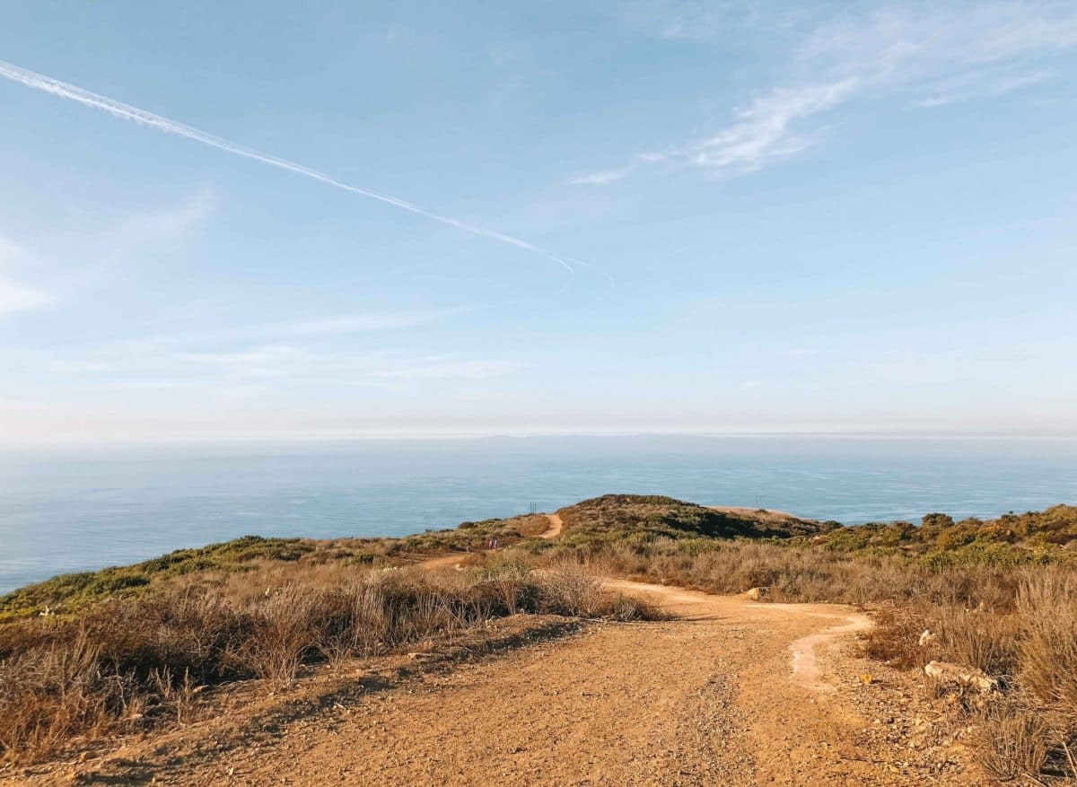
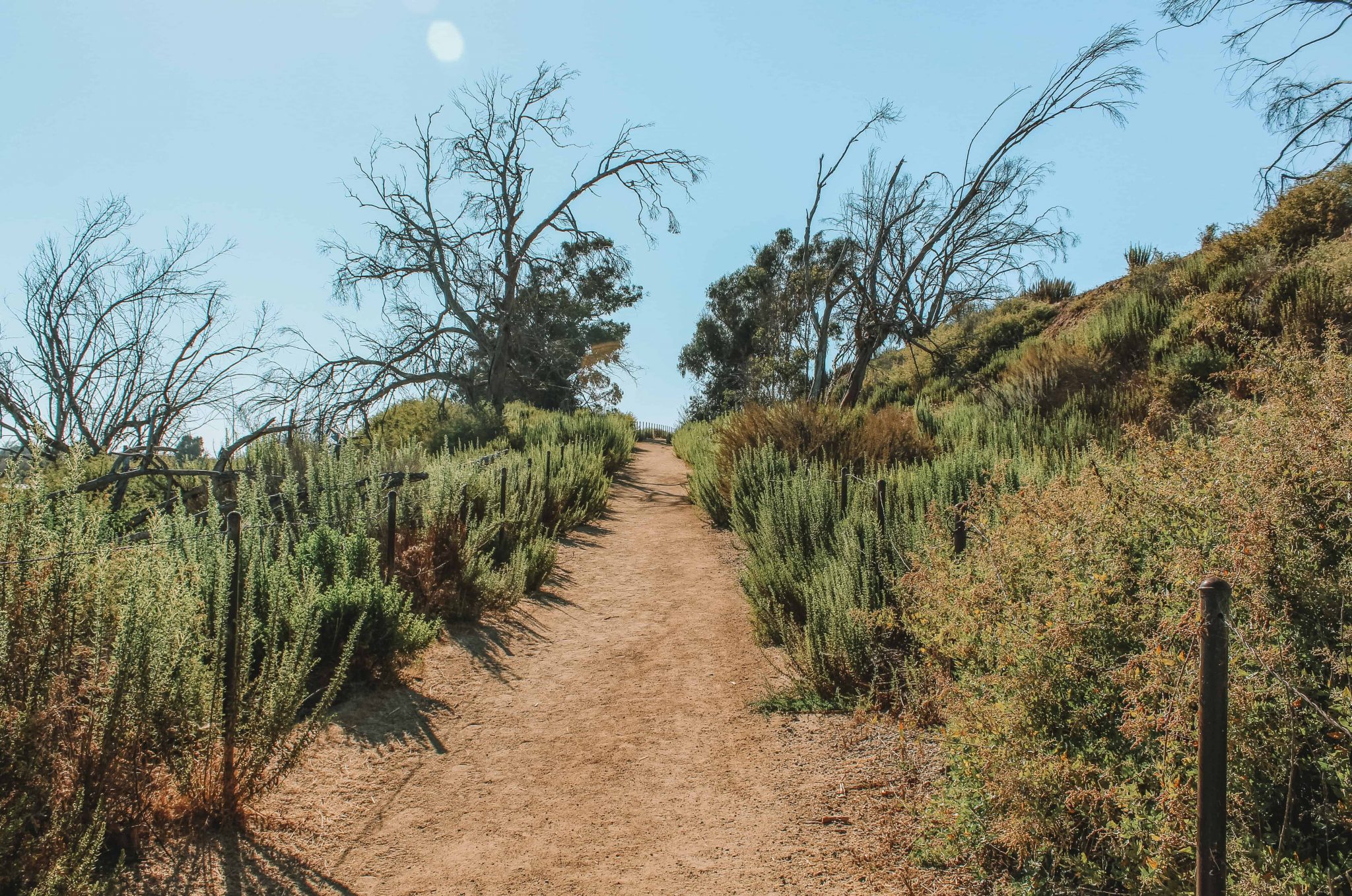
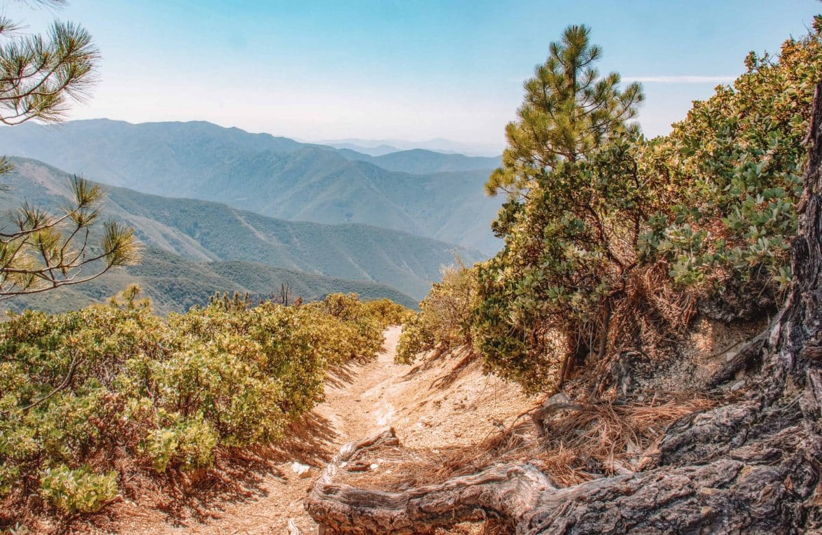
Top of the World Hike via Canyon Acres Trail
Length: 2.4 miles | Elevation Gain: 862 ft | Trail Guide
Features: Wildflowers, ocean views, dog-friendly.
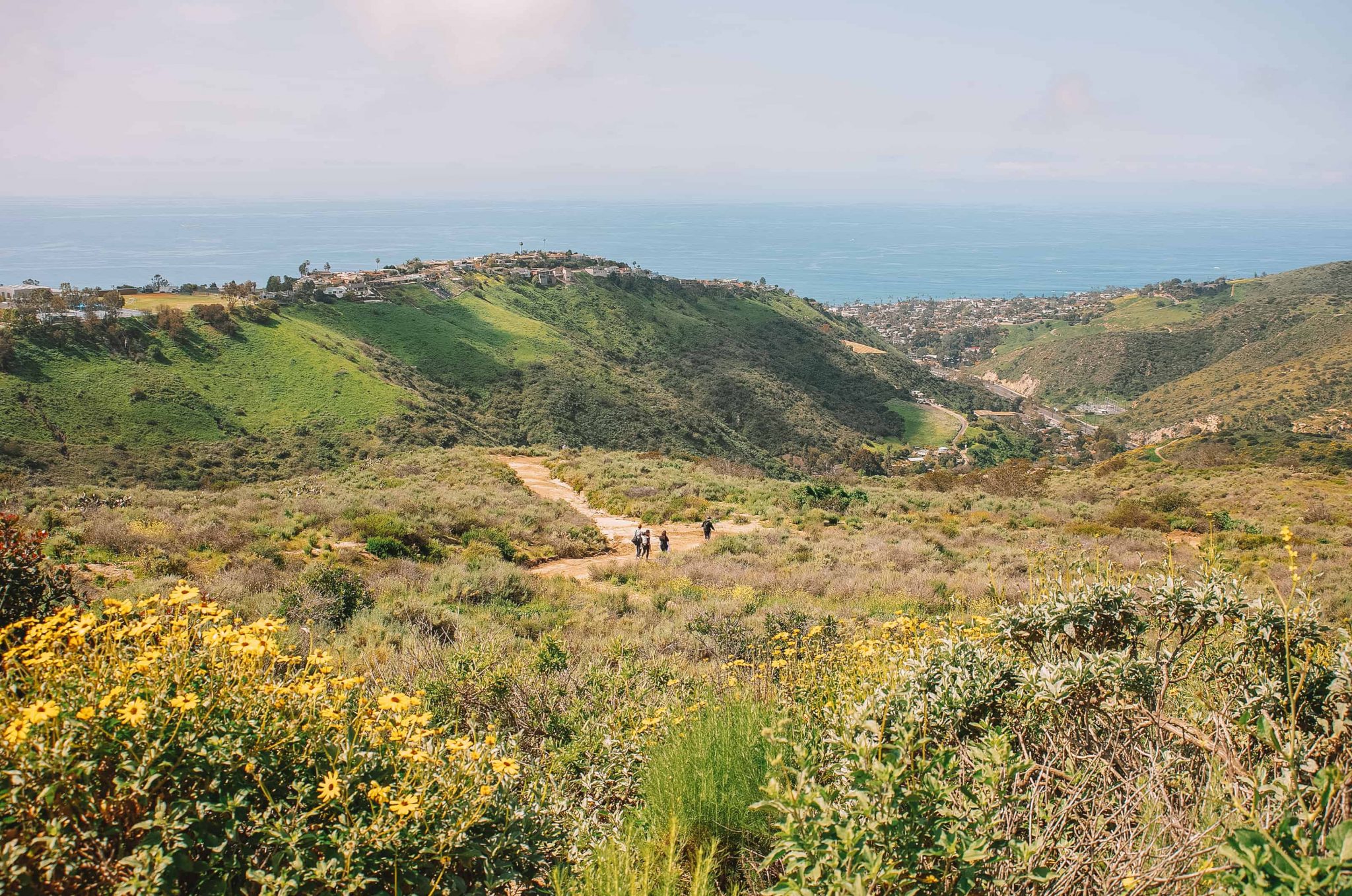
The out and back Canyon Acres Trail takes you to one of the best views in Southern California, a local spot called Top of the World.
Top of the World is a gorgeous lookout point located in Laguna Beach at the Aliso and Wood Canyons Wilderness Park. You’ll experience 360-degree views with the Pacific Ocean on one side and Saddleback Valley on the other.
One of my favorite things about this hiking trail is that the highest point has a relaxing park area with benches and restrooms to make it easy to enjoy some of the best views in Orange County.
The Top of the World hike will truly make you feel on top of the world and give you spectacular views from Catalina Island to Dana Point to Mt Baldy. It’s a great open space to meditate and soak in all the beauty.
This steep uphill trail is a great workout with almost no flat walking at all so make sure you have the energy for a steady incline on the way up.
Fun Fact: If you don’t want to break a sweat, you can drive straight to Alta Laguna Park in Laguna Beach and walk right into the Top of the World area to still appreciate the views without the effort.
San Clemente Beach Trail
Length: 4.5 miles | Elevation Gain: 55 ft | Trail Guide
Features: Right next to the ocean, dog-friendly, pier, restrooms.
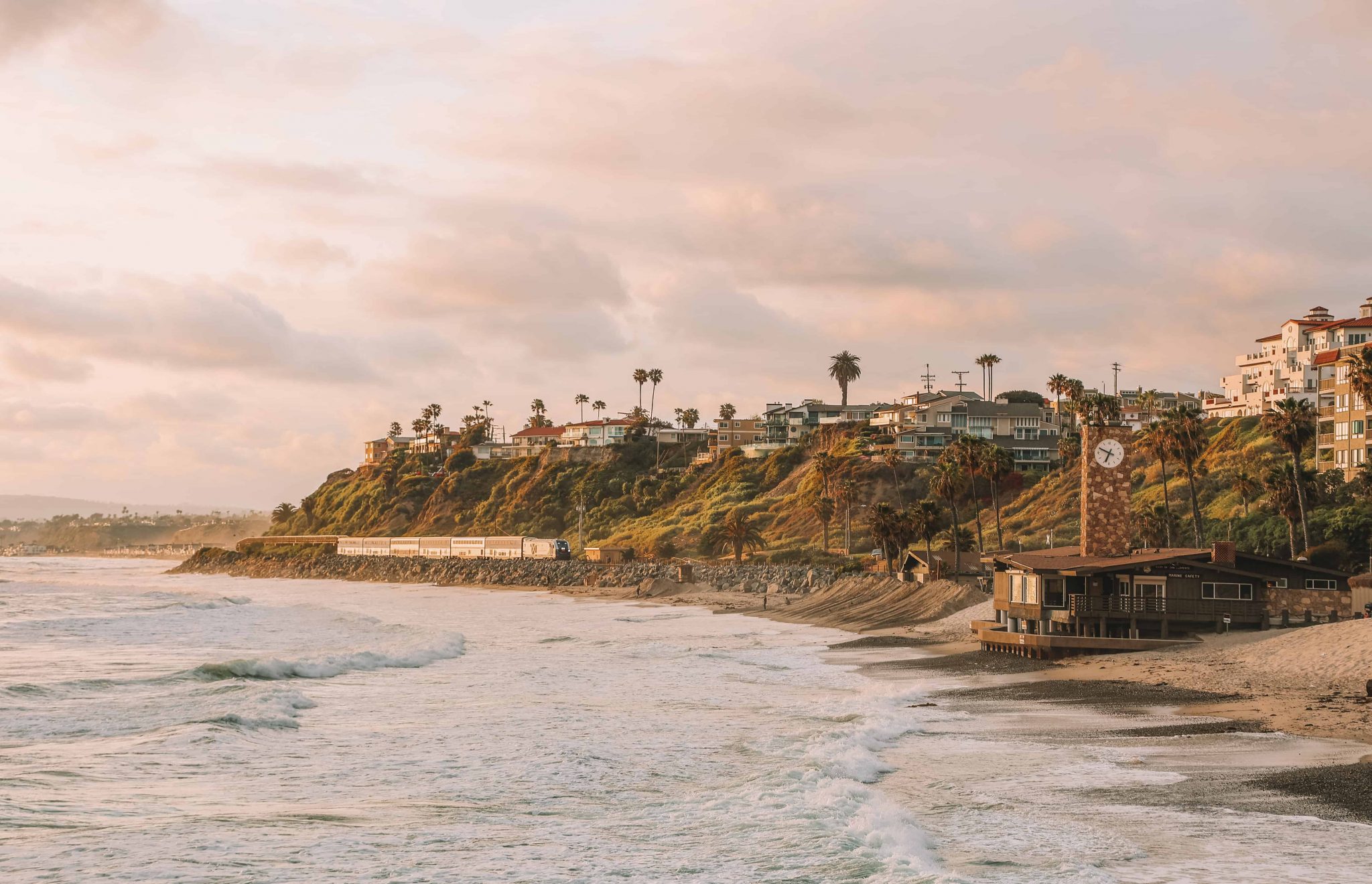
Attention all beach lovers, this is the hiking trail for you. The San Clemente Beach Trail is the best trail in Orange County for strolling along the Pacific Ocean.
One of the most unique things about this trail is that not only will you be walking directly next to the ocean the entire time, but you’ll also be walking next to train tracks.
As the name suggests, this out and back mostly flat trail is located in San Clemente, California, and is usually very well-trafficked. It’s the perfect easy hike for a family walk or for taking Fido for a spin.
One of the coolest features of this trail is that the San Clemente Pier is located smack dab in the center of it.
From the trail, you can detour right onto the pier and stroll over to the beach for even more fantastic waterfront views. I suggest stopping at the tasty Fisherman’s Restaurant & Bar on the pier for a quick bite to refuel.
Parking is plentiful in this area but it will cost a few dollars. You can easily make a full day of your visit to San Clemente Beach (one of the best beaches in Orange County) and dip those feet in the sand after exploring the hiking trails.
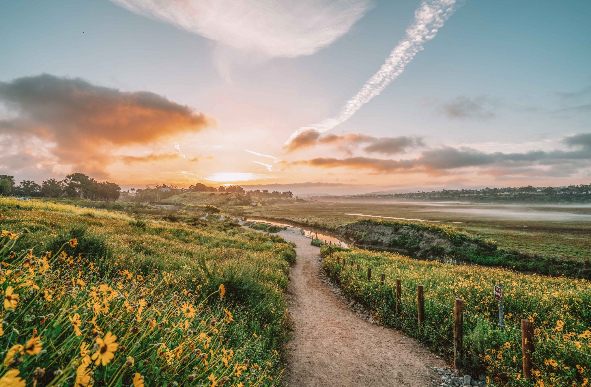
Bolsa Chica Ecological Reserve Hike
Length: 3 miles | Elevation Gain: 78 ft | Trail Guide
Features: Bird watching, wetlands marsh, ocean views, port-a-potty.
The Bolsa Chica Ecological Reserve hike is one of the best family-friendly hikes in Orange County and is my personal favorite.
Bolsa Chica State Beach sits right between Huntington Beach and Sunset Beach and it’s much quieter than its bustling neighbors.
Directly across the Pacific Coast Highway from this state beach is a wetlands area called the Bolsa Chica Ecological Reserve.
This is my favorite place to enjoy nature and work on my photography. The Bolsa Chica Ecological Reserve is also one of the best places in Orange County for bird watchers.
At the reserve, you’ll find hundreds of birds (over 200 species!), colorful flowers, and marshes all while the ocean breeze is blowing through your hair.
There is plenty of free parking at a few different access points. If you’re looking for a wheelchair-accessible route be sure to park in the Pacific Coast Highway parking lot.
Borrego Canyon Trail to Red Rock Canyon
Length: 4.1 miles | Elevation Gain: 452 ft | Trail Guide
Features: Wildflowers, horses are allowed, red rocks.
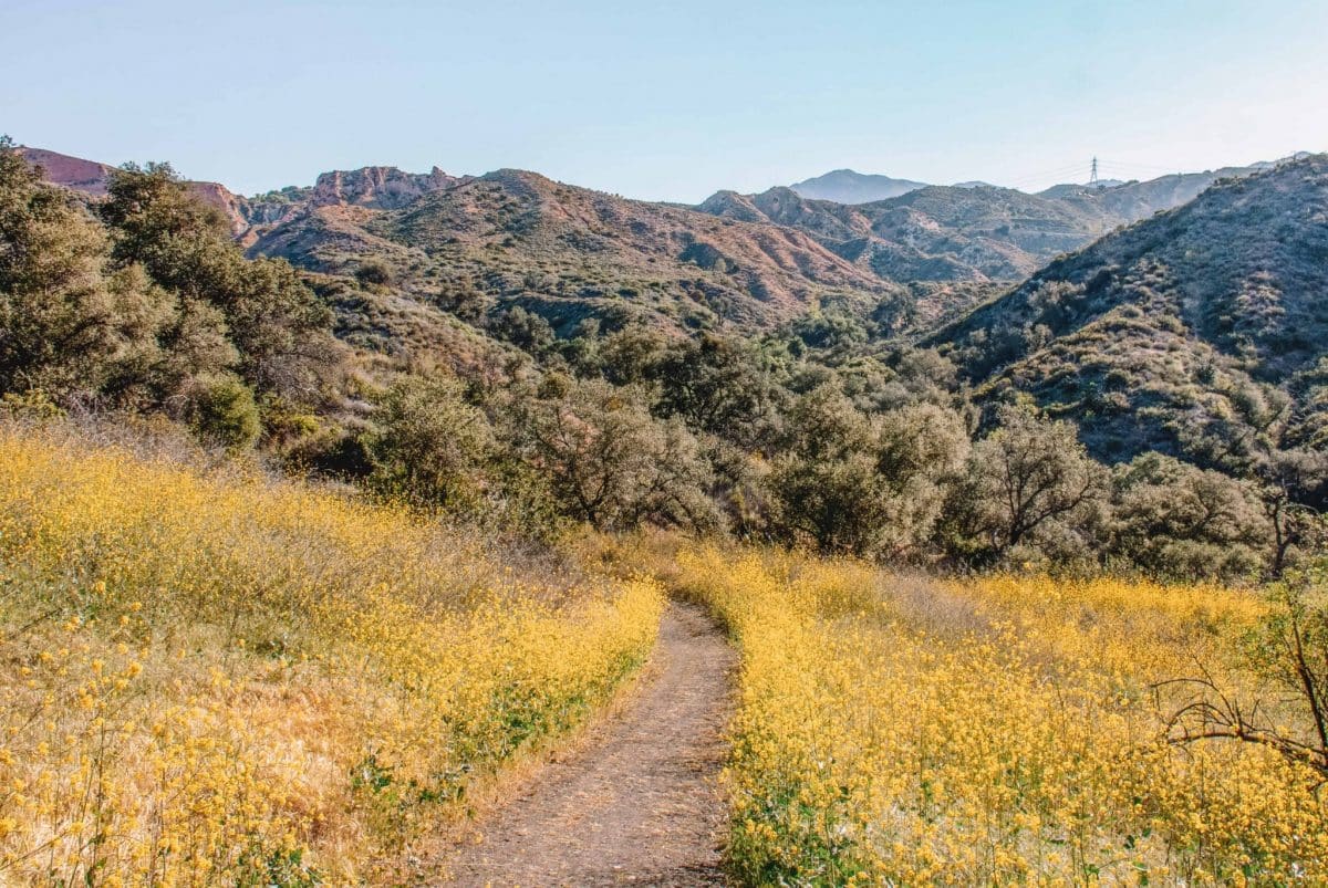
This out and back trail in the Foothill Ranch area is a cool place to take your family on an easy weekend hike that offers some unique scenery.
Once you reach the halfway point at the Red Rock Canyon and see the red glow of the rocks, the landscape will make you feel like you’re on another planet (or maybe just in Sedona, Arizona)
Be sure to stop and do some rock climbing here to explore the Red Rock Canyon a bit more but be aware that sometimes they block off certain areas of the stone to keep it protected.
Another thing to note is there are occasional closures at the Whiting Ranch Wilderness Park and Trabuco Canyon where this trail is located so be sure to check the Orange County Park website before you head out.
This 4-mile hike begins at the Borrego Staging Area and parking is $3 per day and easy to find.
Peters Canyon Loop Trail
Length: 5.9 miles | Elevation Gain: 623 ft | Trail Guide
Features: Horse-friendly and dog-friendly, lakes, wildflowers, restrooms.
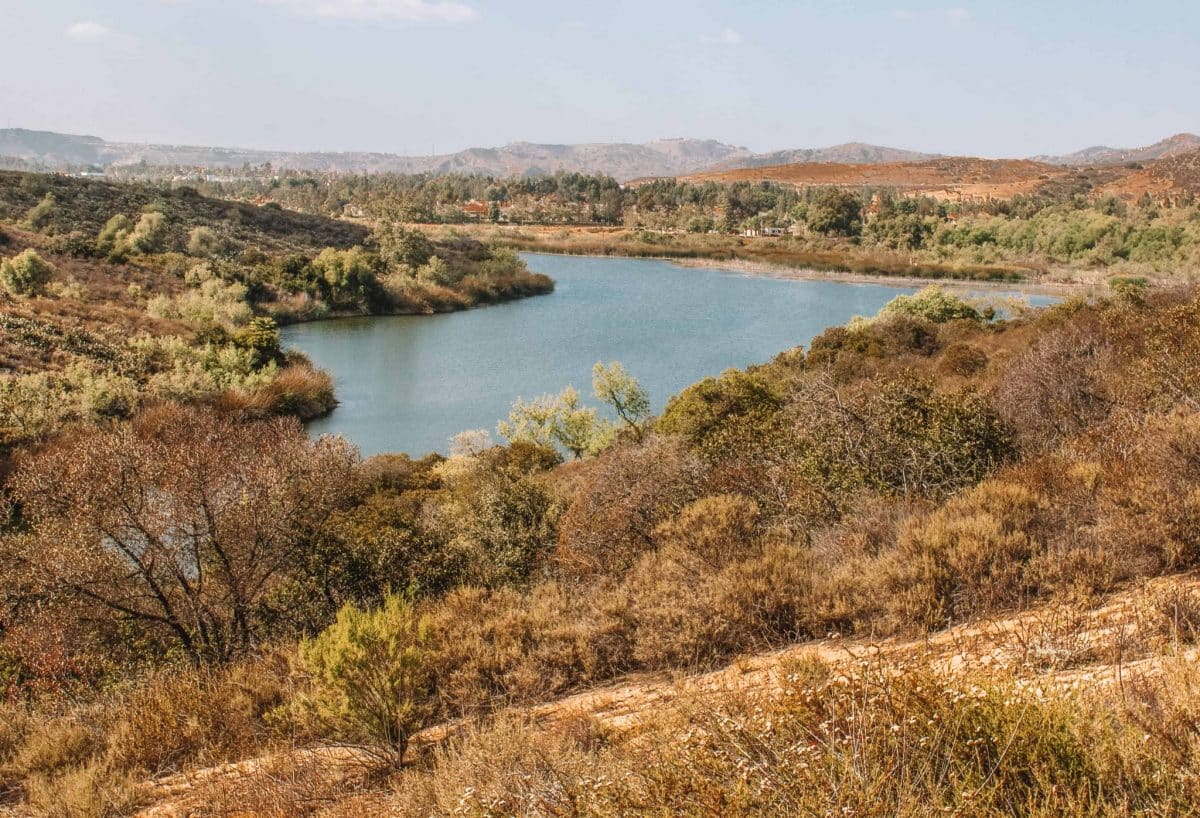
If you’re looking to test your endurance and want to explore the lake located in Peters Canyon Regional Park, be sure to put this trail on your list.
There are two bodies of water on opposite ends of the loop and a lot of up and down action to really get your heart rate going.
Make sure you wear hiking shoes with good tread on this hike as there are a few downhill areas that can get super slippery. It also might be a good idea to bring along your hiking sticks for this trail.
Laguna Coast Wilderness Park Trails
The Laguna Coast Wilderness Park is enormous with 7,000 acres of trails to explore in some of the most picturesque landscapes in the San Joaquin Hills that surround Laguna Beach. There’s a $3 parking fee and the park is open from 8 am to 5 pm daily.
There are a ton of great hikes in this park with something for every skill level. Here are a few of my favorites.
Laguna Coast Wilderness Park Loop
Length: 6.2 miles | Elevation Gain: 1,033 ft | Trail Guide
Features: Wildlife, restrooms nearby.
The Laguna Coast Wilderness Park Loop is a gorgeous trail that’s shaded and lets you experience full-on nature with pristine coastal canyons and a ridge trail with panoramic views along the first part of the route.
The one downside to the trail is that the last part of the hike follows alongside the 133 highway. This can get a little noisy with cars zooming by and can certainly break your zen with nature for a bit.
Other than that, this trail has a ton of hills and challenging terrain for you to get those muscles working.
The parking lot doesn’t open until 8 am so if you’re an early hiker, you’ll need to find alternative parking in the residential area nearby.
Laurel Canyon, Laurel Spur, Willow Trail Loop
Length: 3.3 miles | Elevation Gain: 603 ft | Trail Guide
Features: Wildlife, restrooms, bird watching, camping, ocean views, waterfall.
Located in Aliso Viejo, the Laurel Canyon, Laurel Spur, Willow Trail Loop is a beautiful shady multi-use trail that has a lot of inclines and declines. This makes it ideal for mountain bikers or hikers looking to get a good workout in.
Because this is a popular mountain biking trail, be mindful of the speedy bikers that zoom by and stay aware of your surroundings.
To avoid mountain bikers altogether, stick to the Laurel Trail portion of this route since bikes aren’t allowed on the Laurel Trail past the Stagecoach Trail cutoff.
This loop trail can get busy and sometimes has a line at the $3 parking pass kiosk on Saturday mornings. Because of this, I’d recommend going for a hike here during the week if you can. If the conditions are right, you might even spot a waterfall along the trail too.
If you’re looking for an easier hike in the Laguna Coast Wilderness Park head to Barbara’s Lake Loop Trail. It’s a nice 2.8-mile loop with minimal elevation.
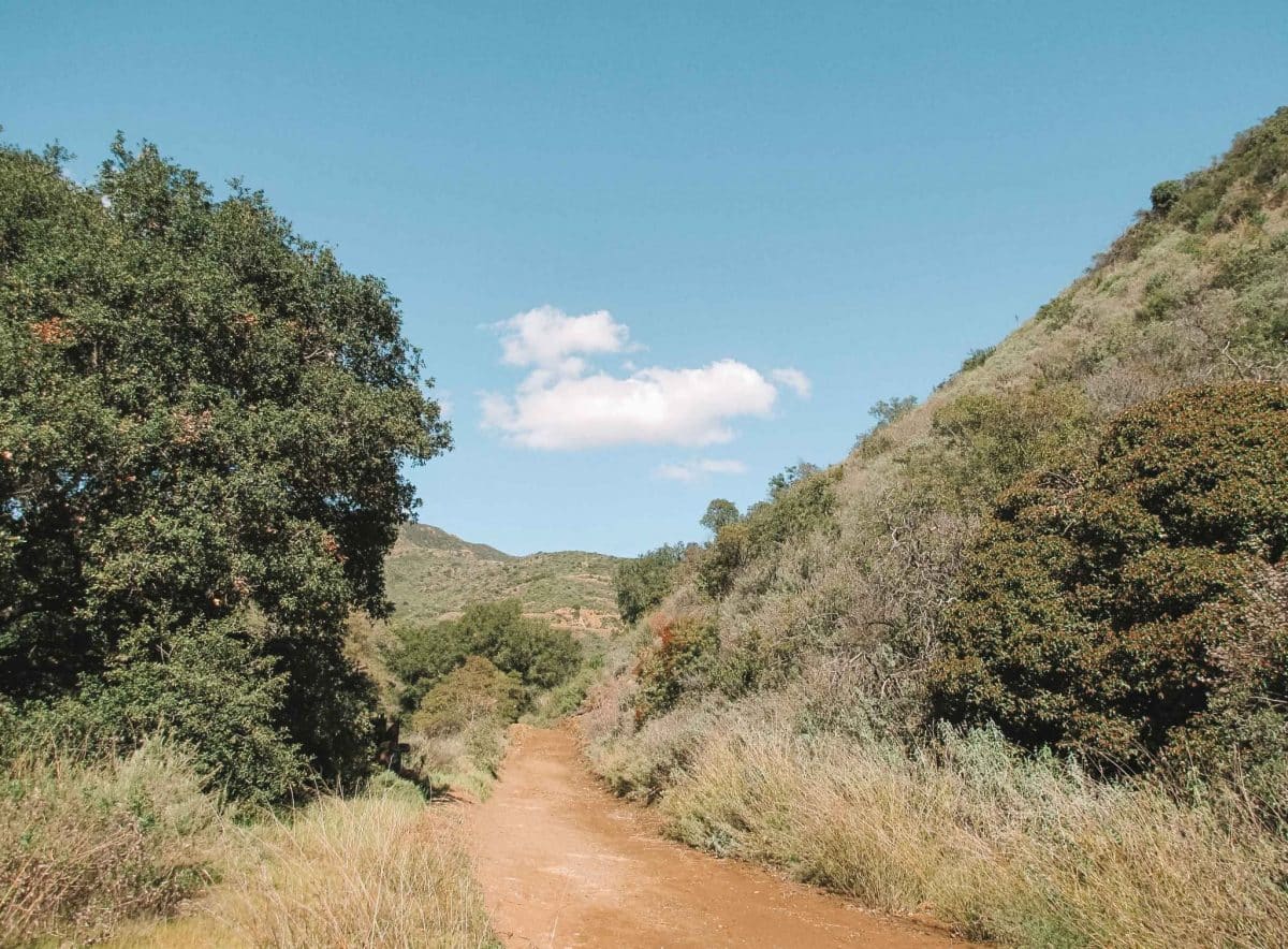
Bridge to Nowhere Hike
Length: 9.5 miles | Elevation Gain: 1246 ft | Trail Guide
Features: Waterfall, great views, bridge/historic site, dog-friendly.
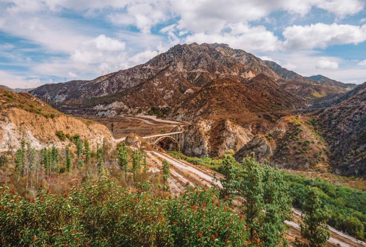
If you’re visiting the Angeles National Forest and looking for a challenge, be sure to check out the Bridge to Nowhere Hike via East Fork Trail.
This out and back 9.5-mile hike takes you along the east fork banks of the San Gabriel River and is usually pretty crowded.
This is a fun trail if you’re looking to cool off in some water along the way. There are a ton of stream crossings and even some swimming holes to explore so be sure to wear waterproof hiking shoes or rugged water sandals and maybe even a swimsuit.
Most of the trail is through scrub brush, so you’ll also want to wear long pants to protect your legs.
The highlight of this hike is the large bridge that was built in 1936. It looks a little out of place because there’s no road leading into it (hence the name). The road has long since swept away over the years.
You’ll need an Adventure Pass to use this trail, which you can buy at many of the local small shops in the area.
Chiquito Trail to Chiquito Falls
Length: 9.1 miles | Elevation Gain: 1,571 ft | Trail Guide
Features: Lake Elsinore, dog-friendly, waterfall, mountain biking, restrooms.
One of the best places to see a waterfall in Orange County is here at the Chiquito Trail in the Cleveland National Forest.
Spring is the best time to experience the waterfall because of the higher water levels, but fair warning, if it’s been a dry season, you may not see much. “Chiquito” actually means small in Spanish, so don’t expect Niagara Falls.
This is a fun, easy-to-follow trail that has just the right amount of up and down and shady spots. It’s one of the best hikes to get a steady workout while soaking up the greenery and wildflowers.
This Chiquito loop trail, which is near Lake Elsinore, California requires an adventure pass that you can purchase at the Candy Store across the street from the trailhead parking.
Black Star Canyon Falls Trail
Length: 6.8 miles | Elevation Gain: 941 ft | Trail Guide
Features: Waterfall, dog-friendly, rock climbing, bird watching.
Looking for a challenging hike? The Black Star Canyon Falls Trail is for you.
This out and back trail is located in the Santa Ana Mountains and takes you to Black Star Canyon. The canyon is a cool historical archaeological site known for being the home to the Black Star Coal Mining Company back in the 1800s.
If you want to hike to Black Star Canyon Falls, just make sure you’re prepared to climb.
If you take the hike to the turnaround point, you’ll find yourself hopping over boulders to get up the stream to reach the 65-foot Black Star Canyon Falls.
For this trail, you’ll want to wear long pants and be on the lookout for poison oak since there’s a ton of it along the route.
Local tip: There’s only ONE paved road that crosses through the Santa Ana Mountains – Ortega Highway. If you have time before or after your hike, you should spend some time exploring this twisting dramatic drive that lets you experience the Santa Ana Mountains to the fullest from the road. The Ortega Highway crests the range and then takes you right down into the Lake Elsinore area.
Other Places to Hike in Orange County
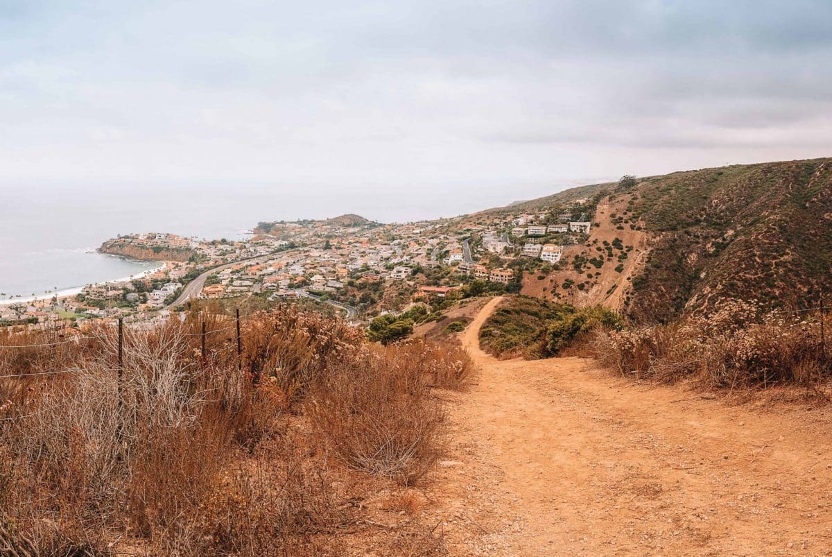
Badlands Park and South Laguna Coast Trail
Length: 2.3 miles | Elevation Gain: 219 ft. | Trail Guide
Features: Dog-friendly, bird watching, great views.
Hands down, the out and back Badlands Park and South Laguna Coast Trail has some of the best ocean views in Orange County.
On a clear day, you can see from San Clemente through Newport Beach. You might even be able to see Catalina Island and the Santa Cruz Islands if you’re lucky.
If you’re looking for an easy scenic hike this is an ideal one to do. This trail takes you directly behind a bunch of gorgeous Laguna Niguel million-dollar homes, which will quickly have you dreaming of living in a luxurious beach home.
There’s plenty of street parking on Isle Vista Street and a stair entrance with picnic tables right at the top of the trailhead.
From the trailhead, turn left and go down the stairs to get to the rock formation. The sandstone formations make it look like the rocks have come from Badlands National Park in South Dakota, which is where the name of the park comes from.
Take the Seaview Trail to walk along the cliffs with more incredible views and an ocean breeze. This multi-use trail also allows bikes, horses, and dogs.
You can access this trail the same way you did Badlands Park Trail but turn right instead of left, or you can enter through Ocean Way.
Bommer Canyon Trail
Length: 4.6 miles | Elevation Gain: 810 ft | Trail Guide
Features: Bird watching, mountain biking, wildflowers, restrooms.
The Bommer Canyon Loop Trail is a natural delight nestled right in the suburbs of Irvine, California.
It’s a well-marked trail with a beautiful landscape in the San Joaquin Hills. Besides its convenient location, this is a great trail to enjoy nature with a steady incline to keep your heart rate up.
There are restrooms and a drinking fountain at the entry point. Parking fills up quickly on the weekends so you’ll want to get there early.
Tenaja Falls Hike
Length: 1.5 miles | Elevation Gain: 311 ft | Trail Guide
Features: Waterfall, wildflowers, bird watching, dog-friendly.
If you love waterfalls, this is one of the best hikes to do in Orange County.
The Tenaja Falls Trail is located in the San Mateo Canyon Wilderness in Murrieta, California.
The easy route to the falls is less than a mile from the trailhead. There is also a longer 7.5-mile scenic route through Fisherman’s Camp and along the San Mateo Creek if you’re looking for a longer hike.
For the shorter 1.5-mile hike to the falls, once you pass the Fisherman’s Camp sign, take the trail to the left.
You’ll have to cross a shallow rocky creek to get there so watch your step. If it’s been dry in Southern California the creek might be dried up which makes it easier to cross.
There are a few swimming holes spread out near the top of the falls. The one that’s easiest to get to can be a bit shallow but is a fun spot to cool you off on a hot day.
Tips for Hiking in Orange County
- Go for a sunset hike – There’s nothing better than an oceanside sunset hike in Orange County. Be strategic about your timing so that you’re not too far from your car when you have to find it again once the sun goes down. Or, make sure to bring a headlamp or flashlight.
- Picturesque flowing waterfalls might not be realistic – Orange County is a very dry area with on average 35 days of rain per year. In most cases, those gorgeous waterfalls need rain to max their flow out so if you are visiting during a dry month, the flow may not be that spectacular.
- Be prepared to run into some wildlife, you are in the wild after all. Don’t forget that you’re visiting the home of various animals. You might run into coyotes, rattlesnakes, mountain lions, birds, and many more animals along the hiking trails in Orange County. Most people have no issues, but here are some tips for hiking and wildlife:
- Be aware of your surroundings and don’t hike after dark.
- Rattlesnakes sometimes sun themselves in the middle of the trail. Keep your distance if you come across one and give it space to slither away.
- Stay on the marked trails to avoid encountering ticks that like to live in shaded, grassy areas. Check you and your dog for ticks after your hike.
- If you encounter a coyote or mountain lion, back away slowly but don’t EVER turn your back or run.
What to Pack for Hiking in Orange County

- Bring plenty of water – enough for you (and your dog if you’re hiking with one)
- Waterproof hiking shoes for getting over those slippery creeks
- Physical or downloaded trail maps – cell service is minimal or non-existent
- High energy snacks to fuel up
- First aid kit
- Dress in breathable layers – Read our guide to the best hiking clothes for women
- Sunglasses and a hat to protect yourself from the heat
- Sunscreen
- Insect repellent
- Hiking poles – especially if you’re hiking a steep area or need the extra support for your knees
- Waste bags to clean up after your dog
- Handheld GPS, outdoor watch with GPS (like a Garmin watch), or a good hiking app that you can use offline
- Compact binoculars if you’re into birdwatching
- A durable phone case
Looking for other California hikes? Check out our guides to the Trans-Catalina Trail, best Bay Area hikes, Catalina Island hiking, Berkeley Fire Trails, best hikes in Laguna Beach, best Malibu hikes, best Santa Cruz hikes, best Torrey Pines hikes, best Big Basin hikes, best hikes in San Francisco, best San Jose hikes, best Joshua Tree hikes, and best Big Bear hikes.
Get your FREE California Travel Planner – including printable checklists and my favorite two-week itinerary for the state.
ABOUT THE AUTHOR

Rosie Queen
Rosie Queen is a travel blogger and creative writer who grew up on the South Side of Chicago. Since moving to Huntington Beach in 2019, she has been exploring every nook of Southern California and beyond with her adventure-seeking husband and adorable Golden Doodle, Indy. She’s obsessed with her dogs, color guard/marching band, national parks, and road trips.
Looking for more Southern California travel inspiration? Check out these related posts below!
11 Best Beaches in Malibu, California
10 Most Beautiful and Best Beaches in Laguna Beach, California
14 Fun Things to do in Julian, California
34 Things to do in Long Beach, California

Pin this image for future reference


Very nice tips, thank you so much for sharing, love your blog!