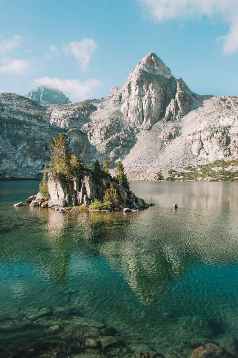
The best hikes in Sequoia National Park and Kings Canyon to help you make the most of your trip to these national parks.
Sequoia and Kings Canyon National Parks are huge, gorgeous parks in California’s Sierra Nevada Mountains that offer miles and miles of trails.
But with hundreds of miles of trails to choose from, it can be a little overwhelming to decide which hikes to tackle. This is especially true without cell service, which both parks are notorious for.
To help you find the best trails for your trip, I’ve hand-picked my favorite hikes in Sequoia National Park and Kings Canyon National Park.
I’ve arranged them by difficulty level so you can easily sort through the list and find the hikes that work best for your trip.
Think of this as your shortcut to the best Kings Canyon and Sequoia National Park hikes!
Note: this post contains affiliate links, which help run this site at no extra cost to you so I can keep providing free travel advice and tips.
Kings Canyon & Sequoia National Parks Trail Map
Be sure to check out the current trail closures in Sequoia and Kings Canyon here.
Best Hikes in Sequoia National Park and Kings Canyon
#1 Roaring River Falls
Best hike for a wheelchair-accessible waterfall
Distance: 0.3 miles | Elevation Gain: 26 ft | Difficulty: Easy
Location: Cedar Grove area of Kings Canyon National Park
Trailhead: 36.78376, -118.62220
Features: 40-foot waterfall and views of North Mountain.
Trail guide
The Roaring River Falls trail is short, sweet, and a perfect stop for antsy kiddos or anyone–including wheelchair users–who needs some misting.
Roaring River Falls is perhaps one of the shortest Kings Canyon Trails and is best in early summertime.
On your return route from this Kings Canyon waterfall, you’ll get views of North Mountain on the other side of the canyon.
You can connect this trail to Zumwalt Meadow (not wheelchair friendly) for a longer hike.
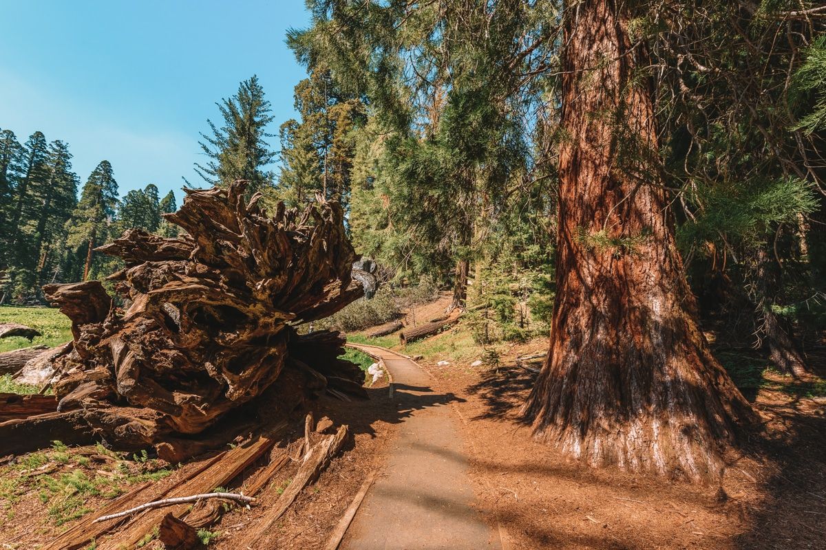
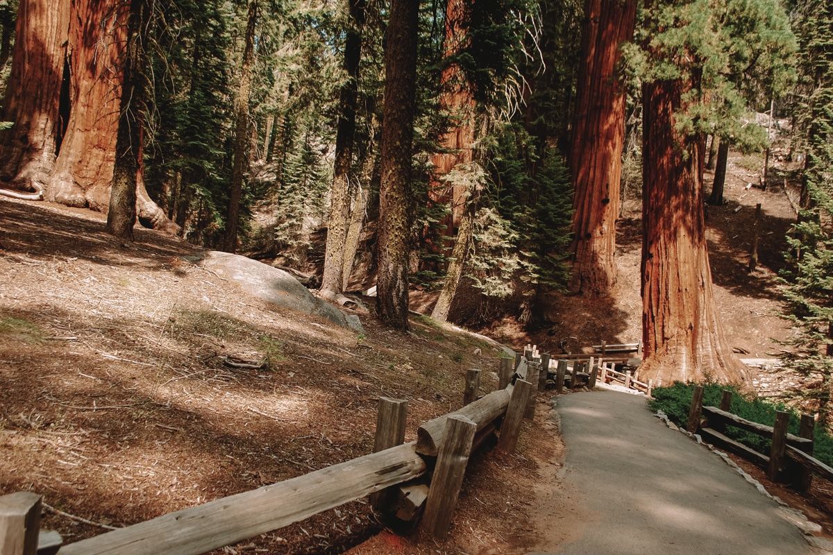
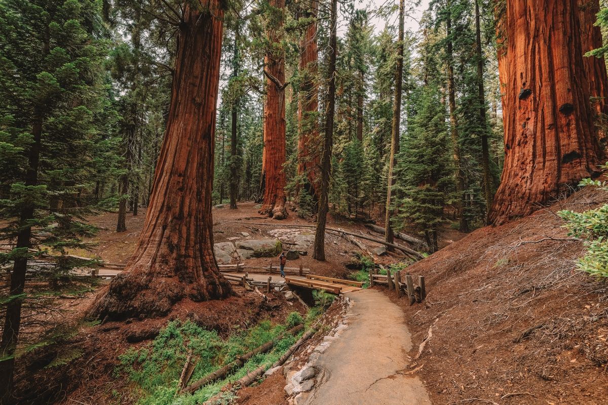
#2 General Grant Loop Trail
Best hike for the fastest tour of giant sequoias
Distance: 0.7 miles | Elevation Gain: 32 ft | Difficulty: Easy
Location: Grant Grove area of Kings Canyon National Park
Trailhead: 36.74678, -118.97281
Features: The second-largest tree in the world, plus a historic cabin and the Fallen Monarch tree.
Trail guide
The General Grant Loop Trail features the General Grant Tree, the second largest tree by volume worldwide (second to the General Sherman Tree in Sequoia). In 1926, Calvin Coolidge dubbed it “America’s Christmas Tree.”
In addition to the General Grant Tree, you can walk inside a fallen sequoia tree, the Fallen Monarch, and explore the historic Gamlin Cabin.
This trail is an easy jumping-off spot to explore other sequoia groves in Kings Canyon, including Redwood Mountain (the world’s largest sequoia grove) and North Grove.
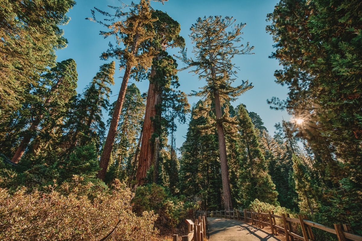
#3 Big Trees Trail
Best hike for those who want to learn about giant sequoia ecology
Distance: 1.2 miles | Elevation Gain: 50 ft | Difficulty: Easy
Location: Lodgepole area of Sequoia National Park
Trailhead: 36.56506, -118.77279
Features: Giant sequoia trees surrounding a quiet meadow where wildlife spotting is frequent.
Trail guide
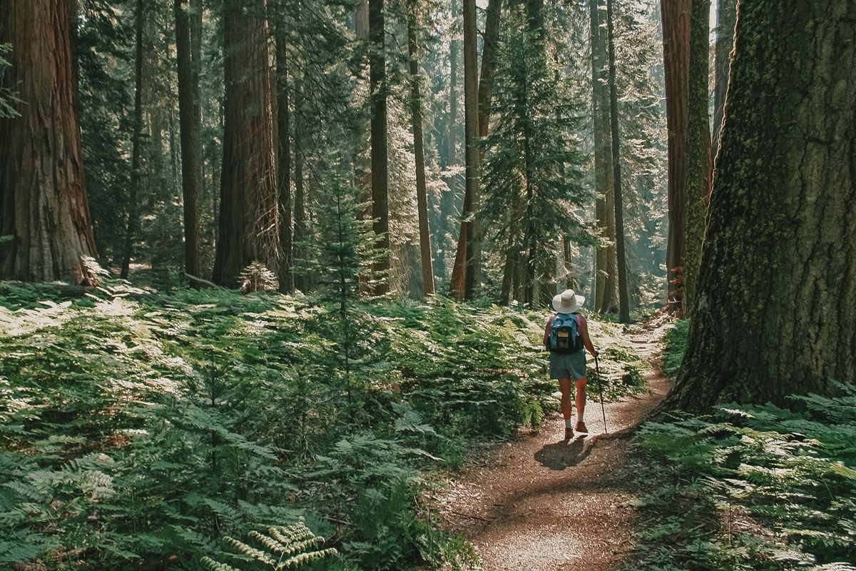
The Big Trees Trail is one of the best hikes in Sequoia National Park for those who want to understand sequoia ecology better.
This trail goes around Round Meadow and includes many interpretive displays to explain the nature along the path.
The Big Trees Trail distance is short–just 1.2 miles–and is wheelchair accessible. Because there’s a meadow nearby, this is also an excellent spot to see wildlife.
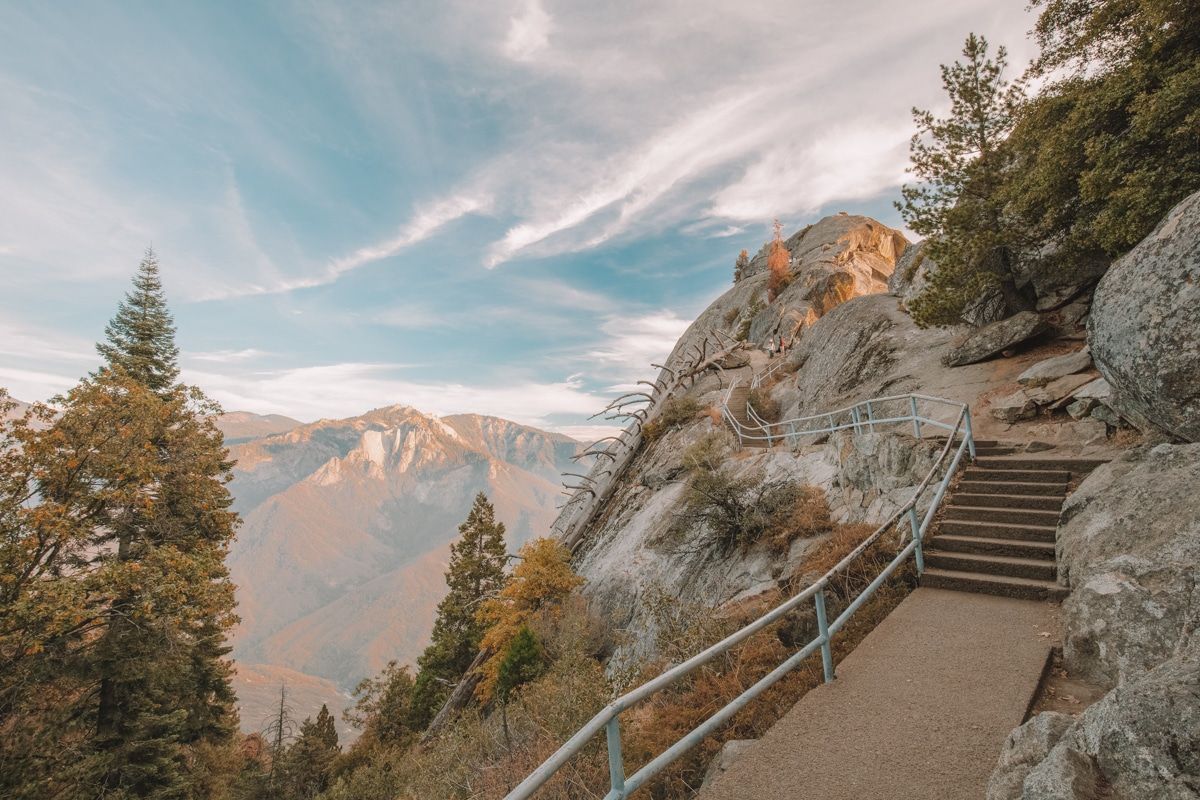
#4 Moro Rock
Best hike for sunset views
Distance: 0.5 miles | Elevation Gain: 183 ft | Difficulty: Easy
Location: Lodgepole area of Sequoia National Park
Trailhead: 36.5468, -118.76557
Features: The top of Moro Rock includes sweeping vistas of the surrounding Sierra.
Trail guide
The Moro Rock Trail is almost like a mini (very mini) Half Dome hike.
The stairs leading to the top of Moro Rock were the first official construction project of the National Park Service in 2017.
Today, Moro Rock is still one of the most popular Sequoia National Park hiking trails.
The Moro Rock Trail begins two miles off the General’s Highway and includes 300 feet of stairs leading to the top of a granite dome.
At the top of Moro Rock, you’ll get views of the Great Western Divide and the whole western face of Sequoia National Park.
FYI–the famous Tunnel Log, which you can drive under, is just a half-mile past Moro Rock.
#5 General Sherman Tree Trail
Best hike for first-time visitors to Sequoia-Kings Canyon
Distance: 1.2 miles | Elevation Gain: 154 ft | Difficulty: Easy
Location: Lodgepole area of Sequoia National Park
Trailhead: 36.58488, -118.74983
Features: See the largest tree by volume on planet Earth!
Trail guide
The General Sherman Tree is the planet’s biggest tree by volume!
Because the General Sherman tree is such an icon, the General Sherman Trail is one of the best hikes in Sequoia National Park for first-time visitors.
A short, paved trail, the General Sherman Tree Trail is wheelchair accessible from a parking lot two miles north of the Giant Forest Museum (many of the big-tree trails tend to be more accessible).
And if you’re looking for a longer hike, the General Sherman Trail is a great launching spot for other popular giant sequoia hikes.
#6 Crescent Meadow Loop Trail
Best hike for wildflowers
Distance: 1.3 miles | Elevation gain: 131 ft | Difficulty: Easy
Location: Lodgepole area of Sequoia National Park
Trailhead: 36.55472, -118.74887
Features: Lush green meadow with wildflowers surrounded by giant sequoias.
Trail guide
The Crescent Meadow Loop Trail is located at the end of Crescent Meadow Road and includes a short, flat walk around Crescent Meadow.
At the beginning of summer, the meadow has an array of lovely wildflowers, making it a fantastic spot for photography.
#7 Zumwalt Meadow
Best hike for wildlife viewing
Distance: 1.5 miles | Elevation Gain: 157 ft | Difficulty: Easy
Location: Cedar Grove area of Kings Canyon National Park
Trailhead: 36.79372, -118.59844
Features: One of the most iconic meadow hikes in Kings Canyon.
Trail guide
Zumwalt Meadow is one of the most popular meadow hikes in Kings Canyon National Park. It’s along Highway 180, almost at the end of the road, and is wheelchair accessible.
Viewing wildlife is always hit-or-miss, but meadows are usually excellent places for people to see wildlife because they’re more open.
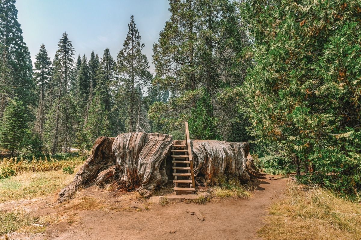
#8 Big Stump Loop Trail
Best hike for a picnic at the end
Distance: 1.6 miles | Elevation Gain: 193 ft | Difficulty: Easy
Location: Grant Grove area of Kings Canyon National Park
Trailhead: 36.72097, -118.97076
Features: The stump of a giant sequoia with a short staircase so you can walk around the top.
Trail guide
The Big Stump Loop Trail in the Grant Grove area of Kings Canyon National Park is a mostly shaded trail with little elevation gain.
The trail ends at the Mark Twain stump; an enormous giant sequoia cut down in the early 1900s. The stump has a little set of stairs so you can get on top.
The stump has previously been called the picnic tree stump. The shade and ease of this trail make it a great place to have lunch (just be sure to stay with your food and don’t leave trash or fruit peels).
#9 Crystal Cave (Closed in 2022)
Best hike for a ranger-led tour
Distance: 0.8 miles | Elevation Gain: 305 ft | Difficulty: Easy
Location: Lodgepole area of Sequoia National Park
Trailhead: 36.58555, -118.82715
Features: Incredible, delicate cave formations.
Trail guide
Crystal Cave is closed in 2022 due to damage from the KNP Fire Complex, but it’s supposed to re-open in 2023.
The Crystal Cave hike is one of the best hikes in Sequoia National Park for a ranger-led tour because you can only enter the cave with a tour guide.
It’s also one of the most unique trails in Sequoia National Park–it’s not every day that you get to walk through a funky looking marble cavern!
Heads up–you’ll need to grab your tickets in advance (you can’t buy them at the cave!). You can purchase tickets ahead of time here. Tours run for 50 minutes and are offered from spring through fall.
#10 Congress Trail
Best hike for giant sequoia enthusiasts
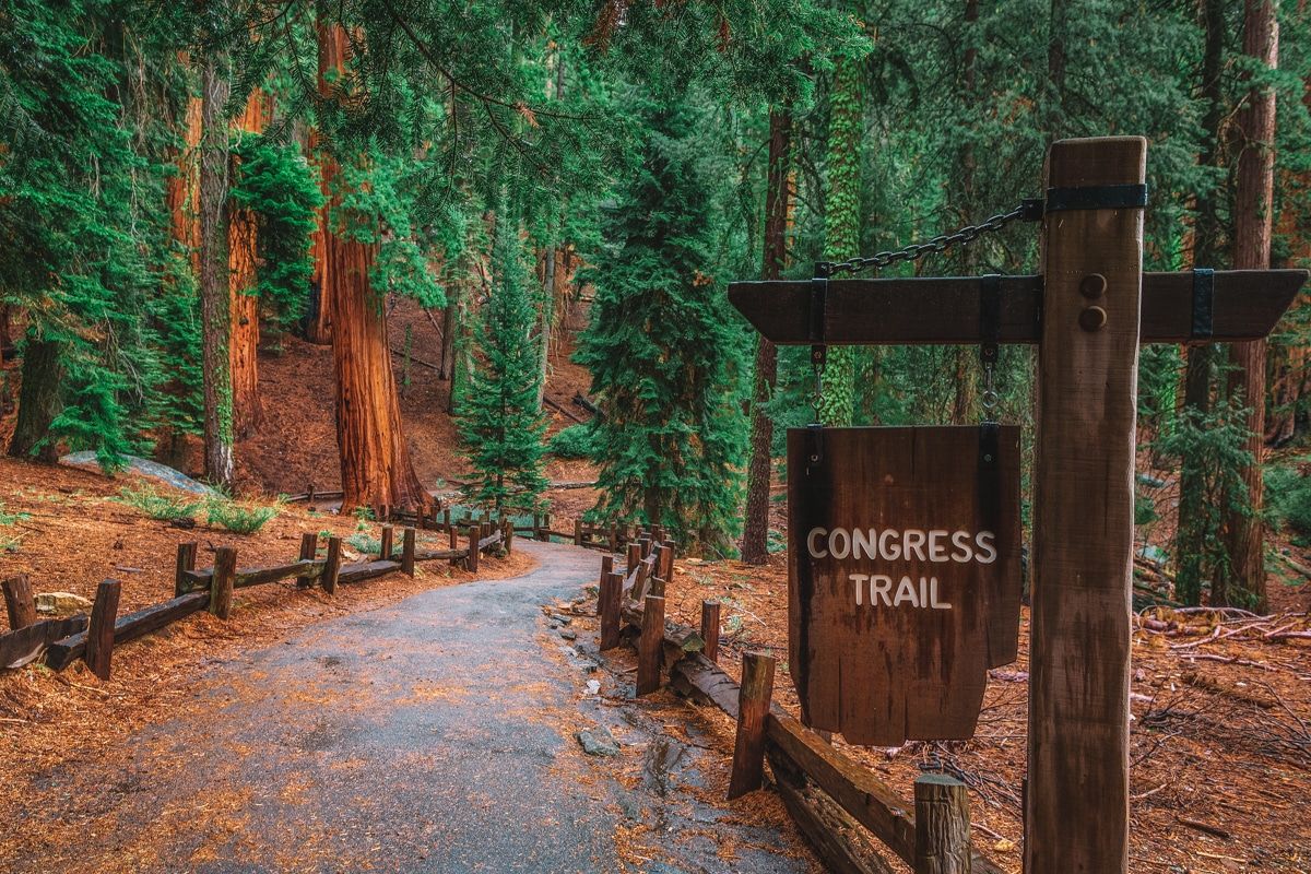
Distance: 2.9 miles | Elevation Gain: 452 ft | Difficulty: Easy
Location: Lodgepole area of Sequoia National Park
Trailhead: 36.58488, -118.74983 (same parking area for the General Sherman Tree)
Features: See the President, House, and Senate groups of giant sequoias.
Trail guide
The Congress Trail takes you through some iconic sequoia groves on a slightly longer hike than the General Sherman Tree Trail. These groves include the House and Senate groups, plus the President Tree.
And the neat thing about this area is that there are hundreds of sequoias, including many big trees without names.
One thing to note–I’ve seen people call the Congress Trail the Giant Forest Loop Trail before. It’s the same trail but it isn’t the trail’s official name, just as an FYI.
This trail is accessible from the same parking lot as the General Sherman Tree Trail. At just under three miles, the Congress Trail takes most people about an hour and a half to do.
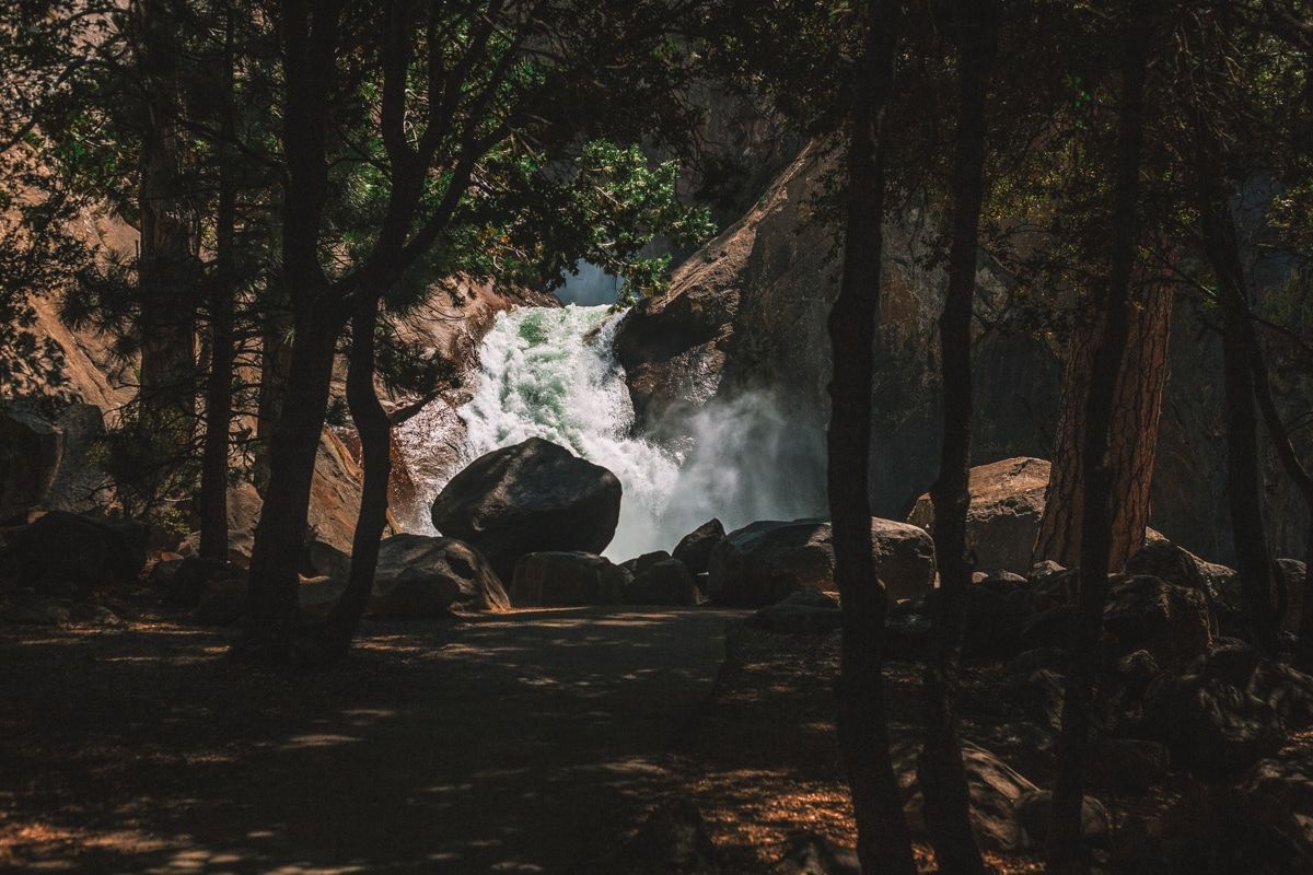
#11 Tokopah Falls Trail
Best hike for early summer vacationers
Distance: 3.8 miles | Elevation Gain: 626 ft | Difficulty: Moderate
Location: Lodgepole area of Sequoia National Park
Trailhead: 36.60506, -118.7228
Features: Kaweah River, pika sightings, and 1,200-foot tall Tokopah Falls.
Trail guide
The Tokopah Falls Trail is one of the best day hikes in Sequoia National Park for early summer because that’s when the waterfall is at its peak.
At 3.8 miles, the Tokopah Falls Trail distance parallels the Marble Fork of the Kaweah River.
Towards the end of the trail, there are boulders where pika frequent. The Tokopah Falls Trail begins in the Lodgepole Campground past the Marble Fork Bridge.
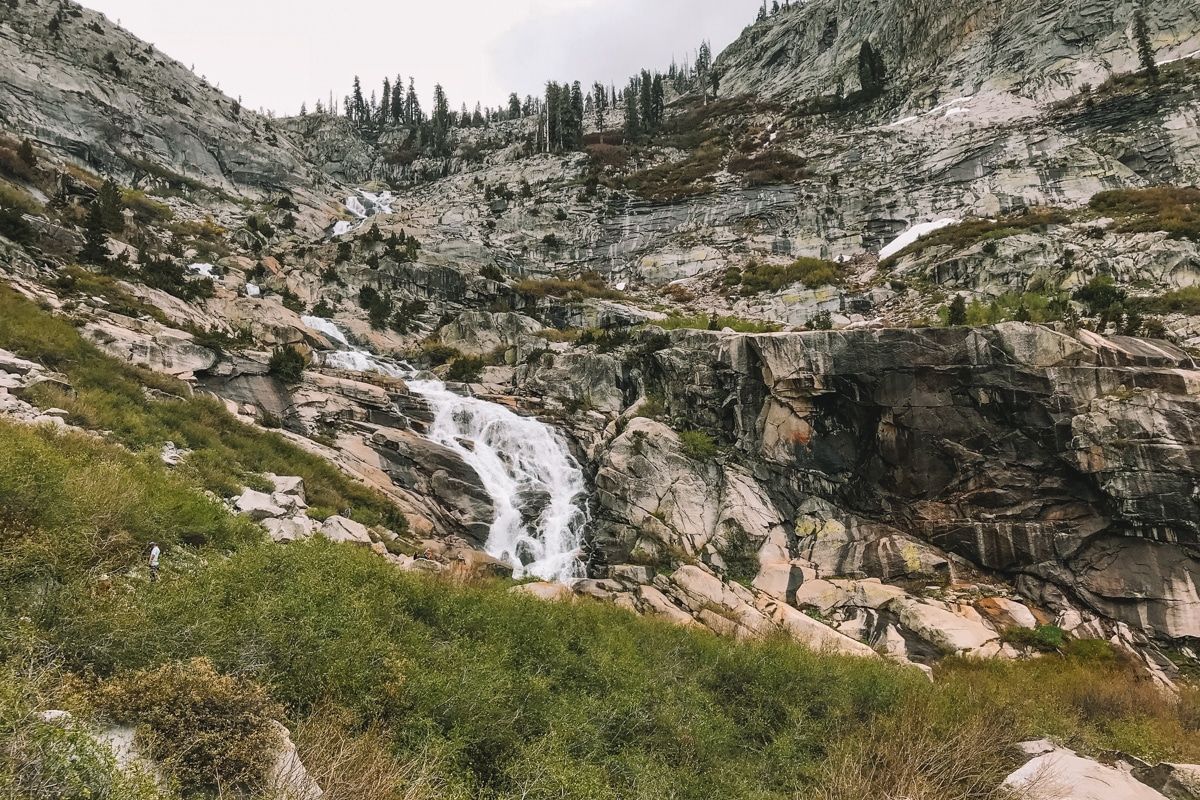
#12 Mist Falls
Best hike for a chill half-day trip
Distance: 8.7 miles | Elevation Gain: 879 ft | Difficulty: Moderate
Location: Cedar Grove area of Kings Canyon National Park
Trailhead: 36.7945, -118.58363
Features: South Fork of the Kings River, Buck Peak, and the 80-foot Mist Falls.
Trail guide
Mist Falls is one of the tallest waterfalls in the Sequoia-Kings Canyon area and one of the best hiking trails for a chill half-day hike.
Yes, this is one of the “moderate” Kings Canyon hikes, but that’s mainly because of the distance. The trail is primarily flat and gains 600 of the 800 feet of elevation in the last mile.
Along the way, you’ll enjoy views of the South Fork of the Kings River and Buck Peak before reaching Mist Falls.
#13 Big Baldy Ridge Trail
Best hike for panoramic views
Distance: 6.4 miles | Elevation Gain: 1,423 ft | Difficulty: Moderate
Location: South of the Grant Grove area of Kings Canyon National Park
Trailhead: 36.69703, -118.87879
Features: Panoramic vistas of California’s Central Valley and the Sierra Nevada mountains.
Trail guide
The Big Baldy Ridge Trail is one of the best Kings Canyon hikes for expansive views. This hike takes you along the western edge of Sequoia and Kings Canyon National Parks.
It provides impressive views of Redwood Canyon and California’s Central Valley to the west and the Sierra ridgeline to the east.
#14 Marble Falls Trail
Best hike for winter
Distance: 7.8 miles | Elevation Gain: 1,499 ft | Difficulty: Moderate
Location: Foothills area of Sequoia National Park
Trailhead: #14 in the Potwisha Campground, 36.51847, -118.80138
Features: Small waterfalls before you reach Marble Falls and views of Milk Ranch Peak.
Trail guide
The Marble Falls Trail is one of the few I’ve listed in the Foothills (low elevation) district, which makes it one of the best hikes in Sequoia National Park in winter.
This part of the park is open year-round, but, like most waterfall hikes, it’s best to enjoy this one before July to get the full effect.
The 70-foot waterfall peaks in early summer, plus the temperatures are more bearable in the early season. In April and May, you’ll find the trail lined with wildflowers.
#15 Watchtower Trail
Best hike for people who love heights
Distance: 8.2 miles | Elevation Gain: 2,106 ft | Difficulty: Moderate
Location: Lodgepole area of Sequoia National Park
Trailhead: 36.59667, -118.7344
Features: Sheer dropoffs and views into a gorgeous glacially carved granite canyon.
Trail guide
The Watchtower Trail is one of the best hikes in Sequoia National Park for people who love sheer dropoffs because that is precisely what you’ll be hiking over.
This trail begins at the same parking lot as the Lakes Trail. If you’re interested in hiking the Lakes Trail, you can continue past the Watchtower for an extra epic day.
Note that sometimes this trail is referred to as the Heather Lake Trail because it also connects to Heather Lake.
#16 Mineral King Trail to Eagle Lake Trail
Best hike for early fall
Distance: 6.5 miles | Elevation Gain: 2,214 ft | Difficulty: Difficult
Location: Mineral King area of Sequoia National Park
Trailhead: 36.44886, -118.59542
Features: Eagle Lake and views of White Chief Peak and Hengst Peak
Trail guide
The Eagle Lake Trail is another one of the most beautiful hikes in Sequoia National Park where you may find it easier to get away from the crowds.
This is one of the best hikes in Sequoia National Park for fall because it’s still accessible by road and the temperatures are still pleasant in Mineral King then.
No, there are no giant trees here, but quiet Eagle Lake and the views of White Chief Peak and Hengst Peak are rewarding enough.
This hike leaves from the same parking lot as Sawtooth Pass, at the end of Mineral King Road.
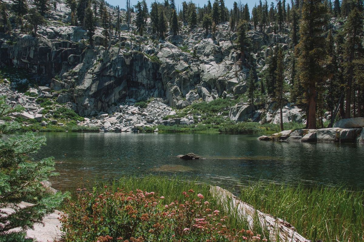
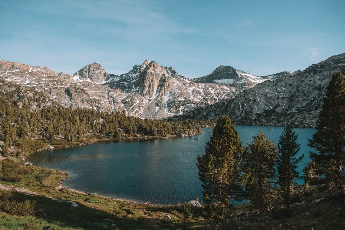
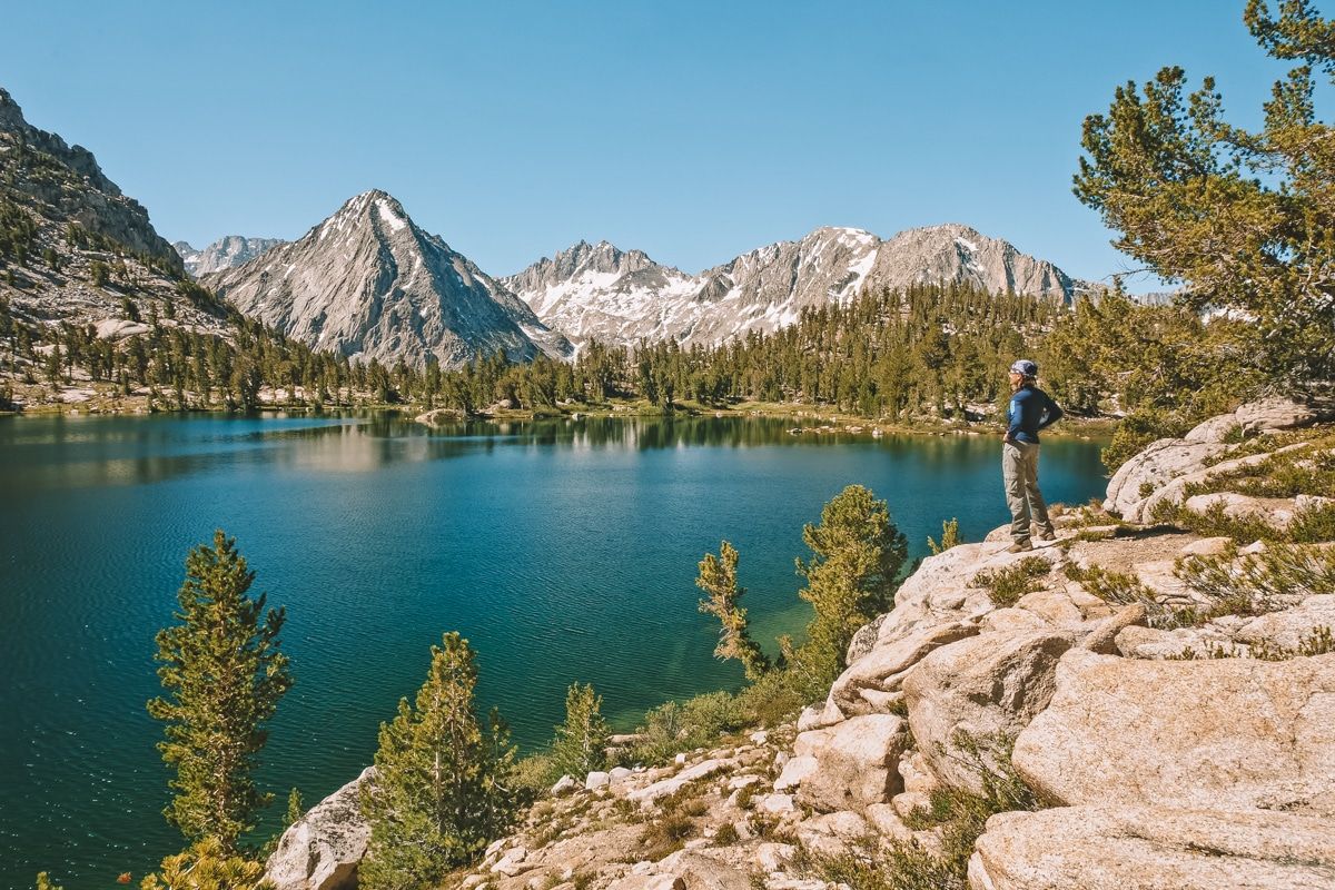
#17 Heather Lake, Emerald Lake, and Pear Lake Trail (AKA Lakes Trail)
Best hike for alpine lakes
Distance: 11.6 miles | Elevation Gain: 3,234 ft | Difficulty: Difficult
Location: Lodgepole area of Sequoia National Park
Trailhead: 36.59658, -118.73437
Features: Three to four gorgeous subalpine lakes.
Trail guide
The Lakes Trail is one of the best lake hikes in Sequoia National Park because there are four gorgeous alpine lakes at the end.
Heather Lake, Emerald Lake, Pear Lake, and Aster Lake are all super popular backpacking destinations.
Dispersed backcountry camping isn’t allowed here because this area is so popular, but you can camp in designated campsites with a permit.
#18 Alta Peak Trail
Best hike for a strenuous backcountry trip
Distance: 13.5 miles | Elevation Gain: 3,986 ft | Difficulty: Difficult
Location: Lodgepole area of Sequoia National Park
Trailhead: 36.5647, -118.77336
Features: Stunning views of the surrounding western Sierra, including Mt Whitney.
Trail guide
Alta Peak is one of two alpine peaks accessible from the Giant Forest area.
You’ll park in the same lot for the General Sherman Trail and Congress Trail at the end of Wolverton Road, about 10 minutes from the Giant Forest Museum.
The Alta Peak trail distance is 13.5 miles round trip, which is my personal distance limit for one day of hiking.
Alta Peak would also make a great overnight backpacking trip. The sweeping views from Alta Peak include Mt Whitney and the surrounding Sierra Nevada.
Or you can make this trip even longer if you want a tour through the giant forest.
#19 Sawtooth Pass Trail
Best hike to avoid the crowds
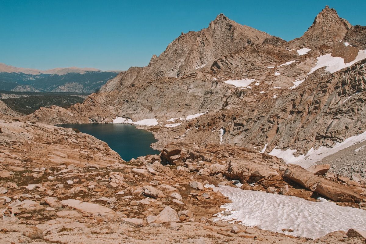
Distance: 13.2 miles | Elevation Gain: 4,937 ft | Difficulty: Difficult
Location: Mineral King area of Sequoia National Park
Trailhead: 36.45331, -118.59676
Features: Monarch Lake and Columbine Lake.
Trail guide
Sawtooth Pass is one of Sequoia’s Mineral King district hikes. This southerly district is not connected to the popular Lodgepole area and is only accessible to those with high-clearance vehicles.
Those factors alone make the Sawtooth Pass Trail quieter than other Sequoia hikes.
The Sawtooth Pass trail is a solid full-day adventure with significant elevation gains that will take you to the Monarch Lakes and Columbine Lake.
FYI–the trail beyond Monarch Lakes is quite rough (i.e., it isn’t maintained often).
#20 Rae Lakes Loop
Best hike for a 3+-day backpacking trip
Distance: 39.1 miles | Elevation Gain: 7,670 ft | Difficulty: Very difficult
Location: Cedar Grove area of Kings Canyon National Park
Trailhead: 36.79439, -118.58363
Features: Mist Falls and multiple backcountry lakes.
Trail guide
The Rae Lakes Loop is undoubtedly one of the most popular and best hikes in Kings Canyon for backpacking.
You’ll gain a ton of elevation during this hike, but if you spread the trip out over several days, it won’t be so bad.
This route takes you through diverse Sierra ecosystems, including lush meadows, glacially carved canyons, and an alpine pass at 12,000 ft.
There are waterfalls, lakes, and almost certainly a bear or two along the way.
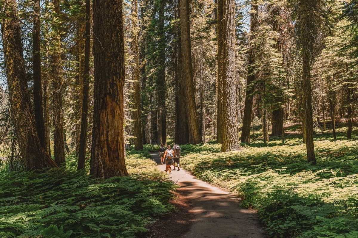
#21 High Sierra Trail
Best hike for those who want to forego regular society (or those training for a through-hike)
Distance: 65.1 miles | Elevation Gain: 15,154 ft | Difficulty: Difficult
Location: Lodgepole area of Sequoia National Park
Trailhead: 36.55446, -118.74882
Features: Everything! Canyons, peaks, giant trees, solitude, and alpine lakes.
Trail guide
Are you ready to just say, “fudge it,” and leave traditional society behind?
The High Sierra Trail is one of the best hikes in Sequoia National Park for those who need a serious break from real life, are training for a through-hike, or just love the mountains.
This trail starts at Crescent Meadow and transverses across the entire Sierra Nevada range, east to west, including the Great Western Divide.
The hike ends at Whitney Portal, a campground area administered by Inyo National Forest.
I would set aside at least a week to make this trip, plus you’ll need to figure out how you’re getting back to the Crescent Meadow Trail.
Hiking Sequoia & Kings Canyon National Parks: What to Expect
History
Sequoia and Kings Canyon National Parks have a special place in national park history.
Sequoia National Park was the second ever national park AND the first national park designated to protect a living organism–the giant sequoia trees–in 1890.
A week after the creation of Sequoia National Park came the founding of General Grant National Park, now the Grant Grove area of Kings Canyon National Park.
These two national parks pre-date the establishment of the National Park Service (1916), and Colonel Charles Young of the US Cavalry managed them. Young was the only commissioned African American officer in the US armed forces at the time.
Kings Canyon National Park was formally established in 1940 and absorbed General Grant National Park.
The two parks share a large border and operate administratively as one park, hence the reference as “Sequoia-Kings National Parks.”
Landscape
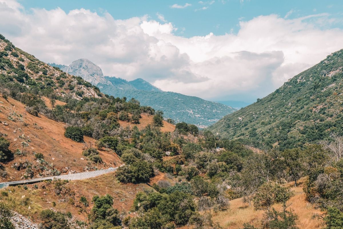
Sequoia and Kings Canyon National Parks are both in the Sierra Nevada Mountains in Central California.
The elevation ranges from 1,500 ft in the Foothills region of Sequoia National Park (near the Ash Mountain entrance) to over 14,000 ft on Mt Whitney, the tallest peak in the lower 48.
The most popular areas of the park, like Lodgepole Village in Sequoia National Park, sit closer to 7,000-8,000 ft, which can be enough to induce altitude sickness in some people.
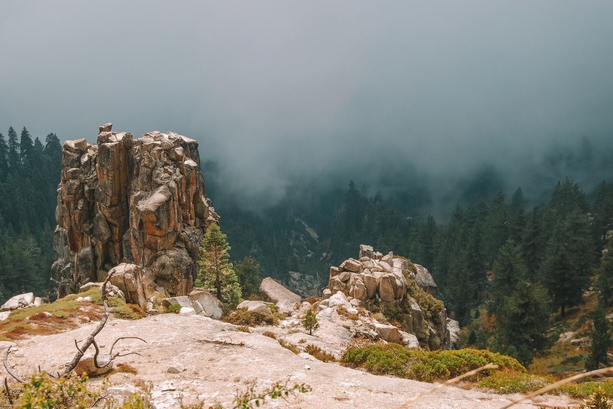
Both parks include many groves of giant sequoia trees, rolling hills, and sheer, jagged granite canyons. Lakes dot the mountains, which are popular backcountry hiking destinations.
Check out the park’s page on natural features and ecosystems to learn more about the unique habitats in these parks.
Weather
Weather in Sequoia and Kings Canyon varies dramatically depending on your elevation. Before you go, check the weather page on the Sequoia-Kings website to get a complete picture of what to expect.
Sequoia and Kings Canyon National Parks are summer parks, so they aren’t very accessible during the winter.
There aren’t many roads through either park (in fact, the vast majority of both parks are inaccessible by vehicle). And due to the high elevation of the roads, it’s usually late April or May when they open for the season.
If you’re recreating in the sequoia groves or high country, the weather will be cooler than you expect, even in summer, and especially at night.
The High Sierra is notorious for surprise rainstorms in the summer and snow flurries in the shoulder season.
By contrast, the Foothills regions of the parks are warm and dry in the summer and mild in the winter.
Wildlife
There are all kinds of neat wildlife in Sequoia-Kings National Parks, but below are the ones you should consider while having fun in the park.
Bears
There are only black bears in California (not grizzlies), even though many black bears in California are brown.
Seeing a bear is one of the most exciting wildlife encounters you can have on land. But sadly, bears suffer the most from encounters with people who don’t know what they’re doing.
Snakes
There are rattlesnakes in Sequoia-Kings, mainly at the lower elevations. Wearing high topped hiking boots and staying on trails will help avoid most negative encounters.
Ticks
There are ticks in Sequoia-Kings and tickborne illnesses in California that you don’t want to mess with.
I always put my socks on over my hiking tights, and I tuck my hiking shirt into my pants for maximum protection. Plus, bring bug spray and use it!
Read our recommendations for full-coverage hiking clothes to protect against snakes, ticks, and the elements.
Dogs
Straight up, I would not bring my dog to Sequoia-Kings National Parks. It just wouldn’t be worth it because Sequoia-Kings have no dog-friendly trails.
You can only have dogs in parking lots, established picnic areas, and campgrounds. They can’t go on any trails, not even the paved ones, or even if they’re in a dog carrier.
Also, please don’t be that person that tries to pass their dog off as a service animal. The rangers will ask (yes, they’re allowed to ask) and have a very narrow definition of what counts as a service animal.
Tips for Hiking in Sequoia National Park and Kings Canyon
Check out more trail safety tips at Sequoia and Kings Canyon National Parks here.
Download the free National Parks App
The National Park Service recently launched a free app for all 400+ national park service units. It includes interactive trail maps to find the best hikes, accessibility information, and more.
You can save individual park info for use offline (very important at Sequoia-Kings), and the platform does a great job of answering basic questions and orienting you to the park.
It’s an excellent idea to have this app in your back pocket (so to speak) since many visitor center hours don’t accommodate early morning risers or late arrivals.
For tech-savvy hikers, there are a lot of great apps to choose from. Read our guide to the best hiking apps.
Buy Your Entrance Pass Online Before You Go
Even visitors to Sequoia National Park 100 years ago had to wait in line at the entrance station.
Expedite your trip through the line by buying your park pass online before you go. You don’t need a reservation to enter either park, but you do need the entrance pass.
You won’t be able to skip the line with your online pass, but it will make the transaction with the ranger faster.
Follow Food Storage Rules to a T
Wildlife doesn’t need your food to survive and human food harms their health. This rule goes for bears, chipmunks (perhaps the most brazen park animal), and ravens.
You must follow the food storage guidelines to a T. The park provides food storage lockers at all campgrounds and many trailheads. Put anything food-related or smelly (toiletries, sunscreen, etc.) in the lockers.
You even need to put empty coolers in the food storage lockers because bears associate coolers with food, and if they see it in your vehicle, they may attempt to get in.
Having snacks or sunscreen in your backpack is fine, but always keep your pack on you or within arms reach.
You will not entice a bear to follow you if you have food in your pack, but you may draw it to steal your pack if you leave it out of reach.
Chipmunks and ground squirrels (i.e., vectors of the plague–yes, that plague) are particularly obnoxious around unattended packs.
Planning to camp in Sequoia National Park? Read our full guide to Sequoia National Park Camping.
Know How To React if You See a Bear
First, you must always be *at least* 50 yards (half a football field) from any bear.
If you see a bear in a developed area (campground, parking lot, trailhead, etc.), scream (I mean, like LOUD) and make lots of noise.
A bear will rarely “get angry” and act aggressively in the presence of another angry mammal (you). Never, ever throw food toward a bear to “distract” it. All you’re doing is teaching it to approach humans for an easy snack.
If you see a bear more than 50 yards away in the wild, take a moment to appreciate the natural beauty but don’t linger or point the animal out to other people.
You may be very respectful toward wildlife, but you have no idea what the next person will do.
Consequences of Not Following Bear Safety Rules
Bears have a special place in my heart. I’ve lived in the Sierra a long time and scared off more bears than I can count, so I just have to say:
It’s WAY more common for a bear to have a bad “person encounter” than for a person to have a bad “bear encounter.”
There has never been a human death by a black bear in California–ever–yet hundreds of bears are killed each year due to the actions of ignorant people.
Getting close to bears (or letting bears get close to you) teaches the bear that it’s ok to approach humans.
Know the Signs of Altitude Sickness
Many popular features in Sequoia-Kings National Parks are around 8,000 ft. This is the height that people start to experience altitude sickness (heck, even altitudes of 5,000 ft can make some folks ill).
If you start to have nausea, dizziness, headaches, a rapid heartbeat, or just feel off, the only way to fix your body is to go down in elevation.
ABOUT THE AUTHOR

Meredith Dennis
Meredith is a biologist and writer based in California’s Sierra Nevada. She has lived in 6 states as a biologist, so her intel on hiking and camping is *chef’s kiss* next level. One of her earliest camping memories was being too scared to find a bathroom at night on a family camping trip. Thankfully, she’s come a long way since then and she can help you get there too!
Looking for more guides to national parks in California? Check out our related articles below!
California National Parks: A Guide to All 9 parks
Epic California National Park Road Trip
Best Hikes in Joshua Tree National Park
Things to do in Death Valley National Park
Pin this image for future reference

