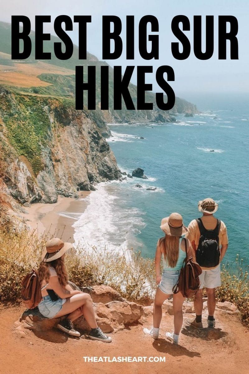
The best Big Sur hikes that showcase the natural beauty of this unique coastal paradise in California.
I’d heard about Big Sur a long time before I visited for the first time. Before visiting, I pictured a large and busy California beach town with tan people surfing.
I was surprised to learn that the town of Big Sur is actually tiny and the main thing Big Sur is famous for (besides beautiful seaside cliffs) is its wilderness!
I didn’t see many tanned surfer dudes, but I saw lots of people bundled against the fog and wind. Ha!
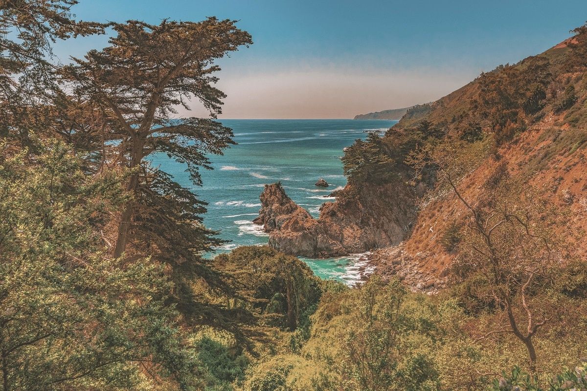
Big Sur isn’t so much a town as it is an area in California. Specifically, it’s the 90 miles between Carmel-by-the-Sea and San Simeon on the Central California Coast.
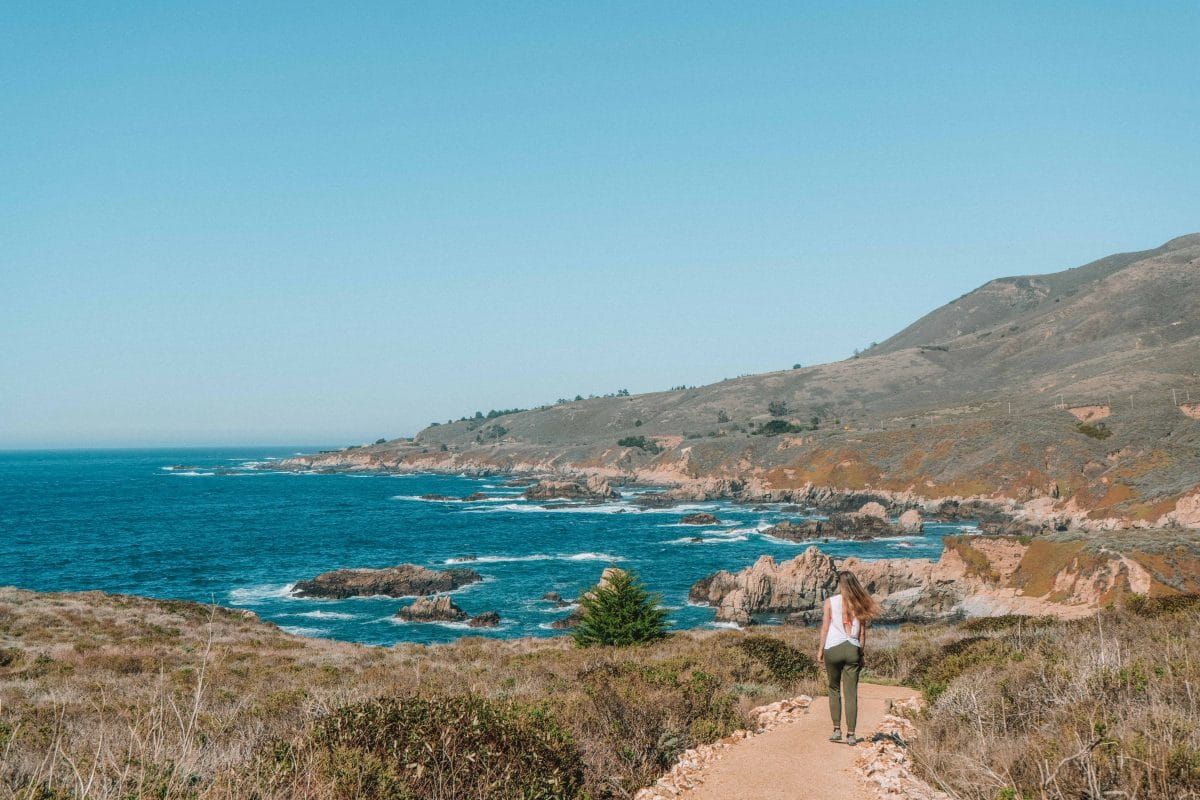
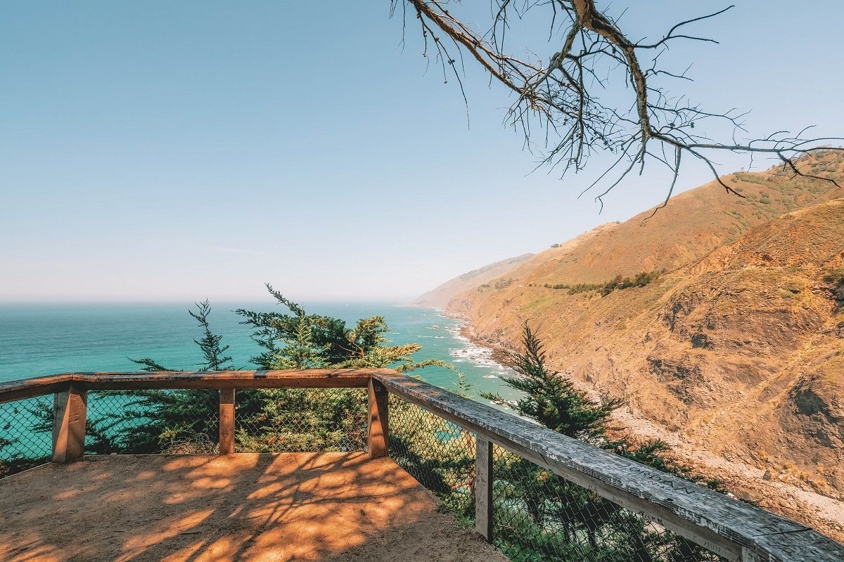
Highway 1 (also known as the Pacific Coast Highway on this stretch) famously winds through Big Sur along the coast and is well-known for sea cliff views and picturesque bridges along the way.
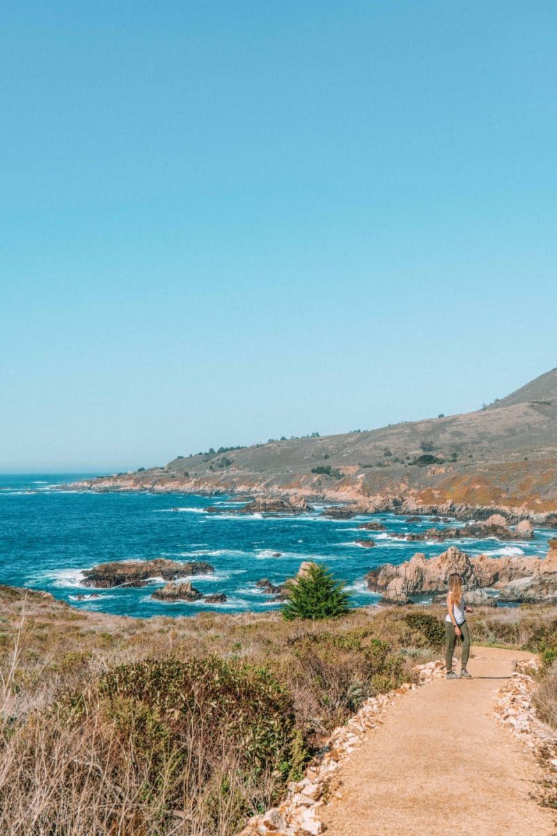
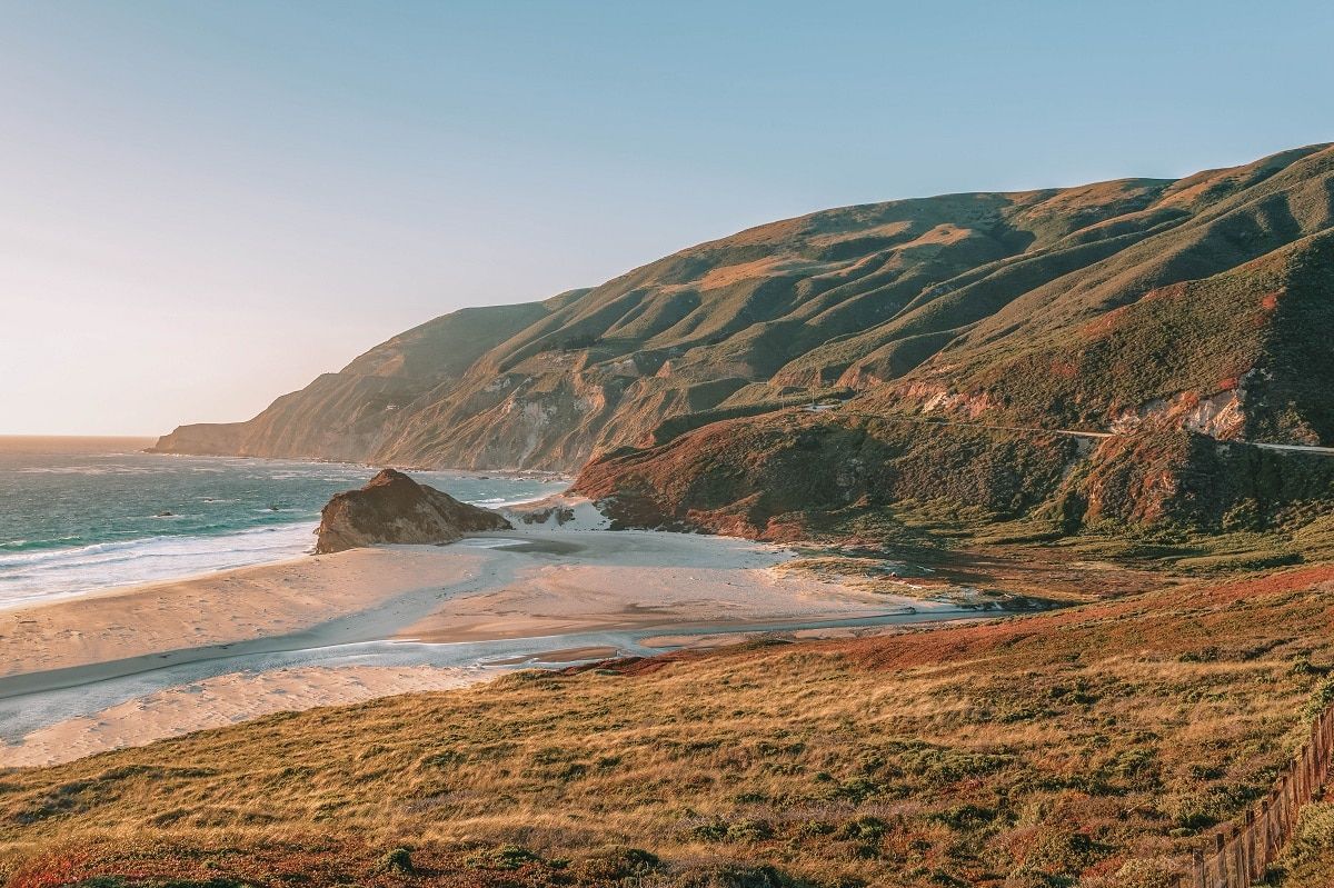
Big Sur is an undeniably gorgeous area and with five California state parks, plus one national forest, there are an endless number of Big Sur hiking trails to explore.
Below, I’ve picked the best Big Sur hikes (that are open as of June 2022) so that you can find the best nature spots and views in Big Sur easily.
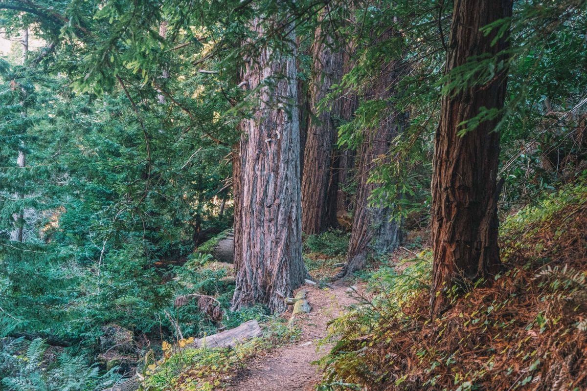
Whether you’re looking for redwood hikes, beach hikes, mountain hikes, whale watching, or wildflower spotting, there’s a hike in Big Sur for you.
Note: this post contains affiliate links, which help run this site at no extra cost to you so I can keep providing free travel advice and tips.
Big Sur Hikes Map
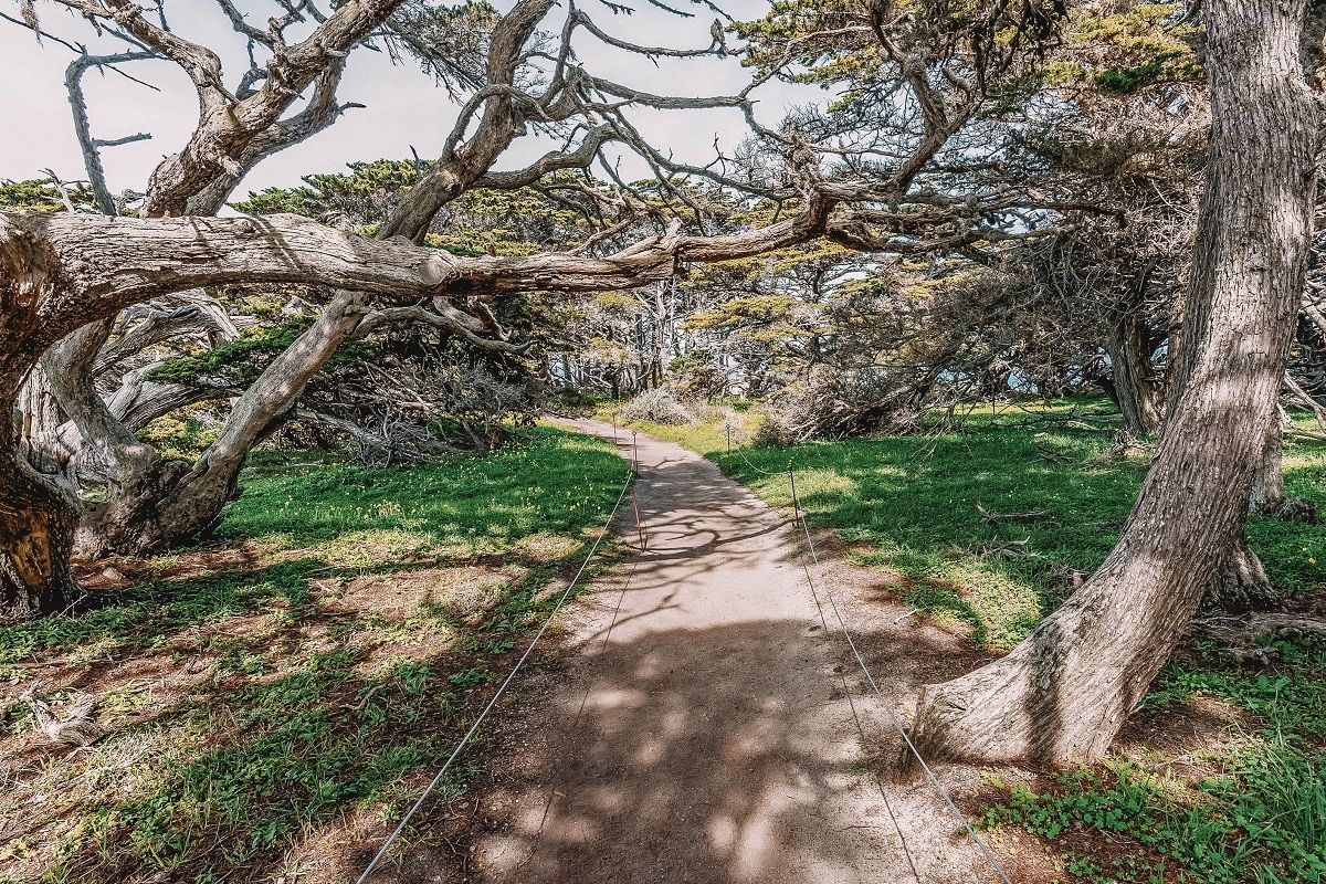
Hiking in Big Sur
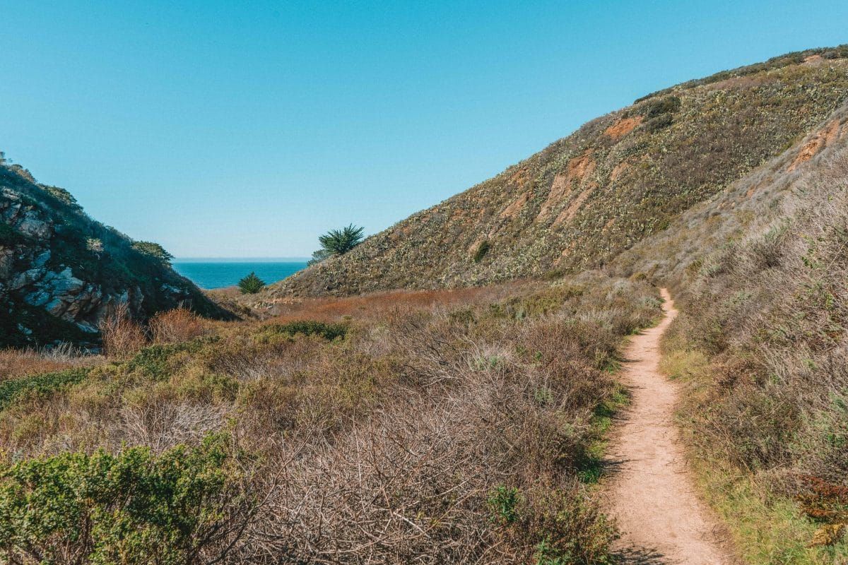
There are five state parks in the Big Sur region, plus Los Padres National Forest and the Santa Lucia Mountains. This means there are tons of trails, beaches, rivers, and mountains to explore.
Here are a few tips to get you started with hiking in Big Sur like a pro.
- Trail status in Big Sur changes all the time. Wildfires and landslides can unfortunately close trails for years, so it’s always best to check the status of the trail you want to visit before you go. Most California State Parks have a “Trail Status” page, and the same goes for the US Forest Service, which oversees the national forests around Big Sur.
- There are not many places to take dogs in Big Sur. This is in part because of the high density of wildlife in the area. Check out this handy flyer for information about where dogs are allowed in Big Sur.
- Prepare to pay for day passes. Most of the parks in the area have a $10 day-pass fee that’s good for one vehicle. There are some exceptions. For example, Garrapata State Park doesn’t collect a fee to enter but rather is supported by the fees of the surrounding parks.
- Several California State Park annual passes are available for purchase or free depending on your circumstance. If you have a fourth-grade child in your household, you are eligible for a free parks pass. Economically disadvantaged families, veterans, and elderly folks also qualify for free or reduced passes.
- Go early! This area is very popular, especially on summer weekends. Some of these parks have fairly small maximum capacities. For example, Point Lobos State Reserve only has space for 75 cars in its parking lot, after which it’s closed to additional vehicles. Plan to get to your destination before 9:30 am or after 3:00 pm. If you can’t find parking at the park, you can sometimes park along the highway, just be careful of other cars!
Point Lobos State Natural Reserve
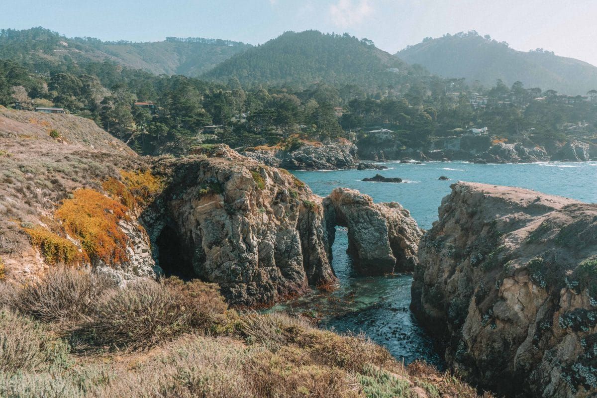
I consider myself something of a parks nerd and the California state parks routinely blow me away.
I’ve never been disappointed by a state park and Point Lobos State Natural Reserve is the “crown jewel” among these parks.
The reserve protects an astounding diversity of both terrestrial and aquatic diversity plus archeological and geologic rarities.
The reserve is part of the Monterey Bay National Marine Sanctuary and is a hotspot for scuba divers, photographers, painters, and nature enthusiasts of all stripes.
Point Lobos State Natural Reserve is 23 miles, or a 35-minute drive, north of central Big Sur.
#1 Sea Lion Point Trail
Best hike for a guaranteed sea lion sighting
Distance: 0.6 miles | Elevation Gain: 15 ft | Difficulty: Easy
Trailhead & Parking: 62 Point Lobos, Carmel-by-the-Sea, CA 93923. You can park inside the park for a fee or, if the lots are full, park for free along the side of the road outside the park entrance.
Features: Tremendous wildlife diversity and Sea Lion Cove.
Trail Guide
The Sea Lion Point Trail is very short and highly popular, especially for families with kids; this is one of the best hikes in Big Sur for guaranteed sea life viewing.
The trail takes you to a point overlooking Sea Lion Cove where sea lions routinely haul out. You can hear them barking from the trail, but be sure to bring binoculars if you want a good look.
Sometimes there’s a ranger out there with binoculars if you don’t have your own set. Plus, they can answer all your questions!
If you’re looking for more coastal views and want to extend this trail, I’d recommend adding on the short Sand Hill Trail. It connects with Sea Lion Point Trail around the Sea Lion Point lookout.
#2 Bird Island Trail
Best hike for birdwatching
Distance: 0.8 miles | Elevation Gain: 75 ft | Difficulty: Easy
Trailhead & Parking: Bird Island Trail Parking Lot.
Features: Bird Island, China Cove, and Gibson Beach.
Trail Guide
The Bird Island Trail in Point Lobos State Natural Reserve is an easy 0.8-mile loop trail that takes you to Bird Island.
Bird Island was once part of the mainland but over time the crashing waves eroded the rocks away, separating the end of the land from the coast and creating an island. Or, in this case, a series of many islands.
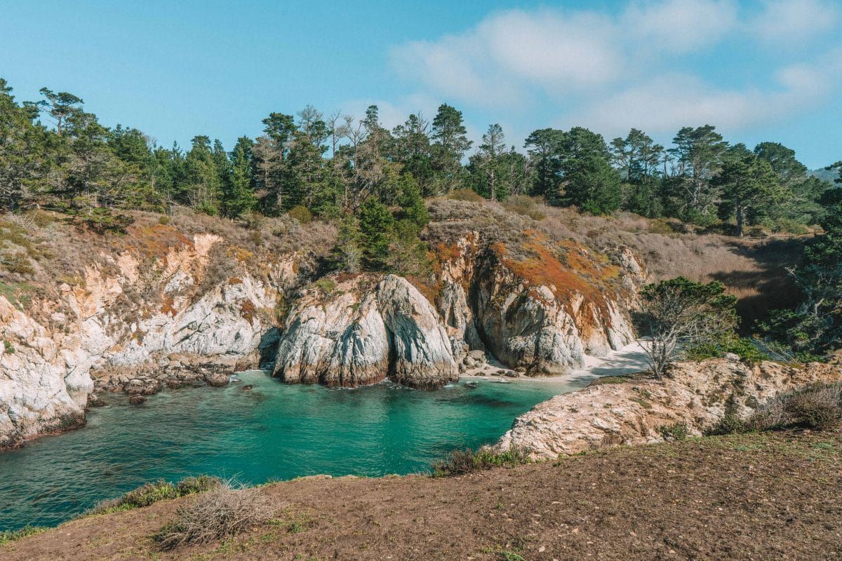
In addition to birdwatching, the trail takes you by China Cove and Gibson Beach–both white sand beaches.
China Cove, in particular, features beautiful blue-green, clear water that is a favorite spot for harbor seals with pups in the springtime.
#3 Cypress Grove Trail
Best hike for sunset photography
Distance: 0.8 miles | Elevation Gain: 59 ft | Difficulty: Easy
Trailhead & Parking: Point Lobos Parking Lot, 62 Point Lobos, Carmel-by-the-Sea, CA 93923
Features: Tunnel of cypress trees and Pacific Ocean views.
Trail Guide
The Cypress Grove Trail is one of the most popular hikes in Point Lobos because of its picturesque coastal views and unique cypress groves.
These trees are special! So special some of the groves have their own names.
This is a short and easy hike with almost no elevation gain. The trees are especially striking at sunset and provide a nice photo opportunity.
#4 South Shore Trail
Best hike for extended cliffside views
Distance: 2.5 miles | Elevation Gain: 150 ft | Difficulty: Easy
Trailhead & Parking: 62 Point Lobos, Carmel-By-The-Sea, CA 93923 to start from the north or Bird Island Trail Parking Lot to start from the south.
Features: Bluff trail that meanders through a variety of natural features.
Trail Guide
If you find yourself with a little more time on your hands (~3 hours) and you want to explore more of Point Lobos State Natural Reserve, you should check out the South Shore Trail.
The South Shore Trail hugs the Big Sur coastline and is a 2.5-mile out-and-back hike with very little elevation gain.
You can start the hike on either end of this bluff trail. Starting from the north, you’ll park at the main Point Lobos parking area. Starting from the south, you’ll park at the parking lot for the Bird Island Trail.
You’ll pass by Sea Lion Point at the north end of the trail and Hidden Beach at the south end. Hidden Beach is a cute, protected beach area surrounded by rocky outcrops.
Bring your plant ID guide to see if you can find the Monterey Cyprus trees, which are endemic (meaning they only grow in one location) to this stretch of coastline.
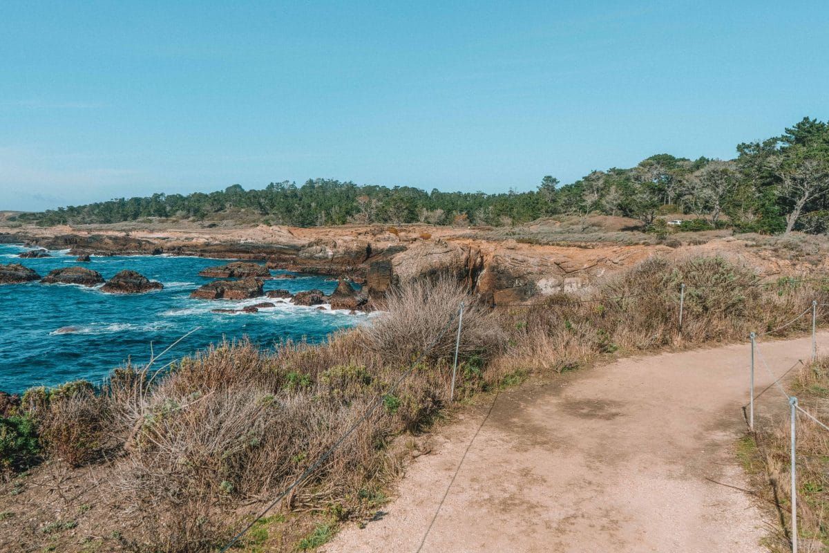
Garrapata State Park
Garrapata State Park is south of Point Lobos State Reserve and north of Andrew Molera State Park.
This park offers two miles of beaches along with almost 3,000 acres of upland forest (including redwood groves) on the east side of Highway 1.
The park’s most popular features are the trails along the coast, which offer great views of the Monterey Bay National Marine Sanctuary.
Sealife, including grey whales and harbor seals, are frequent visitors to the sanctuary.
#5 Garrapata Bluff Trail
Best hike for ocean views on the fly
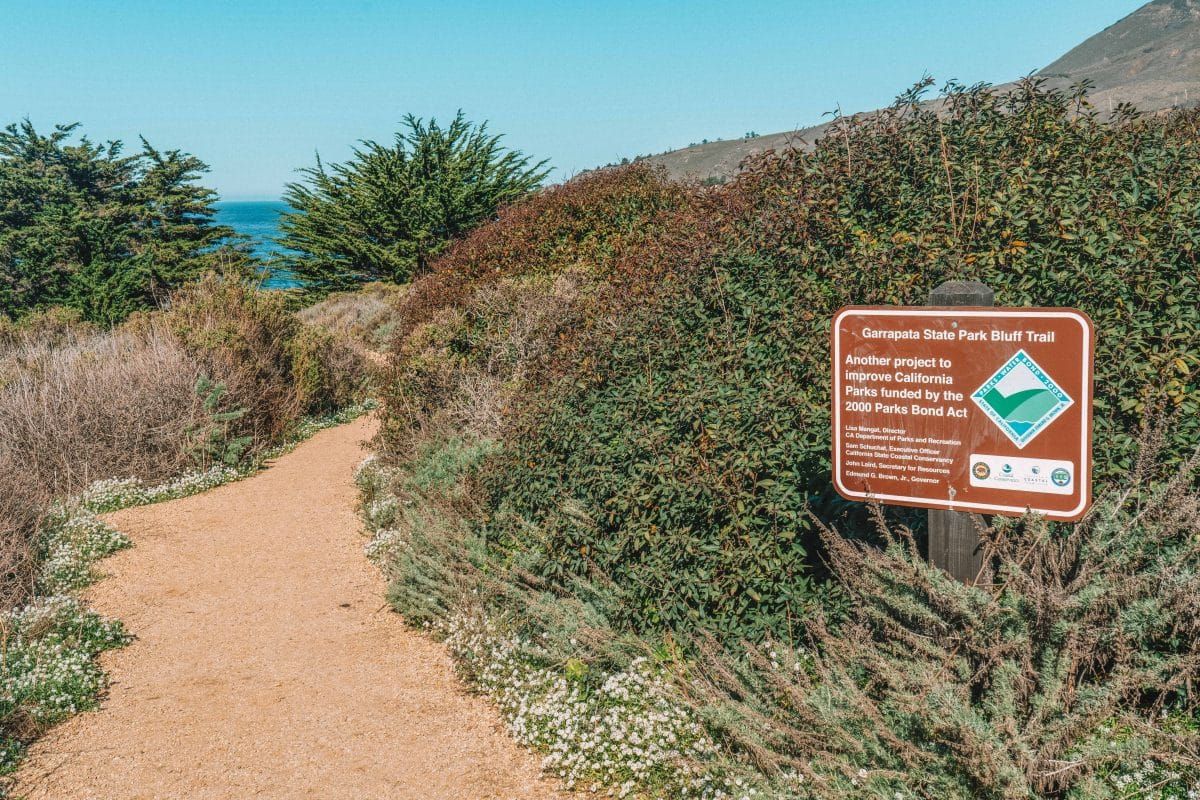
Distance: 0.8 miles | Elevation Gain: 49 ft | Difficulty: Easy
Trailhead & Parking: Garrapata State Park Bluff Trail Parking lot, Carmel-by-the-Sea, CA 93923.
Features: Small waterfalls, ocean views, and views of Soberanes Point.
Trail Guide
If you’re visiting the Big Sur area but only have a short amount of time to see some stunning views, the Garrapata Bluff Trail is perfect for you.
This is a very short and easy trail that will take you along the cliffside bluff overlooking the ocean. It takes most people about 15 minutes to do this hike.
This is an extremely popular and photogenic hike so expect other people on the trail with you.
One of the neat features of this hike is the small waterfalls that are found where the Soberanes Creek flows into the Pacific Ocean.
There are also some lovely red and white colorful cliffs abutting the Santa Lucia Mountains to the east of Highway 1.
Finally, there’s Soberanes Point itself, which is a common subject for Big Sur photography. You’ll get to see the point from many different angles on this hike.
This park’s hiking trails are marked off by numbered gates. You’ll enter this trail near Gate 8 and end near Gate 7.
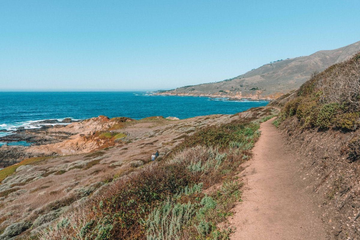
#6 Soberanes Point and Whale Peak Trail
Best hike for whale watchers
Distance: 1.8 miles | Elevation Gain: 311 ft | Difficulty: Easy
Trailhead & Parking: Soberanes Point Trailhead.
Features: Great views of the Monterey Bay National Marine Sanctuary.
Trail Guide
If you’re psyched on whales, sea lions, or sea otters, the Soberanes Point and Whale Peak Trail in Garrapata State Park is a good choice. This short 1.8-mile loop trail starts at the Soberanes Point Trailhead.
If you’re keen on seeing grey or humpback whales, time your visit with either the winter or spring migration seasons.
One thing to keep in mind before you go with your hopes full of whales is that this area of Big Sur can be quite foggy. So, be sure to check the weather before you head out.
This is a short and easy trail and a nice way to stretch your legs if you’re passing through the area.
#7 Soberanes Canyon and Rocky Ridge Trail
Best hike for redwoods
Distance: 4.4 miles | Elevation Gain: 1,750 ft | Difficulty: Moderate
Trailhead & Parking: Soberanes Canyon Trailhead, Carmel-by-the-Sea, CA 93923.
Features: Waterfall and redwood groves.
Trail Guide
If you’re near Carmel-by-the-Sea and interested in a moderate hike through redwood groves with great ocean views, the Soberanes Canyon and Rocky Ridge Loop Trail is a great choice.
The Soberanes Canyon Trail is located in Garrapata State Park. Garrapata State Park features two miles of Pacific coastline as well as a good chunk of mountain trails on the east side of Highway 1.
This is a wonderful little state park but note that “garrapata” means “tick” in Spanish so plan to bring lots of bug spray and long pants!
Park at the Soberanes Canyon Trailhead (putting that into Google should get you there) and you’ll find the trailhead just off Highway 1.
You’ll pass signs for the state park on your way in but there’s no official park entrance station and you don’t need to pay a fee for day hiking.
The Soberanes Canyon Trail can be done as a 2.8-mile out-and-back trail or a longer 4.7-mile loop trail that includes the Rocky Ridge Trail (this is the one I recommend!).
The highlight of this trail is the corridor of redwood trees and the viewpoint from the top of Rocky Ridge. There’s a decent amount of elevation gain on this bad boy, which is why it’s rated as moderate.
Andrew Molera State Park
Andrew Molera State Park is one of the biggest California State Parks in the Big Sur area.
This relatively undeveloped park is situated just north of the town of Big Sur and takes up 4,700 acres on both sides of Highway 1.
#8 East Molera Trail
Best hike for a workout
Distance: 3.6 miles | Elevation Gain: 1,466 ft | Difficulty: Strenuous
Trailhead & Parking: East Molera Trailhead.
Features: Ocean views.
Trail Guide
The East Molera Trail begins right at Highway 1 and takes you up a series of steep switchbacks to a ridge overlooking the Pacific Ocean.
This would be a great route if you’re doing endurance training because it’s an exposed trail (i.e. no shade) and the grade is quite steep: 18-26% in some places.
If you’re looking to extend your hike, you can continue on the unofficial trail to Post Summit. It rounds out to 9.1 miles, and by some accounts, is even prettier than the official trail.
#9 Bluffs and Panorama Trail via Creamery Meadow
Best hike for pygmy redwood groves
Distance: 7.9 miles | Elevation Gain: 1,276 ft | Difficulty: Moderate
Trailhead & Parking: Creamery Meadow Trailhead, Andrew Molera State Park.
Features: Spring wildflowers, ocean views, and pygmy redwood groves.
Trail Guide
The Bluffs and Panorama Trail via Creamery Meadow is a classic Big Sur hike. This out-and-back trail has excellent ocean views and wildflowers in the spring.
Start this trail at the Creamery Meadow Trailhead in Andrew Molera State Park.
From there, you’ll cross the Big Sur River (your feet may get wet–bring sandals!) and head onto the Creamery Meadow Trail. This is the trail that has beautiful flowers in the spring.
You’ll then turn left at the junction for the Bluffs Trail, which takes you on an epic stroll along the Big Sur coast, high up on the bluffs.
This trail then leads to a junction with the Panorama Trail. If you choose the Panorama hike add-on, you’ll walk through a pygmy redwood forest!
While there are lots of Big Sur redwood hikes, seeing the pygmy redwoods is one of those must-have experiences if you’re in the area.
If you’re looking for more redwood hiking options, read our guide on where to find redwoods near San Francisco.
#10 Ridge Trail
Best hike for experienced hikers in good shape
Distance: 8.4 miles | Elevation Gain: 1,100 ft | Difficulty: Moderate-strenuous
Trailhead & Parking: Creamery Meadow Trailhead, Andrew Molera State Park.
Features: Ocean views with a workout. 😉
Trail Guide or AMSP Trail Guide
If you’re looking for more of a challenge with a higher viewpoint than the Bluffs Trail in Andrew Molera State Park, opt for the Ridge Trail. The Ridge Trail essentially parallels the Bluffs Trail at a higher elevation.
This steep trail is rated moderate to strenuous and includes 1,100 feet of elevation gain, but it also offers amazing views of the Pacific Ocean.
And you can make it (a little) longer, connecting multiple hiking trails to make a loop.
The Ridge Trail leads to the Panorama Trail which leads to the Bluffs Trail. You can then return to the parking lot via the Creamery Meadow Trail. The entire loop trail is 8.7-miles round trip.
Julia Pfeiffer Burns State Park
Julia Pfeiffer Burns State Park was named after an early pioneer woman and includes several miles of gorgeous coastline.
The most popular viewpoint in the park, McWay Falls, looks like the lagoon where the mermaids lived in Peter Pan.
Julia Pfeiffer Burns is a small state park that’s broken up into two parcels, both along the coast on the west side of Highway 1.
#11 Partington Cove Trail
Best hike for a crystal-clear cove
Distance: 1.1 miles | Elevation Gain: 347 ft | Difficulty: Moderate
Trailhead & Parking: Partington Cove Trailhead, CA-1, Big Sur, CA 93920.
Features: Overlooks Partington Cove.
Trail Guide or JPFSP Trail Guide
The Partington Cove Trail utilizes an old wagon road to take you down a steep trail to the Big Sur Coast.
You can go to Partington Cove (iconic for clear blue water), Partington Creek, or Partington Point. This trail is easy and a nice way to move your legs on a road trip.
All of these locations are named for John Partington, a homesteader in the 1870s who utilized the cove to transport tanoak bark and redwood logs up and down the coast.
On your way to the cove, you’ll even go through a tunnel he built through the mountain!
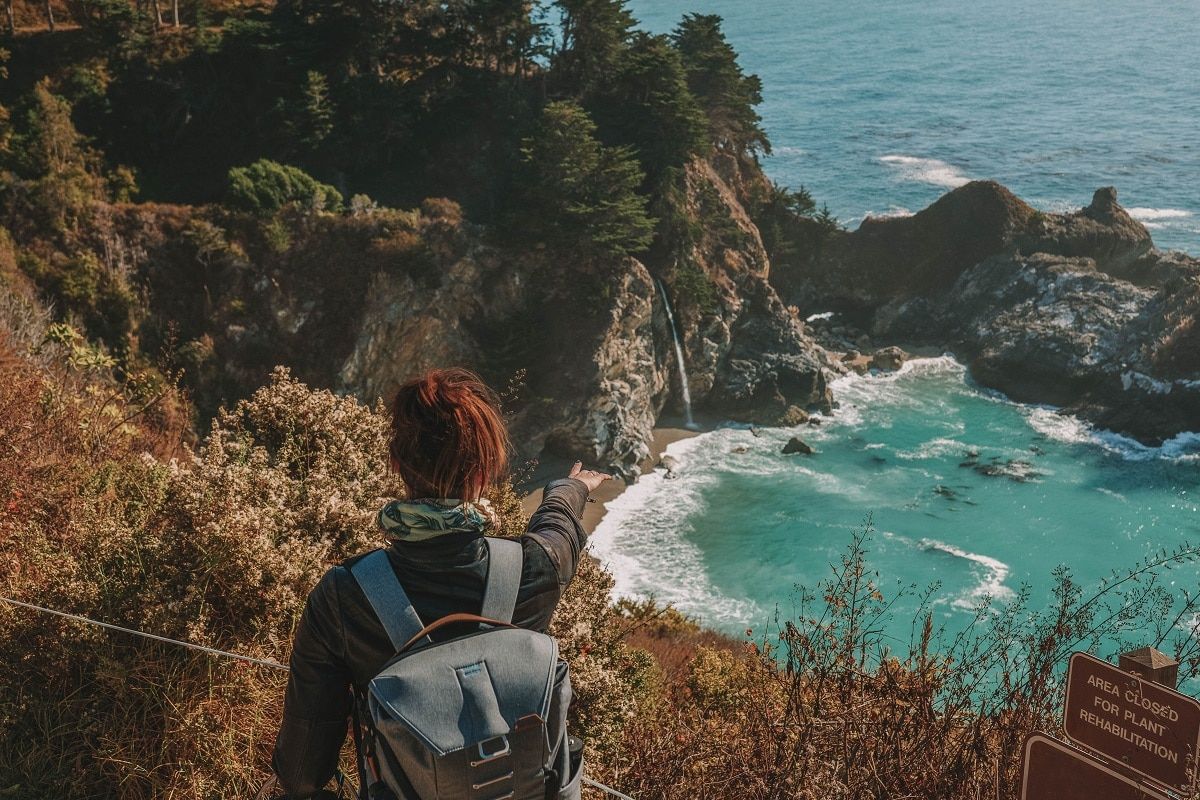
#12 McWay Falls Overlook Trail
Best hike for sunrise photography
Distance: 1.2 miles | Elevation Gain: 193 ft | Difficulty: Easy
Trailhead & Parking: McWay Waterfall Trailhead, Big Sur, CA 93920.
Features: McWay Falls.
Trail Guide or JPFSP Trail Guide
The McWay Waterfall Trail is one of the most iconic day hikes in Big Sur. The trail is located in Julia Pfeiffer Burns State Park and is popular for good reason.
At the overlook, you’ll take in McWay Falls, an 80-foot waterfall that empties onto the beach and into a blue lagoon. It’s truly stunning.
The beach is not accessible and the state park staff are very serious about keeping people off it due to the very hazardous and crumbling cliffs all around.
No worries though, the best view of the waterfall is from the McWay Waterfall Trail. If you can get to the viewpoint in the morning, the sunrise is lovely here.
#13 Tan Bark Trail
Best hike for a little taste of every Big Sur ecosystem
Distance: 6.1 miles | Elevation Gain: 2,024 ft | Difficulty: Strenuous
Trailhead & Parking: Partington Cove Trailhead, CA-1, Big Sur, CA 93920.
Features: Redwood groves, Big Sur Coastline, and historic Tin House.
Trail Guide or JPFSP Trail Guide
The Tan Bark Trail starts at the same trailhead as Partington Cove, but takes you in the opposite direction on a big loop trail that winds through a wide variety of ecosystems.
This trail has quite a bit of elevation gain and is rated as strenuous but includes almost every Big Sur ecosystem you can think of.
You’ll get coastal views as you hike along the ocean bluffs, then start a demanding series of switchbacks that take you through a previously burned forest and into redwood groves.
The Tan Bark Trail tops out at the historic Tin House, which is a crumbling structure built in the 40s by a former New York Congressman.
Note: Always watch out for falling trees if you’re hiking on windy days.
Pfeiffer Big Sur State Park
Pfeiffer Big Sur State Park is perhaps the most popular state park in the area since it’s close to the town of Big Sur and has a campground.
This is where we stayed when we visited the area and the campground definitely had “Ewok-forest” vibes. That is to say, it was dark and green and lush.
The park sits on the western end of the Santa Lucia Mountains and includes trails around the Big Sur River Gorge and the Big Sur River.
Read our complete guide to camping in Big Sur.
#14 River Path and Warden’s Path Hike
Best hike for dogs
Distance: 0.6 miles | Difficulty: Easy
Trailhead & Parking: Day Use Lot #2, Pfeiffer Big Sur State Park.
Features: Stroller, wheelchair, and dog-friendly path near the Big Sur River.
Trail Guide
If you’re a dog owner looking for some dog-friendly trails, it can be hard to find options in the California State Parks.
Generally, dogs aren’t allowed on any trails in the state parks, but they’re allowed in campgrounds and day-use areas as long as they’re leashed.
Dogs are also allowed on roads and paved trails, so the River Path and Warden’s Path are perfect for dog owners since they’re fully paved.
It’s also super easy to get to this trailhead. Shortly after you go through the park entrance, you’ll see Day Use Lot #2.
Park there and you can take the River Path as well as the Warden’s Path, which loops around the Big Sur River.
#15 Big Sur River Gorge Trail
Best hike for choosing your own adventure
Distance: 1.2 miles | Elevation Gain: 75 ft | Difficulty: Easy
Trailhead & Parking: Pfeiffer Big Sur State Park Campground (between sites 111 and 112). Park in Day Use Lot #2 or Day Use Lot #4.
Features: Big Sur River Gorge.
Trail Guide
If you’re someone who doesn’t like to follow a trail map, then the Big Sur River Gorge Trail in Pfeiffer Big Sur State Park is for you.
In the beginning, the trail is paved (0.5 miles round trip) but then the trail leads you to the mouth of the Big Sur River Gorge.
This beautiful gorge is walled in by granite and is one of the more popular features in Pfeiffer Big Sur State Park.
You can continue up into the gorge by following the river over boulders and river rocks. Just note that the rocks are slick so I’d recommend wearing water shoes or Chacos.
The Gorge Trail has amazing swimming holes and is a fantastic place to cool down in the summer.
To get to the trail, you’ll start in Pfeiffer Big Sur State Park Campground, between sites 111 and 112.
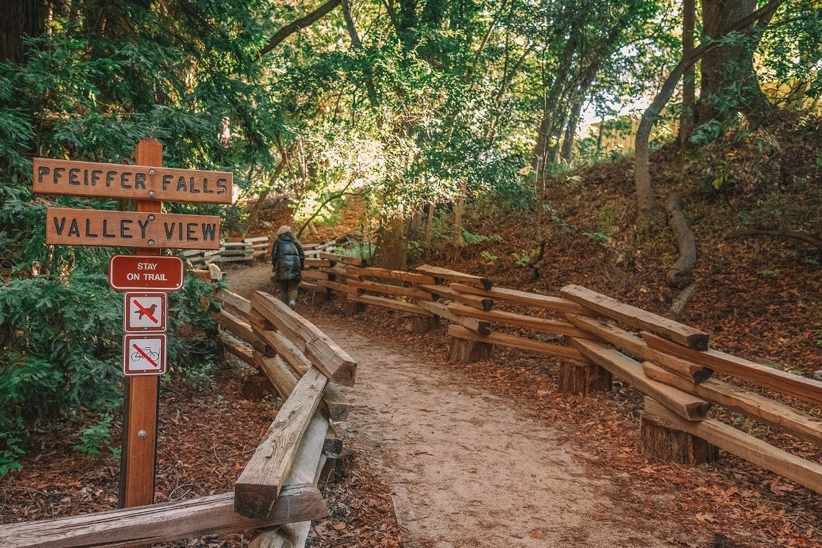
#16 Pfeiffer Falls Trail and Valley View Overlook
Best hike for views of the Big Sur River Valley
Distance: 1.8 miles | Elevation Gain: 554 ft | Difficulty: Moderate
Trailhead & Parking: Day Use Lot #2, Pfeiffer Big Sur State Park.
Features: Views of the Big Sur River Valley, Point Sur, and Pfeiffer Falls.
Trail Guide or PFSSP Trail Guide
The Pfeiffer Falls Trail and Valley View Trail are a popular combo because you get a little bit of everything in a short distance.
Start in Day Use Lot #2 for this Big Sur waterfall hike and follow the signs for Pfeiffer Falls and Valley View.
The initial trek up the Valley View Trail involves a somewhat steep climb of around 500 feet, but the pain will be worth the gain as you crest out at the Valley View Overlook.
From here, you’ll see the Big Sur River Valley, Point Sur, and Andrew Molera State Park. As you head back down the Valley View Trail, take a short detour on the Pfeiffer Falls Trail to see the 60-foot waterfall.
#17 Buzzard’s Roost Trail
Best hike for mountain views
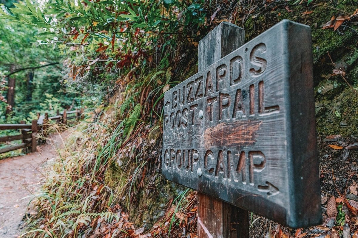
Distance: 2.6 miles | Elevation Gain: 750 ft | Difficulty: Moderate
Trailhead & Parking: Day Use Lot # 4, Big Sur, CA 93920.
Features: Big Sur River, redwood groves, and views of the Santa Lucia Mountains.
Trail Guide or PFSSP Trail Guide
One of the things the Big Sur area is known for is its redwoods, and Pfeiffer Big Sur State Park is the heart of redwood country.
If you only have a short time in Pfeiffer Big Sur State Park, you should do the Buzzard’s Roost Trail because it’s the most popular trail in the park.
This moderate 2.6-mile trail meanders along the path of the Big Sur River, through a redwood forest, and finally onto the high point (literally): Buzzard’s Roost.
This sunny, elevated spot gives you great views of Sycamore Canyon, as well as the Santa Lucia Mountains.
Note that while Pfeiffer Big Sur State Park is near the Pacific Ocean, there’s no ocean access from this park. You’ll have to go to nearby Julia Pfeiffer Burns State Park for that.
Limekiln State Park
Limekiln State Park is named after the historic furnaces (lime kilns) that were built to produce lime (an important ingredient in cement at the time) in the 1800s.
The park is halfway between Morro Bay and Monterey and is just over 700 acres. In addition to the historic limekilns, the park includes coastal access and redwood forests.
Due to recent wildfires, the trails in Limekiln State Park aren’t open but the campground and beach are still accessible.
As of June 2022, there isn’t a mention on the park website of when the trails may reopen.
Los Padres National Forest
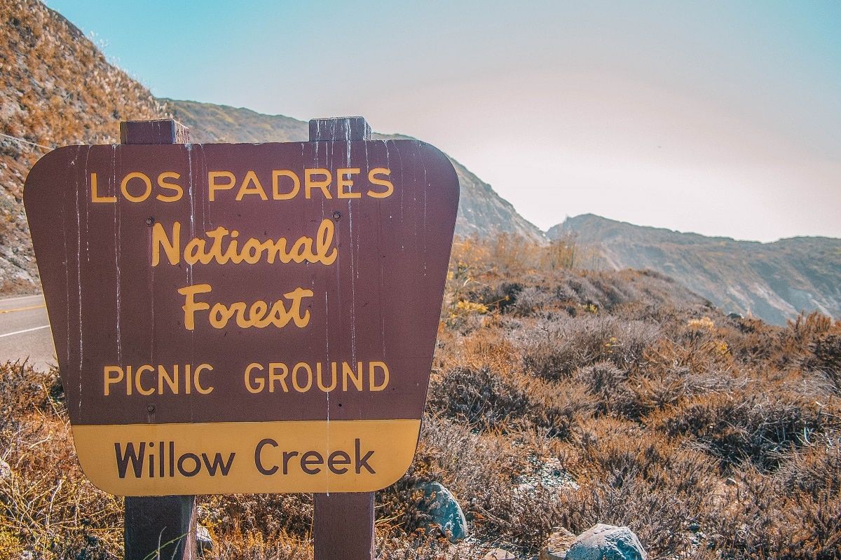
Los Padres National Forest is the third-largest national forest in California and stretches from south of Monterey to the northwest end of Los Angeles.
This forest is mostly wilderness, meaning it doesn’t have many major roads through it.
The terrain encompasses a wide variety of ecosystems, from beaches to high-elevation forests and deserts.
One note about exploring national forests: national forests are subdivided into wilderness districts.
For example, you may see that the Mill Creek Trail is in the Ventana Wilderness, which is a part of Los Padres.
#18 Salmon Creek Falls Trail
Best hike for quick waterfall access
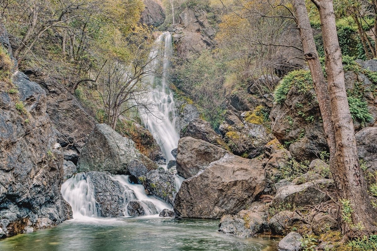
Distance: 0.3 miles | Elevation Gain: 26 ft | Difficulty: Easy
Trailhead & Parking: Salmon Creek Trailhead, CA-1, Big Sur, CA 93920.
Features: 120-foot Salmon Creek Falls.
Trail Guide
Salmon Creek Falls is not only a Big Sur waterfall hike but one of the few dog-friendly hikes in Big Sur.
This trail is located is in Los Padres National Forest, which is generally more dog-
friendly than the surrounding state parks.
The trailhead takes you to a beautiful 120-foot waterfall just a quarter-mile in. It’s also a great starting point for backpackers exploring the Silver Peak Wilderness in Los Padres National Forest.
The Salmon Creek Falls Park trailhead begins 3.7 miles north of the Ragged Point Inn in Ragged Point, CA.
#19 Sand Dollar Beach Trail
Best hike for wide-open beaches
Distance: 0.4 miles | Elevation Gain: 104 ft | Difficulty: Easy
Trailhead & Parking: Sand Dollar Day Use Beach, CA-1, Big Sur, CA 93920.
Features: Biggest beach in Big Sur.
Trail Guide
If you’re day-tripping from Big Sur and looking for a popular beach, check out the Sand Dollar Beach Trail in Los Padres National Forest.
The Sand Dollar Beach Trail takes you to Sand Dollar Beach, which is the biggest beach in the Big Sur area.
The trail to the beach is very easy. It goes straight from the parking lot and includes a set of stairs.
In addition to the little trail to the beach, you can take a spur trail to an overlook or walk south along a bluff trail overlooking the ocean.
Just like anywhere along the coast, there can be poison oak. Make sure to Google what the leaves look like (or see the video below), steer clear of them, and you’ll be fine.
To get to the Sand Dollar Beach Trail, park in the large, signed Sand Dollar Beach Day Use Parking Lot on the ocean-side of Highway 1.
Plaskett Creek Campground is also right across the highway. This beach trail is just under an hour from the town of Big Sur.
#20 Mill Creek Trail
Best hike for families with kids visiting the Mill Creek Picnic Area
Distance: 2.3 miles | Elevation Gain: 413 ft | Difficulty: Easy
Trailhead & Parking: Mill Creek Trailhead
Features: A quiet stream
Trail Guide
South of the town of Lucia is the popular Mill Creek Picnic Area and the Kirk Creek Campground.
If you’re visiting either of these areas, the Mill Creek Trail is a great, easy out-and-back trail that follows along Mill Creek.
This hike will take you east through the forest and usually takes people about 1-2 hours to complete.
Because of the short distance, the shade from the forest, and the low elevation gain, this is a great half-day hike with kids.
#21 Pine Ridge Trail, Big Sur Station
Best hike for backpacking
Distance: 8.4-24 miles | Elevation Gain: 1,100-1,500 ft | Difficulty: Strenuous
Trailhead & Parking: Big Sur Station Visitor Center, 47555 CA-1, Big Sur, CA 93920.
Features: Ventana Wilderness in the Santa Lucia Mountains.
Trail Guide
The Pine Ridge Trail in the Ventana Wilderness in Los Padres National Forest is one of the best Big Sur trails for backpacking.
You can choose your own adventure on this trail and hike anywhere from eight to 24 miles. See the Pine Ridge Trail Elevation and Distance Profile link for trail details.
This very popular trail is dotted with seven backcountry camps that are common stopping places for backpackers.
The route is a mix of Big Sur redwoods grading into conifer and hardwood forests towards the east.
There’s no backcountry permit required to do this hike, but you do need a California Campfire Permit (free)–you can get one here.
This is one of the most popular backpacking trails in the Big Sur area, so anticipate the backcountry camps to fill up on busy weekends and peak seasons.
Other Notable Big Sur Hikes (If You Have More Time)
#22 Ragged Point Cliffside Trail
Best hike for the “Million Dollar View”
Distance: 0.8 miles | Elevation Gain: 400 ft | Difficulty: Moderate
Trailhead & Parking: The Portal to Big Sur sculpture.
Features: Famous coastal views.
Trail Guide
The Ragged Point Cliffside Trail is a short but very steep 0.8-mile out-and-back trail that starts in Ragged Point, CA.
The trail starts just behind a famous sculpture called the Million Dollar View, and when you get there, you’ll see why. The sculpture frames a breathtaking view of the coastline.
The trail descends 400 feet for views of Black Swift Falls and the black sand beach that rims the coastline.
#23 Boucher Trail
Best hike for elephant seals and historic lighthouses
Distance: 3.8 miles | Elevation Gain: ~100 ft | Difficulty: Easy
Trailhead & Parking: Elephant Seal Rookery Parking Lot, 46 miles north of San Luis Obispo.
Features: Lots of elephant seals and Piedras Blancas Light Station.
Trail Guide
If you’re in the area of San Simeon, in the southern part of the Big Sur area, you should check out the Boucher Trail!
The Boucher Trail is an easy 3.8-mile out-and-back trail that’s relatively flat. It takes you to a few different spots to see elephant seals laying on the beach.
Elephant seals can be quite entertaining to watch. The giant bulls sometimes charge each other on the beach (it can be a little violent, fair warning) and the newly pupped babies are super cute too.
You’ll also get great views of the historic Piedras Blancas Light Station.
The lighthouse was built in 1875 and is still operational today! However, to explore the lighthouse you’ll need to get on an official tour.
The trailhead for this trail is unmarked, so to get there you’ll need to park in the Elephant Seal Rookery parking lot, which is marked from the highway.
#24 Pine Ridge Trail to Sykes Hot Springs
Best hike for hot springs
Distance: 19.5 miles | Elevation Gain: 7,339 ft | Difficulty: Strenuous
Trailhead & Parking: Ventana Wilderness Parking Lot.
Features: Hot springs and backpacker campgrounds.
Trail Guide
The Pine Ridge Trail to Sykes Hot Springs is a fantastic backpacking trip. Not only are there hot springs at the end of the hike, but there are five hike-in campgrounds where you can rest for the night.
This trail is located in the Ventana Wilderness of Los Padres National Forest.
There’s no getting around it –this is a challenging hike. Not only is the distance too much for most people for one day, but there are two river crossings as well.
This is a very busy, much-traveled trail so note that the parking lot and the campgrounds fill up fast. It’s best to do this one mid-week!
ABOUT THE AUTHOR

Meredith Dennis
Meredith is a biologist and writer based in California’s Sierra Nevada. She has lived in 6 states as a biologist, so her intel on hiking and camping is *chef’s kiss* next level. One of her earliest camping memories was being too scared to find a bathroom at night on a family camping trip. Thankfully, she’s come a long way since then and she can help you get there too!
Looking for more California travel inspiration? Read our related articles below!
Best Romantic Getaways in California
Pin this image for future reference

