Your complete Catalina Island hiking guide! These are the best trails and viewpoints to discover a completely different side of the island.
Dusty hiking trails, calf-burning hills, coastal views everywhere you look, palm trees framing scenic bays, ocean breezes, wildlife, and civilization that’s never too far away – this is what you can expect with hiking on Catalina Island.
One of California’s most popular islands, there’s a lot to love about Catalina Island. A lot of people just visit the island for its good beaches and a relaxing day trip or weekend away.
However, for those looking for something that’s both a little more adventurous and more connected to nature, there’s nothing better than exploring the island’s backcountry hiking trails and panoramic viewpoints.
To give you an idea, Catalina Island has more than 165 miles of hiking trails for all levels of hikers.
There’s the famous Trans-Catalina Trail but also a variety of day hikes that take you to hidden parts of the island that few people get to see.
It’s the best way to experience a completely different side of the island that’s less crowded and more serene.
After visiting Catalina Island twice to hike around the island, including most recently for the Trans-Catalina Trail, I have a lot of recommendations for good hikes on the island.
These are my picks for the best hikes on Catalina Island, whether you’re looking for a short walk from town or a multi-day trek.
Note: this post contains affiliate links, which help run this site at no extra cost to you so I can keep providing free travel advice and tips.

Avalon to Descanso Beach Club
Length: 1.3 miles | Elevation Gain: N/A | Type: Out-and-back
Features: Near town, coastal views, and flat.
If you’re looking more for a nice walk than a hike, head over to Descanso Beach Club from Avalon.
This short 1.3-mile out-and-back walk takes you to one of the nicest private beaches on Catalina Island (it’s $2 to access). This path also lets you walk along the scenic Avalon coastline and Casino along the way.
At Descanso, you can spend the day at the beach or sign up for one of the many activities offered nearby, like the Zip Line Eco Tour, before walking back to Avalon.
Related: The Perfect Catalina Island Day Trip
Get your FREE Los Angeles Mini Guide + a printable checklist with 100+ things to do in the city!
Airport Loop Trail
Length: 2.8 miles | Elevation Gain: 351 ft | Type: Loop | Trail Guide
Features: Views looking out over Catalina Island, relatively flat, wildflowers in the spring.
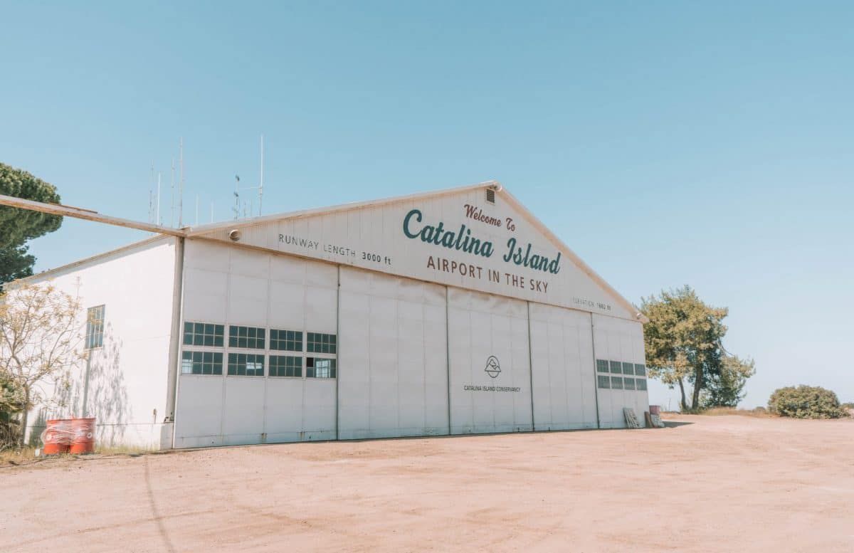
If you’re making a trip to the Catalina Airport in the Sky (usually via the Wildlands Express Shuttle from Avalon if you’re not hiking the TCT), don’t miss the Airport Loop Trail.
This short, 2.8-mile trail is mostly flat and just loops around the airport with views of Black Jack Mountain and Cottonwood Canyon along the way.
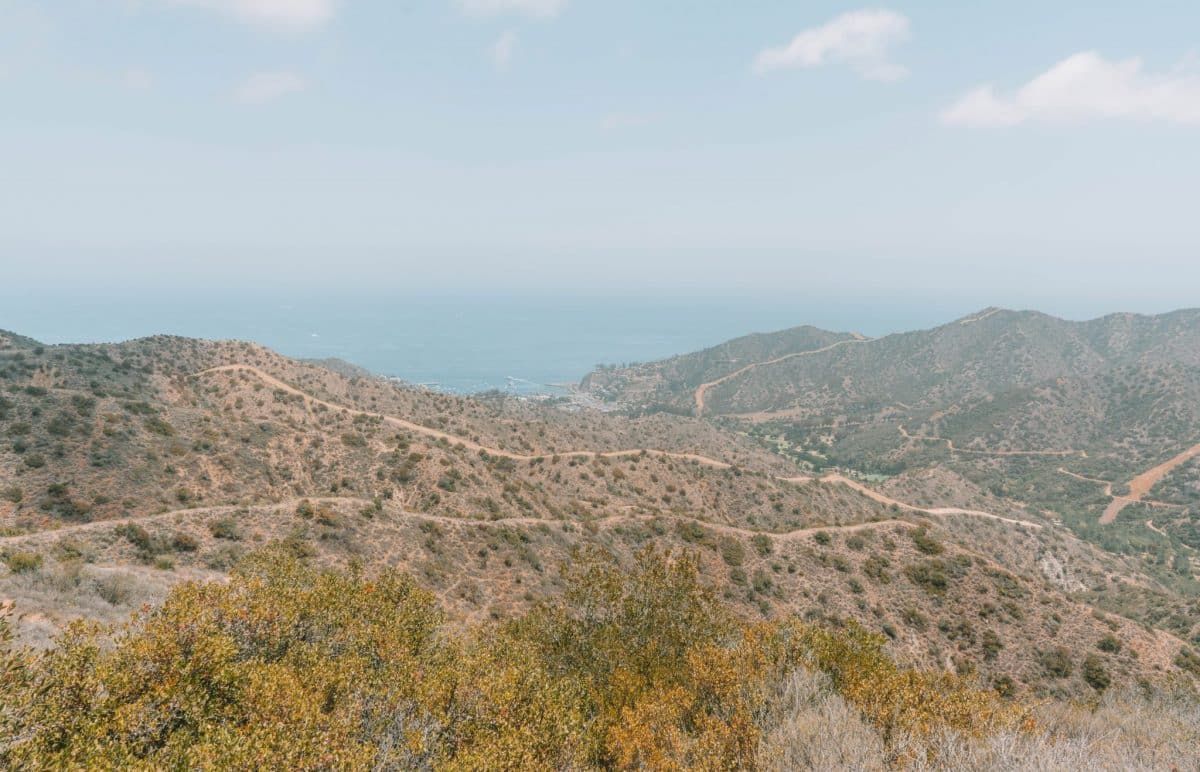
Wrigley Memorial to Garden To Sky Summit
Length: 2.8 miles | Elevation Gain: 731 ft | Type: Out-and-back | Trail Guide
Features: Garden to walk around before or after your hike, 360-degree views from the summit, the trail is a gravel road the whole way.
If you’re looking for a slightly more challenging trail with more elevation gain, head up to the Wrigley Memorial and Botanical Garden to hike to a stunning viewpoint called Garden to Sky.
It costs $8 per person to get into the Wrigley Memorial area, but it’s a nice area to walk around either before or after your hike.
Leaving from the memorial, you’ll make your way uphill along Avalon Canyon Road, until you get to the Garden to Sky Summit. At the summit, you’ll get a 360-degree view of both sides of the island.
To get to the Wrigley Memorial, you can either start the hike from the town of Avalon and hike up Avalon Canyon (you’ll need to add on another three miles roundtrip to do this), or you can take the Catalina Trolley, a taxi, or rent a golf cart.
Hermit Gulch Campground to Hermit Gulch Lookout
Length: 3.4 miles | Elevation Gain: 1,174 ft | Type: Out-and-back | Trail Guide
Features: Scenic lookout points, coastal views, challenging uphill climb, options to add on other hiking trails along the way to make it a longer hike with more sights.
The Hermit Gulch Trail is the easier and shorter version of the longer hike to Black Jack from Avalon (mentioned below).
This hike gives you the most scenic parts of the longer Black Jack hike and doesn’t take you too far from town.
With that said, the Hermit Gulch Trail is still a steep uphill climb for the first half of the trail before you make your way back to town.
At Hermit Gulch Lookout, you’ll be rewarded with views looking over Avalon in the distance and its surrounding hills. It’s one of the most stunning viewpoints in Avalon, along with the 3 Palms Scenic Overlook.
From Hermit Gulch, you can either head back down the way you came or hike a little further to another viewpoint at Lone Tree Point and then make your way back.
Another option to make the Hermit Gulch Trail a loop hike is to continue on Divide Road to the Garden to Sky Summit.
From there, you can walk down through the Wrigley Botanical Garden and Memorial before making your way back to Hermit Gulch Campground.
Hermit Gulch Campground is about a mile from town. So to start your hike, you can either walk there from town (and add on an extra two miles roundtrip) or rent a golf car or take a taxi.
Avalon to 3 Palms Scenic Overlook
Length: 3.6 miles | Elevation Gain: 400 ft | Type: Loop
Features: Scenic overlooks, near town, along the road.
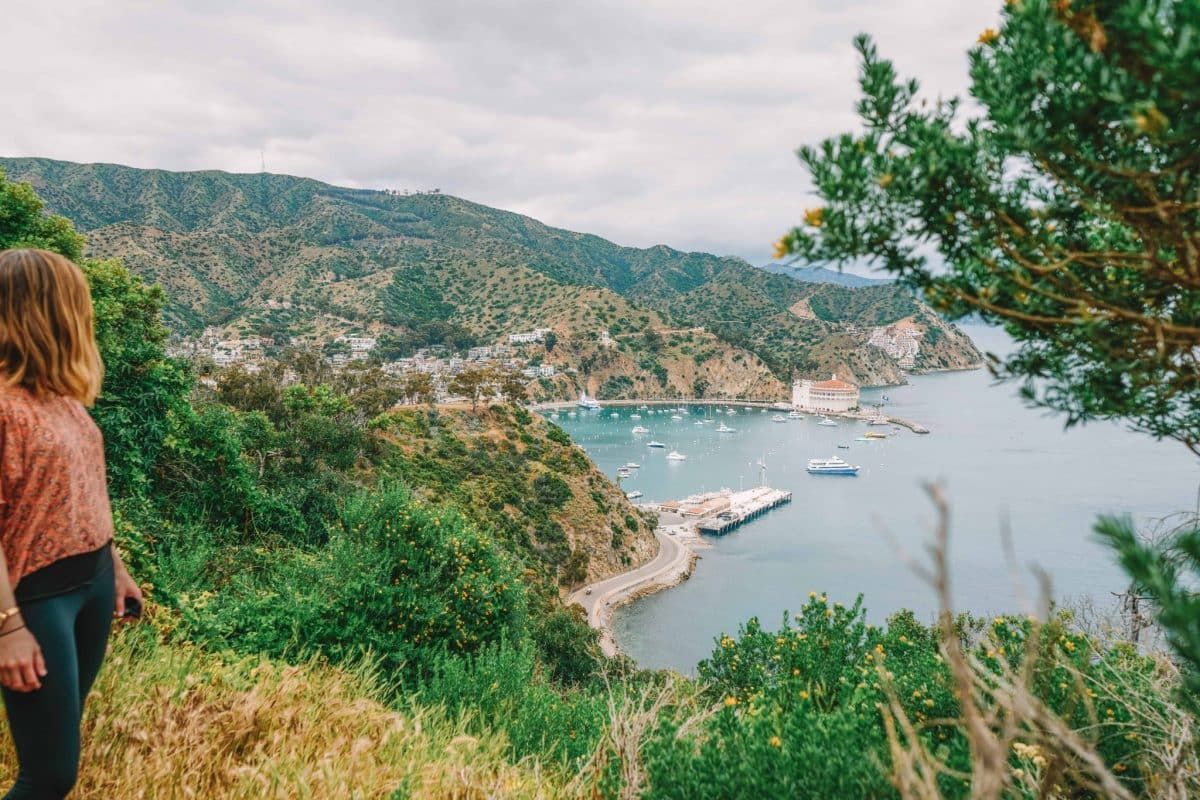
This is the first hike I ever did on Catalina Island and it’s still one of the prettiest lookout points I’ve found in Avalon.
Of course, you can just rent a golf cart to see these viewpoints more quickly and with less effort. However, if you’re looking for a decent hike in town and to take in the sights at a more leisurely pace, this is a good option.
Starting from the Avalon Pier, you’ll walk along Pebbly Beach Road until you get to Lovers Cove. This isn’t much of a beach but there’s a nice bench you can sit on and this is also a good spot for snorkeling if you want to take a break.
From the cove, you’ll continue along the road past the gas station, until you get to Wrigley Road. Take a right to head up the hill on Wrigley Road.
This is where you’ll really get to experience one of those famous Catalina hills. It’s a constant uphill climb from here on out until you start getting to the viewpoints.
Along Wrigley Road, you’ll pass by three viewpoints – Ocean Scenic Overlook, 3 Palms Scenic Overlook (my favorite), and Buena Vista Point Scenic Overlook.
Once you get to the last viewpoint, you’ll start making your way down Wrigley Road and back into town.
Little Harbor to Ben Weston Beach
Length: 9 miles | Elevation Gain: 719 ft | Type: Out-and-back
Features: Secluded beach that’s good for surfing, mostly along the road, not too steep.
I only recommend this hike if you’re staying in Little Harbor for a couple of nights and you’re looking to discover a hidden beach on Catalina Island.
The hike to Ben Weston Beach takes about an hour and a half one way and is mostly along the road until the very end.
To start the hike, head to Little Harbor Road and make your way south. The road will eventually turn into Middle Ranch Road, which you’ll take until you get to the Dry Creek Beach Trail on the right. This is the trail that will take you down to Ben Weston Beach.
Just note that there are no facilities at the beach and it’s not a great spot for swimming.
With that said it’s one of the best beaches on Catalina Island for surfing, so you might be able to watch some surfers if you’re not riding the waves yourself.
Or, you can pack a picnic to enjoy at the beach before you head back.
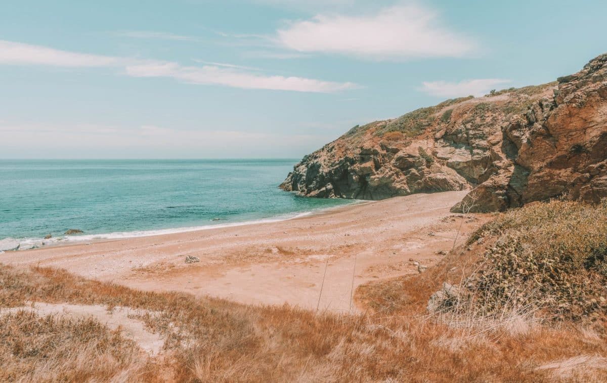
Parsons Landing to Starlight Beach
Length: 9.2 miles | Elevation Gain: 1,332 ft | Type: Out-and-back
Features: Scenic views, remote beach, part of the old TCT.
Another secluded beach hike on the island, the hike to Starlight Beach from Parsons Landing used to be part of the old Trans-Catalina Trail.
The beach itself isn’t much to look at compared to your other options on Catalina Island and it’s not a great place for swimming, but the hike features stunning views along the way.
Plus, it’s very likely you’ll get the beach to yourself once you arrive since it’s such a remote place.
This is another hike that I’d only recommend doing if you have an extra night camping at Parsons, or if you want to add it onto your Trans-Catalina itinerary.
Two Harbors to Little Harbor
Length: 11.2 miles | Elevation Gain: 2,972 ft | Type: Out-and-back | Trail Guide
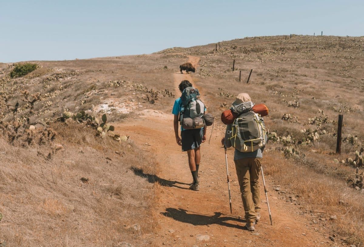
Features: Panoramic views, challenging ascents and descents, bird watching, bison, cacti, relaxing beach.
The hike from Two Harbors to Little Harbor and back is no joke.
I did the hike from Little Harbor to Two Harbors as part of the Trans-Catalina Trail and it was probably the most difficult day on the trail in terms of the straight ascent.
If you’re up for the challenge though, I’d recommend camping at Little Harbor for a night or two to break up the hike (and because it’s one of the best campsites on Catalina Island) before heading back to Two Harbors.
You can even book a kayak rental to arrive when you get there so you can explore the little coves near the beach if you have more time.
And even though this is a challenging hike, it’s well worth it for the panoramic views along the way in every direction and to see the scenic harbors at the end.
Plus, when we did the one-way version of this hike, we came across bison on the trail so it could be a good place for bison spotting as well.
Two Harbors to Parsons Landing Hike
Length: 14.1 miles | Elevation Gain: 2,691 ft | Type: Loop | Trail Guide: Hard way there & easy way back
Features: Steep ascents and very steep descents on the hard way, coastal views, remote campsite and beach, cacti.
There are two ways to hike from Two Harbors to Parsons Landing – the hard way (via Silver Peak Trail) and the easy way (via West End Road).
If you want the most variety and a challenge, I’d recommend doing the hard way there and the easy way back along West End Road. This is also how you would hike it if you’re doing the TCT.
However, I’d only recommend this if you’re able to book a campsite at Parsons to break up the hike from Two Harbors because the hard way can be brutal.
If you’re doing this hike as a day hike, it might be better to do the easy way there and back from Two Harbors.
Plus, the easy way is much more scenic and takes you in and out of little coves along the way.
However you decide to hike it, you’ll be rewarded with one of the prettiest remote beaches and campsites on Catalina Island at Parsons.
Avalon to Black Jack Campground
Length: 21.4 miles | Elevation Change: 6,678 ft | Type: Out-and-back or point to point (10.7 miles) | Trail Guide
Features: Steep ascents, stunning vista points, bison spotting, cacti, views of Avalon from above.
Another difficult hike on Catalina Island, the hike from Avalon to Black Jack is part of the Trans-Catalina Trail and involves a lot of uphill climbing.
This is another one I’d only recommend if you plan to camp at Black Jack Campground before heading back to Avalon, or if you’re doing it as part of the TCT.
The Avalon to Black Jack route takes you to stunning vista points looking back towards Avalon at the Hermit Gulch Lookout and through scenic backcountry hiking trails.
This is also a good route to try and spot some Bison. We saw one chilling in the shade right before we got to Blackjack Campground and there were a lot on the hills in the distance as we were hiking past.
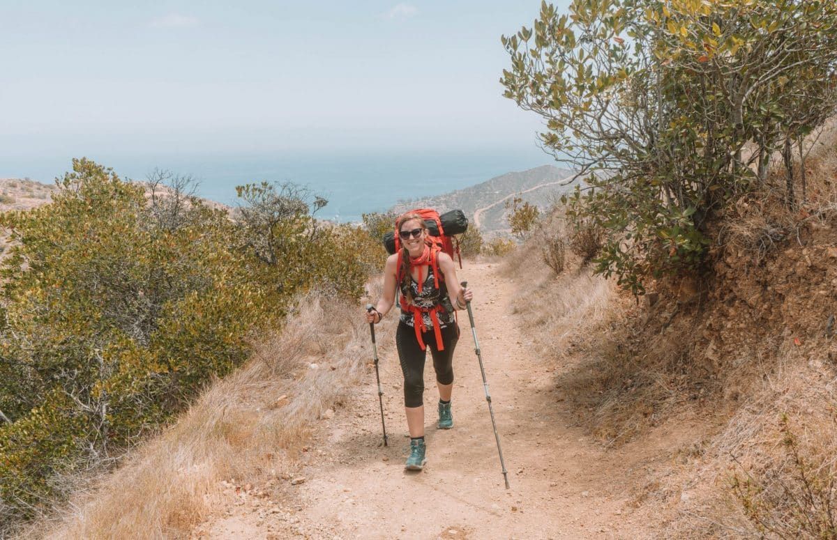
Trans-Catalina Trail
Length: 38.5 miles | Elevation Gain: 8,615 ft | Type: Point to point
Features: Coastal views for days, bison spotting, cacti, challenging ascents and descents, multi-day journey, wildflowers in the spring, Catalina Island’s most famous trail.
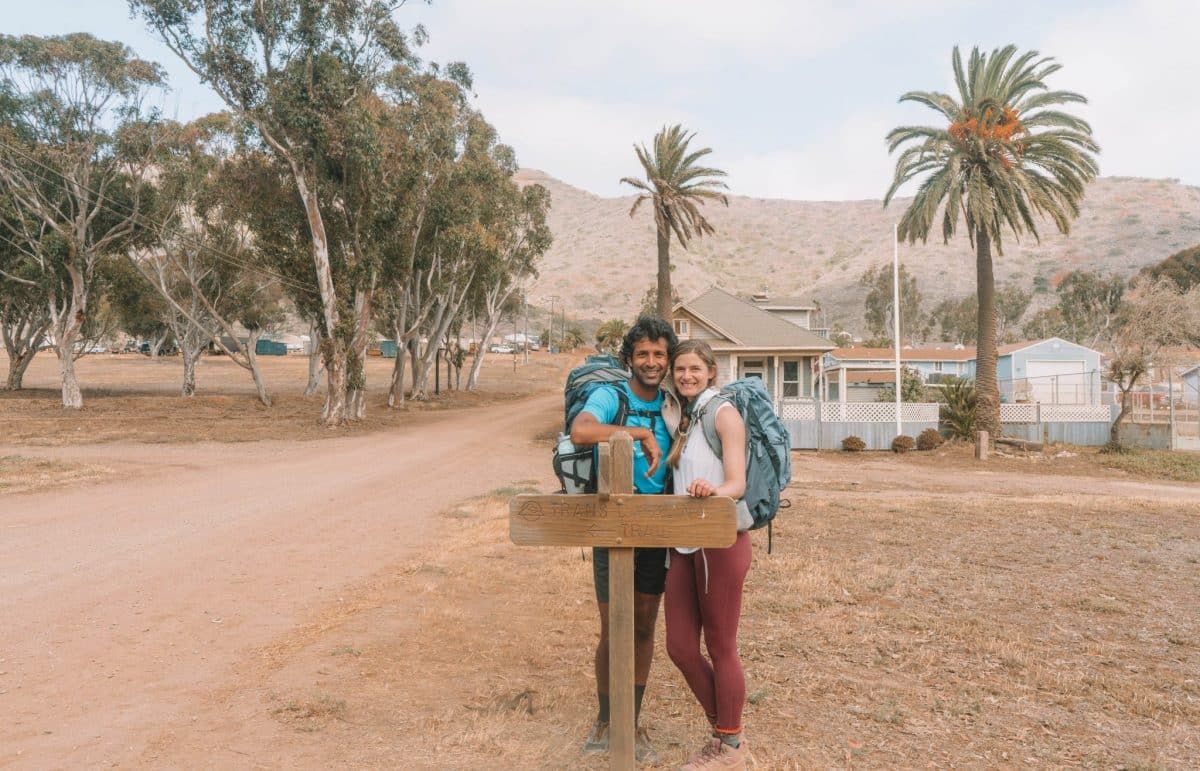
And finally, there’s the Trans-Catalina Trail, the most popular multi-day hike on the island. I completed this trail in May of 2021 and it quickly became one of my favorite hikes that I’ve done.
I’d recommend giving yourself five days and four nights to complete the trail.
Be prepared for a lot of elevation changes, stunning coastal and island views, bison and lizards, and plentiful hidden beaches and coves along the way. If you love coastal hikes, it’s hard to beat the Trans-Catalina Trail.
This is the 5-day itinerary we did for the trail:
- Day 1: Avalon to Black Jack Campground
- Day 2: Black Jack to Little Harbor Campground
- Day 3: Little Harbor to Two Harbors Campground
- Day 4: Two Harbors to Parsons Landing Campground (the hard way via Silver Peak Trail)
- Day 5: Parsons Landing to Two Harbors (the easy way via West End Road)
Tips for Hiking Catalina Island
- Permits are needed for most hiking trails – Any land that’s not in the immediate vicinity of either Two Harbors or Avalon is part of the Catalina Island Conservancy. This means that you’ll need permits from the Catalina Island Conservancy for pretty much all of these hikes, except for the ones that stay within the town area. Luckily, permits are free and easy to get. You can grab one here before you start hiking. Note: Permits are only needed for day hikes. If you’re camping overnight, your camping reservation serves as your hiking permit (just make sure to carry a copy with you).
- Watch out for the wildlife – There’s a lot of wildlife to discover on Catalina Island. The most notable being the bison that were placed on the island in 1924 for a movie shoot. If you see bison on the trail, give them a wide berth. There are a number of signs all over the island warning you about the bison and how dangerous they can be. Other wildlife you might come across include rattlesnakes, deer, lizards, and ticks (which is why it’s good to wear long pants).
- There’s little shade on the hiking trails – Bring more water than you think you’ll need, take your time going up those hills, bring a hat, and try to hike early in the day.
- Catalina hills are no joke – Catalina Island is full of huge hills and most of these hiking trails reflect that. Be prepared for some steady and steep inclines and declines if you want to go hiking on Catalina Island and bring proper footwear.
- Camp overnight where you can – If you have the time, do some backpacking and spend a night or two at different campsites. There are a lot of side trails from different backcountry campsites that are worth discovering without necessarily needing to do the whole Trans-Catalina Trail.
What to Pack for Hiking on Catalina Island
- Hiking permit
- Breathable hiking shirt(s)
- Long pants
- Hiking boots
- Sunscreen, sunglasses, and hat
- Plenty of water
- Insect repellent
- Hiking poles
- Day pack
- Swimsuit (if you’re hiking to a beach)
- Hiking snacks
- Travel insurance
- Handheld GPS, an outdoor watch with GPS (like a Garmin watch), or a good hiking app that you can use offline
- Compact binoculars if you’re into birdwatching
- A durable phone case
For Overnight Hikes
- Backpacking backpack
- Camping gear – tent, sleeping bag, sleeping pad, beanie, camp dishes, etc
- Camp food
- Toiletries
- Comfortable sandals for around camp
Looking for other California hikes? Check out our guides to the Trans-Catalina Trail, best Bay Area hikes, Berkeley Fire Trails, best hikes in Laguna Beach, best hikes in Orange County, best Malibu hikes, best Santa Cruz hikes, best Torrey Pines hikes, best Big Basin hikes, best hikes in San Francisco, best San Jose hikes, best Joshua Tree hikes, and best Big Bear hikes.
Get your FREE Los Angeles Mini Guide + a printable checklist with 100+ things to do in the city!
ABOUT THE AUTHOR

Mimi McFadden
Founder & Editor-In-Chief
Mimi McFadden initially started The Atlas Heart in 2013 to write about her adventures abroad. But since 2019, The Atlas Heart has become a love letter to the Golden State. Mimi enjoys sharing her first-hand knowledge and expertise with the places she knows so well and making the most comprehensive travel guides possible. When she’s not hiking and exploring new places in California, she loves to travel abroad, read in her cozy chaise lounge, play basketball, and connect with friends and family over board games. Over her 28 years in California, she has lived in Santa Cruz (18 years), San Diego (5 years), and the San Francisco Bay Area (5 years), where she currently resides.
Looking for more Southern California travel inspiration? Check out these related posts below!
22 Things to do in Death Valley National Park
22 Things to do in Palm Springs, California
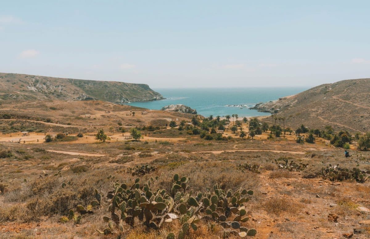
Camping at Parsons Landing Campground

Pin this image for future reference

