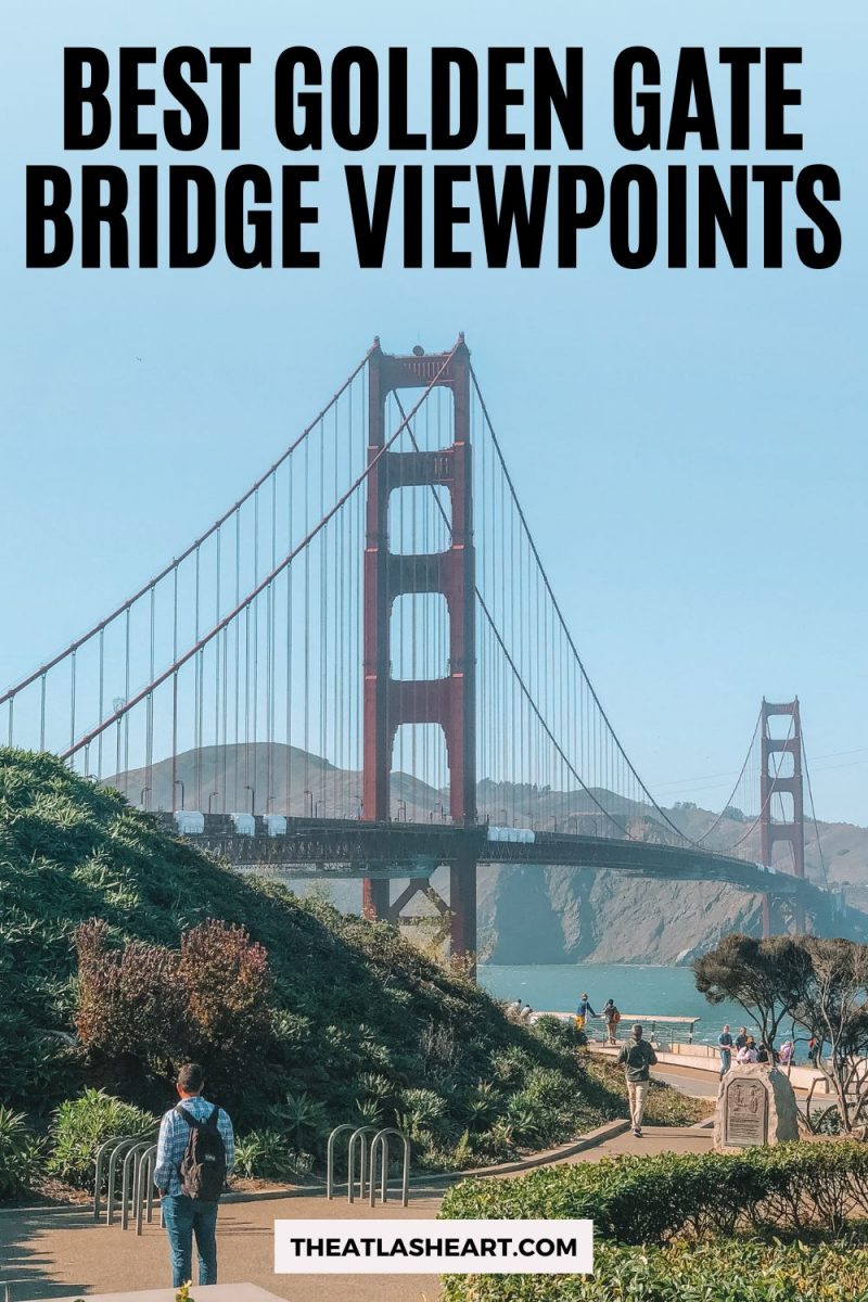
The best Golden Gate Bridge viewpoints in San Francisco and Marin.
Despite Hollywood’s obsession with destroying this bridge in movies–and more than one real-life earthquake–San Francisco’s iconic Golden Gate Bridge remains the city’s best-known landmark.
Its art-deco style, striking orange hue, and stunning natural surroundings make this bridge instantly recognizable.
One of the first things I wanted to do when I arrived in San Francisco was to find the best Golden Gate Bridge viewpoint, take photographs, and walk across it.
I’ve crossed the bridge many times since, but I still get my phone out every time.
The Golden Gate Bridge, San Francisco Bay, and the city of San Francisco itself are so photogenic it’s very easy to capture a stunning image.
But you need to know where to go to get that postcard-perfect picture–and cross your fingers for some sunshine.
In this article, I’ve found all the best viewpoints (including parking tips), so you can capture an iconic image for yourself.
Note: this post contains affiliate links, which help run this site at no extra cost to you so I can keep providing free travel advice and tips.
Get your FREE California Travel Planner – including printable checklists and my favorite two-week itinerary for the state.
Golden Gate Bridge Viewpoints Map
Best Viewpoints of the Golden Gate Bridge
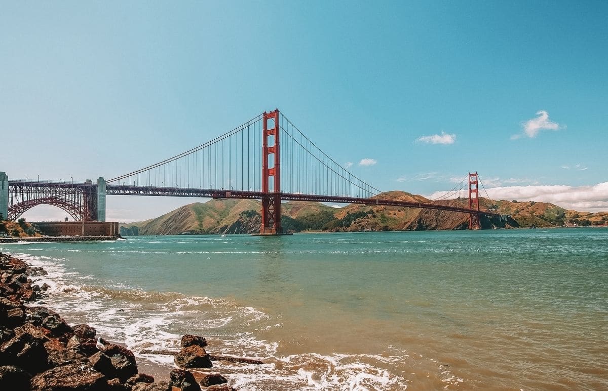
Fort Point

Distance from Golden Gate Bridge: 0.3 miles
Address: Long Ave & Marine Dr, 201 Marine Dr, San Francisco, CA 94129
How to get there: From Union Square, head north toward Pier 39, then follow Bay St to Marina Blvd.
Parking: There’s parking on Marine Dr and at the Battery East parking lot.
Features: View the bridge from underneath with the arches of Fort Point in the foreground.
The brick arches of Fort Point offer an interesting visual counterpoint to the criss-cross structures of the Golden Gate Bridge, which towers over the fortress.
This viewpoint will appeal to anyone interested in architecture, or looking for a unique angle on a much-photographed icon.
Fort Point is a three-story brick building, originally built to protect the San Francisco Bay during the Gold Rush in 1853. Soldiers guarded the bay during the Civil War, then again during World War II.
Now preserved as an essential part of San Francisco’s history, Fort Point is free to the public. Look out for seasonal guided tours, especially the atmospheric Fort Point candlelight tours.
Torpedo Wharf
Distance from Golden Gate Bridge: 0.5 miles
GPS coordinates: (37.8091381, -122.4702153)
How to get there: Take the San Francisco Bay Trail to the Warming Hut, then walk out onto the pier.
Parking: There is a parking lot at the end of Marine Dr.
Features: Best views of the city and bridge from the San Francisco side.
As I mentioned above, Crissy Field is a great place to hang out on a sunny San Francisco day.
From the field, take a short walk along the San Francisco Bay Trail until you reach the Warming Hut, a National Park-run bookstore/coffee shop. From there, you’ll spot a pier stretching out into the water.
This is Torpedo Wharf, named for the submarine mines planted from here by the U.S. Army as part of the bay’s defense.
As it juts out into the bay, the pier is perfectly placed for some incredible views of the San Francisco skyline and the Golden Gate Bridge.
The view is improved by the cute sea lions, who warm themselves on the sunny rocks. You’ll want to bring a jacket, however–the wind is strong out on the jetty.
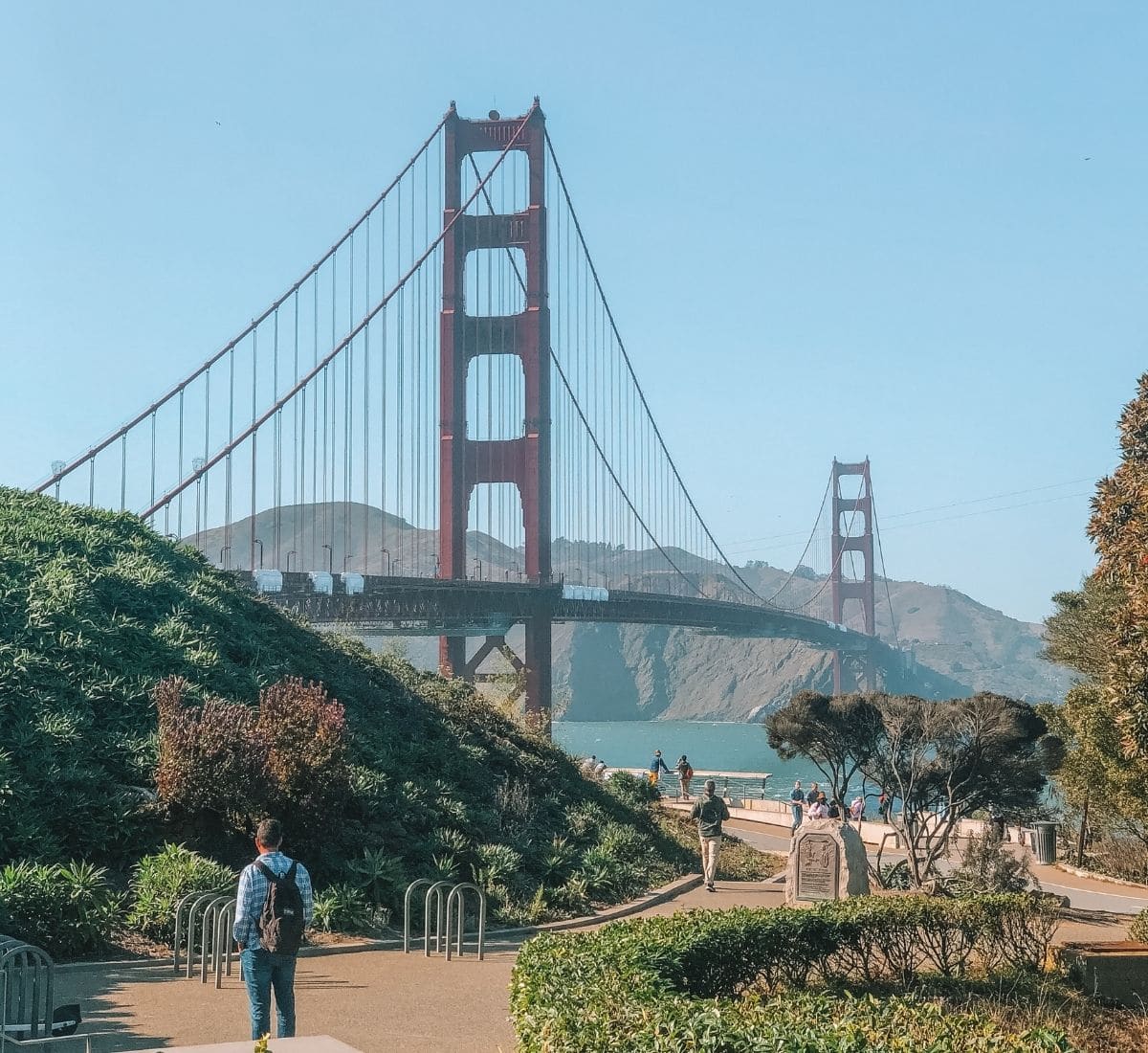
Crissy Field
Distance from Golden Gate Bridge: 0.7 miles
GPS coordinates: (37.8042874, -122.4647022)
How to get there: Crissy Field is located at the northernmost tip of San Francisco. You can drive along US-101, take the 30 bus from Union Square to Sports Basement, or hop on the free PresidiGo Shuttle, which makes several stops downtown.
Parking: Parking is pretty easy, there are plenty of spaces on Mason Street or at Sports Basement.
Features: Golden Gate Bridge views across a grassy field with mountains in the background.
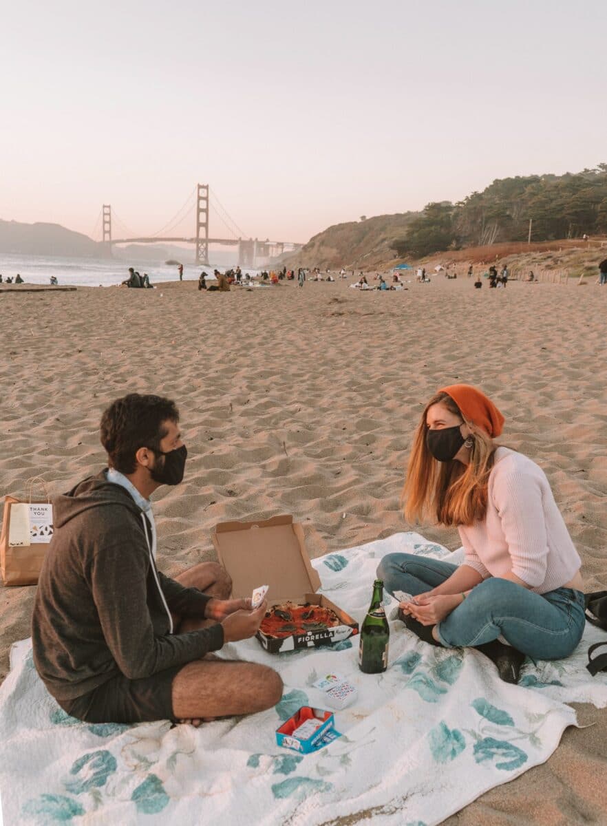
Crissy Field is a green, open space in the north of the city, which invites you to grab lunch, throw down a blanket, and enjoy a picnic with an incredible view of the bridge.
Once an airfield, it’s now perfect for playing frisbee or flying a kite, with plenty of space to play on the wide lawn.
Crissy Field leads down to Golden Gate Beach, a sunny stretch of sand that’s safe for swimming, unlike the wilder beaches to the west.
You can get a good shot of the Golden Gate Bridge from here too, often with sailboats gliding by. It’s also an area that’s best explored on foot, along the San Francisco Bay Trail.
On foggy days, head over to the Warming Hut at the northern end for a cup of hot chocolate to take off the chill, and spot the seals that like to hang out at the wharf.
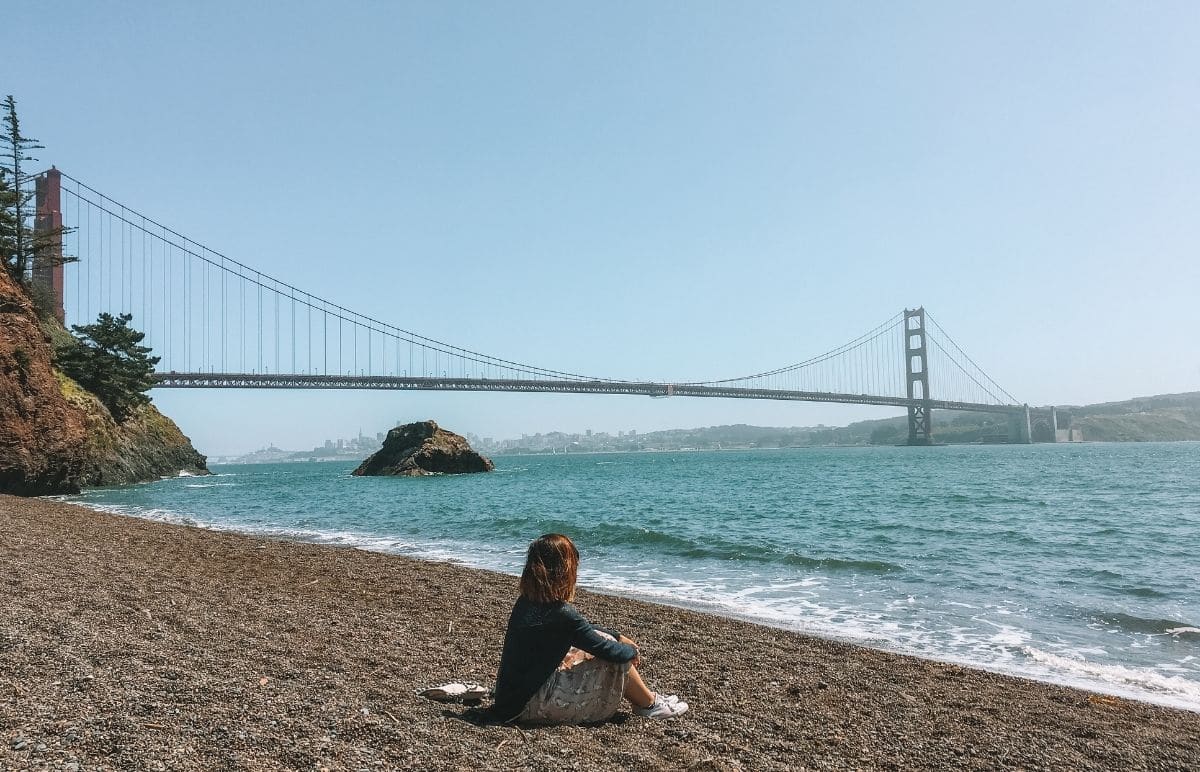
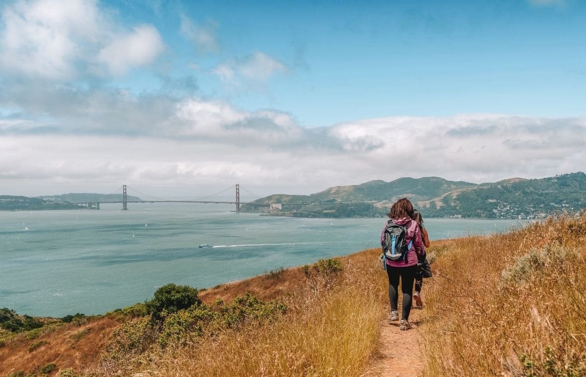
Marshall’s Beach
Distance from Golden Gate Bridge: 0.7 miles
GPS coordinates: (37.8016521, -122.4798778)
How to get there: Marshall’s Beach is just north of Baker Beach.
Parking: Park at Baker Beach parking lot or Langdon Court.
Features: Beautiful views of the Golden Gate Bridge from a quiet beach.
If you love the natural setting of Baker Beach but you’re not a fan of the crowds, head over to the more secluded Marshall’s Beach, located around the corner from Baker Beach.
You can get a beautiful shot from the top of the stairs as well as down on the beach, and you’re less likely to include random strangers in your photograph.
This westward-facing beach is also one of the best spots in the city to capture a sunset over the Pacific Ocean (fog allowing).
And don’t stop at Marshall’s Beach–you’ll also get amazing Golden Gate Bridge views on the Batteries to Bluffs Trail (one of the best urban hikes in San Francisco) above the beach as well.
I especially like stopping at the Golden Gate Overlook, a platform along the path. You can get a shot of the bridge’s towers framed between two cypress trees.
This spot is a favorite for couples taking their wedding photos but isn’t overcrowded.
Cavallo Point
Distance from Golden Gate Bridge: 0.9 miles
Address: 601 Murray Circle, Fort Baker, Sausalito, CA 94965
How to get there: From San Francisco, cross the Golden Gate Bridge and take the Alexander Ave exit, then turn right onto Bunker Rd, and left onto Murray Circle.
Parking: Parking is available at the hotel.
Features: A Sausalito Golden Gate Bridge view from the comfort of your own room.
Cavallo Point is a luxury hotel at the foot of the Golden Gate Bridge. Make a reservation at Murray Circle, the on-site restaurant, and ask for a seat outside on the sunny porch.
You’ll be able to take in the Golden Gate Bridge as you savor your lunch or watch the sunset over cocktails.
The lodge has pathways through gardens with more great spots for photography. It would be a great location for portraits or for a romantic occasion (like a proposal!).
If you’re looking to grab a bite to eat while you’re in the area, read our guide to the best Sausalito restaurants.
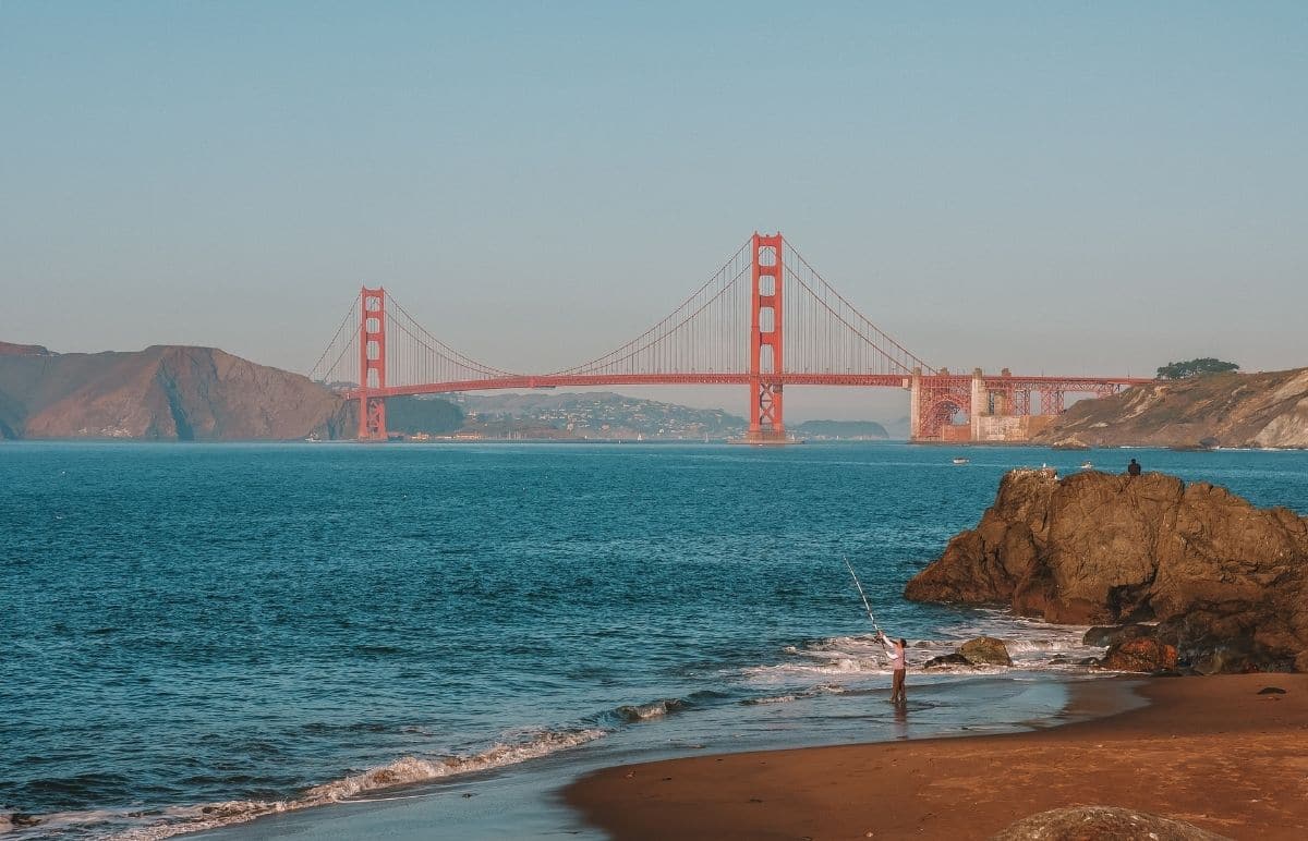
Baker Beach
Distance from Golden Gate Bridge: 1 mile
GPS coordinates: (37.7947698, -122.4831280)
How to get there: Park in the parking lot just off Lincoln Blvd., or take the 38 bus from Union Square toward the Outer Richmond neighborhood.
Parking: Baker Beach parking lot.
Features: See the Golden Gate Bridge with the Marin Headlands in the background and a beach in the foreground.
Play in the surf with the iconic orange bridge as your background at Baker Beach, a one-mile stretch of sand in the northwest corner of San Francisco.
On a sunny day, the blues of the ocean and sky contrast beautifully with the bridge.
Surrounded by nature on all sides, it’s my favorite view of the Golden Gate Bridge and also one of the easiest to access, as the beach is just steps from the parking lot or bus route.
Baker Beach is popular with just about everyone in the city. Dogs are allowed off-leash, nudity is allowed in the northernmost area and families take their kids to play in the sand.
This also means it can get crowded, especially on a warm day when San Franciscans head over to escape the heat of the city.
North Vista Point View
Distance from Golden Gate Bridge: 1.1 miles
Address/GPS coordinates: Parking lot, Golden Gate Bridge, Sausalito, CA 94965, (37.8324586, -122.4802131)
How to get there: After crossing the bridge from San Francisco, take the first exit, marked Vista Point.
Parking: There is a small, free parking lot.
Features: Easy access to a close-up view of the bridge.
If you’re walking or biking across the bridge, this is the first viewpoint you’ll come across on the north side.
Since this viewpoint is at the same level as the bridge, you’ll look up at the structure rather than down like you would on the Conzelman Road vantage points on the other side of the freeway.
As a result, you’ll get a close look at the bridge’s structure rather than a bird’s eye view.
If you want to check out both views, there’s a walkway leading from this vista point across to the trailheads on the western side.
If you can’t find a spot in the parking lot here, continue driving to the Alexander Ave exit, then turn left onto Bunker Road.
You’ll find several turnouts and parking lots on this side, then you can take the walkway back over to the North Vista Point View.
China Beach
Distance from Golden Gate Bridge: 2.1 miles
Address/GPS coordinates: China Beach, 340 Sea Cliff Ave., San Francisco, (37.7881634, -122.4907467)
How to get there: Take the stairs down to the beach from Seacliff Ave.
Parking: Park in the parking area at the intersection of Seacliff Ave and Camino Del Mar.
Features: Small, quiet beach tucked between the popular Baker Beach and Lands End.
The tiny area of sand at China Beach is protected from the wind by rock walls, making this a nice sunny spot for a picnic with a view of the Golden Gate Bridge.
It’s best to time your visit with low tide since there will be more space. You can also explore the miniature marine worlds in the tide pools that form at low tide.
China Beach was named for the Chinese fishermen who would camp here, and there’s a small monument to them on the beach.
Although small, China Beach is often less crowded than the better-known Baker Beach next door. There’s also a cluster of picnic tables available.
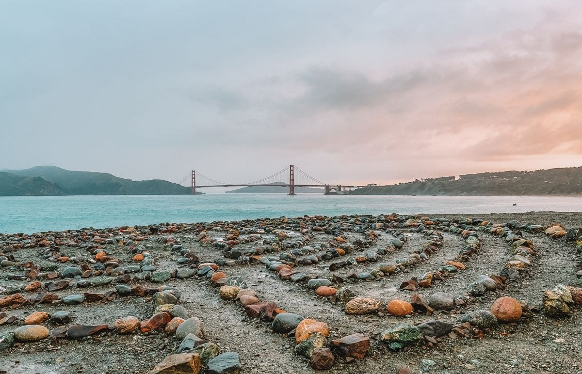
Lands End Lookout
Distance from Golden Gate Bridge: 2.8 miles
GPS coordinates: (37.7880419, -122.5059137)
How to get there: From the parking lot at El Camino Del Mar, follow the Lands End Trail down the steps and out to the lookout.
Parking: 1200-1298 El Camino Del Mar, San Francisco, CA 94121.
Features: Rugged scenery and a giant heart.
Lands End in San Francisco is special for its history, scenery, and local icon status as the site of the Land’s End Labyrinth.
The lookout offers great views of the famous San Francisco bridge, Marin Headlands, and the Pacific Ocean.
Take the Lands End Trail from the road up to the Coastal Trail, where you’ll head down some steps, ending at the Lands End lookout on the cliff’s edge.
This is a remote and rocky corner of the city with plenty of fog and chilly winds. It’s perfect for an atmospheric picture of the Golden Gate Bridge, standing tall over the white-tipped waves.
The labyrinth at the lookout is created from a variety of rocks. It has been carefully reassembled every time the rocks get moved and thrown off the cliff (which has happened a lot in recent years).
Unfortunately, the artist who maintains the labyrinth declared they were done after the last time a vandal destroyed the maze.
However, another hero has stepped up to craft a heart out of the scattered rocks, making a new piece of public art to delight visitors.
Slackers Hill
Distance from Golden Gate Bridge: 2.8 miles
Address/GPS coordinates: Conzelman Rd. Parking Lot, Sausalito (37.8338626, -122.4944786)
How to get there: Once across the bridge, take the Alexander Ave exit then left onto Bunker Rd, right on McCullough, and park in the lot.
Parking: Conzelman Rd Parking Lot, which is free.
Features: A nice short hike to a superb view of the bridge and the San Francisco skyline
Hike up to Slackers Hill and be rewarded with 360-degree views of the city and the Golden Gate Bridge from the Marin side.
The one-mile out-and-back trail is short but steep. From the parking lot at the Conzelman Rd turning circle, take the Slacker Trail uphill.
At the fork, turn right onto the Slackers Hill Trail and continue to the top. There’s no shade on this trail, so come prepared for wind and sunshine.
At the summit of Slackers Hill, you’ll see beaches, the Marin Headlands, the ocean, the city, and, of course, the bridge.
This is a particularly beautiful spot to watch the sunset. If you do want to see the sun go down, plan to arrive about an hour before so you have enough time for the 30-minute hike to this Golden Gate Bridge vista point.
SCA Trail
Distance from Golden Gate Bridge: 3 miles
Address/GPS coordinates: Conzelman Rd, Sausalito; (37.8325109, -122.4820159)
How to get there: Find the trailhead at the third parking lot along Conzelman Road.
Parking: Park in the small trailhead parking lot.
Features: A thrilling hike through Marin’s beautiful mountains with views of the bridge at every turn.
The SCA Trail is over four miles long, winding through the gorgeous Marin Headlands on the north side of the Golden Gate Bridge.
Start from the parking lot and take the trail up, making a detour to the top of Slackers Hill if you’re looking for a loftier viewpoint.
This is an out-and-back path with not much available shade, so pick a cool day or try to get there early to avoid the heat.
There are so many opportunities along this trail for a photograph of the bridge, so take your time and see what the weather brings you. It’s especially scenic when low clouds partially obscure the bridge.
The SCA Trail is a great way to combine a hike through the hills with a memorable picture of San Francisco.
Battery Spencer
Distance from Golden Gate Bridge: 3.5 miles
Address/GPS coordinates: Conzelman Rd, Sausalito, CA 94965 (37.8275450, -122.4815780)
How to get there: From US-101, take Alexander Ave and turn left onto Bunker Rd, then right onto Conzelman. Park in the small lot and take the trail to the Battery Spencer lookout.
Parking: There is a small, free parking lot.
Features: Spectacular views of the bridge and the city.
It’s worth waiting patiently for one of the dozen parking spots to open up for this jaw-dropping Golden Gate postcard viewpoint.
Battery Spencer was once a military lookout position, chosen for the sweeping vistas of the bay. Now, tourists walk by the abandoned outpost to enjoy beautiful views of the Golden Gate Bridge and beyond.
It’s a short trail from the parking lot to the peak, where you’ll find a large dirt area with plenty of space for everyone.
If you’re looking for an atmospheric image of the bridge rising out of the famous fog, try visiting in the morning. Late afternoon is beautiful too when the golden hour emphasizes the bridge’s orange hue.
The time of day and weather conditions can have a huge impact on your experience, so it’s worth making repeat visits to this magical spot.
While you’re parked up at Battery Spencer, check out the Golden Gate Observation Deck nearby. This area also has a ton of great spots to capture the perfect Golden Gate Bridge photo.
Kirby Beach
Distance from Golden Gate Bridge: 3.9 miles
Address/GPS coordinates: Kirby Beach, (37.8268922, -122.4891663)
How to get there: From San Francisco, cross the Golden Gate Bridge and take the Alexander Ave exit. Turn left onto Bunker Rd, then left onto McCullough Rd. At the traffic circle, take the second exit onto Conzelman Rd and park at the Battery Wagner lot.
Parking: Park in the Golden Gate View Point parking lot, which is free.
Features: Take your camping gear and camp out in front of the Golden Gate Bridge for a unique night’s sleep.
It’s a one-mile descent down to the beach at Kirby Cove, but well worth the effort for the beautiful view of the Golden Gate Bridge from the beach.
On a sunny day, you’ll see sand, surf, and the Golden Gate Bridge stretching out over the ocean to San Francisco.
This popular photography spot used to feature a swing but it has now been dismantled by the park service. You’ll still get a great Golden Gate Bridge photo from here, however.
Plus, there’s a hike-in campground just above the beach, where you can watch the sunset (and sunrise) behind the bridge.
There are only a handful of tent sites at this exclusive spot, so be ready to book months ahead of your visit.
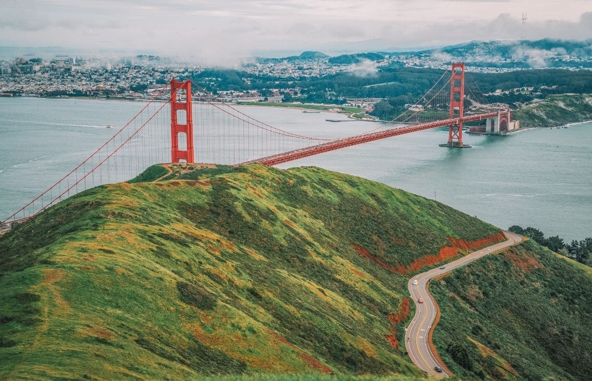
Hawk Hill
Distance from Golden Gate Bridge: 4 miles
Address/GPS coordinates: Conzelman Rd, Sausalito, CA 94965 (37.8275373, -122.4996782)
How to get there: From San Francisco, cross the Golden Gate Bridge to the Marin side and take exit 442 for Alexander Ave., go left on Bunker Rd., then left again on McCollough Rd., before turning onto Conzelman Rd.
Parking: Golden Gate Bridge Lookout parking lot.
Features: Go for the spectacular bridge views, stay for the wildlife.
Hawk Hill is a fabulous viewing point for the Golden Gate Bridge, high in the hills on the Marin side.
You’ll get a bird’s eye view of the bridge, with the city of San Francisco sparkling in the background.
Conzelman Road has several great viewing spots, not all of which have parking. Luckily, Hawk Hill does have a small parking lot, making it the most convenient, as well as potentially the best viewpoint of the Golden Gate Bridge.
In addition to capturing a great shot of the famous bridge, stick around with your binoculars and watch the hawks soaring overhead.
If you want to get a better chance of spotting the birds, visit from September to November during their fall migration. Hike the 0.2-mile Hawk Hill trail and enjoy the views.
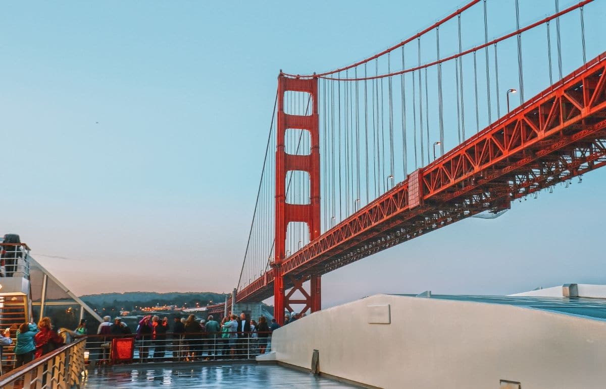
Bay Boat Cruise
Distance from Golden Gate Bridge: 4.5 miles
Address: Pier 43 ½, San Francisco
How to get there: From Union Square, take the F tram north to Fisherman’s Wharf.
Parking: Pier 39 Parking Garage on The Embarcadero is nearby.
Features: Unique views from right under the bridge.
Take a guided cruise with Red and White Fleet for a truly unique viewpoint, by sailing directly beneath the Golden Gate Bridge.
Departing from Pier 43, the boat offers great views of the San Francisco skyline before passing between the towers, which rise 746 feet above the water.
There are plenty of opportunities to marvel at the bridge as you pass by Angel Island, Alcatraz Island, and the Bay Bridge (the Golden Gate’s less famous sister connecting the city to the East Bay).
Although the Bay Bridge lacks the iconic status of the Golden Gate, it’s still an impressive sight.
Check it out at dusk, when the entire span is lit up with thousands of sparkling LED lights in a dazzling display–it’s even on our list of the best things to do in San Francisco at night.
Alcatraz
Distance from Golden Gate Bridge: 4.6 miles
Address/GPS coordinates: Alcatraz Island
How to get there: Take the Alcatraz Island ferry from Pier 33 in San Francisco.
Parking: There are commercial parking lots available around Pier 33.
Features: Alcatraz is a must-do San Francisco experience and the view from the prison cell is unique!
Snap a compelling picture of the Golden Gate Bridge from The Rock, San Francisco’s infamous prison island.
A ticket from Alcatraz City Cruises includes a return ferry trip, access to the island, and a self-guided audio tour of the national park. Day and night tours are available.
The ferry trip yields plenty of photo opportunities, as the boat sails close to the bridge.
Once you’re on the island, there are many places to get some interesting shots of the city and the bridge from the prisoner’s recreation yard, prisoner gardens, or from inside the cells.
If you take a night tour, you can get an amazing photograph of the sun setting behind the bridge.
If you like to incorporate creepy vibes into your photography, a tour of Alcatraz would be perfect for you.
My biggest tip is to book tickets far in advance, as tours are popular and usually sold out on the day since it’s one of San Francisco’s most popular attractions.
Point Bonita Lighthouse
Distance from Golden Gate Bridge: 5 miles
Address/GPS coordinates: Point Bonita Lighthouse, Sausalito; (37.8153953, -122.5295396)
How to get there: From the Golden Gate Bridge, take the Alexander Ave exit, then turn left onto Bunker Rd, and left onto Field Rd. The parking lot is at the end of the road.
Parking: Park in the small lot at the trailhead.
Features: Historic, active lighthouse with outstanding ocean and Golden Gate Bridge scenic viewpoints.
Point Bonita is home to another guardian of the San Francisco Bay–a lighthouse warning ships of the rocky shoreline.
Hike the half-mile trail out to the still-active Point Bonita Lighthouse for a refreshing walk and sweeping vistas of the Golden Gate Bridge.
The trail out to the lighthouse is steep and may be difficult for young children, but the views out to the ocean and San Francisco are spectacular. The lighthouse, built in 1855, is open on Sundays and Mondays.
The bridge is fairly far from this viewpoint, but the beautiful scenery offers stunning views. It’s best to visit on a sunny day, as you won’t see much of the bridge when the fog sweeps in.
Angel Island
Distance from Golden Gate Bridge: 12 miles
GPS coordinates: (37.8655487, -122.4344958)
How to get there: Take the Golden Gate Ferry from Pier 39 or Angel Island Ferry from Tiburon.
Parking: Park at Pier 39 or in Tiburon.
Features: See the Golden Gate Bridge from an island in the bay.
Angel Island, the largest natural island in the San Francisco Bay, offers spectacular views of the city and the bay.
It’s a quick ferry ride out to the island, but with no cars and very few buildings, it’s a world away from city life.
From the vantage point of Angel Island, you can see the entire span of the Golden Gate Bridge, connecting the peninsula with the Marin headlands.
Overnight camping is also permitted at Angel Island, so you can stay for the sunset–just make sure to book well in advance because these spots book up quickly.
Angel Island was once used as a quarantine station, processing thousands of immigrants– mostly from China–seeking the American dream.
You can learn about their stories in the U.S. Immigration Station Barracks Museum on the island. There are also miles of trails, two beautiful beaches, and picnic areas to enjoy.
The best view of the Golden Gate Bridge is from Camp Reynolds on the west side of the island.
Walking and Biking the Golden Gate Bridge
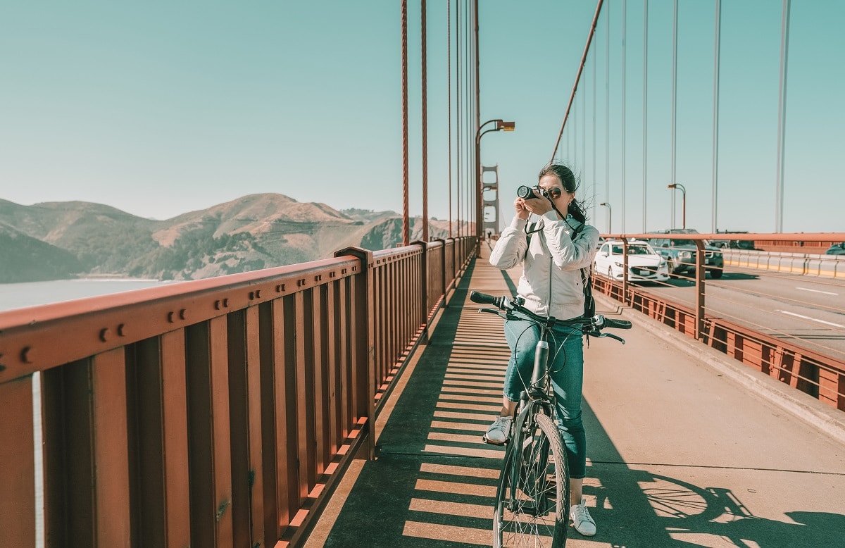
Walking or biking across the Golden Gate Bridge are popular ways to experience the bridge up close and to get some artistic photographs of the bridge’s architecture.
It’s a 1.7-mile hike or bike on the walkway, and there is no charge to cross if you’re on foot or biking.
Cyclists and pedestrians use separate paths on weekends and after 3:30 pm on weekdays, but share one side at other times.
I like to bike from San Francisco, continue onto Sausalito on the Marin side, then return on the ferry. I’ve also walked across, turned around, and walked back, which took a couple of hours.
If you’re looking for parking, check out Overlook Lot at Langdon Ct, San Francisco, CA 94129. The Welcome Center also has parking but it’s limited to two hours and fills up quickly, especially on the weekend.
We’ve rented bikes, helmets, and bike locks from Bay City Bike, located at Fisherman’s Wharf. If you’re looking for a guided tour, you could do this three-hour bike tour.
The tour includes several iconic San Francisco sights like the Palace of Fine Arts, Fort Mason, and Crissy Fields, as well as the bridge crossing into Sausalito. And electric bikes are an option if you’re not thrilled at pedaling for that long.
Tips for Seeing the Golden Gate Bridge
Dress for Karl
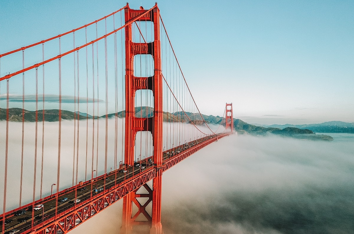
I am, of course, referring to Karl the Fog, San Francisco’s mischievous foggy phenomenon.
Regardless of how sunny and warm it is when you step outside your city hotel, please believe me when I say layer up for any excursion that takes you near the water.
Those tourists wearing the “I love San Francisco” hoodies may or may not actually love San Francisco, they’re freezing cold and bought the first warm thing they saw when they got off the tour bus.
Check the weather
Again, the fog: it can take photographs from “meh” to “wow” or completely white out everything except your hand in front of your face.
Check the Golden Gate Bridge cam for up-to-date weather information to determine whether you’re getting a stunning picture of the Golden Gate Bridge with fog, or just a bunch of fog.
If getting that perfect picture is important to your visit: come in October. The fog recedes, the days are sunnier and your chances of viewing the bridge unobscured are higher.
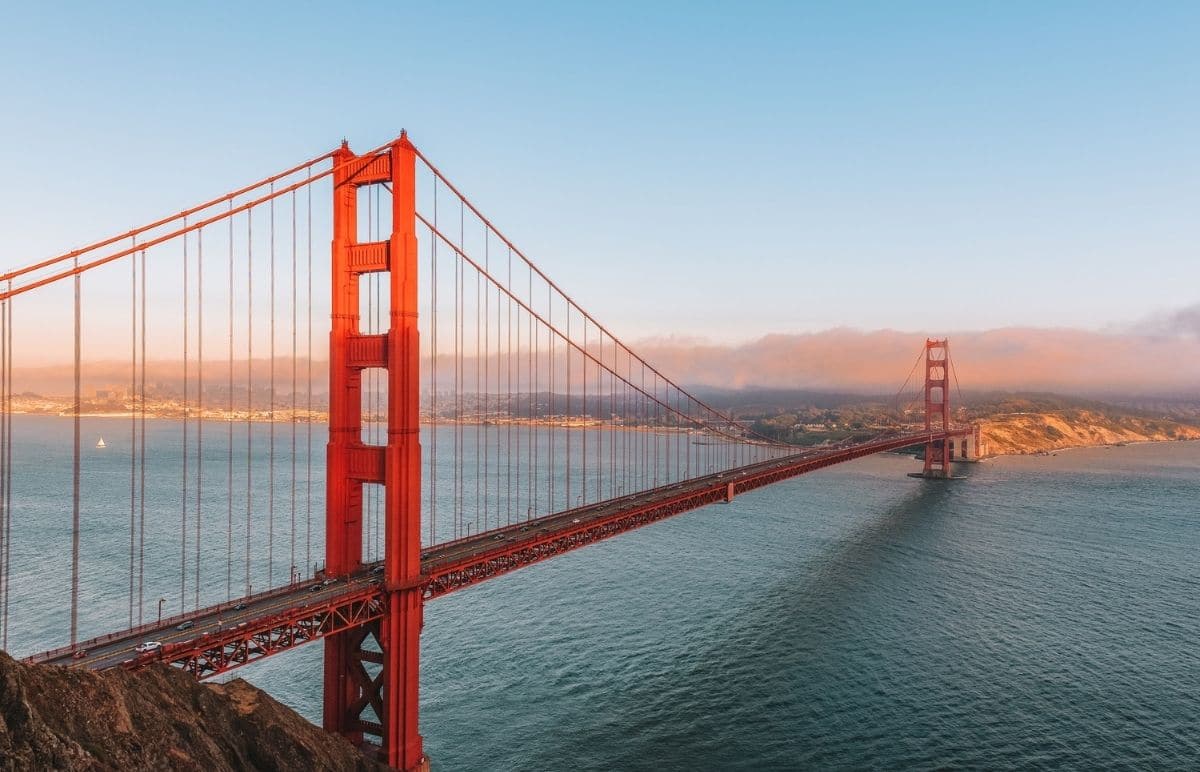
Best time to photograph the Golden Gate Bridge
Early morning and late afternoon are the best times to see the Golden Gate Bridge when the light casts a golden hue over the landscape.
The Golden Gate Bridge at night can also be a beautiful sight, as the lights reflect in the water below.
In San Francisco, the fog can descend at any time but your best shot at avoiding it is in the late afternoon.
If you’re lucky, you might get just a few wisps of fog clinging to the towers, enough for a moody image but not so much that you lose the bridge entirely.
Golden Gate Bridge FAQs
What is the best view of the Golden Gate Bridge?
That’s completely down to your personal preference!
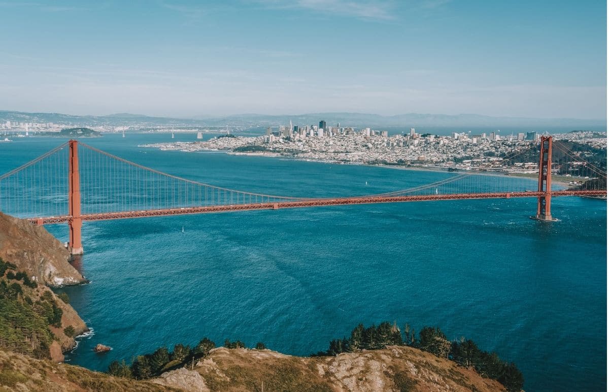
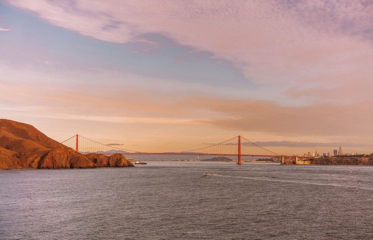
The famous “postcard view” of the Golden Gate Bridge from above with the San Francisco skyline behind is from Battery Spencer on the Marin side.
My favorite view is from Baker Beach, with the beautiful Marin headlands in the background and the beach in the foreground.
What lies under the Golden Gate Bridge?
Underneath the Golden Gate Bridge, and 216 feet of water, lies the Chester, a steamboat that sank in 1890.
A National Oceanic and Atmospheric Administration (NOAA) survey in 2014 revealed the boat is still upright and still intact, after the fatal collision on a foggy August day over 100 years ago.
How do you get a good picture of the Golden Gate Bridge?
Pick one of the spots listed above, keep an eye on the Golden Gate Bridge cam for visibility, and bring a tripod or selfie stick for an amazing picture.
Where can you see the Golden Gate Bridge at night?
You can visit any of these spots at night, except at Fort Point, which closes at 5 pm.
If you want to visit Angel Island at night, you’ll need to camp. Night tours of Alcatraz are also available (and extra creepy).
Can I drive across the Golden Gate Bridge? How about walking or biking across it?
You can walk, bike, or drive across the Golden Gate Bridge. Pedestrians and cyclists cross for free, drivers pay a toll going from the north side back to the city.
There are no toll booth operators anymore, so if you drive, be sure to remember to pay the toll online within 48 hours of crossing or have your FasTrak ready.
Why does the Golden Gate Bridge hum?
After a safety railing was replaced in 2020, residents near the Golden Gate Bridge started noticing an eerie humming sound in high winds.
The retrofit, designed to make the bridge safer in strong wind conditions, appears to have turned the structure into a giant harp.
Many locals are unhappy with the sound and engineers are currently working on a solution.
Why is the Golden Gate Bridge red?
The Golden Gate Bridge’s color is “International Orange”. The color was originally a primer of red lead paint, intended only to protect the steel structure from rusting.
However, when the architect saw the struts, he realized the color was perfect.
It was eye-catching enough that ships sailing through the bay would see the bridge clearly in the fog and offered a pleasing contrast to the blues and greens of its environment.
Bridges of the time were usually painted grey or black, so it was a bold move to choose such a bright hue.
Why is the Golden Gate Bridge so iconic?
At the time of completion in 1937, the Golden Gate Bridge was the tallest and longest suspension bridge in the world.
At 746 feet high and 1.7 miles long, the bridge was considered a marvel of engineering at the time and has certainly proven so since.
The Golden Gate Bridge, which took just four years to build, has also withstood two major earthquakes.
One was when the bridge was under construction and the other was during the Loma Prieta earthquake of 1989, which flattened a section of the newer Bay Bridge.
Its strength lies in its flexibility–the bridge is designed to bend and sway in the wind or during an earthquake.
In addition to its serious engineering credentials, the bridge is straight-up gorgeous. Not only for the color but also because of its graceful Art Deco design, with cables and towers that seem to float over the water.
This potent combination of strength and beauty makes it a target for destruction in so many disaster movies, including Superman, Godzilla, X-Men, and San Andreas, to name a few.
ABOUT THE AUTHOR

Sarah McDonald
Sarah McDonald is a travel writer based in the Bay Area. She writes for the national parenting website Red Tricycle and on her own family travel blog, Tiny Trailblazers. She loves exploring California’s outdoors and has a weakness for a national park gift shop.
Sarah enjoys sharing her Bay Area expertise with readers curious to try popular restaurants and off-the-beaten-path adventures in California. When she’s not writing reviews and travel guides, you’ll likely find her trying to keep up with her kids on a hiking trail or deciphering the menu at a new restaurant.
Looking for more Bay Area travel inspiration? Read our related guides below!
30 Best Bay Area Hikes Near San Francisco
Best Thrift Stores in San Francisco
Places to See Redwoods Near San Francisco
Best Weekend Trips from San Francisco
Things to do in San Jose, California
Pin this image for future reference

