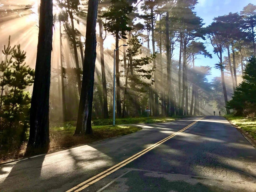
The best hikes in San Francisco! These are the best hiking spots around the city for good views and getting the good kind of lost in nature. No driving necessary.
Although there are various hiking opportunities and parks around the Bay Area and beyond, a lot of people don’t realize how many hiking opportunities there are within San Francisco as well.
If you’re not looking to go too far from the city, especially right now with shelter in place orders still in effect indefinitely, there are plenty of options to get out in nature without having to leave the city.
With its hilly nature and almost never-too-hot climate, San Francisco is truly an ideal city to go hiking around.
Yes, San Francisco can be chilly, foggy, and windy at times.
But as long as you dress appropriately, it can be an enjoyable place for urban and coastal hikes near the bay.
Plus, hiking in San Francisco means you’ll get a good calf workout AND great views pretty much anywhere you go because of the city’s famous hills.
These are my picks for the best hikes in San Francisco for those looking to get out in nature without having to drive outside of the city.
And I’m sure you’re already well aware of this but it doesn’t hurt to mention it again: if you plan to go hiking in San Francisco, please wear a mask and stay six feet apart from anyone who is not in your household.
Stay safe and enjoy the natural beauty of San Francisco with these hikes!
Note: this post contains affiliate links, which help run this site at no extra cost to you so I can keep providing free travel advice and tips.
Related: 46 Things to do at Night in San Francisco
What to Pack for San Francisco Hikes
Besides a few months of the year (September to November), San Francisco stays on the cooler side year-round.
People are usually surprised when they visit San Francisco for the first time because they think of California and think hot weather.
But besides the gorgeous weather that comes to the city in early fall, you can usually expect temperatures to stay in the mid-50s to low-60s year-round.
Because of this, layers are important when you’re tackling San Francisco hiking trails.
Due to where the city is situated and its location near the water, San Francisco is also known to have microclimates.
So even though it might seem like it’s beautiful and sunny when you leave for your hike, the weather can change quickly depending on the neighborhood and time of day.
Even if you don’t think you’ll need it, always bring a jacket with you when you’re going on a hike in San Francisco.
If you have sensitive ears like me, it also doesn’t hurt to carry a beanie or baseball hat with you since it can get windy throughout the city, especially near the water.
This is the full list of what I would recommend bringing on a San Francisco hike:
- Hiking jacket (if you choose to go with a light windbreaker, I’d recommend having an extra layer underneath like a light sweater)
- Moisture-wicking shirt – Read our guide to the best hiking clothes for women.
- Leggings, hiking pants, or shorts (if you’re hiking in shorts it’s still good to have at a pair of legging or pants in the car in case the weather turns chilly).
- Hiking backpack
- Water
- Hiking shoes or comfortable sneakers (hiking boots aren’t really needed for these more urban hikes, but they don’t hurt if that’s all you have)
- Snacks
- Hat (beanie or baseball cap)
- Sunglasses
- Sunscreen
- Handheld GPS, outdoor watch with GPS (like a Garmin watch), or a good hiking app that you can use offline
- Compact binoculars if you’re into birdwatching
- A protective phone case like Otterbox
Get your FREE California Travel Planner – including printable checklists and my favorite two-week itinerary for the state.
Tips for Hiking in San Francisco
- Read trailhead signs and be conscious of local habits – California, and especially San Francisco, takes sustainability and the environment seriously. If there are sectioned off parts of a trail, it’s probably for good reason. Don’t go off trail if it’s going to destroy the local habitat. It’s also important to read trail signs ahead of time to know what type of plants are in the area (e.g. poison oak), as well as local insects and animals. For instance, quite a few San Francisco hiking trails have coyote warnings.
- Wear a mask and stay six feet apart – As mentioned above, San Francisco is currently under shelter in place orders that require everyone who is outside and within 30 feet of another person to be wearing a mask at all times. Yes, it sucks to wear a mask while you’re hiking, but public health and the greater good of the community is more important. Please wear a mask and stay safe.
- Bring plenty of water – This is a good hiking tip in general, but especially in the Bay Area where it’s always temperate, it can be easy to forget to drink water or to bring extra water with you.
- Wear sturdy, comfortable shoes with good traction – San Francisco hills are the real deal. Even though you’ll be urban hiking within city limits, it’s worth it to wear comfy shoes that protect you from twisted ankles or from slipping on steep inclines or declines.
Top San Francisco Hikes
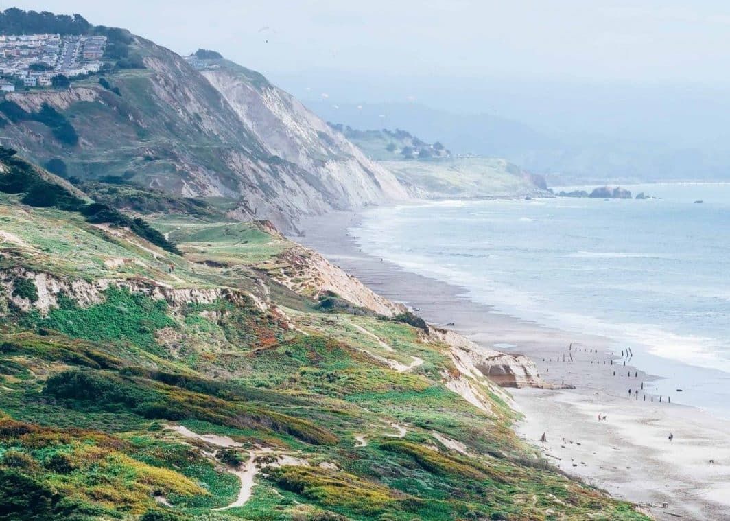
Lands End Hike – Eagles Point to Sutro Baths Hike
Distance: 4 miles
Time to hike: 1 – 1.5 hours
Trailhead: Start from Eagles Point or Sutro Baths
Highlights: Coastal views, historic sites, and wildflowers in the spring
Pet-friendly: Yes. Dogs are allowed on leash
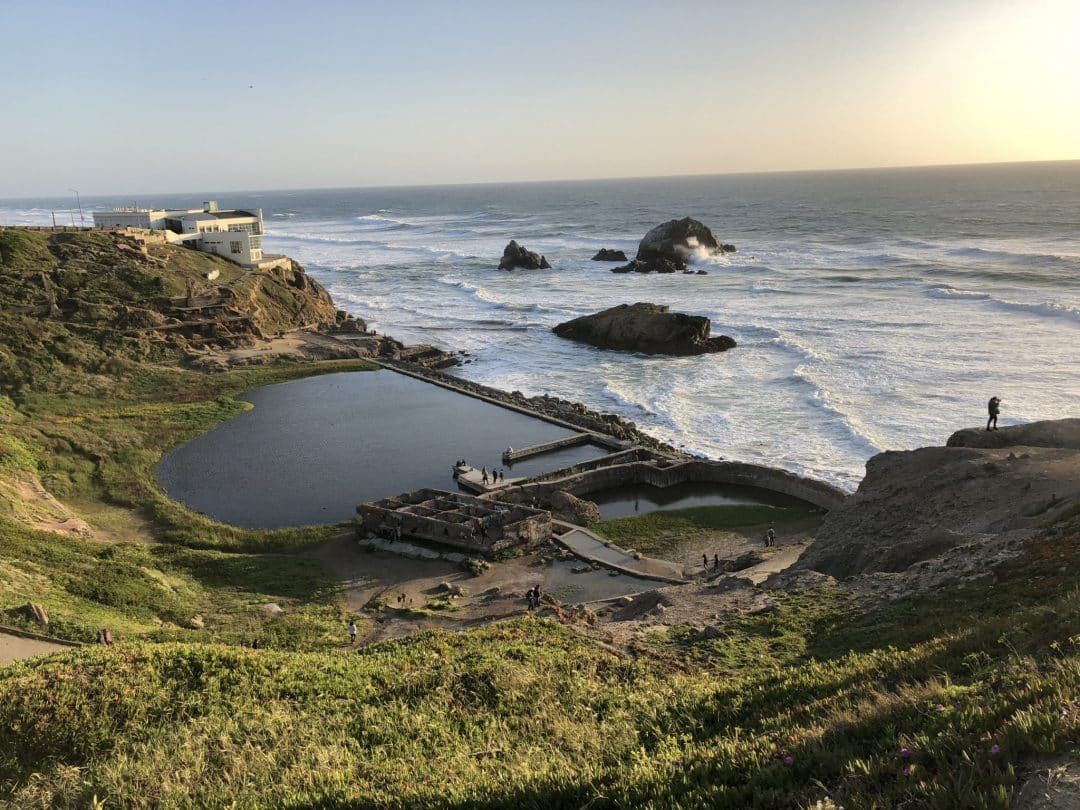
One of the most scenic coastal hikes in San Francisco, the Lands Ends trail is situated on the northwest edge of the city.
Because it’s such a popular place to hike, expect the trail to be crowded, especially on weekends.
If you’re okay with braving the crowds, you’ll be rewarded with views of the Golden Gate Bridge, Marin Headlands, and historic sites and ruins near the ocean.
This is an easy trail that takes less than two hours to walk and is mostly flat the whole way through.
Be prepared for panoramic views of the bay, hidden beaches, and plenty of ocean breezes.
This is one of the best hikes around San Francisco (and I’d even say one of the best hikes in California) if want to be near the ocean, enjoy an easy walk, and appreciate good views.
If you have extra time before your hike, you can walk up to the top of the Lincoln Park Steps for even more good views.
Or you can head to China Beach for a picnic in the sunshine (or likely fog).
Along the trail, make sure to stop in at Lands End Labyrinth, Mile Rock Beach, USS San Francisco Memorial, and Point Lobos.
One thing to note is that I like doing this hike from Eagles Point to the Sutro Baths because I prefer ending at the Sutro Baths to watch the sunset, have a picnic, or grab a drink at Cliff House.
However, if you’d rather have views of the Golden Gate Bridge in front of you (instead of behind you) for most of the hike, it’s better to start from the Sutro Baths.
Batteries to Bluffs Trail
Distance: 1.7 miles, out and back
Time to hike: 30 minutes
Trailhead: Near Lincoln Boulevard and Baker Beach
Highlights: Golden Gate Bridge views, coastal views, and historic sites
Pet-friendly: No. Dogs aren’t allowed on the trail
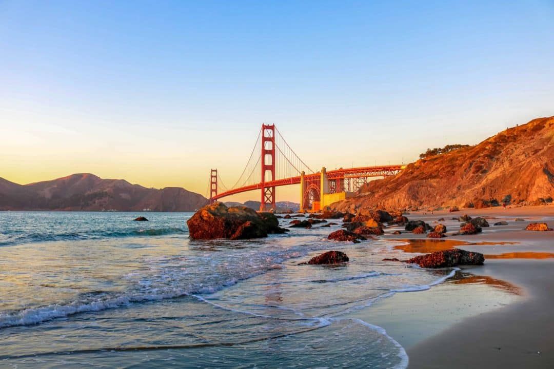
If you’re looking for a quintessential hiking experience in San Francisco, it doesn’t get more iconic than the Batteries to Bluffs Trail.
This is an ideal trail to experience if you want to see every possible angle of the southern end of the Golden Gate Bridge.
There are so many good views along this popular San Francisco trail that I recommend giving yourself twice as much time as you expect because you’ll be stopping to take pictures so much.
Don’t miss the many Golden Gate Bridge viewpoints, the historic batteries, Marshall’s Beach, and Baker Beach.
There are a few ways to add on to the Batteries to Bluffs Trail to make it a longer hike.
If you’re up for a longer, 3.5-mile hike, you can start from the Wave Organ.
From there, you can walk along Crissy Field to Fort Point, stop by the Golden Gate Postcard Viewpoint, and then onto the Batteries to Bluffs Trail, ending at Baker Beach.
Another fun add-on is to walk the Batteries to Bluffs Trail and then walk the Golden Gate Bridge and back.
Walking the Golden Gate Bridge is one of those bucket list things to do in San Francisco, so if you’ve never done it before, this is the perfect time to do it.
Just note that the Golden Gate Bridge is 1.7 miles long, so this will add an additional 3.4 miles onto your Batteries to Bluffs hike.
Golden Gate Park to Ocean Beach Hike
Distance: 4.5 miles, one way
Time to hike: 1.5-2 hours
Trailhead: Start at Oak St and Stanyan St
Highlights: Relaxing atmosphere, gardens, peaceful paths, bison, and ocean views at the end
Pet-friendly: Yes. Dogs are allowed on leash
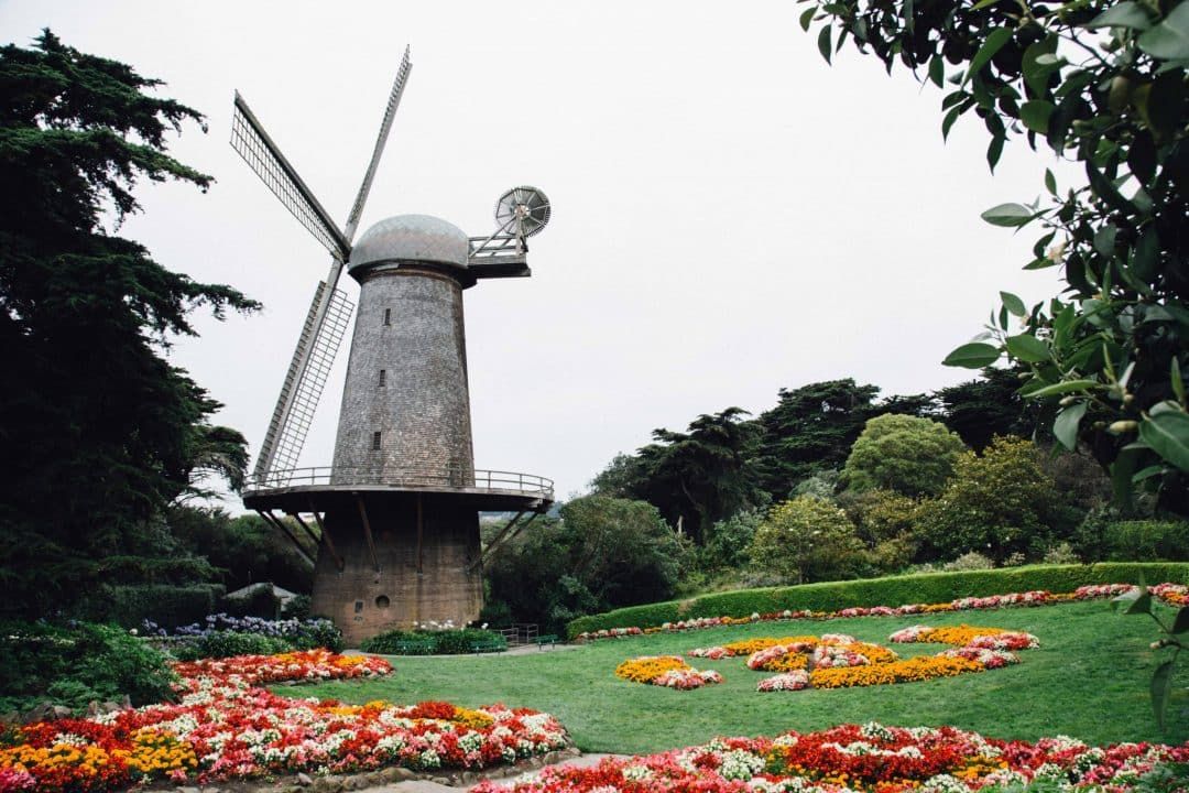
Near the Haight, San Francisco’s hippie neighborhood, you’ll find Golden Gate Park.
Besides being a green and leafy paradise in the middle of the city, Golden Gate Park’s claim to fame is that it’s 20% larger than Central Park in New York City.
It’s also home to several San Francisco museums and attractions, such as the de Young Museum, California Academy of Sciences, Japanese Tea Garden, and the Conservatory of Flowers.
This is all to say that Golden Gate Park is huge and you could spend a whole day or two exploring the park.
Because there’s so much to see, it’s a great park to walk through to see some of the sights and get in some exercise while you’re at it.
I’d recommend starting your walk from the east end of the park, near Stanyan St and Whole Foods.
From there, you can take your time winding your way through what the park has to offer as you walk towards Ocean Beach.
Although a lot of museums are closed right now, there are plenty of outdoor attractions that you can walk by on your way to Ocean Beach.
Give yourself at least a couple hours to hike through the park and don’t miss the National AIDS Memorial Grove, the Shakespeare Garden, Stow Lake, Strawberry Hill, and the Bison Paddock.
If you time it right, you can watch the sunset at Ocean Beach and then grab a takeout dinner at one of the many delicious restaurants in Outer Sunset on your way back.
I usually recommend hiking to Ocean Beach and then taking a Lyft or public transit back.
However, if you’re uncomfortable with that due to the pandemic, you can also hike back through the park on a different trail.
Just make sure you’re prepared for a nine-mile hike if you want to hike to Ocean Beach and back from the eastern side of the park.
Fort Funston Trail
Distance: 2 miles, loop
Time to hike: 45 min – 1 hour
Trailhead: Start from the Fort Funston Parking Lot
Highlights: wildflowers, paragliders, ocean views, historic military fortifications
Pet-Friendly: Yes. Dogs are allowed and can be off-leash
Fort Funston is an often overlooked spot on the southwest edge of the city, but because of that, it’s usually much less crowded than other coastal areas in San Francisco.
This area used to house an active military fort but is now a protected piece of land in the Golden Gate Recreation Area.
The two-mile loop hike around Fort Funston is easy and not overly long, but the views you’ll find once you get to the 200-foot windswept bluffs are well worth the journey.
Plus, there’s a long beach just below that is perfect for laying out and picnicking on a nice day in the city.
The surf and undertow, however, are strong and unpredictable so swimming isn’t recommended at the beach.
Keep in mind that it’s almost always windy on this side of San Francisco, so dress warmly and layer up.
This is also a popular place for hang gliders so you’ll usually see one or two flying above you as you walk the trail, especially from March to October.
If you’re a pet owner, this is one of the best dog-friendly hikes in San Francisco as dogs can run around and be off-leash.
Presidio Promenade Trail
Distance: 4.2 miles, out and back
Time to hike: 1.5 hours
Trailhead: Start at the Lombard Gate
Highlights: Historical sites, redwood grove, scenic viewpoints
Pet-Friendly: Yes. Dog are allowed on leash
As a protected area and former military base in the northwest corner of the city, the Presidio is one of the best places to go hiking in San Francisco.
There are quite a few Presidio hiking trails, but an ideal one to start with is the Presidio Promenade Trail.
This trail is on the easier side, so it’s a good option if you’re looking for a quick walk in nature that isn’t too strenuous.
It’s also a great hike for anyone who wants to learn more about the history of the Presidio.
The trail takes you through several important Presidio sights, including Wayburn Redwood Grove, the Main Post (where the original military post was built by the Spanish), the Presidio Officers’ Club (the oldest building in the Presidio), and the San Francisco National Cemetery.
Other highlights along the trail include the life-sized Yoda statue at the start of the walk, just outside the Walt Disney Museum, as well as a variety of stunning viewpoints.
A few viewpoints that shouldn’t be missed along the Promenade Trail are the Crissy Field Overlook and Battery East Vista.
Before starting your hike in the Presidio, it’s worth it to stop in at the visitor center (once it opens again), to learn more about the history of the area, pick up maps, and get inspiration for other hiking spots in the neighborhood.
If you’re looking for a longer hike, near the end of the Presidio Promenade Trail you can hop on the Batteries to Bluffs Trail for an additional two miles.
Lover’s Lane and Presidio Ecology Trail
Distance: 2 miles, loop
Time to hike: 45 min – 1 hour
Trailhead: Start at the Lover’s Lane trailhead, near the MacArthur Meadow
Highlights: Peaceful walk, wooded, outdoor art
Pet-Friendly: Yes. Dog are allowed on leash
Another Presidio hike and one of the best walks in San Francisco is called Lover’s Lane.
This leisurely stroll through the Presidio is only about 0.6 miles one way, but it takes you through a relaxing wooded stroll and one of the most beautiful parts of the Presidio.
It’s also the oldest foot trail in the Presidio and has an interesting story behind it.
Legend has it that Spanish soldiers used to walk Lover’s Lane to sneak off from the fort and visit their lovers in the city.
Because it’s such a short hike, I’d recommended adding on the Presidio Ecology Trail at the end of Lover’s Lane for a two-mile loop hike.
You also shouldn’t miss “Wood Line,” which is parallel to Lover’s Lane and an interesting piece of outdoor art by Andy Goldsworthy.
This is a very popular trail so there will always be a decent amount of people walking it, but that can be said for all Presidio hikes since the Presidio is one of the best San Francisco neighborhoods for hiking.
Lover’s Lane and the Presidio Ecology Trail are a slightly better workout than the Promenade Trail because they have just over a 300-foot elevation gain.
Best San Francisco Hikes With Views
Twin Peaks Hike
Distance: 2.1 miles, out and back
Time to hike: 1 hour
Trailhead: Start from Twin Peaks Boulevard and Clarendon Avenue, near Tank Hill
Highlights: Good workout, panoramic views, conveniently located
Pet-Friendly: Yes. Dogs are allowed on leash
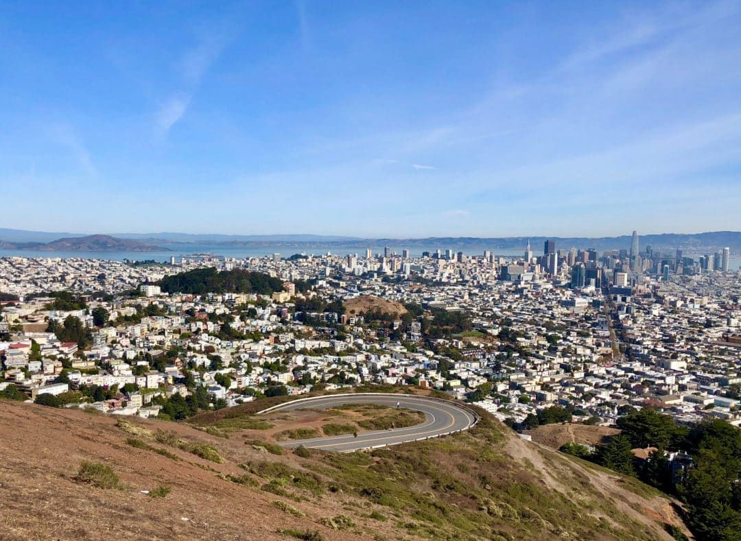
Although most people drive to Twin Peaks to take in the popular viewpoint, if you’re looking for a good workout, hiking can be a fun way to get to the top of the summit.
And if you’ve ever wanted to tackle the Twin Peaks hike, now is as good a time as any since the parking lot is currently closed due to the pandemic.
Twin Peaks is a 925-foot hill that is in the geographic center of San Francisco.
The summit gives you panoramic views of the San Francisco skyline and even the Golden Gate Bridge when it’s not too foggy.
You can hike up to the viewpoint from several different paved roads, but my favorite starting point is from Twin Peaks Boulevard and Clarendon Avenue, near Tank Hill.
From there, you can take Twin Peaks Boulevard all the way up to the top of Twin Peaks with various views and photo ops along the way.
In total, it’s only about a two-mile hike but be prepared for a steady climb to get to the top.
Although your calves might be burning after this short hike, the views are breathtaking from the top.
The best time to visit Twin Peaks for both the lighting and fewer crowds is just before sunrise.
Otherwise, go just before sunset to experience one of the best sunset spots in the city.
Just make sure to pack a jacket since it’s almost always windy at the summit.
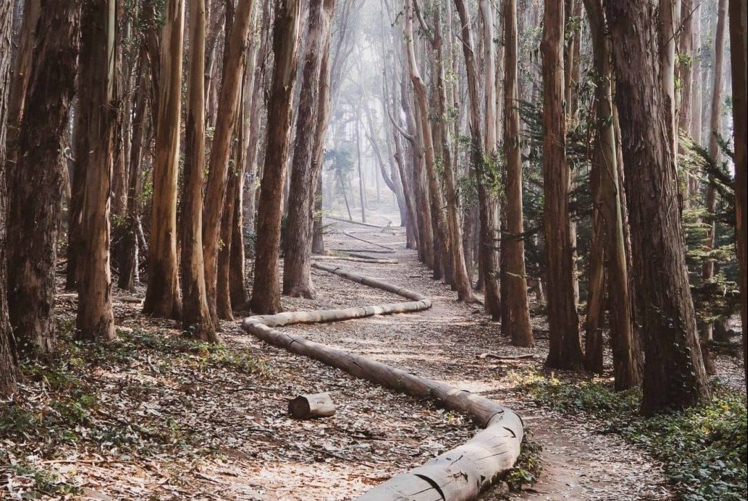
Mount Sutro Hike
Distance: 2 miles, loop
Time to hike: 45 min – 1 hour
Trailhead: Start at the Historic Trail on 17th and Stanyan St
Highlights: Not too crowded, peaceful walk, thick forests, scenic views
Pet-Friendly: Yes. Dogs are allowed on leash
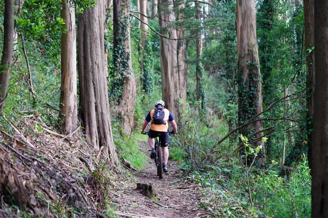
If it’s a foggy day in the city, there’s no better place to head for a hike than Mount Sutro.
This is one of the few hikes in the city where you won’t come across cars, houses, or other things that give it away as an urban adventure.
Instead, Mount Sutro is hushed and heavily wooded with tall eucalyptus trees, making it feel like you’re miles away from the city – or at least across the bridge exploring one of the East Bay’s many regional parks.
Mount Sutro is located near the UCSF campus and, similar to Twin Peaks, you can start the trail from various locations.
One of the best places to begin your hike is at 17th and Stanyan St, where you can take the Historic Trail and finish on the East Ridge Trail to get to the peak.
If you’re looking for more of a workout and steep inclines, as well as more good views, take the North and South Ridge Trails.
Unlike Twin Peaks, this is a much more local hike and therefore won’t be quite as busy.
So if you’re looking to avoid crowds, this is an ideal San Francisco hike to tackle that still gives you stunning views from the top and a good workout.
Since Mount Sutro has such a thick forest, it’s almost always cool and damp.
Wear warm layers and waterproof shoes if possible since the trail is usually muddy.
Mount Davidson Hike
Distance: 1 mile, out and back
Time to hike: 30 minutes
Trailhead: Start at the Mt Davidson hiking path entrance on Juanita Way
Highlights: Quick hike if you’re short on time, scenic views, not too crowded
Pet-Friendly: Yes. Dogs are allowed on leash
Although Mount Davidson is most well known for the concrete cross that can found at its peak, at 928 feet, it’s also the highest point in San Francisco.
The 40-acre park that surrounds the summit is filled with thick, wooded trails and expansive views over San Francisco.
Although Mount Davidson is just south of Twin Peaks, it’s much less crowded.
This is another favorite local spot to hike in San Francisco if you don’t want to be around crowds but still want the views.
The hike up to the top of Mount Davidson and back down is only about a mile, so it’s a short and sweet hike.
It’s perfect for a quick break and a decent workout when you just want to get outside to see another beautiful part of the city.
This is also a good alternative sunset spot in San Francisco instead of Twin Peaks.
In the summer and fall, you can expect to see butterflies near the peak and blackberry bushes are common as well.
Although the shortest hike to the top is only about 0.5 miles one way, it’s worth it to spend up to an hour walking around the meandering trails if you have time to make your hike longer.
Angel Island Hike
Distance: Varies depending on the hike, but generally 5-6 miles roundtrip
Time to hike: 3 hours
Trailhead: You can start both the Perimeter Trail and the hike to the top of Mt Livermore (via the North Ridge Trail) from the ferry terminal
Highlights: Bay views, historic sites, not too crowded
Pet-Friendly: No. Dog’s aren’t allowed on the island
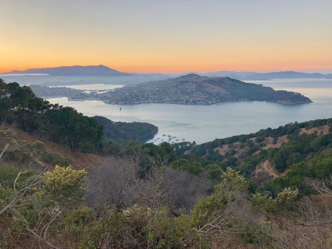
Although often overlooked by tourists and locals alike, Angel Island is one of the best places to go hiking in San Francisco.
The 360-degree views from Angel Island towards San Francisco, the East Bay, the Golden Gate Bridge, Alcatraz, and all of the surrounding Bay Area beauty, is hard to beat.
And as a bonus, Angel Island trails are hardly ever crowded since most people choose to go on the air tram tour around the island instead of hiking.
At 740 acres, let’s just say there’s a lot of land to explore on Angel Island.
There are a few different hikes you can tackle around the island, but the main Angel Island hike is the Perimeter Trail.
This 5.5-mile loop trail offers panoramic bay views and is a decent workout with a couple of big hills and a 350-foot elevation gain.
It’s the best trail to learn more about the layered history of Angel Island, taking you by sights like Camp Reynolds, Point Blunt, and Immigration Station.
It’s also an easy one to follow since you just follow the perimeter road around the island, but it’s also the busiest trail since it’s on the road.
If you’re looking for more of a secluded experience, as well as a more strenuous hike, my favorite hike on Angel Island is to the top of Mt. Livermore.
At the top of the summit, you’ll be rewarded with some of the best views of the Bay Area and you might even get to see Karl the Fog rolling into the city from a distance.
You can either get to the top from the Sunset Trail or the North Ridge Trail, both of which are around three miles and have an 800-foot elevation gain.
My recommendation would be to go up one trail and go down the other trail so that you get the best variety of views possible throughout the hike.
For food, you can grab sandwiches from Angel Island Cafe near the ferry dock for a picnic midway through your hike.
Also, don’t forget to check when the last ferry leaves so you’re not accidentally stranded on the island overnight.
Best Parks in San Francisco with Short Hikes
Glen Canyon Park
Note: At the time of publication (6/3/2020), Glen Canyon Park is open.
Distance: 1.8 miles, loop
Time to hike: 45 minutes
Trailhead: Start at the Glen Canyon Trailhead from Bosworth St
Highlights: Rock formations, canyon views, not too crowded
Pet-Friendly: Yes. Dogs are allowed on leash
Glen Canyon Park is a quiet hideaway tucked into a residential part of the city.
The canyon borders various local neighborhoods and spans 70 acres, making it the perfect hiking oasis in San Francisco.
As soon as you enter Glen Canyon Park, you’ll feel like you’re more remote than you actually are, it’s that quiet.
Although Glen Canyon Park isn’t known for its stunning viewpoints like the other parks on this list, it offers a couple trails to explore.
The main trail through the park is a 1.8-mile loop that features flowers (in the spring), rock formations, Islais Creek, and just over a 300-foot elevation gain.
It’s an ideal easy hike in San Francisco that’s perfect for a short jaunt in nature.
Bernal Heights Park
Note: At the time of publication (6/3/2020), Bernal Heights is open.
Distance: 1 mile, loop
Time to hike: 30 minutes
Trailhead: Start from the Bernal Heights Park Parking Lot
Highlights: Panoramic views, not too crowded, wildlife (birds), wildflowers
Pet-Friendly: Yes, dog are allowed on leash on the trail and there’s an off-leash area for dogs to play
One of the best local parks for views without the crowds, Bernal Heights Park is nestled in a residential neighborhood in the southeast corner of the city.
The short one-mile loop trail around the park is an easy walk that allows you to take in a 360-degree view of the city and even features bright California poppies during the warmer parts of the year.
If you’re a birder, this is also a great park for bird watching if you bring a pair of binoculars, with over 40 species of birds that call the park home.
Lake Merced Park
Note: At the time of publication (6/3/2020), Lake Merced Park is open.
Distance: 4.5 miles, loop
Time to hike: 2 hours
Trailhead: Start from the parking area
Highlights: Lake views, not too crowded, wildlife
Pet-Friendly: Yes. Dogs are allowed on leash and there’s an off-leash dog park near Lake Merced Boulevard
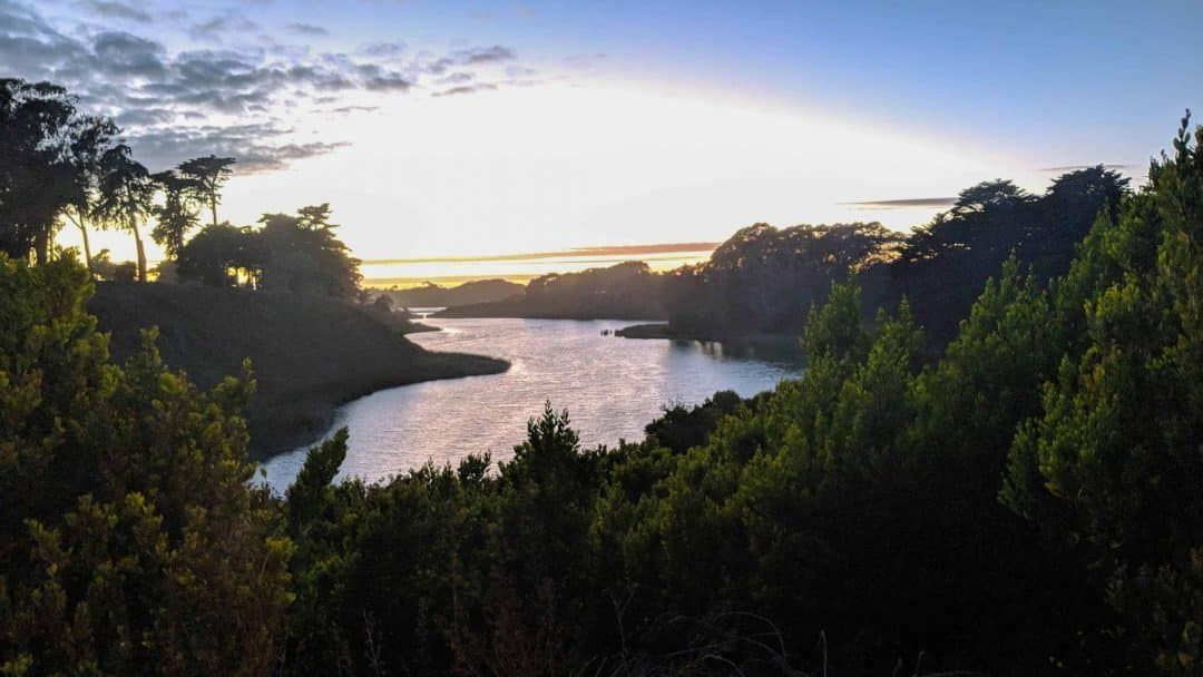
Not too far from Fort Funston, you’ll find Lake Merced Park, a 614-acre park situated in the southwest corner of the city.
The park’s main feature is its large freshwater lake that is a beautiful spot for picnics.
It’s also a good place for a nice walk around the water on the Lake Merced Trail.
The 4.5-mile paved Lake Merced Trail goes around the perimeter of the lake and allows you to take in the best parts of the park, the natural habitat, as well as the local wildlife.
If you’re looking for a local hike that is mostly flat and not overly windy, this is a good place to go.
Bayview Park
Note: At the time of publication (6/3/2020), Bayview Park is open.
Distance: 1.3 miles, loop
Time to hike: 30 minutes
Trailhead: Start at the gate near 900 Key Ave
Highlights: Eucalyptus trees, scenic views, not too crowded
Pet-Friendly: Yes. Dogs are allowed on leash
Another good off-the-beaten-path option is Bayview Park, where you can soak up 360-degree views of San Francisco surrounded by eucalyptus trees.
The Bayview Hill Loop Trail is just over a mile, but along the way, you’ll come across oak groves, Islais cherry trees, and plenty of good views that are devoid of tourists.
At the top of the hill, you’ll also find the well-known radio tower that was built in 1934 by the William Randolph Hearst Company.
Best Hiking Near San Francisco – Top 3 Bay Area Hikes
If you’ve already done all of the above hikes or you’re just looking for more hiking options that aren’t too far from the city, these are some of the best places to hike in the Bay Area.
Muir Woods Hikes
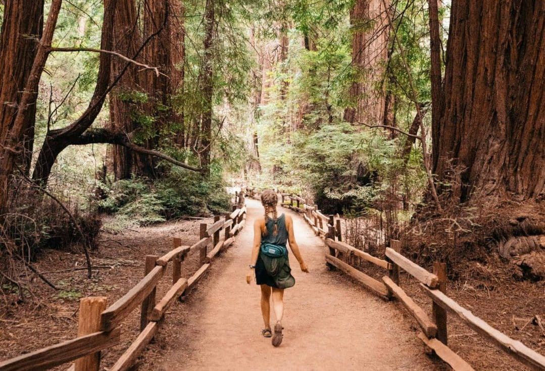
Muir Woods is a popular place to go for a hike near San Francisco for good reason – it’s the best place to find old-growth California redwoods near the city.
And if you’ve never experienced what it’s like to walk amongst huge California redwoods – it’s magical.
Because of how popular the park has become in recent years, it’s worth it to plan ahead before you make the trek to Muir Woods.
Most importantly, if you’re driving or taking the public Muir Woods Shuttle, you need to make reservations in advance.
Otherwise, there are also plenty of Muir Woods tours that go up to the park from the city, but these only give you about an hour to an hour and a half in the park.
There are a few hikes in Muir Woods, all of them are fairly easy and usually take around 1-2 hours to complete.
They’re also some of the best redwood hikes near San Francisco.
Just note that there’s no cell reception up at Muir Woods so plan accordingly.
Marin Headlands Hikes
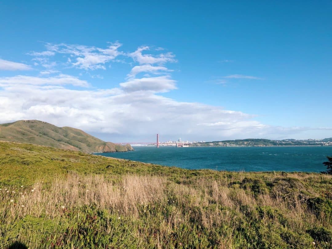
If you’re looking for beautiful coastal views, look no further than the Marin Headlands.
This is hands down one of my favorite places to hike in the Bay Area for its open trails and expansive ocean views.
And the best part about the Marin Headlands is that it’s huge and only about a 30-minute drive from San Francisco.
There are several hiking trails around the headlands and you could easily spend the whole day hiking there.
A few favorite trails include the Tennessee Valley Trail, Point Bonita Trail, and the Rodeo Beach Coastal Trail Loop.
There are also various historic sights and famous viewpoints to be found around the Marin Headlands, including the postcard view of the Golden Gate Bridge from Battery Spencer.
Mount Diablo Hikes
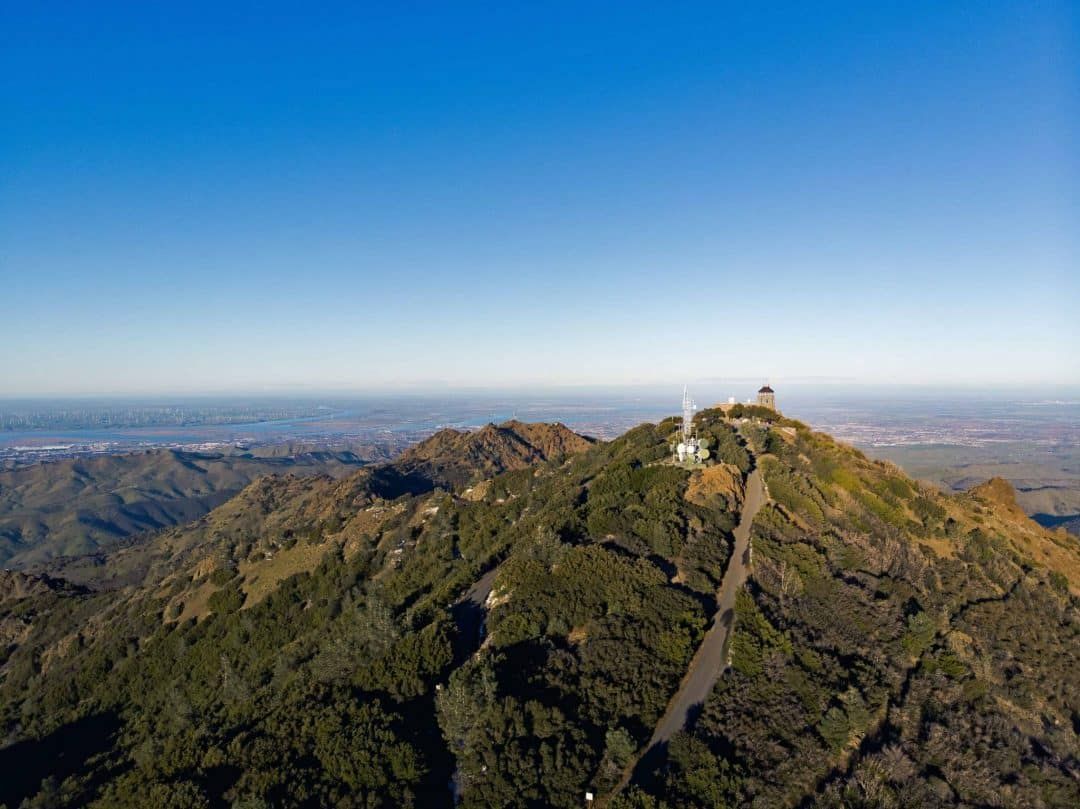
If you’re looking for a challenging hike in the Bay Area, hiking to the top of Mount Diablo is a rite of passage for every local (and visitor too!).
The Summit Trail is a seven-mile out and back trail that has over a 2,000-foot elevation gain.
If you’re willing to trek to the top of the summit, you’ll find one of the best (and highest) views in the Bay Area.
Plus, bragging rights that you tackled one of the hardest hiking trails near San Francisco.
If you’re not interested in hiking to the summit, there are plenty of other, less intense trails that can be found around Mount Diablo State Park as well.
These include the Mary Bowerman Interpretive Trail, Curry Point and Balancing Rock Trail, and the Donner Canyon and Falls Hike, among others.
One thing to note is that cell reception tends to be nonexistent at the park so plan accordingly.
Related: 17 Best Weekend Trips from San Francisco
There you have it!
These are the best hikes in San Francisco if you’re looking for an urban hike or an afternoon in nature that’s not too far from the city.
If you have other San Francisco day hikes that you love around the Bay Area, make sure to comment below!
Happy hiking!
Looking for other California hikes? Check out our guides to the Trans-Catalina Trail, best Bay Area hikes, Catalina Island hiking, Berkeley Fire Trails, best hikes in Laguna Beach, best hikes in Orange County, best Malibu hikes, best Santa Cruz hikes, best Torrey Pines hikes, best Big Basin hikes, best San Jose hikes, best Joshua Tree hikes, and best Big Bear hikes.
Get your FREE California Travel Planner – including printable checklists and my favorite two-week itinerary for the state.
PRACTICAL INFO FOR SAN FRANCISCO
Find accommodation, book your rental car, or sign up for a local tour.
Book a vacation rental on Airbnb (and get $40 off your first booking).
Buy your San Francisco Guide here.
ABOUT THE AUTHOR

Mimi McFadden
Founder & Editor-In-Chief
Mimi McFadden initially started The Atlas Heart in 2013 to write about her adventures abroad. But since 2019, The Atlas Heart has become a love letter to the Golden State. Mimi enjoys sharing her first-hand knowledge and expertise with the places she knows so well and making the most comprehensive travel guides possible. When she’s not hiking and exploring new places in California, she loves to travel abroad, read in her cozy chaise lounge, play basketball, and connect with friends and family over board games. Over her 28 years in California, she has lived in Santa Cruz (18 years), San Diego (5 years), and the San Francisco Bay Area (5 years), where she currently resides.
Looking for more Northern California travel and hiking inspiration? Check out these related posts!
Sibley Volcanic Regional Preserve
Berkeley Fire Trails: Hiking Guide
Ultimate Santa Cruz Bucket List
Outdoor Dates Ideas in the Bay Area
The Best Things to do in Lake Tahoe
Best California Breweries to Visit

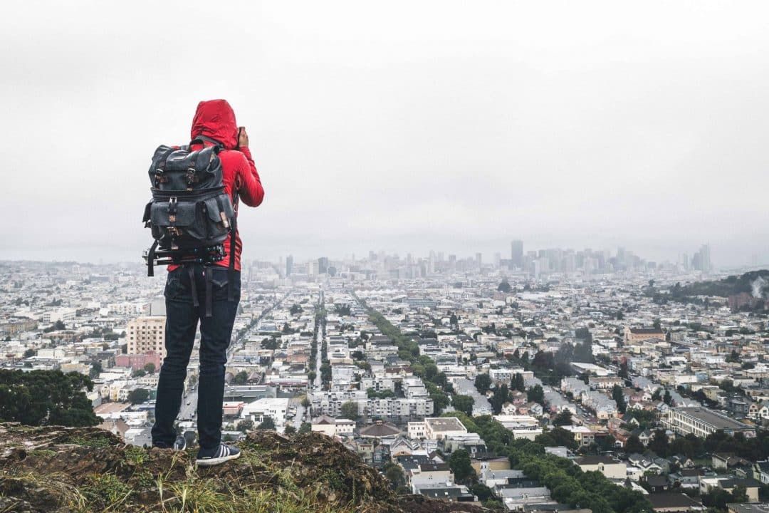
Pin this image for future reference


Hi,
May i know which is the hike where your cover photo of this blog was taken ( overlooking SF along with tree trunks ) ?
That shot was taken at Grandview Park!