The best San Jose hikes to see mountains, forests, and lakes in the beautiful South Bay.
San Jose, home to Silicon Valley tech titans and over a million people, is a modern city with a thriving cultural scene, but it’s also surprisingly packed with open spaces.
Nestled between mountains and the San Francisco Bay, when you want to escape to nature, there are plenty of options near San Jose.
You can take a hike to a lake through rolling hills carpeted in wildflowers, enjoy a spectacular sunset from a mountain peak, or spot wildlife on salt flats – all within a few miles of downtown.
Whether you’re looking for a neighborhood park stroll, a trek through a redwood forest, or a walk through colorful wildflower meadows, you’ll find a San Jose trail for you.
These are my top picks for the best hikes in San Jose to enjoy the South Bay’s natural beauty.
Note: this post contains affiliate links, which help run this site at no extra cost to you so I can keep providing free travel advice and tips.
Get your FREE California Travel Planner – including printable checklists and my favorite two-week itinerary for the state.
Map of Hiking Spots in San Jose, California
Best Hikes in San Jose, California
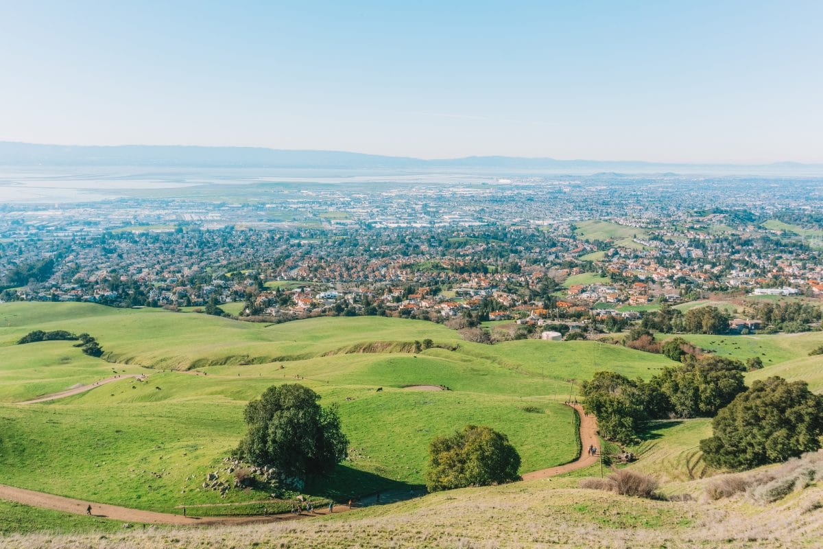
Aquila Loop Trail
Best hike for: Sunset views.
Distance: 1 mile | Elevation gain: 129’ | Difficulty: Easy
Trailhead: Parking lot at Sierra Vista Open Space Preserve; 37.4091583, -121.8011586
Trail Guide
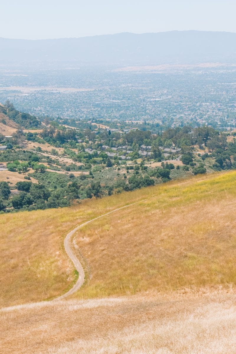
The Aquila Loop Trail is ideal if you’re looking for easy hikes in San Jose.
The loop winds through grassy hills with nice views of the city. With that said, the hillsides are exposed, so this trail is best undertaken during the cooler months, early morning, or later in the afternoon.
Aquila Loop is especially lovely around sunset when you’ll get some great pictures and a beautiful sky. There are also benches where you can rest along the way or pause for a picnic.
Dogs aren’t allowed on this trail.
Almaden Lake Loop
Best hike for: Bringing a picnic.
Distance: 1.4 miles | Elevation Gain: 29’ | Difficulty: Easy
Trailhead: Almaden Lake Parking Lot, 15780 Almaden Expy, San Jose, CA 95118
Trail Guide
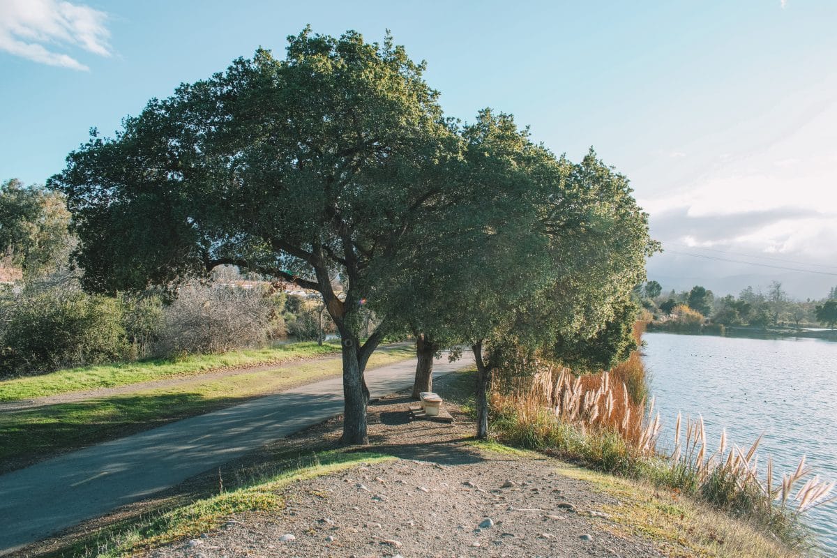
Almaden Lake Loop is a flat, paved trail around Almaden Lake and one of the most popular hiking spots in San Jose.
This is an easy walk, with continuous views of the lake and shade from the trees that line the pathway.
From the parking lot, head south along the trail around the perimeter of the lake. There’s a short section at Coleman Avenue where you’ll need to cross an overbridge to exit the park, then re-enter if you want to do the whole loop.
You’ll be sharing the path with cyclists, dog walkers, strollers, kids on scooters, skaters – you get the point, Lake Almaden can get crowded on a sunny afternoon.
On the plus side, the trail is also wheelchair-friendly. Dogs are welcome on a leash on the east side of the park only.
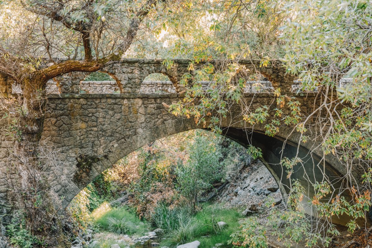
Penitencia Creek Trail
Best hike for: A glimpse into historical San Jose.
Distance: 3.5 miles | Elevation Gain: 262’ | Difficulty: Easy
Trailhead: Mineral Springs Parking Lot, Alum Rock Park
Trail Guide
Located in the eastern foothills of San Jose, Penitencia Creek Trail runs alongside Penitencia Creek in Alum Rock Park.
There are several parking lots in Alum Rock Park but the Mineral Springs lot is closest to the trailhead.
Alum Rock Park is ideal for a family day out, especially with young kids who are not big into walking. The trail follows a beautiful creek shaded by trees and passes by a playground, which makes for a good bribe for the little ones. You’ll also pass by the Youth Science Institute, a nature center with live native animals.
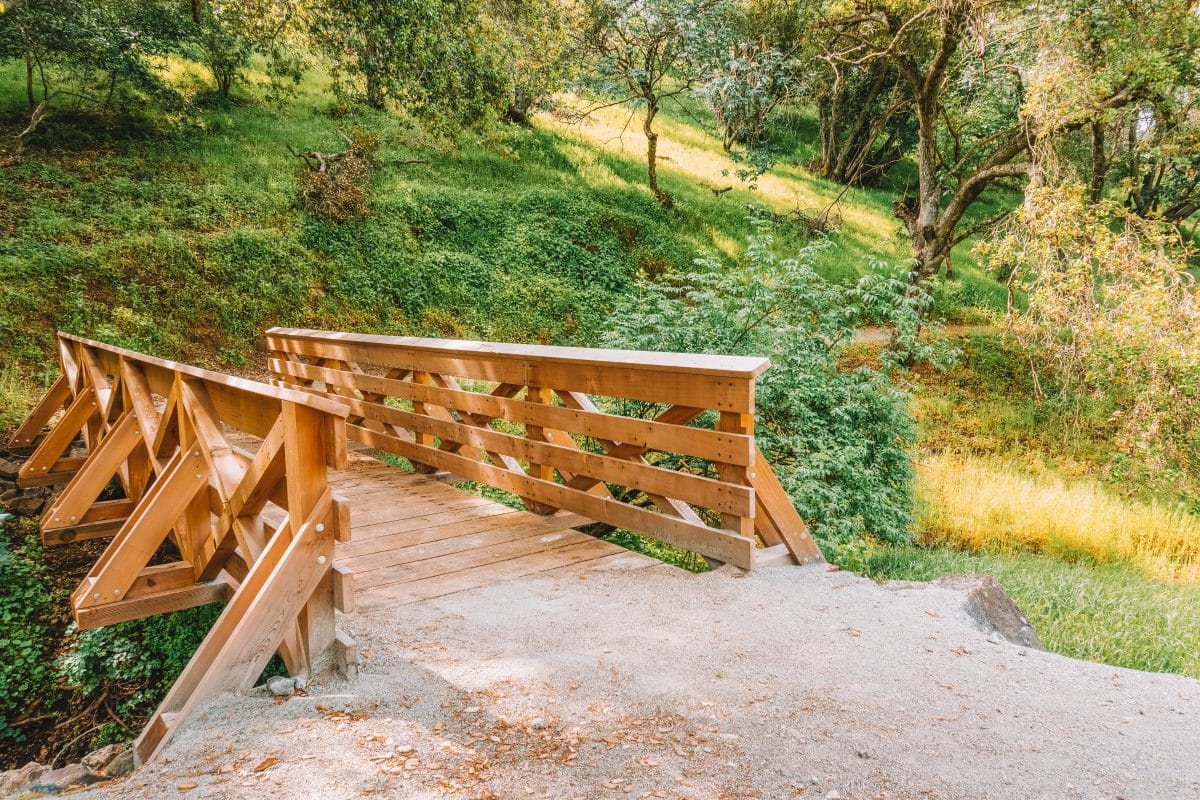
If little legs can’t handle the 3.5-mile out-and-back Penitencia Creek Trail, take the shorter Mineral Springs Loop. On this trail, you’ll cross a stone footbridge and see remnants of the bathhouse that was built here.
You might catch a whiff of sulfur in the air – this is what drew bathers to the area for many years before the city returned the park to nature.
Guadalupe River Trail
Best hike for: Urban explorers.\
Distance: 5.4 miles | Elevation Gain: 85’ | Difficulty: Easy
Trailhead: River Oaks Pl., San Jose, CA 95134
Trail Guide
The Guadalupe River trail follows the Guadalupe River from downtown San Jose up to the San Francisco Bay in Alviso. Currently, it’s split into two hiking trails, with plans to join the halves in the future.
The downtown section starts a few blocks north of San Pedro Square at W. Julian Street, and winds through Guadalupe Park and Gardens. It’s a great path but it’s worth noting that this area has a lot of homeless encampments.
If you prefer to avoid the downtown area, start the trail north of the airport at River View Park and head north toward Alviso. This part of the trail is greener and fresher as you leave behind the freeways that criss-cross San Jose.
As a loop, the trail will take you around 2.5 hours at a distance of 5.4 miles. You could easily do this as a one-way hike, taking the 59 bus back into the city from Alviso Marina County Park.
Alum Rock South Rim Trail
Best hike for: Hikers looking for more of a challenge.
Distance: 4.3 miles | Elevation Gain: 770’ | Difficulty: Moderate
Trailhead: Mineral Loop Parking Lot
Trail Guide
Start your hike on the Penitencia Creek Trail, heading uphill further into the park. Follow the creek until the trail loops around and joins with the South Rim Trail.
A series of switchbacks will take you back down, with plenty of opportunities to take a rest and enjoy the views.
About halfway down, the trail forks. If you’re short on time, take the steeper Switchback Trail to get back to the parking lot, or continue down the South Rim Trail for a longer hike. The trail will eventually connect with the Woodland Trail, becoming flatter and shadier.
As this is a hike with an uphill section, be aware of the heat. San Jose is hot in the summer and while Alum Rock is a great place to escape the sun with shady trees and a flowing creek, strenuous exercise will quickly dehydrate you.
I’d recommend tackling this hike in the cooler months or during the early morning in the summer.
Also, make sure to take plenty of water and let someone know where you’re going and what time you plan to return.
Senador Mine to Mine Hill Loop
Best hike for: Discovering San Jose’s mining past.
Distance: 14 miles | Elevation Gain: 2,553’ | Difficulty: Moderate
Trailhead: Mockingbird Hill Entrance, Almaden CA 95120; 37.1936932, -121.8367567
Trail Guide
The Senador Mine to Mine Hill Loop is a 14-mile trail through San Jose’s Almaden Quicksilver County Park.
This 4,000-acre park with multiple hiking trails was once the site of mercury mining, an element used during the gold rush.
The remnants of historic mining operations are still scattered throughout the park, adding an interesting historical angle to these South Bay hikes.
Start the walk from the Mockingbird Hill Entrance, which has a parking lot and restrooms. Then, head down the Hacienda Trail and go left at the fork to take the New Almaden Trail. At the next fork, take the Cinnabar Trail, then continue onto the Mine Hill Trail.
To continue the loop, turn left onto the Senador Mine Trail, which takes you past Senador Mine, following McAbee Creek.
After another half a mile or so, you will see the New Almaden Trail on your right – this is your shortcut back to the parking lot if you’re ready to go back.
Otherwise, continue your hike around, eventually joining up with the Guadalupe Trail until you find the Cinnabar Trail again.
The Cinnabar Trail will take you back to the start, completing your loop around Almaden Quicksilver County Park.
Almaden Quicksilver County Park is partially shaded by groves of oaks, but there are sections with no cover so you’ll want to avoid the hottest part of the day.
This hike is especially best in the spring when the wildflowers cover rolling green hills and the lack of shade is more of a benefit than a drawback.
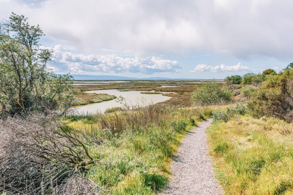
Alviso Slough Trail
Best hike for: Wildlife spotting.
Distance: 9 miles | Elevation Gain: 72’ | Difficulty: Easy
Trailhead: Alviso Marina County Park Parking Lot, 1195 Hope St., Alviso, CA 95002
Trail Guide
Step out into the San Francisco Bay on the Alviso Slough Trail, a nine-mile loop on boardwalks and paths through the salt marshes.
From the picnic area, pick up the trail heading north, passing information signs and an observation deck.
Stick to the Alviso Slough Trail to complete the loop around the salt ponds, or cross over to the Mallard Slough Trail for a shorter loop.
The last time I did this hike, there was some construction going on that made it impossible to complete the whole Alviso Slough Trail loop. Even if that’s still the case, it’s a worthwhile hike.
Most notably, there are some great views of the surrounding mountains and the fresh bay breezes make this park ideal for enjoying the hiking trails any time of the year.
I especially recommend this hike at sunset, as the sky is beautiful and wildlife is more active later in the day.
Alviso Slough Marina County Park is located next door to Don Edwards San Francisco Bay National Wildlife Refuge, the largest urban wildlife refuge in the country.
Take a pair of binoculars and you may spot some of the white pelicans, kites, hawks, ospreys, and eagles that call the sanctuary home.
Eagle Rock Trail
Best hike for: Beautiful views.
Distance: 2.7 miles | Elevation Gain: 498’ | Difficulty: Easy
Trailhead: The front entrance to Alum Rock County Park on 15350 Penitencia Creek Rd., or start from Eagle Rock Parking Lot for a shorter route.
Trail Guide
The Eagle Rock Trail is another easy-to-moderate hike in Alum Rock County Park.
The route is steep in some parts but the wide trail isn’t too difficult, even if you’re not in great shape. Plus, the reward is sweeping views from the summit.
From the first parking lot at the park’s main entrance (DO NOT go to the Alum Rock entrance, this is a pedestrian-only gate), take the Penitencia Creek Trail into the park, following the creek.
Continue on this trail to cross the road, then take the Lariat Trail uphill before turning right onto the North Rim Trail.
At the fork, turn left to continue to the summit on the Eagle Rock Trail. Once you’ve enjoyed the view and rested, head back down, backtracking down the North Rim Trail.
Once you get to the Lariat Trail, take a right to return to the parking lot along a different route.
If you want to go straight to the summit, park at the Eagle Rock parking lot. From there, cross the road and head straight up the Lariat Trail.
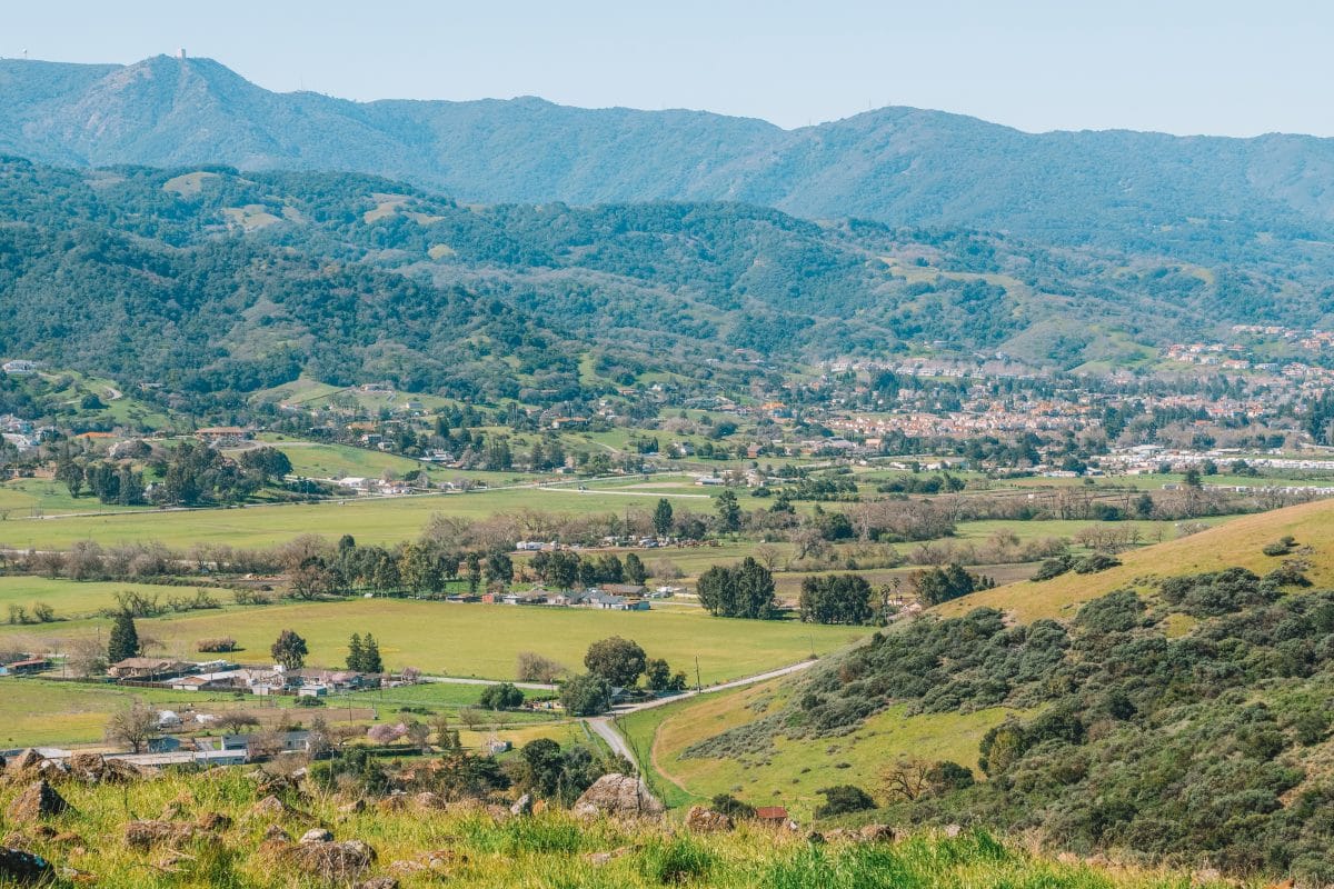
Joseph D. Loop Trail
Best hike for: Lakes and rolling hills.
Distance: 2 miles | Elevation Gain: 291’ | Difficulty: Easy
Trailhead: Grant Lake Parking Lot, Mt. Hamilton Rd., San Jose, CA 95127; 37.3425571, -121.7157607.
Trail Guide
The Joseph D. Loop in Joseph D. Grant County Park is an easy, flat loop passing by two lakes.
It’s good for kids because the few uphills are fairly gentle and there’s a lot of wildlife in this park. Look out for wild turkeys, wild pigs, eagles, and, if you’re there in the fall, tarantulas!
Take the Lakeview Trail, then join the McCreery Trail to check out the small McCreery Lake until you get to the Loop Trail.
Continue along this trail to the Yerba Buena Trail, which follows Mt. Hamilton Road back up to the parking lot.
Calero Creek Trail
Best hike for: Dog walking.
Distance: 7.4 miles | Elevation Gain: 652 ft | Difficulty: Moderate
Trailhead: Camden Ave & Queenswood, Santa Teresa County Park, San Jose, CA; 37.2123213, -121.8327370.
Trail Guide
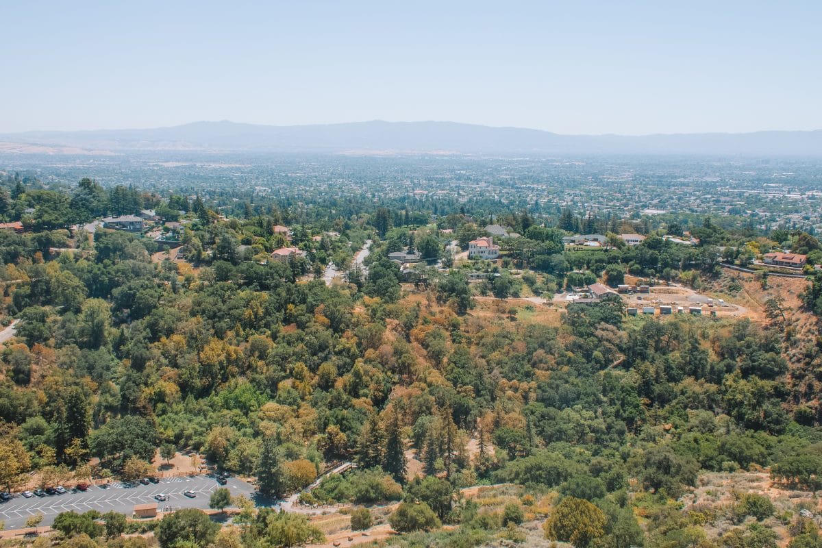
Calero Creek Trail is a partially paved, moderate loop through Santa Teresa County Park in New Almaden. Dogs on leashes (and dog carriers) are allowed on these hiking trails, so this is a great place to take your pooch.
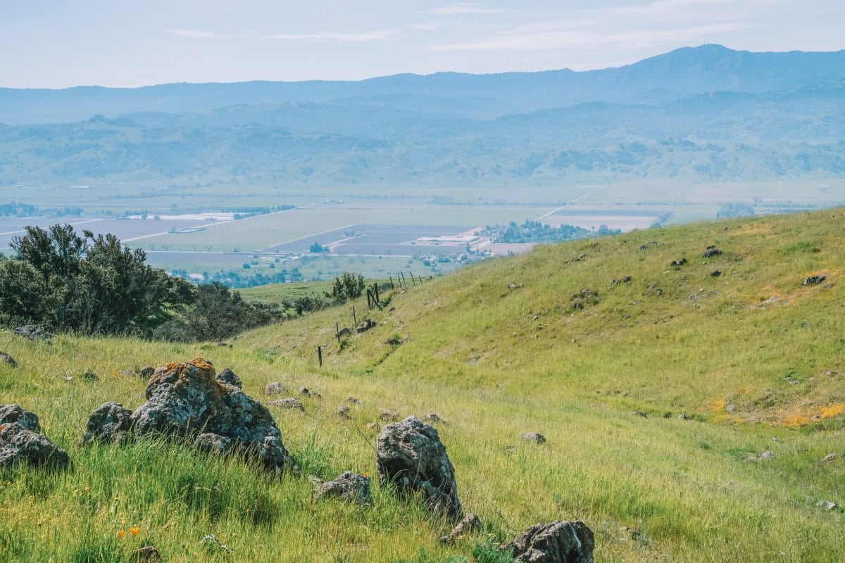
Santa Teresa County Park offers spectacular views over the Almaden and Santa Clara valleys.
Many of the hiking trails are flat, but there are some steep sections around Coyote Peak. And in spring, this is a great spot for wildflowers.
From the trailhead, follow the path into the park and up a series of switchbacks. At the fork, take the Mine Trail to the left, continuing uphill.
At the parking lot, find the Pueblo Trail and follow the path around the top end of the park, before rejoining the Mine Trail downhill.
Coyote Peak Trail
Best hike for: A good workout.
Distance: 3.8 miles | Elevation Gain: 750 ft | Difficulty: Moderate
Trailhead: Santa Teresa County Park, Bernal Rd, San Jose, CA 95120; 37.213874, -121.785598
Trail Guide
Coyote Peak Trail is a moderately difficult hike in Santa Teresa County Park, offering expansive views across Santa Clara County. The path to the summit is steep but think of it as a great workout.
From the parking lot, take the Mine Trail downhill, linking up with the Rocky Ridge Trail, before taking the Coyote Peak Trail up again to the top of the hill.
After a pause to enjoy the view, continue along the trail. At the fork, take the Hidden Springs Trail to get back to the parking lot.
Dogs are allowed on a leash on this trail.
Lisa Killough Loop Trail
Best hike for: Spring wildflowers.
Distance: 8.5 miles | Elevation Gain: 567 ft | Difficulty: Moderate
Trailhead: Calero Park San Vicente Entrance, San Jose, CA 95120; 37.194082, -121.807177
Trail Guide
The Lisa Killough Trail is a five-mile out-and-back hike with a lookout over the wooded hills. You can make this a loop by taking the Cottle Trail back to the parking lot, adding another 3.5 miles to the route.
The path winds over grassy hills, which are golden in the summer and bright green in the wet winter months. During spring, this is a good spot to see wildflowers along the hiking trails.
There’s some shade from trees along the trail but many sections are open, so this trek is best made in the cooler months or during the early morning.
Los Gatos Creek Trail
Best hike for: Making frequent coffee stops.
Distance: 15.6 miles | Elevation Gain: 350 ft | Difficulty: Easy
Trailhead: Los Gatos Creek Trail, St. Elizabeth Dr. Entrance; 37.304342, -121.916804.
Trail Guide
Starting in San Jose and ending in Los Gatos, the Los Gatos Creek Trail is a popular neighborhood path connecting several South Bay cities.
Most of the multi-use trails are shaded by trees, it’s well-maintained, and the creek flows year-round.
This is one of the best hikes in the South Bay for families because it’s easy and there are plenty of places to stop for a break.
The Los Gatos Creek Trail is mostly flat with a few small hills along the route. The trail is over 15 miles long with some paved sections. One thing that’s nice is that no directions are needed for this route, just follow the creek.
Once you get to Los Gatos, head over to Purple Onion on Main Street for a fresh salad and a pastry.
Best Hikes Near San Jose
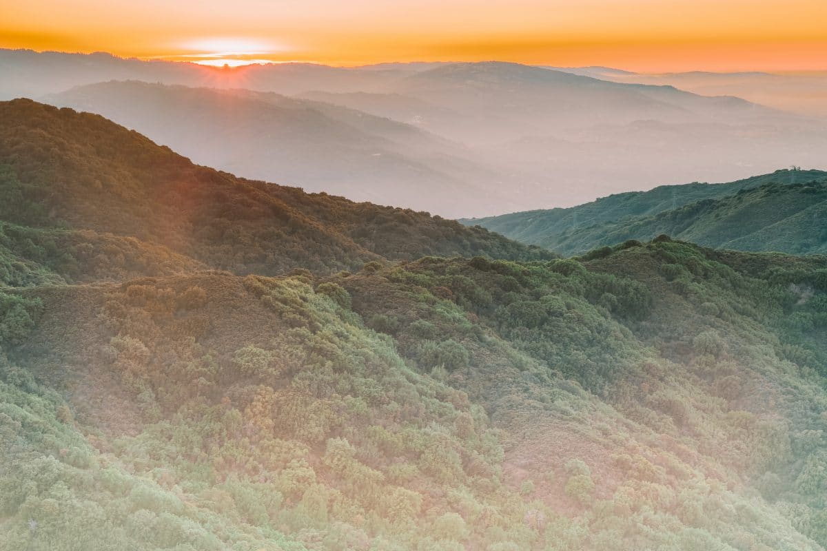
Mount Umunhum Hike
Best hike for: Hikers looking for a more challenging walk.
Distance: 7.7 miles | Elevation Gain: 1,187 ft | Difficulty: Moderate
Trailhead: Sierra Azul Open Space Preserve Parking Lot, Mt. Umunhum Rd., San Jose, 95120; 37.1596087, -121.8754702.
Trail Guide
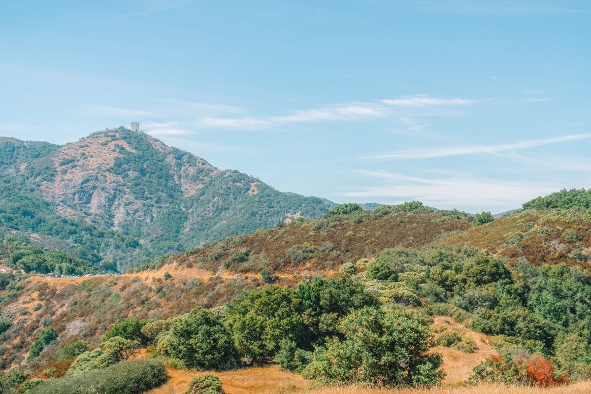
Mount Umunhum towers over South San Jose and the cube-like concrete structure squatting at the summit is a local landmark.
Follow the Mount Umunhum Trail all the way to the peak and you’ll get a closer look at the mysterious building: an old radar tower, a relic of the Cold War.
It’s a long climb to the summit, but at the top, you’ll be rewarded with views across Silicon Valley and beyond.
Unlike a lot of other San Jose hikes, there’s plenty of shade on this trail, as you walk under an oak tree canopy.
As you get closer to the top, the trees give way to chamise and manzanitas, which thrive on the fog that frequently swirls around the mountain top.
Once you get to the peak, check out the tower, the information boards, and the spectacular views, before heading back down the trail, the same way you came up.
This is one of my favorite Bay Area hiking trails and is fun to walk all year round.
Mission Peak Trail
Best hike for: Spectacular views.
Distance: 5.8 miles | Elevation Gain: 2,135 ft | Difficulty: Moderate to Difficult
Trailhead: Stanford Avenue Staging Area, 1997-2099 Stanford Ave., Fremont, CA 94539; 37.5042856, -121.9086418.
Trail Guide
Mission Peak, in the nearby city of Fremont, is popular with hikers and cyclists looking for more challenging hikes around San Jose.
The hike to the summit and back takes around four hours from the staging area if you do it as a loop.
The mountain hiking trails are completely exposed, so plan to walk early in the morning or during the cooler months. If you plan to hike during the winter, avoid rainy days when the trail is muddy and slippery.
There are two hiking trails to the summit, which meet to make a loop. Take the Hidden Valley Trail to ascend for a gentler incline and the steeper Horse Heaven Trail, then Peak Valley Trail on your way down.
Those who make it to the top are greeted with views of San Francisco, Oakland, and San Jose.
If your dog is also up for a challenge, bring them with you – dogs are allowed on the trails, and in some areas, off-leash.
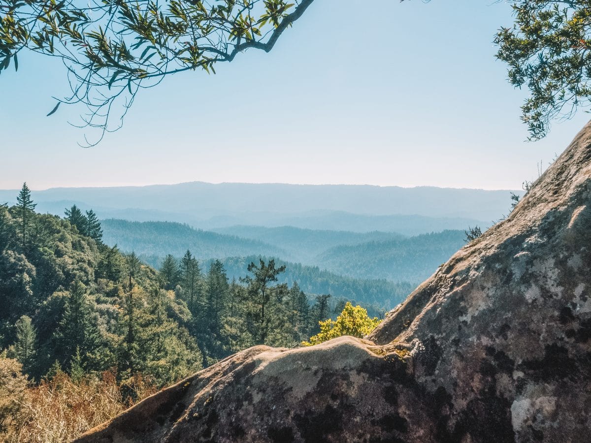
Castle Rock Falls Trail
Best hike for: Waterfalls and redwoods.
Distance: 1.2 miles | Elevation Gain: 288 ft | Difficulty: Easy
Trailhead: Castle Rock Trail, Saratoga, CA 95070; 37.2322365, -122.0981965.
Trail Guide
Castle Rock Falls Trail is a quick out-and-back route through Castle Rock State Park in Saratoga.
Winding through dense forest, this hike is perfect for hot summer days, when you want to swap the stuffy city for the cool Santa Cruz Mountains.
This is one of the only hiking trails in San Jose with waterfalls, or at least close enough to San Jose – Castle Rock State Park is only a 35-minute drive from downtown San Jose.
For the best waterfall experience, hike this trail in April after winter rains have boosted the flow. By fall, expect more of a trickle than a roar.
From the parking lot, take the Saratoga Gap Trail to Castle Rock Falls, then head back along the way you came to get back to the entrance.
Watch out for mosquitoes and stick to the hiking trails as the moss-covered rocks may be slippery.
Tips for Hiking in San Jose
- Wear good shoes, as hiking is no fun with painful feet, or worse, if you slip. Hiking boots are good but my favorite footwear for easier hiking trails are trail running shoes, which are lighter and more comfortable but offer plenty of grip.
- Take safety seriously. We’re lucky to have so much wildlife in San Jose, but be aware – some of it is dangerous. Most notably, be aware of mountain lions, rattlesnakes, coyotes, and ticks. But the biggest danger is the heat. Bring plenty of water, tell someone where you’re going, and never underestimate how hard it is to walk in the full summer sun.
- Bring a credit card or cash. Some of the trailheads have entrance fees for parking, usually between $6 and $10. If you’re a frequent California State Park visitor, consider buying an annual Poppy Pass for $125.
Looking for more to do in the San Jose area? Read our guide to the best things to do in San Jose, California.
What to Pack for Hiking in San Jose
- Hiking boots or trail running shoes
- Two liters of water per adult
- Hiking backpack with a hydration bladder
- Breathable hiking clothes
- Hiking Snacks
- Hat for hiking
- Sunscreen
- Sunglasses
- Light jacket
- Long pants and hiking socks
- Downloaded hiking app
- Outdoor watch (like a Garmin watch)
- Compass
- Cash or credit card for parking
- Bug spray
- Hammock
Looking for other California hikes? Check out our guides to the Trans-Catalina Trail, best Bay Area hikes, Catalina Island hiking, Berkeley Fire Trails, best hikes in Laguna Beach, best hikes in Orange County, best Malibu hikes, best Santa Cruz hikes, best Torrey Pines hikes, best Big Basin hikes, best hikes in San Francisco, best Joshua Tree hikes, and best Big Bear hikes.
Get your FREE California Travel Planner – including printable checklists and my favorite two-week itinerary for the state.
ABOUT THE AUTHOR

Sarah McDonald
Sarah McDonald is a travel writer based in the Bay Area. She writes for the national parenting website Red Tricycle and on her own family travel blog, Tiny Trailblazers. She loves exploring California’s outdoors and has a weakness for a national park gift shop.
Sarah enjoys sharing her Bay Area expertise with readers curious to try popular restaurants and off-the-beaten-path adventures in California. When she’s not writing reviews and travel guides, you’ll likely find her trying to keep up with her kids on a hiking trail or deciphering the menu at a new restaurant.
Looking for more Bay Area travel inspiration? Read our related posts below!
14 Best Urban Hikes in San Francisco
18 Best Weekend Trips from San Francisco
46 Things to do in San Francisco at Night
101 Things to do in Santa Cruz
Best Things to do in Point Reyes
Sibley Volcanic Regional Preserve Hiking Guide

Pin this image for future reference

