Key Takeaways:
- The best hike in Muir Woods is the Main Trail to Hillside Trail Loop. It’s a pleasant, easy two-mile hike that takes you through the best views and most majestic redwood groves in Muir Woods.
- The Bootjack Trail to Ben Johnson Loop is 6.1 miles and a great option for those looking for a longer hike. It connects to the 1.9-mile-long Main Trail loop, so you can see everything in 8 miles, and allows you the option of starting on the Mt. Tamalpais side if you want to avoid the entry fee (read on for more details).
The feeling that you’ve been transported to an old, otherworldly forest with thousand-year-old redwoods greeting you immediately makes for many “best” hikes in Muir Woods.
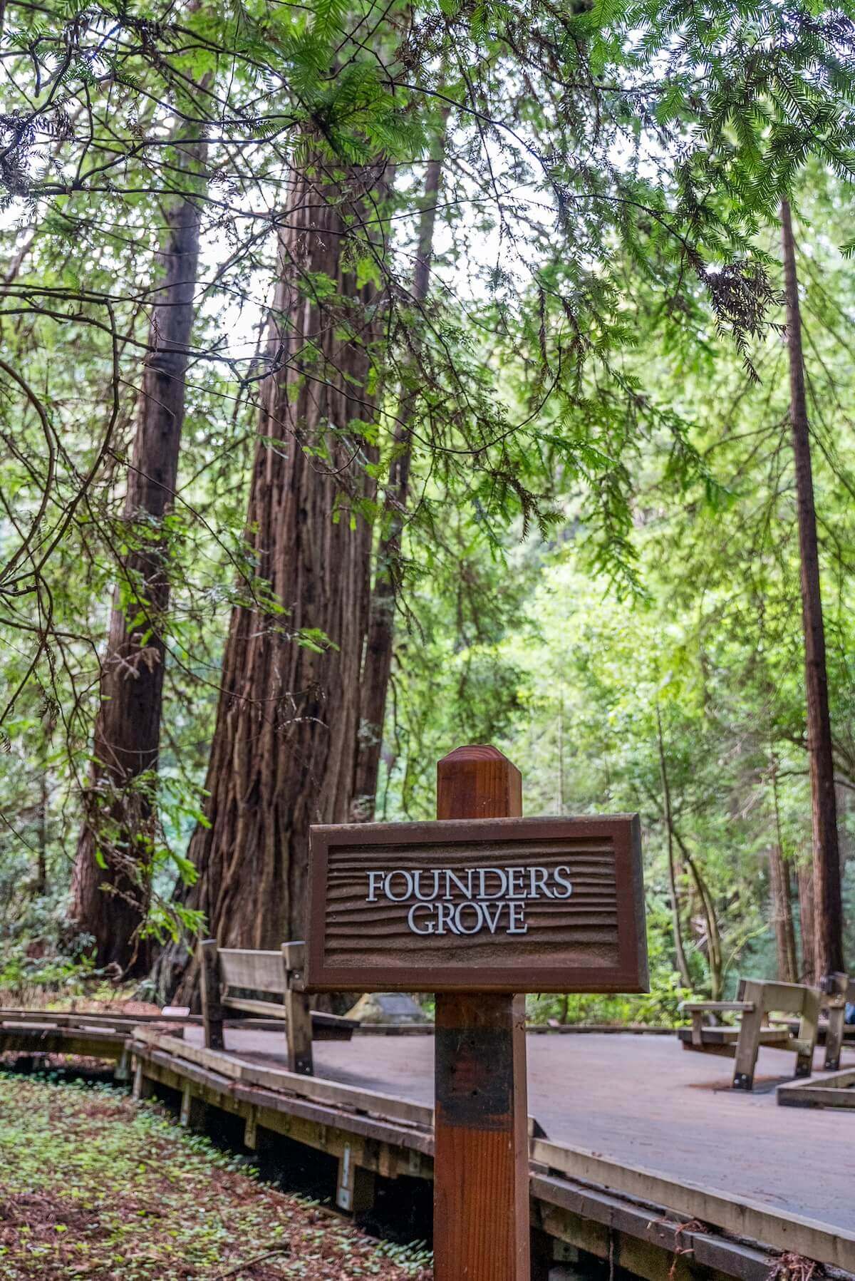
When Mimi and I visited in January of 2024, we loved how immediately at the beginning of the Main Trail, you get to walk past Founders Grove and then, just a short way down, past Cathedral Grove. Instant gratification!
After one mile, we could safely say, “Been there, done that.”
While it was nice to have the most impressive redwoods at the beginning of the hiking trails, we still felt eager to explore the park and were able to hike three and a half trails during our day there.
Our favorite was the Main Trail to Hillside Trail Loop, but they were all fun, and the different lengths and difficulty levels mean that the best trail for you likely comes down to what kind of a hiking trip you want.
To see the best hiking trails at Muir Woods regardless if you want to stop by for just a half hour (but, why the rush?) or you’re spending all day there, check out our list below!
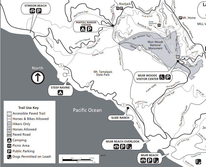
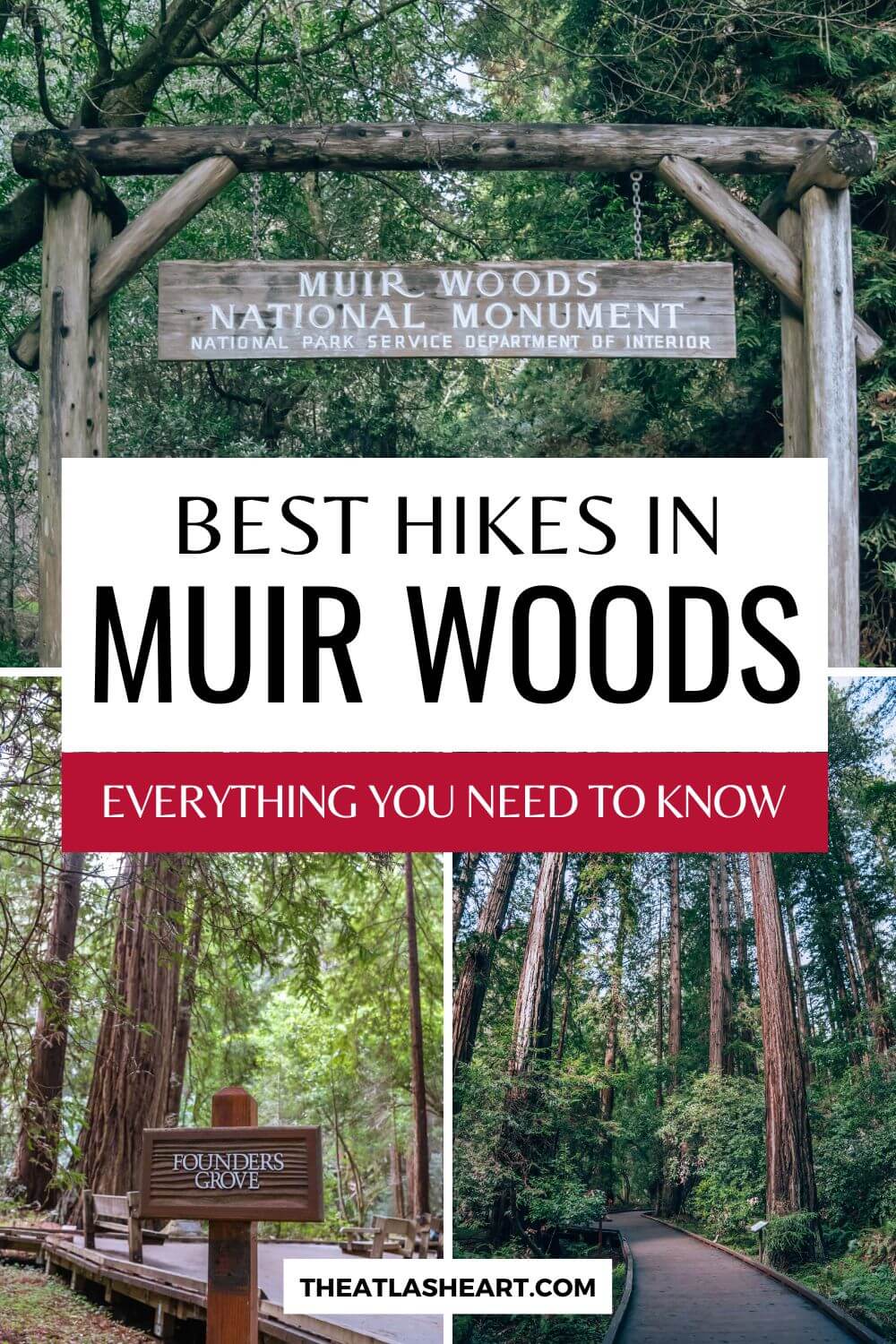
Muir Woods Trail Map
Muir Woods provides a map like the one below. It shows extended hiking trails and is great if you’re planning to hike beyond the Muir main trail.
The Best Hiking Trails at Muir Woods
Muir Woods Main Trail
Length: 1.5 miles
Time: 1 hour 15 minutes
Difficulty: Easy
Elevation: 45 feet
AllTrails
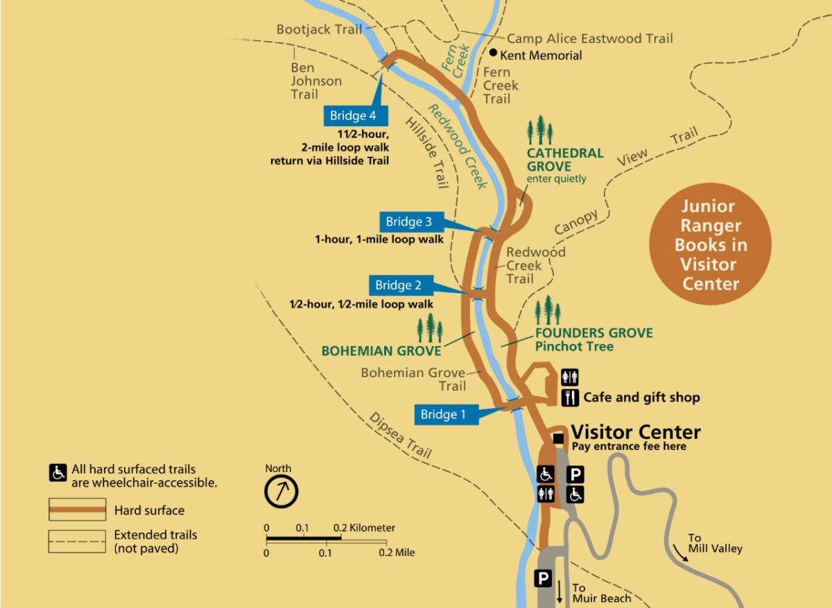
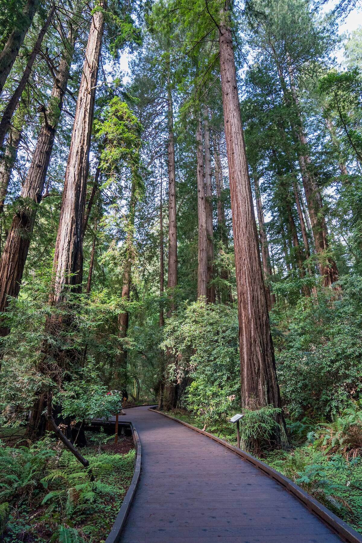
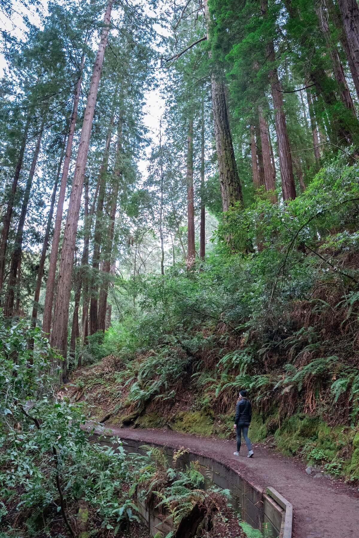
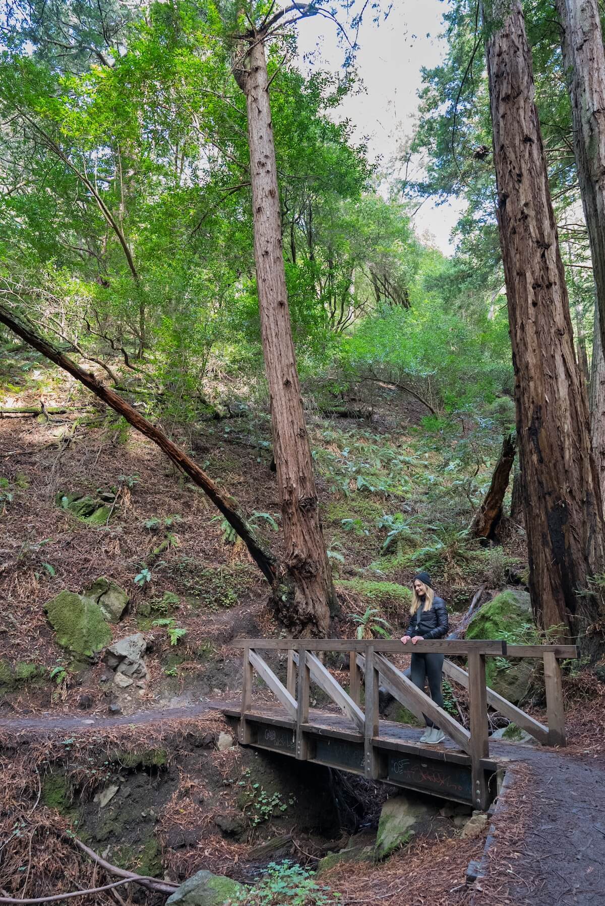
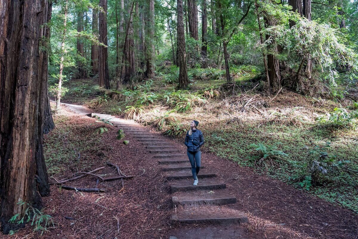
The Muir Woods main trail is a flat, paved, or boardwalk path that’s an easy two-mile loop (or, as you can see in the picture above, you can make it shorter via options to return at bridges along the way).
If you go to Muir Woods, the Main Trail and the Main Trail to Hillside Trail Loop are must-dos.
I don’t know why AllTrails lists it as the 8th best hike–there seems to be some bias against the obvious, popular trails, even if they’re the best hikes.
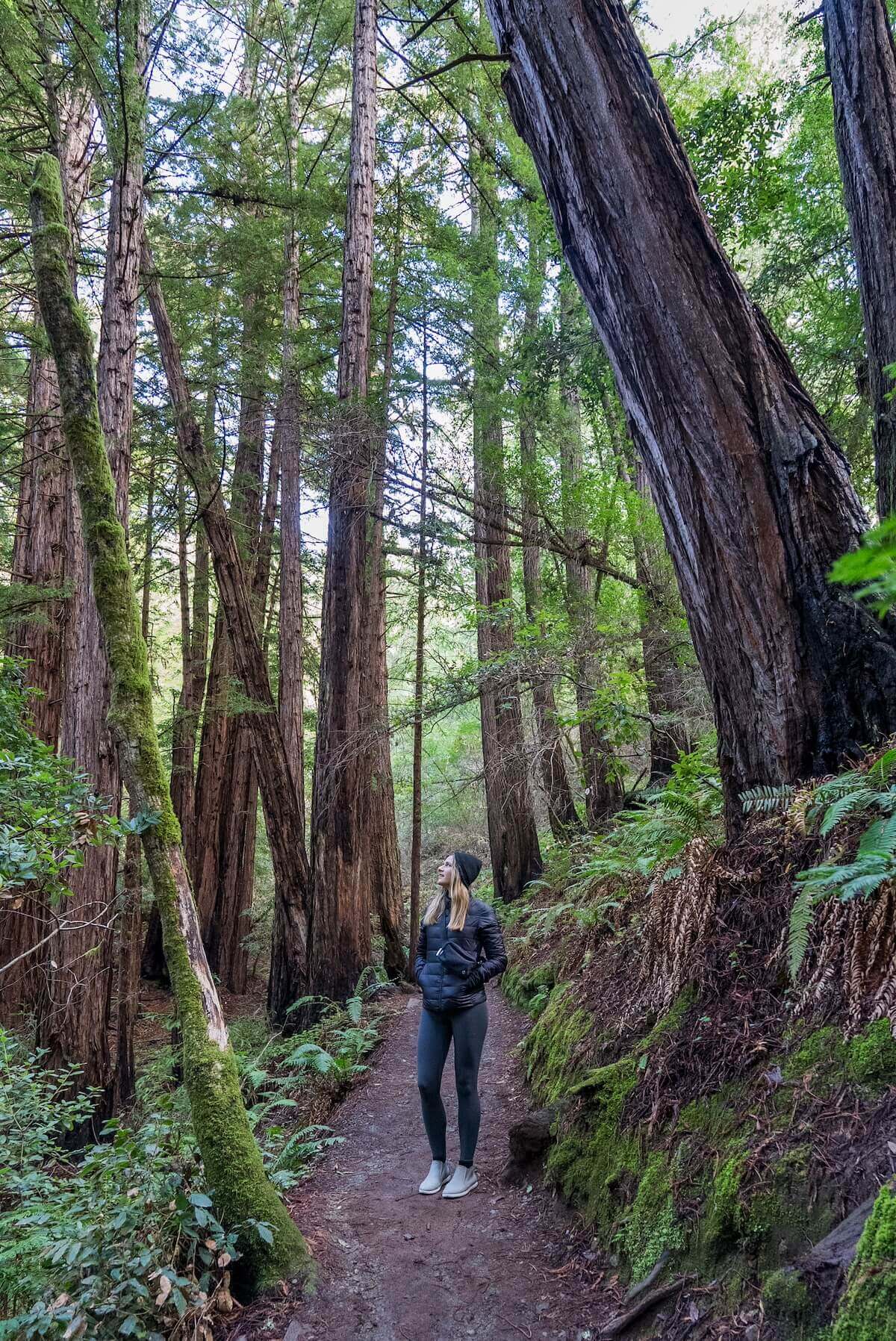
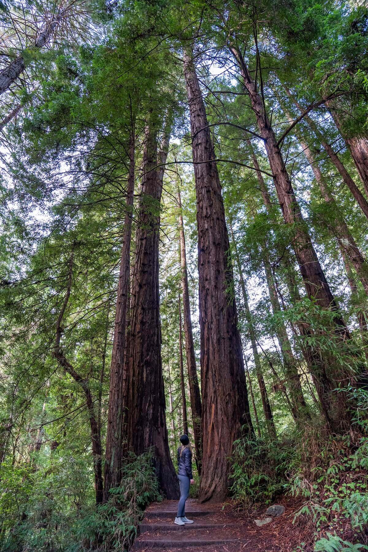
The main trail offers views of the most majestic groves, and you’ll have to arch all the way back to see the tops of the largest, oldest redwoods in Muir Woods.
It’s such an easy, quick, and accessible trail that there’s no reason not to do it.
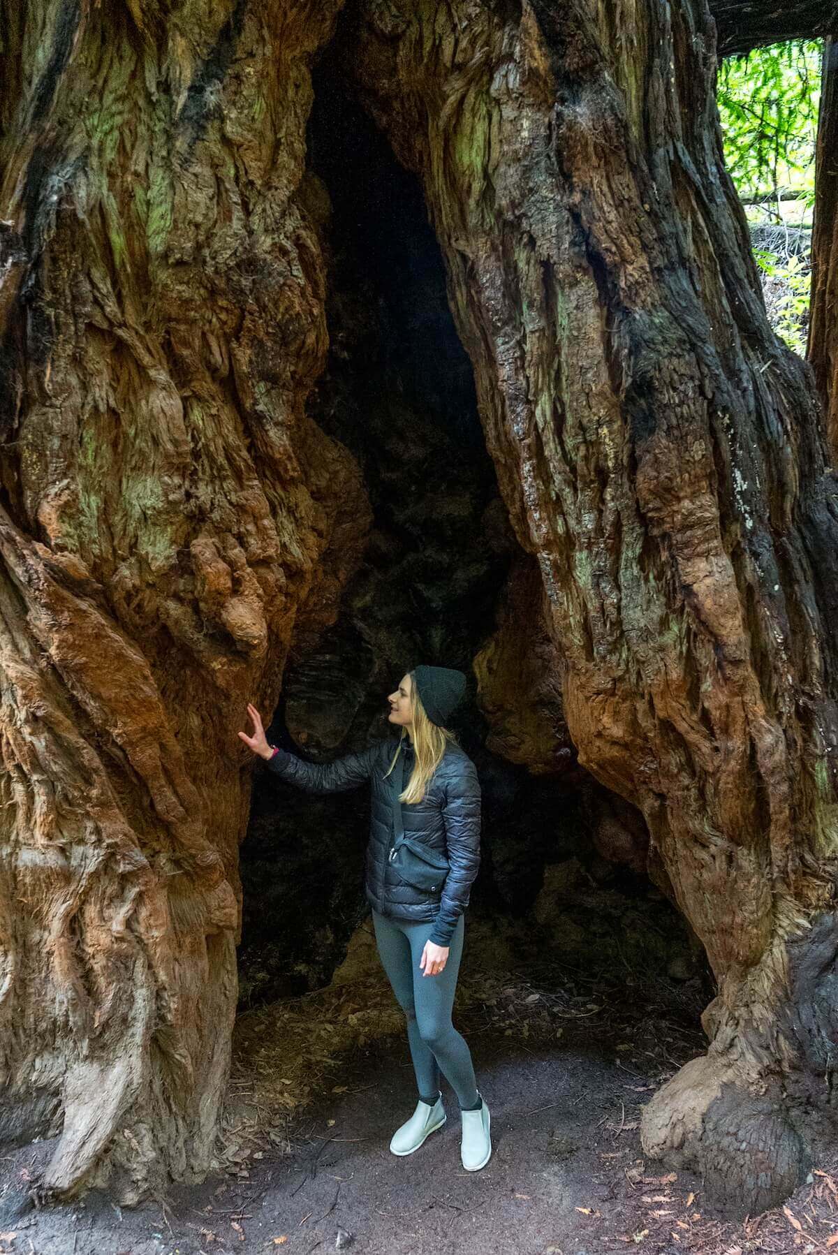
Fun Fact: Redwoods often grow in “fairy circles” due to new trees sprouting from a parent tree’s roots rather than from seeds.
The circular formation helps the parent and children trees share resources and shield each other during storms. You’ll see this formation a lot along the Main Trail.
We really loved how the ease of this trail lets you focus on the trees and enjoy the view without worrying about tripping over roots or other obstacles.
Watching the canopy overhead feels akin to reaching a mountain viewpoint — except there’s no need to hike up miles of paths.
Muir Woods Main Trail to Hillside Trail Loop
Length: 1.9 miles
Time: 1.5 hours
Difficulty: Easy
Elevation: 127 feet
AllTrails
This is the best Muir Woods trail. Taking the Main Trail to the Hillside Trail lets you go past Founder’s Grove and Cathedral Grove on the first half of your hike.
Then, you’ll enjoy an elevated view and Bohemian Grove on the way back.
We preferred this because the slight elevation gain and additional length of the trail reward you with less crowded spaces and different views of the groves along the main path.
What’s better than experiencing two trails in one hike?
Note: AllTrails calls this the Fern Creek and Hillside Loop, but Fern Creek Trail is a west-heading offshoot from the Main Trail. Nonetheless, we included the link for you to use, but be aware in case you’re cross referencing other maps or asking park rangers and they’re confused because Fern Creek Trail and Hillside Trail don’t actually meet.
Fern Creek, Lost, and Canopy Trail Loop
Length: 3 miles
Time: 1.5 hours
Difficulty: Moderate
Elevation: 597 feet
AllTrails
The Fern Creek, Lost, and Canopy Trail loop takes about an hour and a half, and you can start at either the Fern Creek side or Canopy Trail side.
Our Recommendation: If you’re starting earlier in the day, begin with Fern Creek Trail where there’s more sun shining so that you can warm up faster. If it’s already hot out, we’d recommend starting on the Canopy Trail side in order to stay cool.
We really liked the gradual elevation on this trail, which starts you off at the bottom of the trees and slowly elevates you up to the canopy.
It’s not paved like the main trail, so watch out for tree roots along the path. But that lets you really take note of the root structure, which leads us to our next fun fact!
Fun Fact: While giant redwoods might reach heights of nearly 400 feet, they only have roots going 6-12 feet deep. In order to maintain stability with such a shallow foundation, their roots extend up to 100 feet away and intertwine with other trees’ roots for additional support.
This is a great loop if you have some extra time at Muir Woods, but not enough for one of the longer hikes. It conveniently starts and ends along the Muir Woods Main Trail.
Bootjack to Ben Johnson Loop
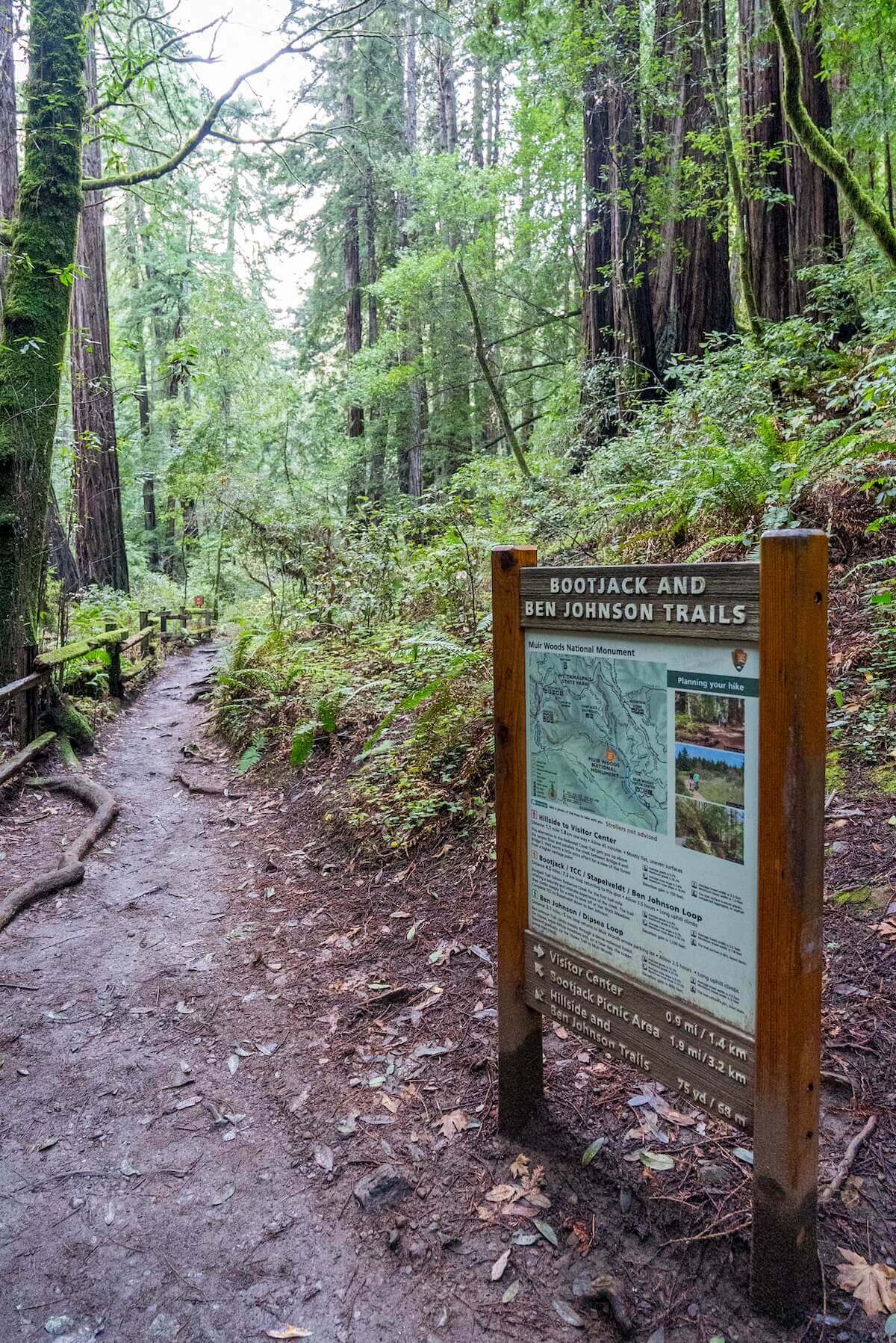
Length: 6.3 miles
Time: 3 hours
Difficulty: Moderate to Strenuous
Elevation: 1158 feet
AllTrails
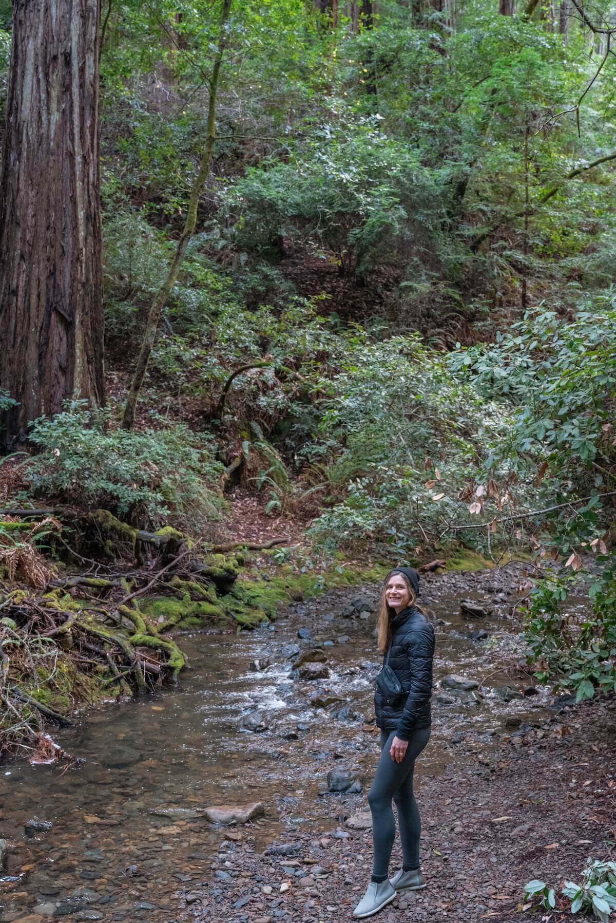
We were only able to hike up 1 mile of the Bootjack Trail before we started running out of time and had to head back. But we really enjoyed it, and it’s rated by others as one of the best day hikes in Northern California!
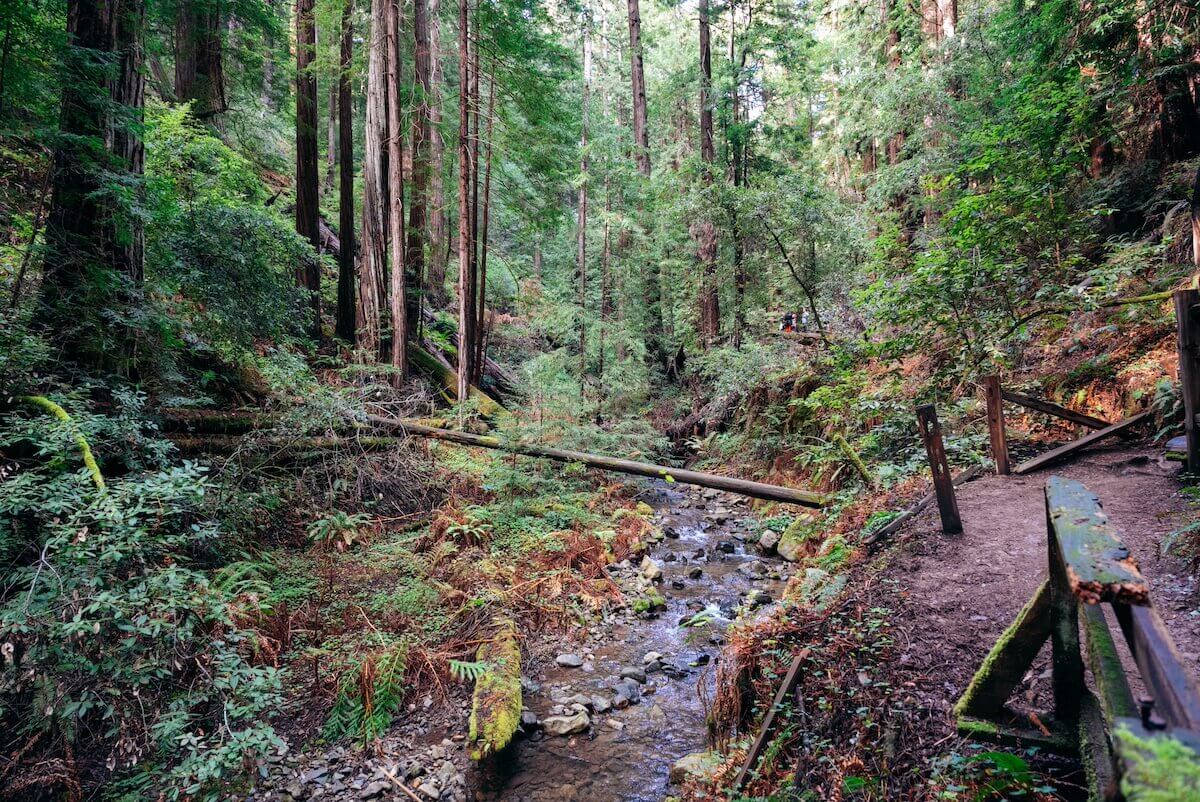
The Bootjack Trail starts at the end of the Main Trail and goes along Redwood Creek initially, quickly taking you out of Muir Woods National Monument and into the adjacent Mt. Tamalpais State Park.
The trail feels very damp, cool, and lush, which is nice. And because it’s mostly flat for the first mile, you still get to enjoy the towering redwood trees in front of you from the ground up.
After that first mile, the elevation picks up, and it becomes more difficult. Considering that you’ll want to spend an hour or two on the Main Trail, we’d recommend this loop only if you’re planning a full day in the Muir Woods area.
Local Tip: If you do plan to hike this loop, you might consider parking at the Bootjack camping parking lot. The parking fee is $8, but going this way means you don’t need to pay the $9.50 Muir Woods parking fee and $15/person entry fee for Muir Woods.
Then, instead of starting with the Main Trail to reach the beginning of the Bootjack to Ben Johnson Loop, you can start with the Bootjack Trail and head down to the Main Trail, after which you can head back via either the Ben Johnson Trail or Bootjack Trail again.
Note that the Bootjack parking lot doesn’t need reservations but can fill up on weekends/camping season.
Ben Johnson to Dipsea Loop
Length: Summer: 4.1 miles; Winter: 5 miles
Time: Summer: 2 hours 15 minutes; Winter: 2 hours 45 minutes
Difficulty: Moderate
Elevation: 971 feet
AllTrails
The Ben Johnson to Dipsea Trail Loop is similar to the Bootjack to Ben Johnson Loop, so you might hike this trail if you don’t have quite as much time.
You should be aware that in the winter, the bridge across Redwood Creek might be closed due to Coho Salmon spawning season, which adds about one extra mile to the trail.
We wanted to hike this trail, but the Stapelveldt junction connecting the Ben Johnson and Dipsea trails was closed (it’s scheduled to reopen in January 2024 and may be open certain weekends – ask a park ranger for current conditions if you’re interested in this trail). The detour would have added about a mile and a half.
In lieu of additional details, here’s this fun fact!
Fun Fact: Redwoods drink up to 160 gallons of water a day, almost half of which comes from absorbing the fog in the air. No wonder they like Northern California so much!
FAQs About Hiking in Muir Woods
Which is better for hiking, Muir Woods or Mt. Tam?
Mt. Tam is better than Muir Woods for hiking because it offers a larger variety of trails and views. Muir Woods has majestic old-growth redwoods, so if your goal is to see ancient trees, choose Muir Woods.
But if you want to spend a full day hiking, Mt. Tam offers more options for trails, is free (whereas Muir Woods is $15/person), and you can even hike into Muir Woods from Mt. Tam.
Are there waterfalls in Muir Woods?
There aren’t any large waterfalls in Muir Woods National Monument. However, some trails from Muir Woods that cut into Mt. Tamalpais State Park, such as the Bootjack Trail, offer waterfall views.
If you’re looking for waterfalls in the area, we recommend the Cataract Falls in nearby Stinson Beach.
Can you hike into Muir Woods from Mt. Tamalpais State Park?
Yes, you can hike into Muir Woods from Mt. Tamalpais State Park via the Bootjack Trail, Ben Johnson Trail, Dipsea Trail, and several other paths.
Is Muir Woods worth the visit, or is it overrated?
Muir Woods is totally worth a visit. It’s one of the few coastal places left with old-growth redwoods, and its proximity to areas like San Francisco, Muir Beach Overlook, Stinson Beach and Muir Beach, and towns like Marin, Sausalito, and Mill Valley make it a perfect day trip.
And if ease and accessibility are big factors for you, I would recommend the Muir Main Trail over just about any other trail in California.
Can you go to Muir Woods without a reservation?
The Muir Woods parking lot requires a reservation, but entry can be purchased at the visitor center upon arrival.
What’s the best time to visit Muir Woods?
The best time to visit Muir Woods is on a weekday during the non-summer months, either right when the park opens at 8 am or a little later, around 3 pm, once crowds have gone down.
Keep in mind that winters can be chilly since the giant redwoods keep the park cool, so bundle up!
Even if you go during peak summer times, a trip is well worth it. We’ve been there in the summer and winter, and both trips were excellent.
Because the main trail is paved, it’s even possible to go right after (or during) a rainy day, so you don’t need to worry about muddy trails if you’re planning on sticking to just the main route.
How do you get to Muir Woods?
To get to Muir Woods, you can drive up the 101 and across the Golden Gate Bridge (if you’re coming from San Francisco or other parts of the Bay Area) and then take Highway 1 until you hit Panoramic Highway and Muir Woods Road.
Alternatively, you can reserve a spot on the Muir Woods Shuttle from Larkspur or Marin if you don’t want to traverse the winding Muir Woods road yourself (or if you didn’t snag a parking reservation in advance.)
Local Tip #1: Download the Google Maps for this area on your phone so you don’t get lost while offline. The Muir Woods area has very poor cell reception. My phone really struggled with the lack of reception and data (which isn’t too uncommon for hikes in the North Bay).
Local Tip #2: Don’t rely on Uber or Lyft to get here. Because of the poor cell service, you likely won’t be able to call them afterward for a ride back home.
For more details on getting there, reservations, and additional tips, read our full article on Muir Woods!
Are there any other hikes in Muir Woods to consider?
There are lots of trails that extend from Muir Woods. Some people ask about a Muir Woods to Muir Beach trail, which would require going along the Coastal View Trail or Redwood Creek Trail. But either option would pass over roads and I’d recommend going north towards Stinson Beach if you want to go along a Muir Woods beach trail.
Another trail to consider, especially if you have bikes, is the Muir Woods Panoramic Trail. This isn’t actually in Muir Woods–it’s in Mt. Tamalpais State Park–and because it’s a bit more inland and near the Panoramic Highway I don’t think it’s the best for hiking.
Conclusion: So What’s the Best Hike at Muir Woods National Monument?
The best hike in Muir Woods is any trail that takes you along the Main Trail to see the oldest, tallest redwoods in Founders Grove, Cathedral Grove, and Bohemian Grove.
The Main Trail to Hillside Trail Loop was our favorite because it’s a quick and easy path and allowed us time to hike additional paths afterward while still making it to Muir Beach Overlook for sunset.
ABOUT THE AUTHOR

Suneel Jain
Partnerships & Management
Suneel has lived in California for 32 of his 35 years of life. He regrets those other three because there really isn’t any other state like the Golden State. Suneel has lived in San Diego, Berkeley, San Francisco, Fremont, Hayward, and Sacramento, and has crashed on plenty of couches when visiting friends and family throughout the rest of the state. As a San Diegan, even if he lives in Norcal now, he still insists on saying “the” before the freeway number, rooting for the Chargers (even if they’re not in San Diego anymore), and gets excited whenever he has an excuse to make a trip down.
Looking for more Bay Area travel inspiration? Check out these related articles below!
Pin this image for future reference

