TL;DR: You’ll experience the best hiking in Laguna Beach at Top of the World via Canyon Acres Trail (2.4 miles) and El Moro Canyon Loop Trail (5 miles). These trails are located in different parks, but both have spectacular views, are dog-friendly, and will give you a great workout!
When you think of Laguna Beach there are a few things that might first come to mind: a famous TV show, beautiful Orange County beaches, or the artsy festivals that are held in the city each summer.
What some people might not know is that the hiking in Laguna Beach is spectacular as well.
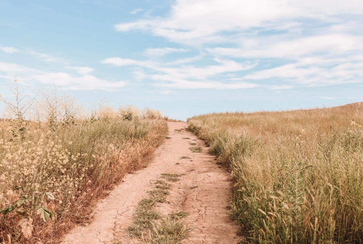
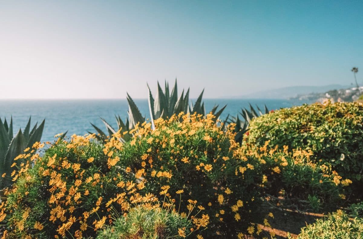
Most trails will provide you with panoramic ocean views, hills upon hills, and an opportunity to explore the Laguna Coast wilderness. April visitors get the added benefit of seeing all of the colorful wildflowers in bloom.
Located about halfway between San Diego and Los Angeles in the heart of Orange County, Laguna Beach offers some of the best parks, hiking trails, and scenic nature in Southern California.
Let’s explore some of the best hikes in Laguna Beach!
Note: this article contains affiliate links, which help run this site at no extra cost to you so I can keep providing free travel advice and tips.
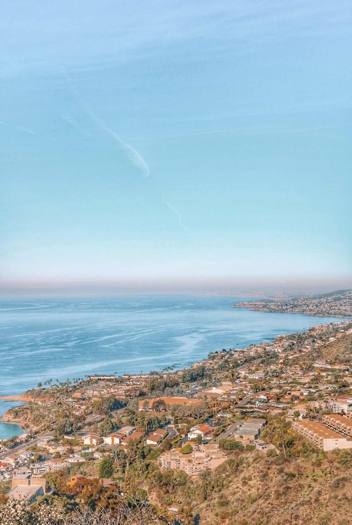
Crystal Cove State Park
Parking: There’s a $15 daily parking fee or you can get in with your annual California Park Pass. When driving down the notorious Pacific Coast Highway there are four entrances to Crystal Cove Park. Here are the four parking lots and the reasons you might want to pick each one.
- Pelican Point – This is the northernmost entrance – great if you want to access the northern part of the state park or if you just want to get in the park ASAP while heading south down the PCH from LA!
- Los Trancos – This is the entrance to access the inland portion of the park where you’ll find Beachcomber Café as well as the shuttle to the Historic District.
- Reef Point – This is the oceanside entrance that offers easy access to paved trails and superb views.
- School-State Park/Moro Canyon Backcountry Entrance & Campground – This is another inland entrance and has access to the Ranger Station visitor center and all of the backcountry hiking trails and campgrounds.
Dog-Friendly: Dogs are welcome on the main 2.5 miles of paved trails that run across the bluff tops oceanside. The only backcountry hike that dogs are allowed on is the El Moro Canyon Trail.
Camping: Three primitive camping sites (Lower Moro, Upper Moro, and Deer Canyon Campsites) that are only accessible by foot and require a 3-mile hike inland. If you don’t want to rough it, Moro Campground is the place for you. This site has 57 sites, allows tents and RVs, and has bathrooms and token showers.
Crystal Cove State Park is one of my favorite places in Orange County because it has EVERYTHING that I associate with the natural beauty of California – gorgeous beaches, fantastic hiking, towering cliffs and bluffs, and backcountry camping.
If you’re a nature enthusiast, you can easily get lost in Crystal Cove State Beach for days!
One of the best things about Crystal Cove is that it has a backcountry and wilderness area that will make you feel like you have escaped from it all.
You can completely submerge yourself in nature while only being a short drive from civilization, the Pacific Coast Highway (PCH) is directly beside you.
Related: Best Beaches in Laguna Beach
Get your FREE California Travel Planner – including printable checklists and my favorite two-week itinerary for the state.
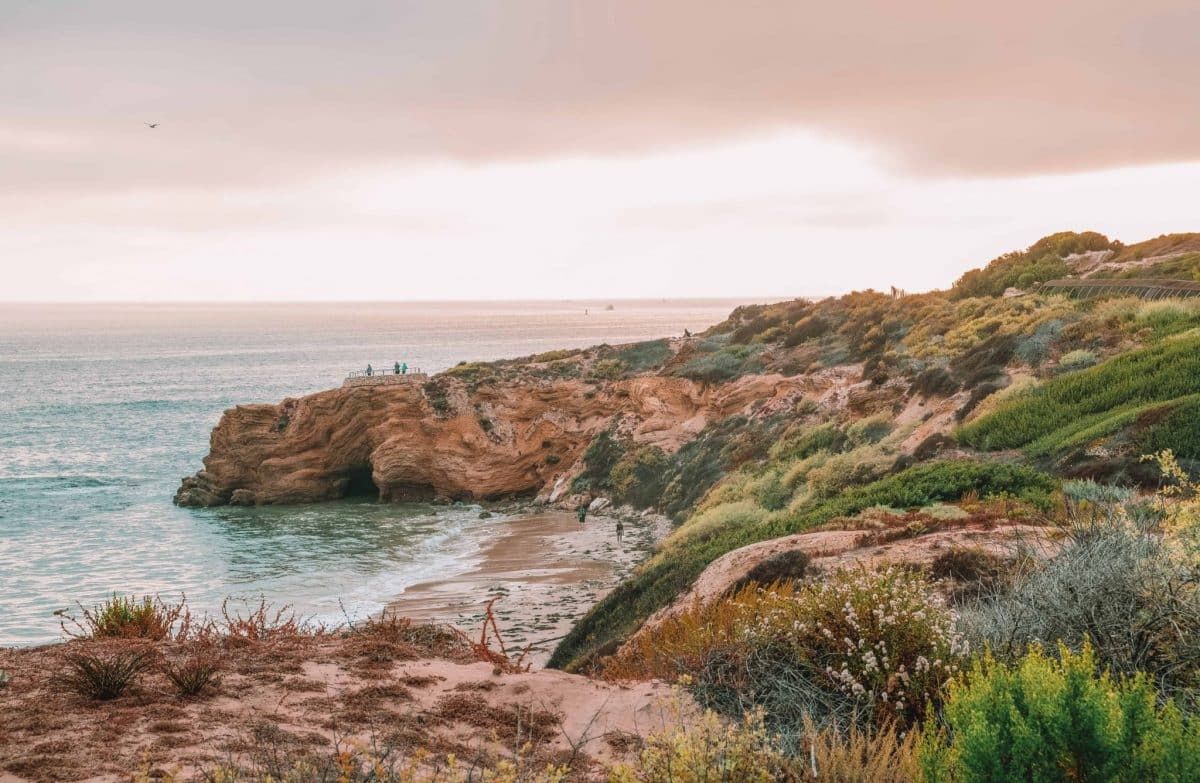
El Moro Canyon Loop Trail
Length: 5 miles | Elevation Gain: 807 ft | Trail Guide
Features: Ocean views, equestrians, biking, ocean views.
The El Moro Canyon Loop Trail begins and ends at the El Moro Visitor Center in Crystal Cove State Park. It’s primarily used by hikers, mountain bikers, and horseback riders.
This loop will give you great views of El Moro Canyon and climbs over 800 feet in elevation to the ridgeline for some breathtaking coastline views.
Here’s a trail tip – if you want to enjoy the ocean views and take it easier on the hike, go clockwise. If you want to give your legs more of a workout, take the trail counterclockwise.
If you’re looking for a shorter hike, try the three-mile El Moro Canyon Short Loop Trail. You can start this hike at the Ranger Station and walk downhill to the dirt trail, where you’ll turn left. Follow that dirt trail to cross the long bridge to get into the beautiful Moro Canyon.
This hike is shorter in distance but has an intense incline, especially if you go counterclockwise. Your legs will get a great workout but the views are worth it.
Crystal Cove Perimeter Loop
Length: 9.4 miles | Elevation Gain: 1354 ft | Trail Guide
Features: Ocean views, camping nearby.
Crystal Cove State Park is one of my favorite places to hike in Orange County because there is something for all different activity levels.
If you’re up for a longer hike, don’t miss the Crystal Cove Perimeter Loop Trail. Your quads will definitely feel the burn in a few spots that have some steep inclines.
There are several options with offshoots of the trail that can shorten your hike, be sure to check the trail maps to navigate the length you want to hike.
This hike has spectacular views from the San Gabriel Mountains all the way to Catalina Island.
Aliso and Wood Canyons Wilderness Park
Parking: $3 per vehicle. Machines accept $1 bills, quarters, and Visa/MasterCard.
Dog-Friendly: Dogs are not permitted, but horses are.
Camping: No camping here but there’s a cool picnic area with eight picnic tables to enjoy.
The Aliso and Wood Canyons Wilderness Park is a designated wildlife sanctuary full of mature oaks, sycamores, and even elderberry trees.
There are 30 miles of hiking trails to enjoy and some spectacular scenery. Some of the trails here can have an elevation gain/loss of over 600 feet, so be prepared and dress appropriately.
Grab a map at the park entrance or at many of the park trailheads and get ready to explore! There are also some portable restrooms near the main park entrance and sprinkled in a few other areas.
Even though the weather in Southern California is almost always sunny and mild, be aware that the trails are typically closed during and after heavy rain.
Valido Trail
Length: 1.1 miles | Elevation Gain: 331 ft | Trail Guide
Features: Bird watching, wildflowers.
This out and back trail is short and sweet but steep. The Valido Trail has incredible views of the ocean at the top and makes for a great place to stop and have an afternoon picnic.
This hiking trail has a ton of offshoots branching off it, so check your map to see if you want to add more distance to your hike. You can usually enjoy beautiful wildflowers, butterflies, and a variety of birds along the way.
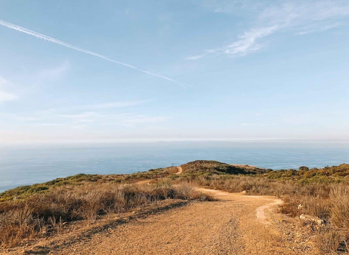
Top of the World Via Canyon Acres Trail
Length: 2.4 miles | Elevation Gain: 862 ft | Trail Guide
Features: Wildflowers, ocean views, dog-friendly.
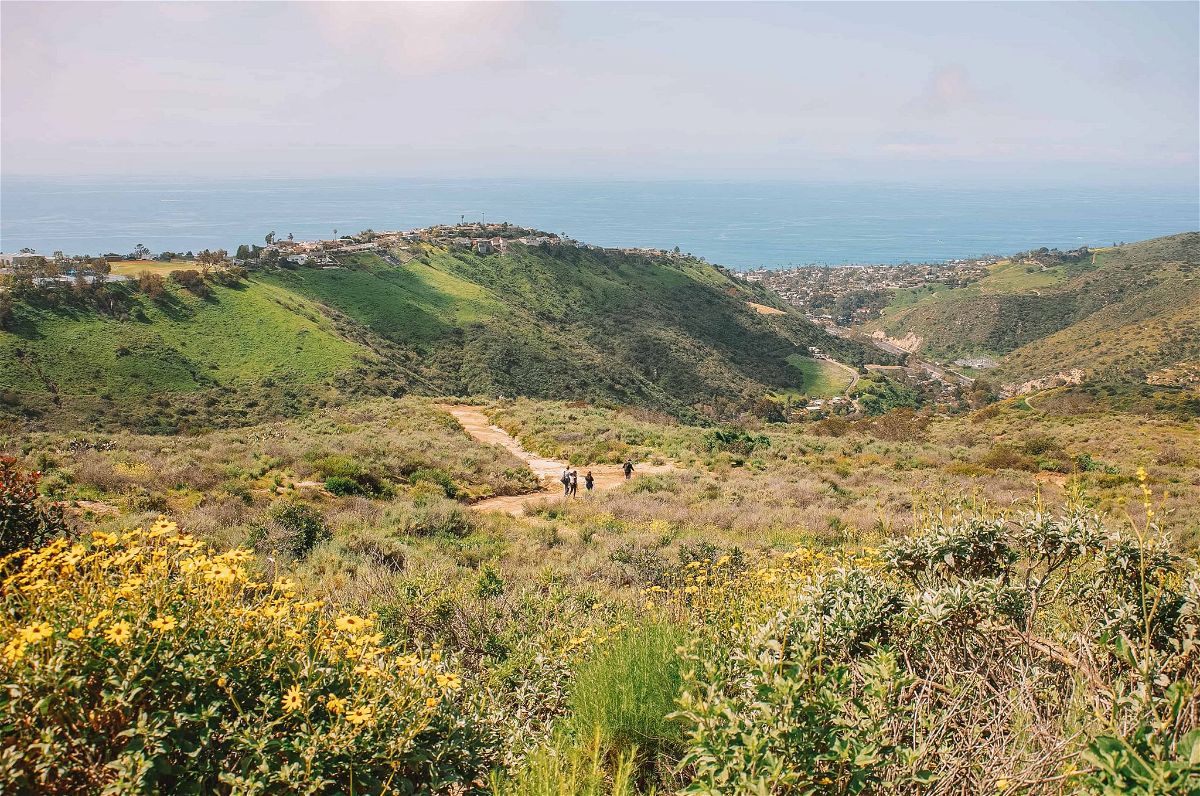
You’ll find some of the best views in Laguna Beach, California on the out and back Canyon Acres Trail. This trail takes you to the Top of the World viewpoint, which is the highest point of the entire hike and a scenic delight.
Top of the World is a gorgeous lookout point featuring 360-degree views with the Pacific Ocean on one side and Saddleback Valley on the other.
One of my favorite things about this trail is that this turnaround point has a relaxing park area with benches, restrooms, and some of the best views in Orange County.
The ocean views at Top of the World are insane. On a clear day, you can see from Mt Baldy to Dana Point to Catalina Island.
It’s a great spot to meditate, slow down, and take it all in. Plan a hike around sunset time to take advantage of the Instagram photo op.
This steep uphill trail is a great workout with almost no flat walking at all, so make sure you have the energy for a steady incline all the way up.
Car Wreck Hike
Length: 3.8 miles | Elevation Gain: 950 ft | Trail Guide
Features: Ocean views, restrooms.
After years of hikers making the trek to see this popular urban legend “car wreck” 1946 Dodge 5-passenger coupe, the Aliso and Wood Canyons Wilderness Park finally made it an official hiking trail in 2013.
This trail is accessible from both Laguna Beach and Aliso Viejo. The way I like to access the Car Wreck Trailhead is to begin in Alta Laguna Park in Laguna Beach. From that park, you’ll hike into Aliso and Wood Canyons Wilderness Park and onto the car wreck.
Wood Canyon Mathis Loop Trail
Length: 5.7 miles | Elevation Gain: 823 ft | Trail Guide
Features: Wildflowers, bird watching, mountain biking.
The Wood Canyon Mathis Loop is a fun trail that usually has tons of bike traffic.
There’s one section that has a pretty steep steady hill. If you go counterclockwise, you’ll be going down that hill, which is what I like to do when I want to take it easy.
If you get a second wind, you’ll also experience the last 0.3 miles as a nice steep climb which is a nice challenge to end your workout.
Laguna Coast Wilderness Park
Parking: $3 daily parking fee that is open from 8 am to 4 pm.
Dog-Friendly: Dogs are not permitted, but horses are.
Camping: No camping.

Explore 7,000 acres and forty miles of endless scenic trails through some of the most picturesque landscapes in Southern California at the Laguna Coast Wilderness Park. This place is spectacular!
You’ll be surrounded by coastal canyons, rocky bluffs, mountains, and towering oak and sycamore woodlands in some of the finest nature that California has to offer.
The hiking trails here are shared between hikers, equestrians/horses, and bicycles, so there’s never a dull moment.
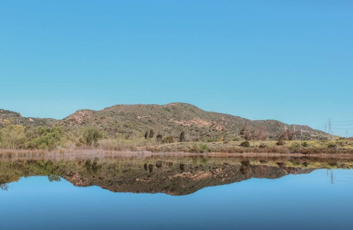
The Laguna Coast Wilderness Park is also home to Orange County’s only lake, Barbara’s Lake. The only restrooms available in the park are near the lake at the Nix Nature Center.
If it’s your first time visiting, be sure to stop by this award-winning nature center to learn a bit more about the park and wildlife in the area. You can even sign up for a guided tour to show you around.
Laurel Canyon Trail
Length: 3.6 miles | Elevation Gain: 375 ft | Trail Guide
Features: Wildlife, restrooms, bird watching, ocean views, waterfall.
The Laurel Canyon Trail starts at the Willow Staging Area and is a favorite mountain biking spot because of all of the roller coaster-like inclines and declines.
Bikes aren’t allowed on the Laurel Trail past the Stagecoach Trail cutoff, so if you want to avoid bike traffic head to this route.
You’ll follow the dirt road away from Laguna Canyon Road, which seems a bit noisy at first but the trail eventually opens up into a quiet meadow.
You’ll pass by Ghost Rock (which looks like a ghost face carved into the rock) and the waterfall area (if the conditions aren’t too dry) before you turn around.
On Saturday mornings this moderate trail can get busy, you might even find a line at the $3 parking kiosks, so try this one during the week if crowds aren’t your thing.
Bommer Ridge Trail
Length: 4.6 miles | Elevation Gain: 810 ft | Trail Guide
Features: Bird watching, mountain biking, wildflowers.
The Boomer Ridge Loop Trail is perfectly nestled right in the middle of the suburbs of Irvine, California. This well-marked trail is a great place to enjoy nature with a steady incline in the San Joaquin Hills.
There’s a drinking fountain and restrooms at the entry point to Bommer Ridge and parking usually fills up quickly on the weekends, so arrive early or plan a trip mid-week.
Barbara’s Lake Loop Trail
Length: 2.8 miles | Elevation Gain: 334ft | Trail Guide
Features: Lake, bird watching, wildflowers.
As you’ve probably noticed by now, many of the hikes in Laguna Beach are challenging because of steep inclines or long distances.
The Barbara’s Lake Loop Trail is one of my favorites because it’s easy and shorter than most of the other hikes when you’re looking for a more mellow hike.
Barbara’s Lake Loop Trail is a relaxing shady trail that’s perfect for a family hike on the weekend. It has enough shade and beautiful scenery with great views of Barbara’s Lake at the halfway point.
Tips for Hiking in Laguna Beach
- Pick up the phone to learn more – Along many of the trails in Laguna Wilderness Park, you’ll see signs posted with a phone number on them. Be sure to take a few minutes and dial the number to listen to the recorded messages to teach you more about the area.
- Know the right of way and rules of the trail – Some of the trails are a bit narrow and require giving the right of way to a fellow traveler. As a rule of thumb, equestrians have the primary right of way, hikers next, and then mountain bikers.
- Bring plenty of water and then pack even more – It’s a known hiker’s rule to carry at least one liter of water for every two hours of hiking. If the terrain is more challenging or the weather is extra hot, bring more. And don’t forget water for your pup if your fur baby is hiking with you.
What to Pack for Hiking in Laguna Beach
- Water – enough for you and your animal
- Physical or downloaded trail maps
- Hiking snacks
- First Aid kit
- Breathable layers – Read our guide to the best hiking clothes for women.
- Sunglasses, a hat, and sunscreen to protect yourself from the heat
- Insect repellent is always a good thing
- Hiking poles – especially if you’re hiking a steep trail
- Quality hiking boots or comfortable walking shoes that have decent support and traction
- Handheld GPS, outdoor watch with GPS (like a Garmin watch), or a good hiking app that you can use offline
- Compact binoculars if you’re into birdwatching
- A durable phone case
Looking for other California hikes? Check out our guides to the Trans-Catalina Trail, best Bay Area hikes, Catalina Island hiking, Berkeley Fire Trails, best hikes in Orange County, best Malibu hikes, best Santa Cruz hikes, best Torrey Pines hikes, best Big Basin hikes, best hikes in San Francisco, best San Jose hikes, best Joshua Tree hikes, and best Big Bear hikes.
Get your FREE California Travel Planner – including printable checklists and my favorite two-week itinerary for the state.
ABOUT THE AUTHOR

Rosie Queen
Rosie Queen is a travel blogger and creative writer who grew up on the South Side of Chicago. Since moving to Huntington Beach in 2019, she has been exploring every nook of Southern California and beyond with her adventure-seeking husband and adorable Golden Doodle, Indy. She’s obsessed with her dogs, color guard/marching band, national parks, and road trips.
11 Best Beaches in Malibu, California
9 Best Beaches in Orange County, California

Pin this image for future reference

