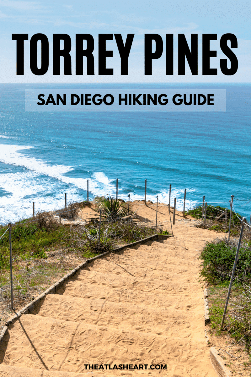
Your Torrey Pines hiking guide, including the best trails and how to get the most out of the park.
After living in San Diego for five years and exploring many of the local hiking trails on sunny weekends, there was one place that I always came back to: Torrey Pines State Natural Reserve.
Situated near North Torrey Pines Road and Carmel Valley Road, Torrey Pines is just a stone’s throw away from La Jolla and the UCSD campus where I went to school.
It’s also by far one of the prettiest places to hike in San Diego to soak up stunning coastal views, golden-hued cliffs, and a sandy beach below.
So, in this detailed Torrey Pines guide, I’m going to give you a full rundown of the best Torrey Pines trails.
You’ll also get all the practical info you should know before you go so you can get the most out of the park.
Note: this post contains affiliate links, which help run this site at no extra cost to you so I can keep providing free travel tips and advice.
Grab your FREE San Diego Travel Planner! You’ll get instant access to printable checklists for what to pack and what to see in San Diego, as well as a full travel itinerary, and key local travel tips you should know.

Torrey Pines Websites
There are two official websites where you can find information and updates while planning your trip to Torrey Pines. The first is the California Parks and Recreation website, which links to the Torrey Pines State Natural Reserve website.
Torrey Pines Map
On either website, you can find a Torrey Pines trail map, including the locations of restrooms, water fountains, the visitor welcome center, and viewpoints.
For additional assistance when you arrive, visit the Torrey Pines Visitor Center.
Torrey Pines Hiking Trails
Torrey Pines trails are perfect if you’re looking to tackle some easy hikes in San Diego.
They’re full of incredible viewpoints, sunshine, and the rarest pine tree in the United States–the Torrey pine tree.
Guy Fleming Trail
Most Popular Torrey Pines Hike
Length: 0.8-mile loop | Time: 15-20 minutes | Trail guide
Trailhead GPS coordinates: 32.922923, -117.255444
The Guy Fleming Trail is by far the most popular Torrey Pines hike.
You probably won’t work up a sweat on this 0.8-mile loop, but you‘ll enjoy some breezy ocean views and a leisurely stroll.
There are also signs along the trail that point out native plant species, for those who’d like to learn more about the local flora.
It’s an ideal hike for small children or those with mobility issues with its relatively flat nature. Just note that it’s not great for strollers nor is it ADA-accessible.
Bonus points if you’re an avid photographer since this trail boasts two scenic outlooks with benches and gorgeous views of the coastal bluffs and the scenic landscape below.
You might even spot some whales or dolphins in the distance from these viewpoints.
Overall, the Guy Fleming Trail is a good hike if you want a brief overview of the park highlights without going on a longer trail. It’s also a great trail for wildflowers if you’re visiting in the spring.
You can learn more about the history of the Guy Fleming Trail here.
Parry Grove Trail
Best Torrey Pines Hike for Wildflowers
Length: 1-mile loop | Time: 20 – 30 minutes | Trail Guide
Trailhead GPS coordinates: 32.921446, -117.255178
Located to the north of the visitor center, the Parry Grove Trail is a half-mile loop and more secluded than the Guy Fleming Trail. However, it still features plenty of ocean views and sights.
Named after Charles C. Parry, who was the first person to document the Torrey pine tree (Pinus Torreyana), this trail is one of the best places to see Torrey pine trees at the park (the rarest pine tree in the United States!).
The Parry Grove Trail is less busy than the Guy Fleming Trail because of its steep section of 118 stone steps, so be prepared for a decent workout. And keep in mind that these steps are slick after rain.
This loop trail takes you through chaparral, pine trees, and past the Scripps Overlook via the Whitaker Garden.
The garden is another spot to learn more about the local desert flora and you might even spot a wild rabbit or lizard while you’re there.
There’s also a water fountain along the trail and benches to rest in the sunshine, including one at the Scripps Overlook.
To reach the Parry Grove Trailhead, you can either park by the beach on the lower level of the park or park in the upper lot and walk down the road.
The lower parking lot is definitely the more strenuous route but on busy days, it’s sometimes the only option for day-use parking near the Parry Grove Trail.
You can learn more about the history of the Parry Grove Trail here.
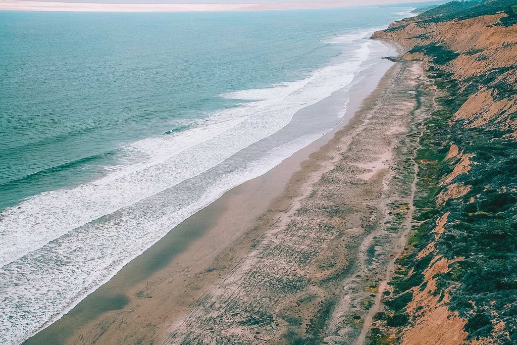
Torrey Pines Beach Trail
Best Torrey Pines Hike to Dip Your Toes in the Water

Length: 1 mile out and back | Time: 20-30 minutes | Trail Guide
Trailhead GPS coordinates: 32.919936, -117.252857
Note: Steeper trails, including the Beach Trail, are often closed after rain to prevent soil erosion. Check the reserve website for up-to-date closures before heading out.
The Beach Trail is an idyllic, Torrey Pines beach hike that takes you through the Upper Reserve on a sandy, rustic trail to the beach.
Take a short detour on the Yucca Point Trail and Yucca Point Overlook for panoramic views of the Pacific Ocean.
Then follow the Beach Trail stairs down to Torrey Pines State Beach 300 feet below, where you can dip your toes in the water and go swimming.
It’s safest if you time your hike so that you arrive at the beach 2-3 hours after high tide. Park officials also advise staying away from the cliffs, where there are sometimes rock slides.
If you leave the beach at low tide, you can continue the Torrey Pines Beach Trail Loop by walking to the lower parking area on the beach.
Looping through the lower parking area instead of going back the way you came makes this around a 3-mile hike.
Razor Point Trail
Best Torrey Pines Hike for Geology Fans
Length: 0.7 miles out and back | Time: 20-30 minutes | Trail Guide
Trailhead GPS coordinates: 32.919936, -117.252857
Note: Steeper trails, including the Razor Point Trail, are often closed after rain to prevent soil erosion. Check the reserve website for up-to-date closures before heading out.
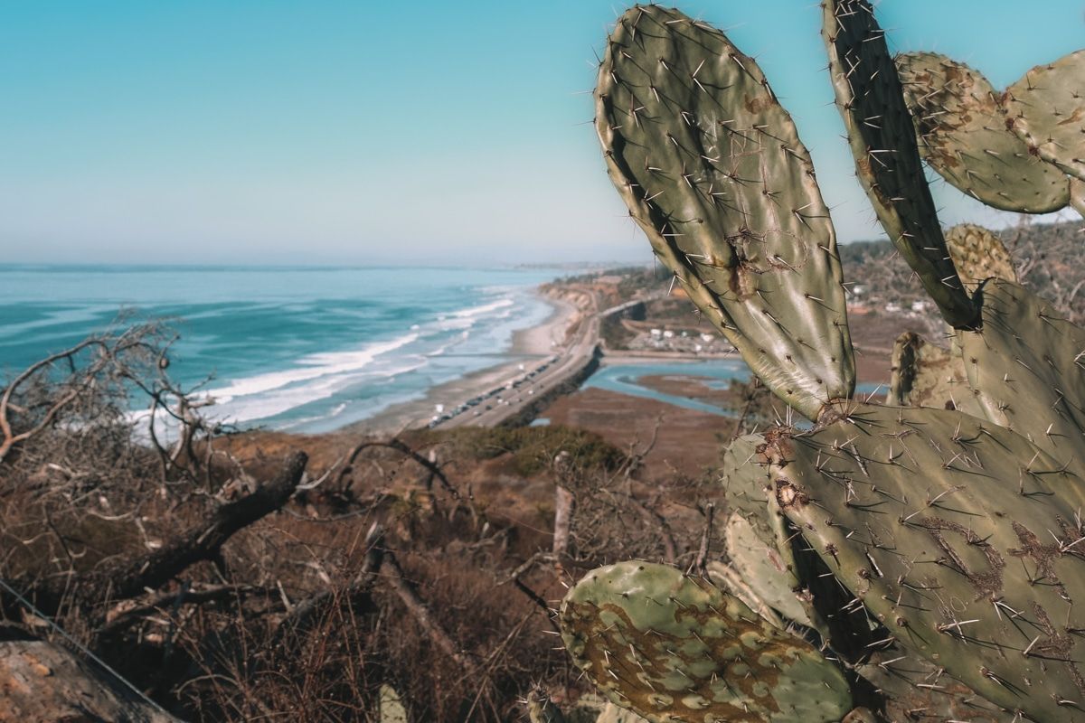
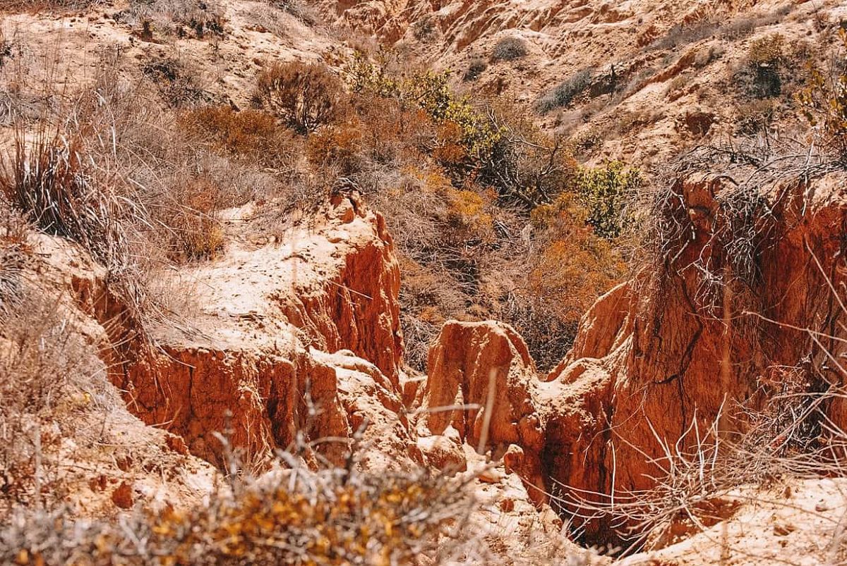
Although Torrey Pines State Natural Reserve is known for its ocean views, the Razor Point Trail allows you to see more of the park’s rock formations up close.
In the spring, you’ll find beautiful cream yucca blooms and honeycomb-shaped tafoni patterns in the rock along the trail.
You’ll also pass Red Butte, a massive sandstone formation where you can see the entire state park along the coastline.
And then there’s Yucca Point Overlook, arguably the most scenic spot in Torrey Pines.
About 2/3 of the way to the Yucca Point Overlook (sometimes called the Razor Point Overlook), you can wander through coastal sage scrub, gnarled trees, and a sculpted sandstone gorge.
Local tip: Looking for a longer hike than the one-mile and under hiking trails, you’ll mostly find at Torrey Pines State Natural Reserve? Combining the Razor Point Trail, Beach Trail, and the Broken Hill Trail together allows you to do a 3-4-mile hike and take in a lot of different park highlights along the way.
Broken Hill Trail
Best Torrey Pines Hike to Get Away from the Crowds

Length: 2.5-mile loop | Time: 60 – 90 minutes | Trail Guide
Trailhead GPS coordinates: 32.916297, -117.247751
Note: Steeper trails, including Broken Hill Trail, are often closed after rain to prevent soil erosion. Check the reserve website for up-to-date closures before heading out.
The 2.5-mile Broken Hill Trail is one of the longer hikes in Torrey Pines State Reserve and can be accessed via a half-mile walk from the upper day-use parking lot.
You can begin the 2.5-mile loop from the trailheads for the North Fork trail or the South Fork trail. And from either direction, you’ll get expansive views of the reserve and the ocean.
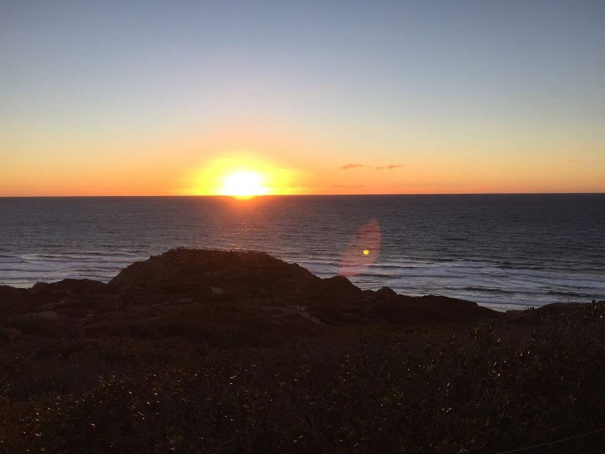
Halfway through the Broken Hill trail, you can hop onto the Beach Trail or continue on to Broken Hill Overlook.
The Broken Hill Overlook is the only elevation gain on the Broken Hill Trail, but it’s worth it for the views if you decide to watch the sunset here instead of along the High Point Trail (featured below).
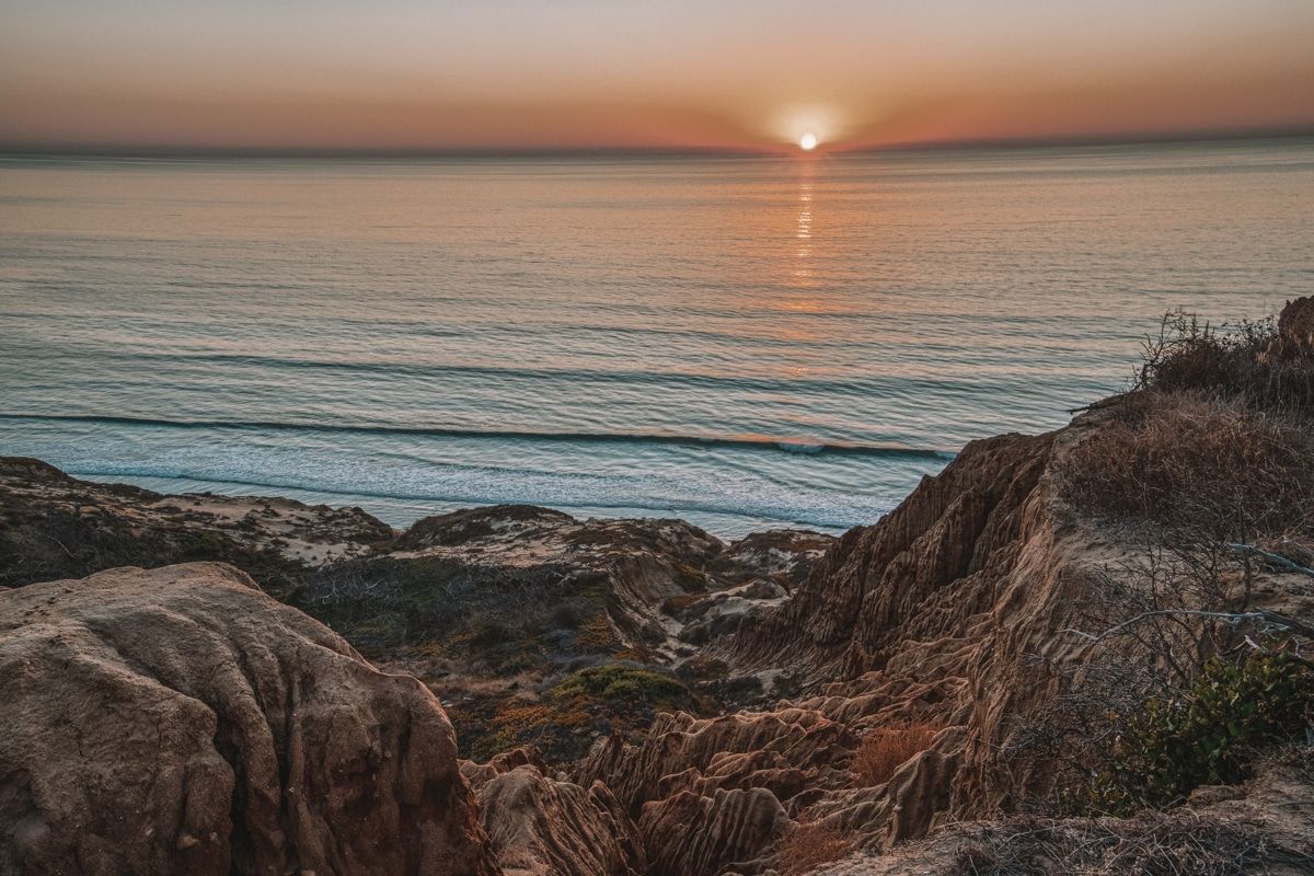
High Point Trail
Best Torrey Pines Hike to Watch the Sunset
Length: 300 ft | Time: 5 – 10 minutes | Trail Guide
Trailhead GPS coordinates: 32.9395, -117.24676
High Point Trail isn’t so much a hike as it is a Stairmaster workout.
You have to climb up 300 feet before reaching the highest point in Torrey Pines State Natural Reserve–the peak of the trail.
After your glute workout, you can enjoy the world-class scenery of Torrey Pines State Reserve, its lagoon, and scenic landscape further inland.
The views from the High Point Trail Overlook are stunning year-round and the sunsets are nothing short of breathtaking.
Torrey Pines Reserve Extension Hiking Trails
If you’re looking for even more Torrey Pines hiking options, check out the other side of the park from the North Beach parking lot entrance and the following hiking trails:
- Red Ridge Loop Trail (0.3 miles)
- Mar Scenic Trail (0.5 miles)
- Daughters of the American Revolution (0.5 miles)
- Margaret Fleming Nature Trail (0.8 miles)
What to Pack for a Torrey Pines Hike
Before going on a Torrey Pines hike, make sure you’re prepared with these items.
- Hydration pack (plus water) – My CamelBack is my favorite way to carry water and stay hydrated on particularly hot hikes.
- Trail Snacks – I like grass-fed Ayobo-yo Biltong beef jerky and vegan-friendly Mega Omega Trail Mix.
- First Aid Kit – No matter where you’re hiking, it’s always good to pack a first aid kit.
- Light Layers – Pack a light layer in case it gets breezy or you stay for sunset. I’d recommend bringing a light windbreaker or a long-sleeve shirt. Read our guide to the best hiking clothes for women for more options.
- Good Hiking Boots – Or quality walking shoes that have good traction.
- Outdoor watch (like a Garmin watch) to track your steps and a good hiking app that you can use offline
- Compact binoculars if you’re into birdwatching.
Quick Tips for Hiking Torrey Pines State Natural Reserve

As paradisal as hiking at Torrey Pines State Reserve might be, it’s still good to know what to expect and to be prepared. Here are a few tips to get you started.
- Do pack everything you need ahead of time – Make sure to pack water and snacks before arriving at Torrey Pines Reserve. There aren’t any food booths or vending machines on-site that sell snacks or beverages, and the nearest gas station is around 15 minutes from the park.
- Don’t bring your dog – Even though the beach and trails seem perfect for your pup to get some exercise, Torrey Pines State Natural Reserve isn’t dog-friendly. This is to keep the local wildlife like rabbits, lizards, and birds safe and sound in their natural habitat.
- Don’t expect a lot of shade – There are long stretches without any shade on many of the Torrey Pines trails, so make sure you pack a hat, sunglasses, and sunblock, and bring plenty of water. You can also check out this guide on hiking in hot weather for more tips.
- Cell service is pretty good at the park – Maybe it’s because it’s not a huge state park and it’s close to cities like Del Mar and La Jolla, but you can get good cell service on most of the hiking trails around the park. This is convenient for getting directions to and from the day-use parking lots and the park’s trailheads, as well as checking in with friends while you’re exploring the reserve.
- Check the reserve’s website before heading out – If it’s raining or recently rained, steep trails such as the Razor Top, Broken Hill, and Beach Trails will probably be closed. This is to prevent soil erosion. Torrey Pines State Reserve doesn’t mess around with the safety of visitors, wildlife, and habitats. It’s also advised that you visit the beach at low tide and stay at least 10 feet away from the cliffs to avoid dangerous rock slides.
Frequently Asked Questions About Torrey Pines Hiking

Torrey Pines parking: Where do you park to hike Torrey Pines?
Since Torrey Pines is one of the most famous state reserves in Southern California, parking is busy (especially on the weekends and holidays).
Find available day-use parking at the North Beach entrance (right near the intersection of North Torrey Pines Road and Carmel Valley Road) or the South Beach entrance (which includes the upper and lower parking lot inside the reserve).
Depending on what season and day you visit (the reserve has demand-based pricing), you‘ll have to pay the following entrance/parking fees:
- South Beach Entrance Parking Lots (including parking at the welcome center ) – $15-$25 per vehicle (this includes the parking lots that are inside the main reserve area and near the most popular trailheads)
- North Beach Entrance Parking Lot – $10-$25 per vehicle
Where can I park for free at Torrey Pines?
If you don’t want to pay for a parking lot, there’s free parking along North Torrey Pines Road and South Camino Del Mar.
Free parking spaces are limited so make sure to get there early if you want to snag one of these spots.
What time does Torrey Pines open?
The Torrey Pines hours are 7:15 am to sunset.
How much does it cost to hike Torrey Pines?
If you park in the North or South Beach parking lots, the day-use fee is $10-$25. Otherwise, there’s no fee for walking into the park.
If you’re on a budget, take the North County Transit Bus route 101 or find a free spot along the road.
Where does the Torrey Pines hike start?
Most Torrey Pines hikes originate from the visitors center or along the South Beach Park entrance road.
How long is the Torrey Pines hike?
There are various hiking trails at Torrey Pines but most are around a mile or under.
With that said, it’s easy to connect trails together if you want to do a 3-4-mile hike.
What is the best hike in Torrey Pines?
The best Torrey Pines hike is the Guy Flemming trail.
You’ll see the famous Torrey pine trees, wildlife, and panoramic views of the ocean. Plus, it’s on the way to the beach.
Can you swim at Torrey Pines?
Yes! Torrey Pines State Beach is an excellent beach for swimming and surfing. It’s also a good family-friendly beach if you’re traveling with kids.
How do I book a tour at Torrey Pines?
Torrey Pines offers a couple of different options for planning a tour:
- Free Guided Hikes: 10am every Friday, Saturday, Sunday, and holidays. Meet at the visitors center.
- Mindful Walks: 8am to 10am first and third Sunday of the month beginning in March.
- Docent-Led Educational Tours and Programs: reservations required for school, senior citizen, and girl scout groups.
How far is Torrey Pines from downtown San Diego?
Torrey Pines State Natural Reserve is about a 20-minute drive from downtown San Diego.
Want to explore more of San Diego? Book a San Diego tour for an insider’s guide to the city.
Looking for other California hikes? Check out our guides to the Trans-Catalina Trail, best Bay Area hikes, Catalina Island hiking, Berkeley Fire Trails, best hikes in Laguna Beach, best hikes in Orange County, best Malibu hikes, best Santa Cruz hikes, best Big Basin hikes, best hikes in San Francisco, best San Jose hikes, best Joshua Tree hikes, best Big Sur hikes, best hikes in Sequoia & Kings Canyon National Parks, best Lake Tahoe hikes, and best Big Bear hikes.
Grab your FREE San Diego Travel Planner! You’ll get instant access to printable checklists for what to pack and what to see in San Diego, as well as a full travel itinerary, and key local travel tips you should know.
ABOUT THE AUTHOR

Mimi McFadden
Founder & Editor-In-Chief
Mimi McFadden initially started The Atlas Heart in 2013 to write about her adventures abroad. But since 2019, The Atlas Heart has become a love letter to the Golden State. Mimi enjoys sharing her first-hand knowledge and expertise with the places she knows so well and making the most comprehensive travel guides possible. When she’s not hiking and exploring new places in California, she loves to travel abroad, read in her cozy chaise lounge, play basketball, and connect with friends and family over board games. Over her 28 years in California, she has lived in Santa Cruz (18 years), San Diego (5 years), and the San Francisco Bay Area (5 years), where she currently resides.
Looking for more Southern California travel tips? Check out these related articles!
Best Things to do in San Diego
A Guide to Little Italy, San Diego
Best Things to do in Julian, California

Pin one of these images for future reference

